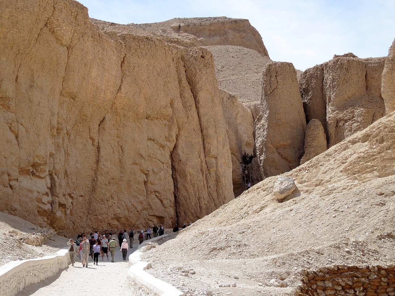
.jpg/1920px-Valley_of_the_Kings_panorama_(450021688).jpg 1920w)
KV18
Also known asTomb KV18
DatedEst. 3600–2500 BCE
Photo Endlisnis · CC BY 2.0Source file on Wikimedia Commons
Overview
About this site
Overview
Tomb KV18 is a rock-cut tomb in the Valley of the Kings, Egypt, intended for the burial of the pharaoh Ramesses X of the Twentieth Dynasty. It was abandoned while still incomplete and was never used for his burial.
Read on Wikipedia3 min readCC BY-SA 4.0
Where it sits in time
The site's dated range, placed against world reference points.
The scale is logarithmic: each step to the left is about ten times older than the last.
Article
KV18
The tomb consists of a large entryway with a decorated lintel and two steps, which lead to two sections of gently sloping corridor separated by steps and gates.
DescriptionSources for this section
- Wikipedia (English): KV18CC BY-SA 4.0
Sources for this section
- Wikipedia (English): KV18CC BY-SA 4.0
The tomb consists of a large entryway with a decorated lintel and two steps, which lead to two sections of gently sloping corridor separated by steps and gates. It ends in a stepped back wall, which illustrates the quarrying method used by the workmen.
Despite its unfinished state, KV18 was partially decorated. The lintel above the entrance has a carved and painted scene of a central solar disc containing a scarab and a ram-headed god, adored on both sides by kneeling figures of Ramesses X, who is accompanied by the goddesses Isis on the left and Nephthys on the right. The door jambs preserve parts of the king's names. The first corridor has traces of decoration, but the only identifiable figure is that of Ra-Horakhty on the left wall.
ExcavationsSources for this section
- Wikipedia (English): KV18CC BY-SA 4.0
Sources for this section
- Wikipedia (English): KV18CC BY-SA 4.0
The tomb was open in antiquity and filled with flood debris; the University of Basel's MISR: Mission Siptah-Ramesses X project counted a total of 30 layers of sediment in the second corridor. The entrance was visible in the early 19th century, when the lintel decoration was copied by early Egyptologists such as Jean-François Champollion in 1826 and later Karl Richard Lepsius.
The first known excavation took place in the winter of 1901-2, when Howard Carter dug around the entrance and found a partial foundation deposit consisting of model tools made of faience. Between 1998 and 2000 the University of Basel's mission carried out a full clearance of the tomb. It removed the wall built by Carter at the far end of the tomb and excavated the flood-washed fill to reveal the unfinished state of the tomb. The team also recorded, catalogued and partially reassembled generator components, and cleaned the walls and lintel of the grime produced by the generators.
Later historySources for this section
- Wikipedia (English): KV18CC BY-SA 4.0
Sources for this section
- Wikipedia (English): KV18CC BY-SA 4.0
In the late 19th and early 20th century the entryway was used by the travel company Thomas Cook & Son as a place to serve lunch to its travellers. In 1902 Howard Carter installed the valley's first electricity generator in the first corridor. It was designed by M. Zimmermann and made by the German company AEG, and it provided electric lighting for six tombs: those of Ramesses IX, Ramesses V and VI, Ramesses III, Ramesses I, Seti I and Amenhotep II. Between 1925 and 1936 the system was upgraded with a switchboard from Thomas Cook & Son of Cairo, allowing two generators to operate simultaneously. It ran in this configuration until 1972, before being partly disassembled.
ContextSources for this section
- Wikipedia (English): KV18CC BY-SA 4.0
Sources for this section
- Wikipedia (English): KV18CC BY-SA 4.0
Rock-cut tombs in the Valley of the Kings, on the west bank of the Nile opposite Thebes, were excavated for pharaohs and powerful nobles of the New Kingdom over a period of nearly 500 years, from the Eighteenth to the Twentieth Dynasty.
Tradition and region
About this kind of monument
Rock-cut tombs of Egypt
Egypt has some of the best-known rock-cut tombs in the world. In the Valley of the Kings, on the west bank of the Nile opposite Thebes, tombs were excavated for pharaohs and powerful nobles of the New Kingdom, for a period of nearly 500 years from the Eighteenth to the Twentieth Dynasty. The valley has two main sections, the East Valley where most royal tombs lie and the West Valley, known as the Valley of the Monkeys, and it is known to contain 65 tombs and chambers. It gained great attention after the discovery of the tomb of Tutankhamun in 1922, and became a UNESCO World Heritage Site in 1979 with the rest of the Theban Necropolis.
Much earlier, Beni Hasan in Middle Egypt is an ancient funerary site cut into the limestone cliffs on the east bank of the Nile about 20 kilometres south of Minya. In the Middle Kingdom it was the principal cemetery of the sixteenth nome of Upper Egypt, the Oryx nome, and its monumental tombs were cut roughly halfway up the cliff, overlooking the valley. Rock-cut tombs are also found at Deir el-Medina, between the Valley of the Kings and the Valley of the Queens.
The mastaba is a different tradition: a flat-roofed rectangular tomb with sloping sides, built of mudbrick or limestone, which marked the burial sites of eminent Egyptians in the Early Dynastic Period and Old Kingdom. The mastaba was built above ground and the rock-cut tomb into the cliff.
Egyptian tombs are among the best dated monuments in the Atlas, because the dynasty or reign of the king or noble who owned them is known.
When visiting, remember that access to many tombs is limited.
Paraphrased from Wikipedia: Valley of the Kings, Wikipedia: Beni Hasan, Wikipedia: Rock-cut tomb, Wikipedia: Mastaba · CC BY-SA 4.0
From the article
Dated moments in the story
- 1901
The first known excavation was conducted in the winter of 1901-2, when Carter excavated around the entrance of the tomb, discovering a partial foundation deposit consisting of model tools made of faience.
Source - 1902
In 1902 Howard Carter installed the Valley's first electricity generator in the first corridor.
Source - 1925
Between 1925 and 1936 the system was upgraded with a switchboard from Thomas Cook & Son of Cairo to allow two generators to operate simultaneously.
Source - 1972
It ran in this configuration until 1972 before being partly disassembled.
Source - 1998
Between 1998 and 2000, the University of Basel's MISR: Mission Siptah-Rameses X project conducted a full clearance of the tomb.
Source
Photographs
5 photographs, each with its author and licence
More photographs
Lore
Evidence & Lore
What the sources actually support — and, kept apart, what has been claimed.
What the evidence supports
Dates
Est. 3600–2500 BCEHow this date was established: Type comparisonTypological estimate, not a date for this site: a hypogeum in North Africa is normally dated between 3600 BCE and 2500 BCE (Atlas typological table).Source for this date
Measured facts
- Intended occupant
- Pharaoh Ramesses XSource: Intended occupant
- Dynasty
- TwentiethSource: Dynasty
- Condition
- abandoned while incompleteSource: Condition
- Sediment layers
- 30 in the second corridorSource: Sediment layers
- First known excavation
- winter of 1901-2Source: First known excavation
- Full clearance
- 1998 to 2000Source: Full clearance
- Culture
- Ancient EgyptSource: Culture
- Length
- 42.68 metreSource: Length
Where it stands
Egypt
The pin marks the monument itself — its exact point.
- Coordinates
- 25°45′00″ N, 32°36′51″ EFor a GPS or map app: 25.75000, 32.61430
Access is as our sources describe it; we have not visited the site to check.
Nearby
The closest sites in the Atlas, by straight line.






Sources
Every record behind this page, with the link it came from.
2 sources behind this page
- 01Wikidata Q1719122wikidata.org
- 02Wikipedia (en)en.wikipedia.org
Image files
- Valley of the Kings panorama (450021688).jpgEndlisnisCC BY 2.0
- Neues Reich. Dynastie XX. Theben (Thebes). Bab el Meluk (Bîbân el-Mulûk)- a. Grab 4, am Eingange rechts; b. Grab 18, über dem Eingange (NYPL b14291191-38415).jpgScan by NYPLPublic domain
- Valley of the Kings 2.jpgZezinho68CC BY-SA 4.0
- Királyok völgye (keleti völgy középső részének sírjai).jpgKingtut at Hungarian WikipediaCC BY-SA 3.0
- Tomb KV18 Ramesses X Lepsius.jpgKarl Richard Lepsius (1810-84)Public domain
Report a correctionWrong date, name, photograph or source? Tell us and it will be put right.
Around this place
The ten nearest sites, by compass
Credit
Text, licence and sources
Adapted from the Wikipedia article "KV18" (English), licensed CC BY-SA 4.0; authors are listed in the page history. Reused under CC BY-SA 4.0. Read on Wikipedia · Edit history and authors
- Wikipedia (English): KV18CC BY-SA 4.0
- Wikidata Q1719122CC0