
Overview
About this site
Overview
KV12 is an unusual rock-cut tomb in the Valley of the Kings, Egypt. It was first used in the Eighteenth Dynasty of Ancient Egypt and then used again in the Nineteenth and Twentieth Dynasties. It was probably used for multiple burials of royal family members, similarly to KV5.
Read on Wikipedia1 min readCC BY-SA 4.0
Where it sits in time
The site's dated range, placed against world reference points.
The scale is logarithmic: each step to the left is about ten times older than the last.
Article
KV12
James Burton, who visited KV12 in the 1820s or 1830s, recorded the presence of mummified remains.
HistorySources for this section
- Wikipedia (English): KV12CC BY-SA 4.0
Sources for this section
- Wikipedia (English): KV12CC BY-SA 4.0
The builders of KV9 broke unintentionally into KV12 while excavating that tomb. James Burton, who visited KV12 in the 1820s or 1830s, recorded the presence of mummified remains.
ContextSources for this section
- Wikipedia (English): KV12CC BY-SA 4.0
Sources for this section
- Wikipedia (English): KV12CC BY-SA 4.0
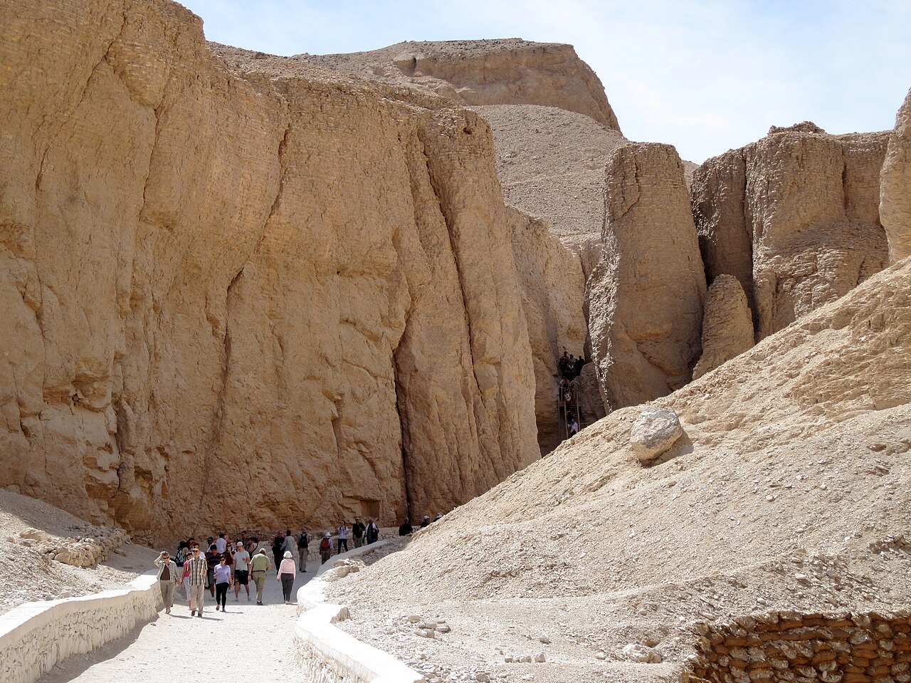
Rock-cut tombs in the Valley of the Kings, on the west bank of the Nile opposite Thebes, were excavated for pharaohs and powerful nobles of the New Kingdom over a period of nearly 500 years, from the Eighteenth to the Twentieth Dynasty. The Valley is known to contain 65 tombs and chambers, and became a UNESCO World Heritage Site in 1979 with the rest of the Theban Necropolis.
Tradition and region
About this kind of monument
Rock-cut tombs of Egypt
Egypt has some of the best-known rock-cut tombs in the world. In the Valley of the Kings, on the west bank of the Nile opposite Thebes, tombs were excavated for pharaohs and powerful nobles of the New Kingdom, for a period of nearly 500 years from the Eighteenth to the Twentieth Dynasty. The valley has two main sections, the East Valley where most royal tombs lie and the West Valley, known as the Valley of the Monkeys, and it is known to contain 65 tombs and chambers. It gained great attention after the discovery of the tomb of Tutankhamun in 1922, and became a UNESCO World Heritage Site in 1979 with the rest of the Theban Necropolis.
Much earlier, Beni Hasan in Middle Egypt is an ancient funerary site cut into the limestone cliffs on the east bank of the Nile about 20 kilometres south of Minya. In the Middle Kingdom it was the principal cemetery of the sixteenth nome of Upper Egypt, the Oryx nome, and its monumental tombs were cut roughly halfway up the cliff, overlooking the valley. Rock-cut tombs are also found at Deir el-Medina, between the Valley of the Kings and the Valley of the Queens.
The mastaba is a different tradition: a flat-roofed rectangular tomb with sloping sides, built of mudbrick or limestone, which marked the burial sites of eminent Egyptians in the Early Dynastic Period and Old Kingdom. The mastaba was built above ground and the rock-cut tomb into the cliff.
Egyptian tombs are among the best dated monuments in the Atlas, because the dynasty or reign of the king or noble who owned them is known.
When visiting, remember that access to many tombs is limited.
Paraphrased from Wikipedia: Valley of the Kings, Wikipedia: Beni Hasan, Wikipedia: Rock-cut tomb, Wikipedia: Mastaba · CC BY-SA 4.0
Photographs
8 photographs, each with its author and licence
More photographs
Lore
Evidence & Lore
What the sources actually support — and, kept apart, what has been claimed.
What the evidence supports
Dates
Est. 3600–2500 BCEHow this date was established: Type comparisonTypological estimate, not a date for this site: a hypogeum in North Africa is normally dated between 3600 BCE and 2500 BCE (Atlas typological table).Source for this date
Measured facts
- Location
- Valley of the KingsSource: Location
- Dynasties of use
- Eighteenth, Nineteenth, and TwentiethSource: Dynasties of use
- Probable use
- multiple royal family burialsSource: Probable use
- Accidental connection
- builders of KV9 broke into KV12Source: Accidental connection
- Early visitor
- James BurtonSource: Early visitor
- Recorded contents
- mummified remainsSource: Recorded contents
- Culture
- Ancient EgyptSource: Culture
- Length
- 92.33 metreSource: Length
Where it stands
Egypt
The pin marks the monument itself — its exact point.
- Coordinates
- 25°45′00″ N, 32°36′51″ EFor a GPS or map app: 25.75000, 32.61430
Access is as our sources describe it; we have not visited the site to check.
Nearby
The closest sites in the Atlas, by straight line.





Sources
Every record behind this page, with the link it came from.
2 sources behind this page
- 01Wikidata Q1719112wikidata.org
- 02Wikipedia (en)en.wikipedia.org
Image files
- Tal der Könige.jpgRolfcosarCC BY-SA 4.0
- Valley of the Kings panorama (450021688).jpgEndlisnisCC BY 2.0
- Valle de los reyes-2007 (2).JPGAlberto-g-roviCC BY-SA 3.0
- Valley of the Kings 2.jpgZezinho68CC BY-SA 4.0
- Thebes, Luxor, Egypt, Valley of the Kings from above.jpgVyacheslav ArgenbergCC BY 4.0
- Királyok völgye (keleti völgy középső részének sírjai).jpgKingtut at Hungarian WikipediaCC BY-SA 3.0
- La valée des rois - panoramio.jpgyoussef_alamCC BY 3.0
- KV12 Schematic.jpgR.F.MorganCC BY-SA 3.0
Report a correctionWrong date, name, photograph or source? Tell us and it will be put right.
Around this place
The ten nearest sites, by compass
Credit
Text, licence and sources
Adapted from the Wikipedia article "KV12" (English), licensed CC BY-SA 4.0; authors are listed in the page history. Reused under CC BY-SA 4.0. Read on Wikipedia · Edit history and authors
- Wikipedia (English): KV12CC BY-SA 4.0
- Wikidata Q1719112CC0