
KV11
Also known astomb of Ramses III
DatedEst. 1539–1075 BCE
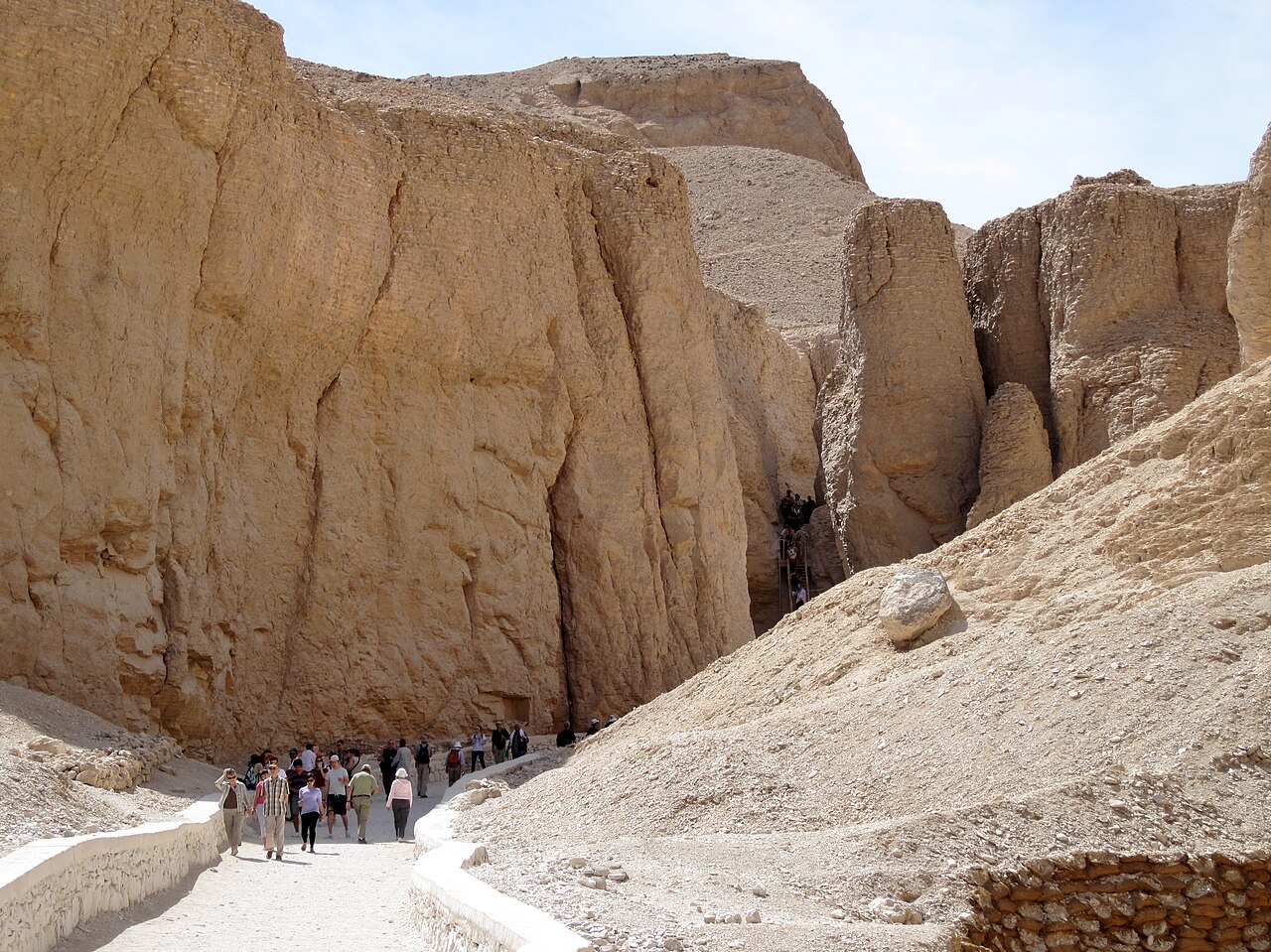
Photo R Prazeres · CC BY-SA 4.0Source file on Wikimedia Commons
Overview
About this site
Overview
Tomb KV11 is the tomb of Pharaoh Ramesses III, in the main valley of the Valley of the Kings, Egypt. It was originally started by Setnakhte but abandoned when it unintentionally broke into the earlier tomb of Amenmesse (KV10); Setnakhte was buried in KV14. KV11 was later restarted and extended on a different axis for Ramesses III.
The tomb has been open since antiquity and has been known as 'Bruce's Tomb', after James Bruce who entered it in 1768, and the 'Harper's Tomb', because of paintings of two blind harpers.
Read on Wikipedia3 min readCC BY-SA 4.0
Where it sits in time
The site's dated range, placed against world reference points.
The scale is logarithmic: each step to the left is about ten times older than the last.
Article
KV11
The second corridor is decorated with the Litany of Re, and at its end the axis of the tomb shifts.
DescriptionSources for this section
- Wikipedia (English): KV11CC BY-SA 4.0
Sources for this section
- Wikipedia (English): KV11CC BY-SA 4.0
The tomb is 188 m (617 ft) long and richly decorated. The second corridor is decorated with the Litany of Re, and at its end the axis of the tomb shifts. The third corridor, decorated with the Book of Gates and the Book of Amduat, leads over a ritual shaft into a four-pillared hall, again decorated with the Book of Gates. A fourth corridor with scenes of the opening of the mouth ceremony leads into a vestibule with scenes of the Book of the Dead, and then into the burial chamber.
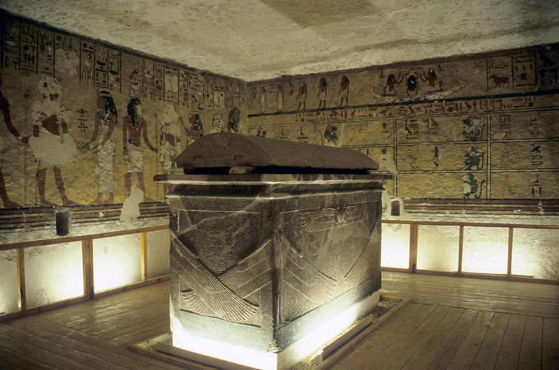
The burial chamber is an eight-pillared hall in which stood the red quartzite sarcophagus; its box is now in the Louvre and its lid in the Fitzwilliam Museum in Cambridge. The chamber is decorated with the Book of Gates, divine scenes and the Book of the Earth, and further annexes beyond it carry the Book of Gates. The outside of the sarcophagus features two scenes from the Amduat.
Research historySources for this section
- Wikipedia (English): KV11CC BY-SA 4.0
Sources for this section
- Wikipedia (English): KV11CC BY-SA 4.0
The tomb was first mentioned by the English traveller Richard Pococke in the 1730s, and James Bruce gave its first detailed description in 1768. Preliminary scientific studies were made by French scholars who had come to Egypt with Napoleon, and then by J. F. Champollion, R. Lepsius and, in the 19th century, G. Lefebure. In 1959 the Egyptian Department of Antiquities asked the Polish Egyptologist Dr. Tadeusz Andrzejewski to document the tomb; he began work under the Polish Centre of Mediterranean Archaeology, University of Warsaw, but soon died. Twenty years later the task passed to Dr. Marek Marciniak, and the introduction of martial law in Poland hindered publication of the results. Since 2017 a German expedition from the Humboldt University and the Egyptian universities in Luxor and Qena has worked on the site, documenting the tomb and carrying out conservation works.
ContextSources for this section
- Wikipedia (English): KV11CC BY-SA 4.0
Sources for this section
- Wikipedia (English): KV11CC BY-SA 4.0
Tombs in the Valley of the Kings, on the west bank of the Nile opposite Thebes, were excavated for pharaohs and powerful nobles of the New Kingdom for a period of nearly 500 years, from the Eighteenth to the Twentieth Dynasty. The valley became a UNESCO World Heritage Site in 1979 together with the rest of the Theban Necropolis.
Tradition and region
About this kind of monument
Rock-cut tombs of Egypt
Egypt has some of the best-known rock-cut tombs in the world. In the Valley of the Kings, on the west bank of the Nile opposite Thebes, tombs were excavated for pharaohs and powerful nobles of the New Kingdom, for a period of nearly 500 years from the Eighteenth to the Twentieth Dynasty. The valley has two main sections, the East Valley where most royal tombs lie and the West Valley, known as the Valley of the Monkeys, and it is known to contain 65 tombs and chambers. It gained great attention after the discovery of the tomb of Tutankhamun in 1922, and became a UNESCO World Heritage Site in 1979 with the rest of the Theban Necropolis.
Much earlier, Beni Hasan in Middle Egypt is an ancient funerary site cut into the limestone cliffs on the east bank of the Nile about 20 kilometres south of Minya. In the Middle Kingdom it was the principal cemetery of the sixteenth nome of Upper Egypt, the Oryx nome, and its monumental tombs were cut roughly halfway up the cliff, overlooking the valley. Rock-cut tombs are also found at Deir el-Medina, between the Valley of the Kings and the Valley of the Queens.
The mastaba is a different tradition: a flat-roofed rectangular tomb with sloping sides, built of mudbrick or limestone, which marked the burial sites of eminent Egyptians in the Early Dynastic Period and Old Kingdom. The mastaba was built above ground and the rock-cut tomb into the cliff.
Egyptian tombs are among the best dated monuments in the Atlas, because the dynasty or reign of the king or noble who owned them is known.
When visiting, remember that access to many tombs is limited.
Paraphrased from Wikipedia: Valley of the Kings, Wikipedia: Beni Hasan, Wikipedia: Rock-cut tomb, Wikipedia: Mastaba · CC BY-SA 4.0
From the article
Dated moments in the story
- 1768
The tomb has been open since antiquity, and has been known variously as "Bruce's Tomb" (named after James Bruce who entered the tomb in 1768) and the "Harper's Tomb" (due to paintings of two blind harpers in the tomb).
Source - 1768
The tomb was first mentioned by an English traveler Richard Pococke in the 1730s, but its first detailed description was given by James Bruce in 1768. Preliminary scientific studies were made by French scholars, who had come to Egypt with Napoleon, and then by, among others, J.
Source - 1959
In 1959, the Egyptian Department of Antiquities asked a Polish Egyptologist, Dr.
Source - 2017
Since 2017, a German expedition from the Humboldt University and the Egyptian universities in Luxor and Qena work on the site.
Source
Photographs
6 photographs, each with its author and licence
More photographs
Lore
Evidence & Lore
What the sources actually support — and, kept apart, what has been claimed.
What the evidence supports
Dates
Est. 1539–1075 BCEHow this date was established: Type comparisonTypical range for hypogeums in Egypt; this site has not been dated itself. The Valley was used for primary burials from approximately 1539 BC to 1075 BC.Source for this date
Where it stands
Egypt
The pin marks the monument itself — its exact point.
- Coordinates
- 25°45′00″ N, 32°36′51″ EFor a GPS or map app: 25.75000, 32.61430
Access is as our sources describe it; we have not visited the site to check.
Nearby
The closest sites in the Atlas, by straight line.





Sources
Every record behind this page, with the link it came from.
3 sources behind this page
- 01Wikidata Q385280wikidata.org
- 02Source for this dateen.wikipedia.org
- 03Wikipedia: KV11en.wikipedia.org
Image files
- KV11 Tomb of Ramses III DSCF2941.jpgR PrazeresCC BY-SA 4.0
- 2025 02 02 11 34 IMG 1059 32.jpgولاءPublic domain
- 2025 02 02 11 34 IMG 1059 33.jpgولاءPublic domain
- Thèbes. Bybân el-Molouk (Bîbân al-Mulûk). 1.2. Tableaux de la salle des harpes dans le 5-e tombeau des rois à l'est; 3-8. Peintures des tombeaux (NYPL b14212718-1268021).jpgImpr. impérialePublic domain
- KV11 Tomb of Rameses III (9794964463).jpgGary Todd from Xinzheng, ChinaCC0
- Királyok völgye (keleti völgy középső részének sírjai).jpgKingtut at Hungarian WikipediaCC BY-SA 3.0
Report a correctionWrong date, name, photograph or source? Tell us and it will be put right.
Around this place
The ten nearest sites, by compass
Credit
Text, licence and sources
Adapted from the Wikipedia article "KV11" (English), licensed CC BY-SA 4.0; authors are listed in the page history. Reused under CC BY-SA 4.0. Read on Wikipedia · Edit history and authors
- Wikipedia (English): KV11CC BY-SA 4.0
- Wikidata Q385280CC0