Overview
About this site
What the sources say
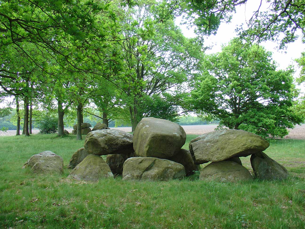
Hunebed D28 ligt samen met hunebed D29 iets ten oosten van het dorp Borger in de richting van Buinen ten zuiden van de N374 in de Nederlandse provincie Drenthe.
Article in DutchRead on Wikipedia4 min readCC BY-SA 4.0
Where it sits in time
The site's dated range, placed against world reference points.
The scale is logarithmic: each step to the left is about ten times older than the last.
The full article
D28: the whole story
In briefSources for this section
- Wikipedia (Dutch): D28 (hunebed)CC BY-SA 4.0
Sources for this section
- Wikipedia (Dutch): D28 (hunebed)CC BY-SA 4.0
D28 is a dolmen in Germany, although the monument known as hunebed D28 lies in the Netherlands. It stands with hunebed D29 a short distance east of the village of Borger, toward Buinen, south of the N374 in the Dutch province of Drenthe. The type dates from 3500 BCE to 2800 BCE by typological estimate.
Hunebed D28 has three capstones, unlike the nearby D29, which has only two. It also has eight supporting stones and two closing stones. The mound that once covered the monument was never higher than the underside of the capstones and has since been dug away. Archaeological research has taken place at the site on several occasions.
H. Tiessing reported in 1905 that many antiquities had been damaged by the digging of the Buineres between 1880 and 1890. Van Giffen examined the dolmen in 1927 and described it as being in good condition. The Biologisch-Archaeologisch Instituut (BAI) at Groningen investigated it in 1985. Finds included pottery, copper-wire beads now held by the Drents Museum, and red flint axes from North Germany.
In July 1878, William Collings Lukis and sir Henry Dryden surveyed forty hunebedden on the Hondsrug for the Society of Antiquaries. Their unpublished report, measurements and watercolours were kept by the Society of Antiquaries, the Guernsey Museum & Art Gallery and the Drents Museum, while the Ashmolean Museum in Oxford holds copies. Their work was published in 2015 by Drentse archaeologist dr. Wijnand van der Sanden. Monuments of this kind in northern Germany and the Netherlands were built by the Funnel Beaker culture.
Summary in EnglishSources for this section
- Wikipedia (Dutch): D28 (hunebed)CC BY-SA 4.0
Sources for this section
- Wikipedia (Dutch): D28 (hunebed)CC BY-SA 4.0
D28 is a dolmen in Borger-Odoorn, Germany. Wikidata describes it as: dolmen in the Netherlands. A typological estimate: 3500 BCE to 2800 BCE. No English Wikipedia article exists for it; the full text below is the Dutch article "D28 (hunebed)", shown in the original language.
BouwSources for this section
- Wikipedia (Dutch): D28 (hunebed)CC BY-SA 4.0
Sources for this section
- Wikipedia (Dutch): D28 (hunebed)CC BY-SA 4.0
Hunebed D28 heeft, in tegenstelling met het nabijgelegen D29, drie dekstenen (D29 heeft er slechts twee). Daarnaast heeft het hunebed acht draagstenen en twee sluitstenen.
De dekheuvel (die inmiddels afgegraven is) is nooit hoger geweest dan de onderkant van de dekstenen.
GeschiedenisSources for this section
- Wikipedia (Dutch): D28 (hunebed)CC BY-SA 4.0
Sources for this section
- Wikipedia (Dutch): D28 (hunebed)CC BY-SA 4.0
H. Tiessing beschrijft in 1905 dat er veel oudheden zijn verstoord door het doorwerken van de Buineres tussen 1880 en 1890.
De hunebedden liggen in een klein bebost gebied midden in een akker, dat te bereiken is via een smal zandpaadje. Er is bij deze hunebedden meermalen archeologisch onderzoek gedaan.
Van Giffen onderzocht het hunebed in 1927 en noemt het hunebed "in goeden staat"
Later onderzocht het Biologisch-Archaeologisch Instituut (BAI) te Groningen het hunebed in 1985.
Er is aardewerk en er zijn van koperdraad gedraaide kralen gevonden, deze behoren thans tot de collectie van het Drents Museum. De kralen stammen waarschijnlijk uit Midden-Europa of Zuidoost-Europa. Ook zijn er rode vuurstenen bijlen uit Noord-Duitsland aangetroffen.
Society of AntiquariesSources for this section
- Wikipedia (Dutch): D28 (hunebed)CC BY-SA 4.0
Sources for this section
- Wikipedia (Dutch): D28 (hunebed)CC BY-SA 4.0
In Engeland ontstond in de jaren zeventig van de 19e eeuw bezorgdheid over de wijze waarop in Nederland hunebedden werden gerestaureerd. In die kringen was men vooral bezorgd dat met de restauraties het oorspronkelijk beeld van de situatie verloren zou gaan. De directeur van de Society of Antiquaries in Londen verzocht de oudheidkundigen William Collings Lukis en sir Henry Dryden om de staat waarin de hunebedden zich op dat moment bevonden nauwkeurig vast te leggen. Zij bezochten in juli 1878 Drenthe en brachten veertig hunebedden op de Hondsrug in kaart. Ze hebben opmetingen verricht en beschreven de aangetroffen situatie, die zij tevens vastlegden in een serie aquarellen. Hun rapportage aan de Society of Antiquaries verscheen echter niet in druk. Hun materiaal werd bewaard bij de Society of Antiquaries, het Guernsey Museum & Art Gallery en het Drents Museum. Het Ashmolean Museum in Oxford bezit kopieën van hun werk. In 2015 publiceerde de Drentse archeoloog dr. Wijnand van der Sanden alsnog hun werk. Hij voorzag hun materiaal van een uitgebreide inleiding. Ook schetste hij de ontwikkelingen met betrekking tot het archeologisch onderzoek van de hunebedden na hun onderzoek tot 2015. Hij gaf als oordeel dat het werk van Lukis en Dryden van hoge kwaliteit was. In het Drents Museum was in 2015 een tentoonstelling over het werk.
Hunebed D28 is weergegeven op Plan XXIII: Er waren nog drie dekstenen aanwezig. De deksteen aan de oostelijke kant was verdwenen. Er waren tien draagstenen. De oostelijke kant van de meest westelijke deksteen was op de grond komen te liggen. Er stonden nog twee poortstenen aan de zuidkant. De archeoloog Janssen heeft deze stenen niet opgemerkt, aldus Lukis en Dryden, tijdens zijn observaties. De dekheuvel is recentelijk 60 centimeter verlaagd.
How this page was madeSources for this section
- Wikipedia (Dutch): D28 (hunebed)CC BY-SA 4.0
Sources for this section
- Wikipedia (Dutch): D28 (hunebed)CC BY-SA 4.0
The summary at the top of this page was written by MiniMax-M3 (2026-11-07) from the cited Wikipedia article “D28 (hunebed)”, translated from Dutch. The numbers in it were checked automatically against the source text. The rest of the page is the article itself, the structured records and computed distances.
Tradition and region
About this kind of monument
German and Dutch Hünengräber (hunebedden)
The megalithic tombs of northern Germany and the Netherlands were built by the Funnel Beaker culture (about 4100 to 2800 BCE), and the style, called Nordic megalith architecture, emerged between 3500 and 2800 BCE. In the Netherlands the tombs are the hunebedden, built between 3470 and 3250 BCE by the western group of the Funnel Beaker culture and used until about 2760 BCE. Of an estimated 100 original tombs, 54 are preserved, 52 of them in the province of Drenthe and two in Groningen. After the Funnel Beaker culture ended the sites were reused by the Single Grave and Bell Beaker cultures in the Early Bronze Age and, to a lesser extent, into the Middle Ages.
In Mecklenburg-Vorpommern up to 5,000 megalith tombs were erected, and more than 1,000 are preserved and protected by law; they belong to the youngest and easternmost part of the western European tradition. Most are dolmens, often lying inside a circular or trapezoid frame of standing stones. Locally they are known as Hünengräber, "giants' tombs", or Großsteingräber, "large stone tombs"; the trapezoid frame is a Hünenbett, "giants' bed", and the circular one a Bannkreis. Between 1964 and 1974 Ewald Schuldt excavated over a hundred sites there and sorted them into simple dolmens, extended dolmens, passage graves, great dolmens, unchambered long barrows and stone cists.
Folklore: the German and Dutch names, with Hüne meaning "giant", carry the old idea that giants were buried here. This is a tradition; the stones were placed by Neolithic farmers.
When visiting, look for the capstones on their supports and the frame of kerbstones around them.
Paraphrased from Wikipedia: Megaliths in the Netherlands, Wikipedia: Megaliths in Mecklenburg-Vorpommern, Wikipedia: Nordic megalith architecture, Wikipedia: Funnel beaker culture, Wikipedia: Dolmen · CC BY-SA 4.0
From the article
Dated moments in the story
- 1878
Zij bezochten in juli 1878 Drenthe en brachten veertig hunebedden op de Hondsrug in kaart.
Source - 1905
Tiessing beschrijft in 1905 dat er veel oudheden zijn verstoord door het doorwerken van de Buineres tussen 1880 en 1890. De hunebedden liggen in een klein bebost gebied midden in een akker, dat te bereiken is via een smal zandpaadje.
Source - 1927
Van Giffen onderzocht het hunebed in 1927 en noemt het hunebed "in goeden staat" Later onderzocht het Biologisch-Archaeologisch Instituut (BAI) te Groningen het hunebed in 1985. Er is aardewerk en er zijn van koperdraad gedraaide kralen gevonden, deze behoren thans tot de collectie van het Drents Museum.
Source - 2015
In 2015 publiceerde de Drentse archeoloog dr.
Source - 2015
Ook schetste hij de ontwikkelingen met betrekking tot het archeologisch onderzoek van de hunebedden na hun onderzoek tot 2015. Hij gaf als oordeel dat het werk van Lukis en Dryden van hoge kwaliteit was.
Source - 2015
In het Drents Museum was in 2015 een tentoonstelling over het werk.
Source
See it in 3D
An interpretive reconstruction of the monument, standing on the real ground at its exact point, under the sun for that place and season. Drag to look around it.
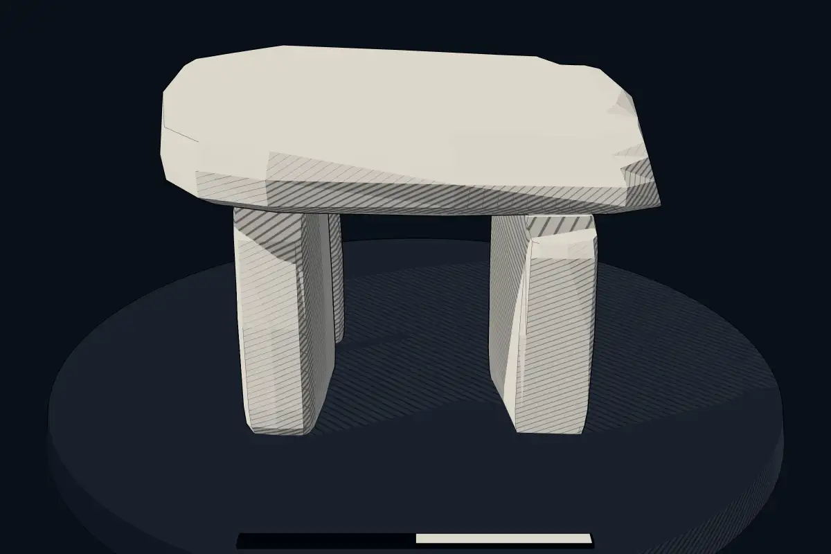
The reconstruction is ours, not a survey: it shows what a monument of this type looks like, at the size the record gives for this one.
Photographs
4 photographs, each with its author and licence
More photographs
Lore
Evidence & Lore
What the sources actually support — and, kept apart, what has been claimed.
What the evidence supports
Dates
Est. 3500–2800 BCEHow this date was established: Type comparisonTypical range for dolmens in Germany; this site has not been dated itself. German dolmens (Huengrab) belong to the Nordic megalith tradition which emerged predominantly between 3500 and 2800 BC.Source for this date
Where it stands
Germany
The pin marks the monument itself — its exact point.
- Coordinates
- 52°55′33″ N, 6°48′39″ EFor a GPS or map app: 52.92592, 6.81094
Access is as our sources describe it; we have not visited the site to check.
Nearby
The closest sites in the Atlas, by straight line.


Sources
Every record behind this page, with the link it came from.
2 sources behind this page
- 01Wikidata Q2326552wikidata.org
- 02Source for this dateen.wikipedia.org
Image files
- Hunebed D28 tussen Borger en Buinen.jpgGouwenaarPublic domain
- HunebedD28.jpgRuben HolthuijsenCC BY 2.0
- Hunebed D28.jpgAlex HoekerdCC0
- Hunebed D28 Goedeljee.jpgJan Goedeljee (1824-1905)CC BY 4.0
Report a correctionWrong date, name, photograph or source? Tell us and it will be put right.
Around this place
The ten nearest sites, by compass
Credit
Text, licence and sources
Text from the Wikipedia article "D28 (hunebed)" (Dutch), licensed CC BY-SA 4.0; authors are listed in the page history. Reused under CC BY-SA 4.0. Read on Wikipedia · Edit history and authors
- Wikipedia (Dutch): D28 (hunebed)CC BY-SA 4.0
- Wikidata Q2326552CC0