Estela Menir da Caparrosa
DatedEst. 2800–1800 BCE
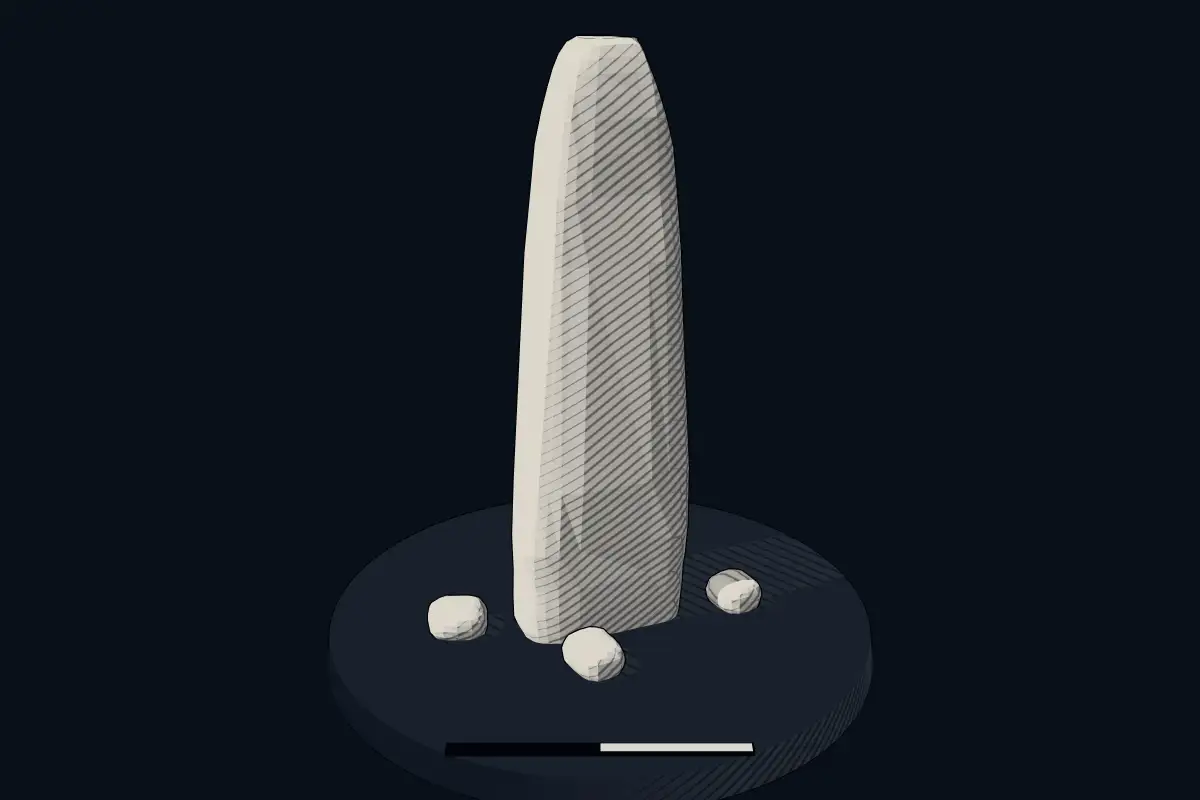
No licensed photograph yetWe have no photograph we may publish for this site, so the interpretive 3D view leads instead.
Overview
About this site
What the sources say
Le menhir de Caparrosa (en portugais : menir da Caparrosa) est un mégalithe datant du Néolithique ou du Chalcolithique situé près de la municipalité de Tondela, dans le district de Viseu, en Région Centre, au Portugal.
Article in FrenchRead on Wikipedia3 min readCC BY-SA 4.0
Where it sits in time
The site's dated range, placed against world reference points.
The scale is logarithmic: each step to the left is about ten times older than the last.
The full article
Estela Menir da Caparrosa: the whole story
In briefSources for this section
- Wikipedia (French): Menhir de CaparrosaCC BY-SA 4.0
Sources for this section
- Wikipedia (French): Menhir de CaparrosaCC BY-SA 4.0
Estela Menir da Caparrosa is a standing stone, or menhir, dating from 2800 BCE to 1800 BCE. It stands in the former parish of Caparrosa, about fifteen kilometres north of Tondela and about twenty kilometres west-southwest of Viseu, in the Centro Region of Portugal, close to the N228 national road.
The monolith is made of granite and measures 2,50 m in height, 1 m in width and 50 cm in thickness. It may be a statue-menhir, a form decorated or shaped to represent a human figure. A cross and the year 1804 were carved into the stone.
Its dating from 2800 BCE to 1800 BCE is based on typological comparison rather than a date obtained directly from the monument. Research on the site is documented in publications by Mário Varela Gomes and J. Pinho Monteiro from 1974-1977 and by Mario Gomes from 1993.
The monument is also known in Portuguese as menir da Caparrosa and appears in the literature as the Marco de Anta or Estela-menir de Caparrosa. Its later carved cross and the date 1804 remain visible features of the granite, although the original purpose of the standing stone is not explained in the available material.
No English Wikipedia article exists for it; the full text below is the French article "Menhir de Caparrosa", shown in the original language.
Summary in EnglishSources for this section
- Wikipedia (French): Menhir de CaparrosaCC BY-SA 4.0
Sources for this section
- Wikipedia (French): Menhir de CaparrosaCC BY-SA 4.0
Estela Menir da Caparrosa is a menhir (standing stone) in Caparrosa e Silvares, Portugal. A typological estimate: 2800 BCE to 1800 BCE. No English Wikipedia article exists for it; the full text below is the French article "Menhir de Caparrosa", shown in the original language.
SituationSources for this section
- Wikipedia (French): Menhir de CaparrosaCC BY-SA 4.0
Sources for this section
- Wikipedia (French): Menhir de CaparrosaCC BY-SA 4.0
Le menhir est situé dans l'ancienne freguesia de Caparrosa, à une quinzaine de kilomètres au nord de Tondela et à une vingtaine de kilomètres à l'ouest-sud-ouest de Viseu ; il se dresse à proximité de la route nationale 228 (N228).
DescriptionSources for this section
- Wikipedia (French): Menhir de CaparrosaCC BY-SA 4.0
Sources for this section
- Wikipedia (French): Menhir de CaparrosaCC BY-SA 4.0
Le monolithe, composé de granite, mesure 2,50 m de hauteur pour 1 m de largeur et 50 cm d'épaisseur ; il pourrait s'agir d'une statue-menhir.
Une croix fut gravée sur la pierre ainsi que l'année 1804.
AnnexesSources for this section
- Wikipedia (French): Menhir de CaparrosaCC BY-SA 4.0
Sources for this section
- Wikipedia (French): Menhir de CaparrosaCC BY-SA 4.0
Bibliographie
(pt) Mário Varela Gomes et J. Pinho Monteiro, « A estela-menir decorada da Caparrosa, Beira-Alta: nota de descoberta », O Arqueólogo Português, iII, vol. VII-IX, 1974-1977, p. 89-93 (lire en ligne [PDF])
(pt) Mario Gomes, « O Marco de Anta ou Estela-menir de Caparrosa », Estudos Pré-Históricos, vol. I, 1993, p. 7-27 (lire en ligne [PDF])
Articles connexes
Liste des sites mégalithiques dans le district de Viseu
Portail du mégalithisme Portail du Portugal
How this page was madeSources for this section
- Wikipedia (French): Menhir de CaparrosaCC BY-SA 4.0
Sources for this section
- Wikipedia (French): Menhir de CaparrosaCC BY-SA 4.0
The summary at the top of this page was written by MiniMax-M3 (2026-11-08) from the cited Wikipedia article “Menhir de Caparrosa”, translated from French. The numbers in it were checked automatically against the source text. The rest of the page is the article itself, the structured records and computed distances.
Tradition and region
About this kind of monument
Iberian menhirs
In Spain menhirs of the western European megalithic type are relatively unusual compared with dolmens, but are common sights in the northern half of the country, where at least 500 have been reported. They are particularly common in the Basque Country, Navarre, northern Burgos and Palencia, Cantabria and the Pyrenees, usually standing alone or in small groups (cromlechs) in elevated places. Most appear to date back to the Stone Age. They are not usually associated with burials, though at the Menhir of Cuesta del Molino in Burgos burials were made at least 2,000 years after the menhir was raised. The Arlobi menhir is one of the most recent examples.
Portugal's highest concentration is in the Alentejo, where the Menhir of Meada is the largest on the Iberian Peninsula. The Menhir of Outeiro, near Reguengos de Monsaraz in the district of Évora, is the second largest in Portugal: a granite monolith 5.6 metres high, about a metre across and an estimated eight tonnes. It was found lying on its side in 1969 by Henrique Leonor Pina and José Pires Gonçalves and re-erected about 1970, and was classified as a national monument in 1971. A hollow in its top has been read as a urethra, so that the stone is taken as phallic; that is an interpretation, not a fact.
The Almendres Cromlech near Évora is the largest group of structured menhirs on the Iberian Peninsula, and one of the largest in Europe. It belongs to the "megalithic universe of Évora", with parallels in the Portela de Mogos cromlech. Its beginnings have been put as far back as the sixth millennium BCE, which would make it extremely early, and it was rediscovered in 1966 by Henrique Leonor Pina.
When visiting, look for stones on high ground and note which way they face.
Paraphrased from Wikipedia: Menhir, Wikipedia: Menhir of Outeiro, Wikipedia: Almendres Cromlech, Wikipedia: List of menhirs · CC BY-SA 4.0
From the article
Dated moments in the story
- 1804
Une croix fut gravée sur la pierre ainsi que l'année 1804.
Source
See it in 3D
An interpretive reconstruction of the monument, standing on the real ground at its exact point, under the sun for that place and season. Drag to look around it.
The reconstruction is ours, not a survey: it shows what a monument of this type looks like, at the size the record gives for this one.
Lore
Evidence & Lore
What the sources actually support — and, kept apart, what has been claimed.
What the evidence supports
Dates
Est. 2800–1800 BCEHow this date was established: Type comparisonTypical range for menhirs in Portugal; this site has not been dated itself. Standing stones are associated with the Beaker people of the European late Neolithic and early Bronze Age c. 2800-1800 BC.Source for this date
Where it stands
Portugal
The pin marks the monument itself — its exact point.
- Coordinates
- 40°37′59″ N, 8°05′08″ WFor a GPS or map app: 40.63316, -8.08553
Access is as our sources describe it; we have not visited the site to check.
Nearby
The closest sites in the Atlas, by straight line.
- Megalithic mound (tumulus with integral stones)Mamoa 1 do Vale d´Anta
 Lapa da Meruje4000–3000 BCE
 Dólmen da Malhada do Cambarinho4000–3000 BCE
- DolmenAnta do Repilau4000–3000 BCE
 Anta da Arca4000–3000 BCE
 Anta da Lameira do Fojo 14000–3000 BCE
 Anta de Arquinha da Moura4000–3000 BCE
- Anta da Arquinha da Moura4000–3000 BCE


Sources
Every record behind this page, with the link it came from.
2 sources behind this page
- 01Wikidata Q48755334wikidata.org
- 02Source for this dateen.wikipedia.org
Report a correctionWrong date, name, photograph or source? Tell us and it will be put right.
Around this place
The ten nearest sites, by compass
- Mamoa 1 do Vale d´Anta3.2 km NW
- Lapa da Meruje4.6 km W
- Dólmen da Malhada do Cambarinho6.0 km NW
- Anta do Repilau11 km NE
- Anta da Arca11 km W
- Anta da Lameira do Fojo 111 km NE
- Anta de Arquinha da Moura15 km SE
- Anta da Arquinha da Moura15 km SE
- Antelas dolmen16 km NW
- Monumentos Megalíticos do Chão de Redondo 1 e 219 km W
Credit
Text, licence and sources
Text from the Wikipedia article "Menhir de Caparrosa" (French), licensed CC BY-SA 4.0; authors are listed in the page history. Reused under CC BY-SA 4.0. Read on Wikipedia · Edit history and authors
- Wikipedia (French): Menhir de CaparrosaCC BY-SA 4.0
- Wikidata Q48755334CC0