
Overview
About this site
Overview
Kabah is an other / unclassified in Mexico. It lies at 20.2484° N, 89.6473° W.
Catalogue recordSources and licences
Where it sits in time
The site's dated range, placed against world reference points.
The scale is logarithmic: each step to the left is about ten times older than the last.
Article
Kabah
ContextSources for this section
- en.wikipedia.orgCC BY-SA 4.0
- en.wikipedia.orgCC BY-SA 4.0
- en.wikipedia.orgCC BY-SA 4.0
Sources for this section
- en.wikipedia.orgCC BY-SA 4.0
- en.wikipedia.orgCC BY-SA 4.0
- en.wikipedia.orgCC BY-SA 4.0
Mesoamerica's civilisations raised carved stone monuments. Maya stelae are tall sculpted stone shafts, often paired with low circular stones called altars, though their actual function is uncertain. Many stelae are carved in low relief, though plain ones are found throughout the Maya region. The sculpting of these monuments spread across the Maya area in the Classic Period (about 250 to 900 CE), and the pairing of sculpted stela and altar is a hallmark of Classic Maya civilisation. The earliest dated stela found in place in the Maya lowlands comes from Tikal in Guatemala, and during the Classic Period almost every Maya kingdom in the southern lowlands raised stelae in its ceremonial centre. The regional background, “Mesoamerican stelae and carved stone”, is given below.
DatingSources for this section
- Fringe claim sourceCC BY-SA 4.0
Sources for this section
- Fringe claim sourceCC BY-SA 4.0
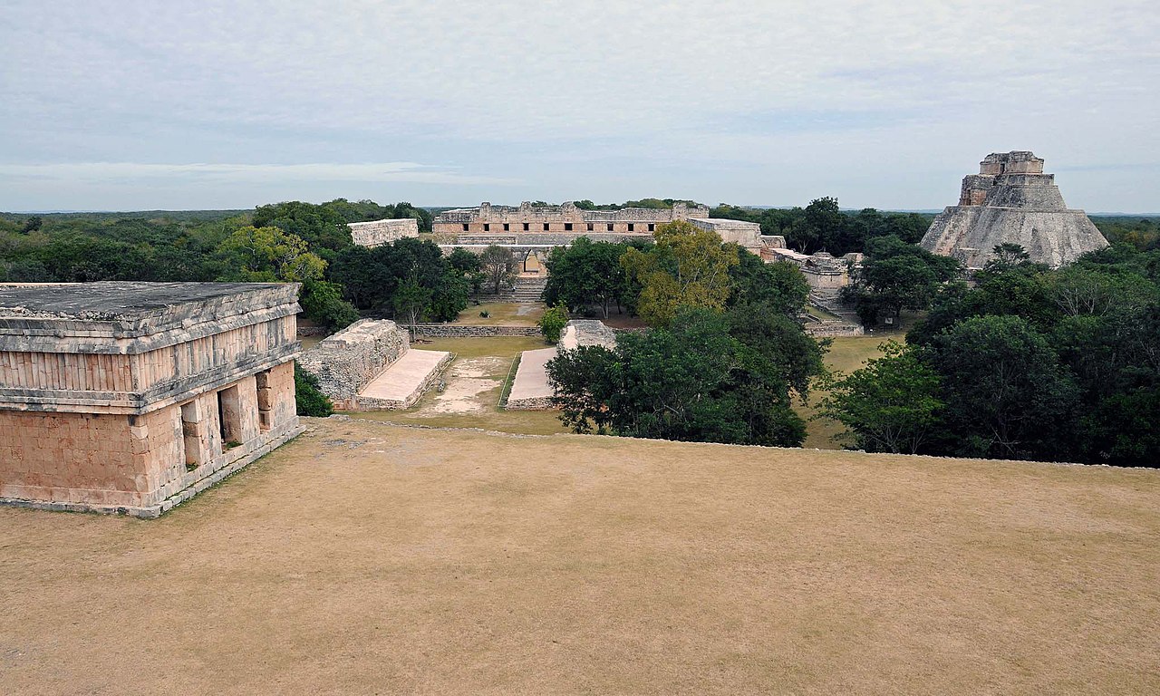
The site is dated 700 CE to 1100 CE by a published source statement. The area was inhabited from the mid-3rd century BCE, and most of the architecture now visible was built between the 7th and 11th centuries CE.
Published age estimates for the site include 700 CE to 1100 CE (published source). The mainstream range is 700 CE to 1100 CE.
Setting
1 other recorded monument lies within 10 km (0 within 1 km, 0 within 5 km), 1 of them of the same type. In Mexico, 10 of the 11 recorded monuments are of this type.
The nearest recorded monuments are Sayil (7.9 km south, other / unclassified); Gran piramide (17.8 km north-west, other / unclassified); Pyramid of the Magician (17.9 km north-west, other / unclassified); Uxmal (17.9 km north-west, other / unclassified).
ProtectionSources for this section
Sources for this section
No heritage designation is recorded for the site.
Tradition and region
About this kind of monument
Mesoamerican stelae and carved stone
Mesoamerica's civilisations raised carved stone monuments. Maya stelae are tall sculpted stone shafts, often paired with low circular stones called altars, though their actual function is uncertain. Many stelae are carved in low relief, though plain ones are found throughout the Maya region. The sculpting of these monuments spread across the Maya area in the Classic Period (about 250 to 900 CE), and the pairing of sculpted stela and altar is a hallmark of Classic Maya civilisation. The earliest dated stela found in place in the Maya lowlands comes from Tikal in Guatemala, and during the Classic Period almost every Maya kingdom in the southern lowlands raised stelae in its ceremonial centre.
The Olmec colossal heads, much older, are stone representations of heads carved from large basalt boulders, from 1.17 to 3.4 metres high. They date from at least 900 BCE and are a distinctive feature of Olmec civilisation. All portray individuals with distinctive features of the people who still live in Tabasco and Veracruz, and the backs are often flat. The boulders came from the Sierra de los Tuxtlas mountains in Veracruz, and given the weight of the stone, which was moved over 150 kilometres, much labour was needed.
Many Maya stelae carry inscriptions in hieroglyphs with dates in the Long Count calendar, and so can be dated to the day. This makes them among the most precisely dated monuments in the Atlas. They commemorate rulers and events, not the dead in general.
The Atlas's records in Mexico, Guatemala and Belize are mostly Maya sites with stelae, altars and carved monuments.
When visiting, look at the carved figure on the front, which is usually a ruler, and at the glyphs on the sides and back. Many stelae are now protected by roofs.
Paraphrased from Wikipedia: Maya stelae, Wikipedia: Olmec colossal heads, Wikipedia: Stele · CC BY-SA 4.0
Photographs
8 photographs, each with its author and licence
More photographs
Lore
Evidence & Lore
What the sources actually support — and, kept apart, what has been claimed.
What the evidence supports
Dates
700–1100 CEHow this date was established: Stated by the sourceThe area was inhabited from the mid-3rd century BCE, and most of the architecture now visible was built between the 7th and 11th centuries CE.Source for this date
Where it stands
Mexico
The pin marks the monument itself — its exact point.
- Coordinates
- 20°14′54″ N, 89°38′50″ WFor a GPS or map app: 20.24843, -89.64730
Access is as our sources describe it; we have not visited the site to check.
Nearby
The closest sites in the Atlas, by straight line.




Sources
Every record behind this page, with the link it came from.
2 sources behind this page
- 01Wikidata Q325468wikidata.org
- 02Fringe claim sourceen.wikipedia.org
Image files
Report a correctionWrong date, name, photograph or source? Tell us and it will be put right.
Around this place
The ten nearest sites, by compass
Credit
Text, licence and sources
Compiled from open records (Wikidata, CC0; OpenStreetMap, ODbL) and a regional background article based on Wikipedia (CC BY-SA 4.0).
- Wikidata Q325468CC0
- Fringe claim sourceCC BY-SA 4.0
- en.wikipedia.orgCC BY-SA 4.0
- en.wikipedia.orgCC BY-SA 4.0
- en.wikipedia.orgCC BY-SA 4.0