
Chambered cairnFringe site
Balnuaran of Clava
DatedEst. 4000–2400 BCE
Photo Sir Gawain · CC BY-SA 4.0Source file on Wikimedia Commons

Overview
About this site
Overview
Balnuaran of Clava is the site of several Late Neolithic megalithic monuments in Strathnairn, Scotland, eight kilometres south-east of Inverness and only two kilometres from the battlefield of Culloden. This kind of stone mound occurs only in north-eastern Scotland, in an area south and west of the Moray Firth, and took the name Clava cairns from Balnuaran of Clava.
The cairns are about 4000 years old and were used in two phases: a fairly short first phase around 2300 to 2000 BCE, and a reuse roughly 1000 years later. The site has been a scheduled monument since 18 August 1882 and is in the care of Historic Environment Scotland.
Read on Wikipedia7 min readCC BY-SA 4.0
Where it sits in time
The site's dated range, placed against world reference points.
The scale is logarithmic: each step to the left is about ten times older than the last.
Article
Balnuaran of Clava
Three stone mounds lie one behind the other on a line, not quite straight, running from north-east to south-west.
ConstructionSources for this section
- Wikipedia (German): Balnuaran of ClavaCC BY-SA 4.0
Sources for this section
- Wikipedia (German): Balnuaran of ClavaCC BY-SA 4.0
Three stone mounds lie one behind the other on a line, not quite straight, running from north-east to south-west. They date from the Late Neolithic or the early Bronze Age, and each is surrounded by a stone circle. A Kerb Cairn about 1000 years younger also lies on the site. The three Clava cairns each consist of a central, roughly circular stone mound. Two are passage graves and the middle one is a ring cairn. The two passage graves formerly had corbelled stone roofs, which have been lost over time. All three mounds are surrounded by a platform of rubble that holds the outer kerb stones in position. These outer stones are graded by height, the tallest at the south-west of each mound and the lowest at the north-east, and the same applies to the kerb stones of the inner chambers.
Red and white stones were used in all the cairns: red sandstone, red conglomerate or pink pegmatite, and pale granite, gneiss and mica schist. A very few stones are black. When the cairns were built they must have appeared very colourful and high in contrast. The stones were arranged by colour as well as by size, so that certain areas appeared entirely white or entirely red.
DescriptionSources for this section
- Wikipedia (German): Balnuaran of ClavaCC BY-SA 4.0
Sources for this section
- Wikipedia (German): Balnuaran of ClavaCC BY-SA 4.0
The north-east cairn is a passage grave whose material is piled to a height of almost 10 feet (about three metres). Its passage, aligned on the winter solstice, was rather low, so that one could not stand upright in it, yet the rays of the setting sun on the day of the winter solstice reached the inner chamber. The chamber has a diameter of 12 to 13 feet (about 3.7 to 4 metres) and is formed by kerb stones 2.5 to 3.9 feet (about 0.8 to 1.2 metres) high. The outer diameter of the cairn is 55 feet (about 16.8 metres), and its outer edge is formed by stones between 1.6 and 3 feet (about 49 and 91 centimetres) high, one of which bears cup marks. A circle of eleven stones surrounds the cairn. Because it is not quite circular, it lies between 24 and 37 feet (about 7.3 and 11.3 metres) from the outer edge of the mound. Its irregular shape could result from the re-erection of three fallen stones in the nineteenth century.
The middle cairn is a ring cairn, that is, a closed, roughly circular ring of stones with a central chamber that cannot be reached by a passage. With a diameter of 18 to 21 feet (about 5.5 to 6.4 metres), the chamber is larger than in the two neighbouring cairns and can never have had a roof. The outer diameter is 52 to 60 feet (about 15.8 to 18.3 metres) and the cairn stands up to four feet (about 1.20 metres) high. Many of its outer kerb stones have been lost, and some of those that remain bear cup marks. The most striking surviving outer stone is a monolith stump 4.3 feet (about 1.30 metres) high. After the mound ceased to be used as a grave, the inner chamber was filled with rubble, which was removed again during the repair work of the 1930s. The cairn is surrounded by a circle of nine monoliths, the tallest of which stands in the south-west of the circle, which has a diameter of 100 feet (about 30.5 metres). Unlike the other two cairns, this mound is linked to four of the monoliths of the circle by stone causeways six to eight feet (about 1.8 to 2.4 metres) wide.
The south-west cairn is a passage grave very similar to the north-east one. It lies about 80 feet from the middle cairn and has an outer diameter of 52.6 feet (about 16 metres). Its passage is 19.9 feet (a little over six metres) long and 2 feet (about 0.6 metres) wide. Like the passage of the north-east cairn it is aligned on the winter solstice, and it begins at the south-west of the cairn. The inner chamber is not quite circular, with a diameter between 11.6 and 13 feet. Its kerb stones, which reach 6.9 feet (about 2.10 metres) in height, include some with cup marks, as does one of the monoliths of the stone circle. The circle consists of ten monoliths standing between 24 and 28 feet (about 7.3 to 8.5 metres) from the edge of the mound. Three of them fell in the nineteenth century and were re-erected in 1876. Two had to be moved for the construction of the present access road and no longer stand in their original positions.
The Bronze Age Kerb Cairn is a small burial place surrounded by a ring of 15 stones, lying south-west of the middle cairn and north of the south-west cairn. It probably dates from around 1000 BCE and is heavily damaged. It was uncovered only in the excavations of the 1950s. It too is built of red and white stones, one of which bears cup-and-ring marks.
HistorySources for this section
- Wikipedia (German): Balnuaran of ClavaCC BY-SA 4.0
Sources for this section
- Wikipedia (German): Balnuaran of ClavaCC BY-SA 4.0
The site was already settled and farmed in the Neolithic before the first mounds were built, around 2300 to 2000 BCE, at the turn from the Late Neolithic to the early Bronze Age. The cairns replaced the settlement that had stood there. They were in use only for a relatively short time and served for a few burials, perhaps even for a single one. When a burial mound went out of use, it was surrounded by a platform of rubble that prevented access to the cairn, and a stone circle was erected at the outer edge of the platform. About 1000 years later the cairns were reused as burial places. At that time new graves were also built close by, among them a Kerb Cairn.
Research historySources for this section
- Wikipedia (German): Balnuaran of ClavaCC BY-SA 4.0
Sources for this section
- Wikipedia (German): Balnuaran of ClavaCC BY-SA 4.0
Three of the mounds were first examined more closely in the nineteenth century, when some bones are said to have been found in the north-east mound in 1828. An excavation in 1858 in the south-west cairn yielded the sherds of two urns and a few finds of calcined bone. In 1870 and 1871 the landowner decided to secure the four best-preserved cairns by surrounding them with a wall and having the vegetation cut back. Stones from the mounds appear to have been used in building the wall. He also laid out the present access road on the south-east side of the site, for which two of the monoliths of the south-west stone circle were moved. Because the cairns were then thought to be Druidic cult sites, the trees now on the site were planted to create a "Druid grove".
At the beginning of the 1930s the Office of Works initiated repairs, since a great deal of stone had fallen from the mounds and lay loose on the ground. Partial excavations were carried out at the same time under Kathleen Kennedy; their results were never published and were rediscovered only at the end of the 1980s. Scientifically documented excavations took place in the 1950s under Stuart Piggott but brought few new findings. In the chamber of the central ring cairn the archaeologists found signs of a fire and some cremated bone. Several excavation campaigns and field surveys between 1994 and 1997, under Professor Richard Bradley of the University of Reading, again examined the Clava cairns in detail and documented the surviving above-ground structures.
ContextSources for this section
- Wikipedia (German): Balnuaran of ClavaCC BY-SA 4.0
Sources for this section
- Wikipedia (German): Balnuaran of ClavaCC BY-SA 4.0
A chambered cairn is a stone mound over one or more burial chambers, entered by a passage. Scotland, and above all Orkney and Caithness, has many Neolithic tombs of this kind.
Tradition and region
About this kind of monument
Orkney, Caithness and Scottish chambered cairns
Scotland, and above all Orkney and Caithness, has many Neolithic tombs. A chambered cairn is a stone mound over one or more burial chambers, entered by a passage. Maeshowe on Mainland Orkney was probably built around 2800 BCE, and gives its name to the Maeshowe type of cairn, which is limited to Orkney; its entrance passage is about 11 metres long, and sunlight enters it at the winter solstice and reaches the rear wall of the chamber. It is part of the Heart of Neolithic Orkney World Heritage Site. In the twelfth century Norse visitors broke in through the roof and left runic inscriptions inside.
Orkney also has the Quoyness cairn on Sanday, built about 3000 BCE and similar in design to Maeshowe, where the remains of several people were found in 1867. Unstan, on a promontory into the Loch of Stenness, is an atypical hybrid of the two main types of Orkney cairn and gave its name to Unstan ware, a type of pottery. The Tomb of the Eagles at Isbister on South Ronaldsay stands on a cliff edge.
On the mainland, the Grey Cairns of Camster in Caithness are two large chambered cairns dating to around 3000 BCE, among the oldest structures in Scotland, with central chambers reached by narrow passages. They were excavated and restored by Historic Environment Scotland and are open to the public.
Dating rests on radiocarbon dates from bone and on pottery, but many cairns were opened by antiquarians in the nineteenth century before records were kept. The Atlas gives a typological range of the fourth to third millennium BCE for most.
When visiting, check access in advance, since some cairns have narrow passages and others are open only at set times.
Paraphrased from Wikipedia: Chambered cairn, Wikipedia: Maes Howe, Wikipedia: Quoyness chambered cairn, Wikipedia: Unstan chambered cairn, Wikipedia: Isbister Chambered Cairn, Wikipedia: Midhowe Chambered Cairn, Wikipedia: Grey Cairns of Camster · CC BY-SA 4.0
From the article
Dated moments in the story
- 2000 BCE
Nach einer ersten, recht kurzen Nutzungsphase um 2300 bis 2000 v. Chr. erfuhren sie etwa 1000 Jahre später eine Wiederverwendung.
Source - 2000 BCE
Der Standort der Cairns war schon in der Jungsteinzeit besiedelt und bewirtschaftet, noch ehe dort die ersten Hügel um 2300 bis 2000 v. Chr., also um die Wende des Endneolithikums zur frühen Bronzezeit, errichtet wurden.
Source - 1000 BCE
Er stammt wahrscheinlich aus der Zeit um 1000 v. Chr. und ist stark beschädigt.
Source - 1000
Etwa 1000 Jahre später fanden die Cairns dann eine Wiederverwendung als Grabstätte.
Source - 1000
Außerdem befindet sich dort ein etwa 1000 Jahre jüngerer Kerb Cairn.
Source - 1858
Eine Ausgrabung im Jahr 1858 im südwestlichen Cairn erbrachte die Scherben von zwei Urnen und – wenn auch nur wenige – Funde von kalzinierten Knochen.
Source - 1870
1870/1871 entschied der damalige Landeigentümer, die vier besterhaltenen Cairns zu sichern, indem er sie mit einer Mauer umgab und die Vegetation zurückschneiden ließ.
Source - 1994
Mehrere Ausgrabungskampagnen und Felduntersuchungen in der Zeit von 1994 bis 1997 unter dem Professor Richard Bradley von der Universität Reading befassten sich noch einmal eingehend mit den Clava Cairns von Balnuaran of Clava.
Source
See it in 3D
An interpretive reconstruction of the monument, standing on the real ground at its exact point, under the sun for that place and season. Drag to look around it.
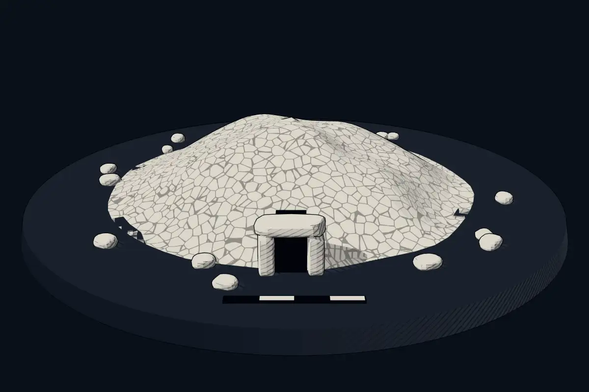
The reconstruction is ours, not a survey: it shows what a monument of this type looks like, at the size the record gives for this one.
Photographs
8 photographs, each with its author and licence
More photographs


Lore
Evidence & Lore
What the sources actually support — and, kept apart, what has been claimed.
What the evidence supports
Dates
Est. 4000–2400 BCEHow this date was established: Type comparisonTypological estimate, not a date for this site: a chambered cairn in the British Isles is normally dated between 4000 BCE and 2400 BCE (Atlas typological table).Source for this date
Measured facts
- Type
- Chambered cairnSource: Type
- Country
- United KingdomSource: Country
- Heritage designation
- scheduled monumentSource: Heritage designation
Where it stands
United Kingdom
The pin marks the monument itself — its exact point.
- Coordinates
- 57°28′25″ N, 4°04′28″ WFor a GPS or map app: 57.47369, -4.07439
Access is as our sources describe it; we have not visited the site to check.
Nearby
The closest sites in the Atlas, by straight line.
- Megalithic mound (tumulus with integral stones)mound 420m WNW of Ballaggan4000–800 BCE
- Megalithic mound (tumulus with integral stones)chambered cairn and standing stone 620m S of Culdoich4000–800 BCE
- Menhir (standing stone)Dalgrambich Farm standing stones2800–1800 BCE
- Stone circlering cairn and stone circle 600m NNE of Mains of Daviot Farm3200–2500 BCE
- Chambered cairnchambered cairn and stone circle 200m NE of Dalcross Castle4000–2500 BCE
- Megalithcupmarks 260m NNW of Braeval Farm4000–2400 BCE
- Megalithic mound (tumulus with integral stones)barrows 300m WNW of Allanfearn4000–800 BCE
- Megalithic mound (tumulus with integral stones)cairn 90m E of Mid Craggie4000–800 BCE
Sources
Every record behind this page, with the link it came from.
2 sources behind this page
- 01Wikidata Q39505213wikidata.org
- 02Fringe claim sourceen.wikipedia.org
Image files
- Balnuaran of Clava 01.jpgSir GawainCC BY-SA 4.0
- The Three Clava Cairns - geograph.org.uk - 551803 cropped.jpgBob EmbletonCC BY-SA 2.0
- 2018 07 10 Schottland (53) Balnuaran of Clava.jpgBewahrerderwerteCC BY-SA 4.0
- 2018 07 10 Schottland (54) Balnuaran of Clava.jpgBewahrerderwerteCC BY-SA 4.0
- 2018 07 10 Schottland (55).jpgBewahrerderwerteCC BY-SA 4.0
- Clava cairn (Balnauran of Clava) 01.JPGNachosanCC BY-SA 3.0
- Clava cairn (Balnauran of Clava) 03.JPGNachosanCC BY-SA 3.0
- 2018 07 10 Schottland (59).jpgBewahrerderwerteCC BY-SA 4.0
Report a correctionWrong date, name, photograph or source? Tell us and it will be put right.
Around this place
The ten nearest sites, by compass
- mound 420m WNW of Ballaggan0.8 km SW
- chambered cairn and standing stone 620m S of Culdoich1.7 km S
- Dalgrambich Farm standing stones4.3 km NE
- ring cairn and stone circle 600m NNE of Mains of Daviot Farm4.4 km SW
- chambered cairn and stone circle 200m NE of Dalcross Castle4.6 km NE
- cupmarks 260m NNW of Braeval Farm5.3 km S
- barrows 300m WNW of Allanfearn5.3 km NW
- cairn 90m E of Mid Craggie5.8 km S
- settlement cairns and field system 600m SW of Craggie Cottage6.7 km S
- Raigmore Cairn6.9 km W
Credit
Text, licence and sources
Adapted from the Wikipedia article "Balnuaran of Clava" (German), licensed CC BY-SA 4.0; authors are listed in the page history. Reused under CC BY-SA 4.0. Read on Wikipedia · Edit history and authors
- Wikipedia (German): Balnuaran of ClavaCC BY-SA 4.0
- Wikidata Q39505213CC0
- Fringe claim sourceCC BY-SA 4.0