cupmarks 260m NNW of Braeval Farm
DatedEst. 4000–2400 BCE
No licensed photograph yetWe have no photograph we may publish for this site, so the interpretive 3D view leads instead.
Overview
About this site
Overview
Cupmarks 260m NNW of Braeval Farm is a megalith in Highland, United Kingdom. It lies at 57.4282° N, 4.0988° W.
Catalogue recordSources and licences
Where it sits in time
The site's dated range, placed against world reference points.
The scale is logarithmic: each step to the left is about ten times older than the last.
Article
cupmarks 260m NNW of Braeval Farm
ContextSources for this section
- en.wikipedia.orgCC BY-SA 4.0
- en.wikipedia.orgCC BY-SA 4.0
- en.wikipedia.orgCC BY-SA 4.0
- en.wikipedia.orgCC BY-SA 4.0
Sources for this section
- en.wikipedia.orgCC BY-SA 4.0
- en.wikipedia.orgCC BY-SA 4.0
- en.wikipedia.orgCC BY-SA 4.0
- en.wikipedia.orgCC BY-SA 4.0
Most of the "megalith" records for Britain in the Atlas come from the Scottish register of monuments, and many are not standing stones at all but carved rocks. Cup and ring marks are a form of prehistoric art found along the Atlantic seaboard of Europe, in Ireland, Wales, northern England, Scotland, Brittany, Portugal and Galicia. They consist of a concave depression no more than a few centimetres across, pecked into a rock surface and often surrounded by concentric circles; sometimes a linear channel, called a gutter, leads out from the middle. They occur as petroglyphs on natural boulders and outcrops, and also as an element of megalithic art on worked stones, such as the slab cists of the Food Vessel culture, some stone circles and passage graves, and the capstones at Newgrange. The regional background, “Prehistoric rock art and standing stones of Scotland”, is given below.
DatingSources for this section
- en.wikipedia.orgCC BY-SA 4.0
Sources for this section
- en.wikipedia.orgCC BY-SA 4.0
No scientific date has been published for this site. Monuments of this type in United Kingdom are generally dated 4000 BCE to 2400 BCE; the site itself may fall inside or outside that range.
Megalithic construction in England is placed at c. 4000 BC; the first henges in Britain appear c. 3000 BC and hundreds of smaller stone circles were built c. 2400 BC.
Setting
18 other recorded monuments lie within 10 km (1 within 1 km, 5 within 5 km). In Highland, United Kingdom, 5 of the 556 recorded monuments are of this type.
The nearest recorded monuments are cairn 90m E of Mid Craggie (0.6 km south-west, megalithic mound); settlement cairns and field system 600m SW of Craggie Cottage (1.5 km south-west, megalithic mound); ring cairn and stone circle 600m NNE of Mains of Daviot Farm (2.2 km north-west, stone circle); chambered cairn and standing stone 620m S of Culdoich (3.7 km north, megalithic mound).
ProtectionSources for this section
Sources for this section
Heritage status: scheduled monument.
Tradition and region
About this kind of monument
Prehistoric rock art and standing stones of Scotland
Most of the "megalith" records for Britain in the Atlas come from the Scottish register of monuments, and many are not standing stones at all but carved rocks. Cup and ring marks are a form of prehistoric art found along the Atlantic seaboard of Europe, in Ireland, Wales, northern England, Scotland, Brittany, Portugal and Galicia. They consist of a concave depression no more than a few centimetres across, pecked into a rock surface and often surrounded by concentric circles; sometimes a linear channel, called a gutter, leads out from the middle. They occur as petroglyphs on natural boulders and outcrops, and also as an element of megalithic art on worked stones, such as the slab cists of the Food Vessel culture, some stone circles and passage graves, and the capstones at Newgrange.
The richest area is Kilmartin Glen in Argyll, which has the most important concentration of Neolithic and Bronze Age remains in mainland Scotland. There are more than 800 ancient monuments within a ten-kilometre radius of the village, with 150 of them prehistoric, including standing stones, a henge, numerous cists and a linear cemetery of five burial cairns that runs over five kilometres. Several of the cairns, and many natural rocks, are decorated with cup and ring marks.
The meaning of the carvings is unknown. Megalithic art tends to be highly abstract, and its meaning is the subject of much debate. On natural outcrops the marks can be dated only broadly, so the Atlas gives a range from the Neolithic to the Bronze Age; on a worked stone of a dated monument they are at least as old as the monument.
When visiting, low light brings out the cups best. Please do not chalk or rub the carvings.
Paraphrased from Wikipedia: Cup and ring mark, Wikipedia: Kilmartin Glen, Wikipedia: Megalithic art, Wikipedia: Rock art · CC BY-SA 4.0
Lore
Evidence & Lore
What the sources actually support — and, kept apart, what has been claimed.
What the evidence supports
Dates
Est. 4000–2400 BCEHow this date was established: Type comparisonTypical range for megaliths in United Kingdom; this site has not been dated itself. Megalithic construction in England is placed at c. 4000 BC; the first henges in Britain appear c. 3000 BC and hundreds of smaller stone circles were built c. 2400 BC.Source for this date
Where it stands
United Kingdom
The pin marks the monument itself — its exact point.
- Coordinates
- 57°25′42″ N, 4°05′56″ WFor a GPS or map app: 57.42821, -4.09877
Access is as our sources describe it; we have not visited the site to check.
Nearby
The closest sites in the Atlas, by straight line.
- Megalithic mound (tumulus with integral stones)cairn 90m E of Mid Craggie4000–800 BCE
- Megalithic mound (tumulus with integral stones)settlement cairns and field system 600m SW of Craggie Cottage4000–800 BCE
- Stone circlering cairn and stone circle 600m NNE of Mains of Daviot Farm3200–2500 BCE
- Megalithic mound (tumulus with integral stones)chambered cairn and standing stone 620m S of Culdoich4000–800 BCE
- Megalithic mound (tumulus with integral stones)mound 420m WNW of Ballaggan4000–800 BCE
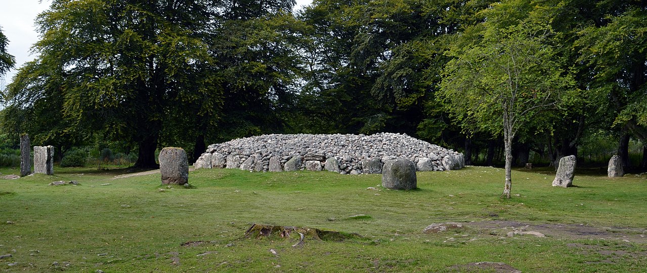 Balnuaran of Clava4000–2400 BCE
- Chambered cairnchambered cairn and stone circle 230m WSW of Druid Temple Farm4000–2500 BCE
- Megalithic mound (tumulus with integral stones)Tomfat Plantation4000–800 BCE

Sources
Every record behind this page, with the link it came from.
2 sources behind this page
- 01Wikidata Q56665899wikidata.org
- 02Source for this dateen.wikipedia.org
Report a correctionWrong date, name, photograph or source? Tell us and it will be put right.
Around this place
The ten nearest sites, by compass
- cairn 90m E of Mid Craggie0.6 km SW
- settlement cairns and field system 600m SW of Craggie Cottage1.5 km SW
- ring cairn and stone circle 600m NNE of Mains of Daviot Farm2.2 km NW
- chambered cairn and standing stone 620m S of Culdoich3.7 km N
- mound 420m WNW of Ballaggan4.5 km N
- Balnuaran of Clava5.3 km N
- chambered cairn and stone circle 230m WSW of Druid Temple Farm6.1 km NW
- Tomfat Plantation6.6 km W
- Mains of Gask,ring cairn and standing stones 130m SSW of7.1 km SW
- Raigmore Cairn7.7 km NW
Credit
Text, licence and sources
Compiled from open records (Wikidata, CC0; OpenStreetMap, ODbL) and a regional background article based on Wikipedia (CC BY-SA 4.0).
- Wikidata Q56665899CC0
- en.wikipedia.orgCC BY-SA 4.0
- en.wikipedia.orgCC BY-SA 4.0
- en.wikipedia.orgCC BY-SA 4.0
- en.wikipedia.orgCC BY-SA 4.0
- en.wikipedia.orgCC BY-SA 4.0