
Gallery grave (allée couverte)
Mougau-Bihan gallery grave
DatedEst. 4500–3300 BCE
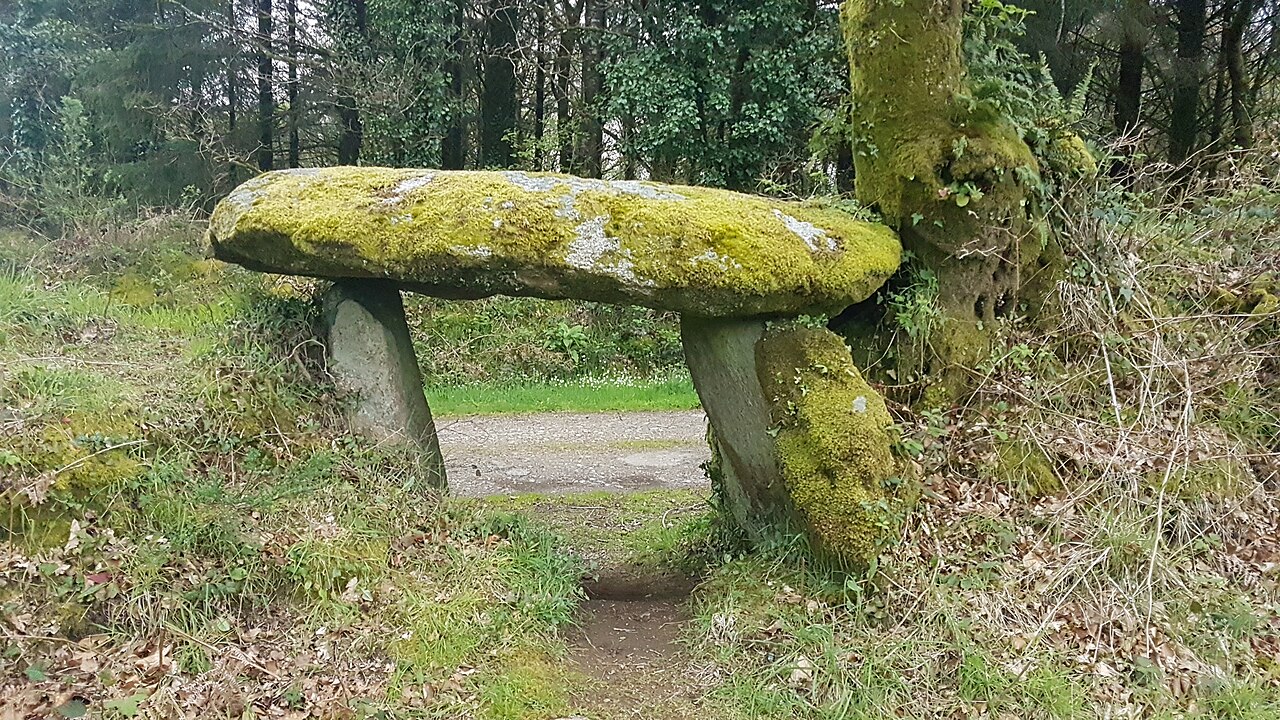
Photo Rolf Krahl ( Rotkraut ) · CC BY 4.0Source file on Wikimedia Commons

Overview
About this site
What the sources say
L'allée couverte du Mougau-Bihan, appelée aussi Ti Lia Ven, est une allée couverte située dans la commune de Commana dans le département du Finistère, en France.
Article in FrenchRead on Wikipedia4 min readCC BY-SA 4.0
Where it sits in time
The site's dated range, placed against world reference points.
The scale is logarithmic: each step to the left is about ten times older than the last.
The full article
Mougau-Bihan gallery grave: the whole story
In briefSources for this section
Sources for this section
The Mougau-Bihan gallery grave, also called Ti Lia Ven, is a covered alley tomb in Commana in the Finistère department of France. The site is listed as a historic monument.
The monument was mentioned in 1843 by Jean-Baptiste Ogée. It may have been excavated in the middle of the nineteenth century, but the outcome of any excavation is unknown. Jean-Marie Abgrall gave the first description in 1884. The gallery grave was listed as a historic monument by decree of 14 June 1909.
The gallery grave runs north-south and opens to the north-northeast. It measures 14 m long, with an internal width of 1 to 1,40 m. It is bounded by eighteen orthostats, ten on the east side and eight on the west. It consists of a rectangular chamber, 11 m long and 1,50 m wide, and a rectangular terminal cell, 2,30 m long and 1,40 m wide. The presence of a vestibule is suggested by a first pillar that projects beyond the first capstone. The entrance's eastern pillar is set at an angle and narrows the passage. A terminal slab separates the chamber from the terminal cell. Five granite capstones cover the structure, four over the chamber and one over the terminal cell.
Several slabs carry bas-relief sculptures. The angled entrance pillar has two pairs of superimposed breasts and a "palette" on its outer face. The last slab on the east side of the chamber has two further palettes, while the terminal slab carries a central sculpture of an axe with a curved handle in the shape of a crook. By comparison, the monument was dated between 3 000 and 2 500 av. J.-C. The record gives a broader dating of 4500 BCE to 3300 BCE based on typological estimate.
No English Wikipedia article exists for it; the full text below is the French article "Allée couverte du Mougau-Bihan", shown in the original language.
Summary in EnglishSources for this section
Sources for this section
Mougau-Bihan gallery grave is a gallery grave (allée couverte) in Commana, France. Wikidata describes it as: gallery grave in Commana, France. A typological estimate: 4500 BCE to 3300 BCE. No English Wikipedia article exists for it; the full text below is the French article "Allée couverte du Mougau-Bihan", shown in the original language.
HistoriqueSources for this section
Sources for this section
Le monument est mentionné dès 1843 par Jean-Baptiste Ogée. Il aurait été fouillé au milieu du XIXe siècle, mais le résultat de ces fouille est inconnu. La première description qui en fut donnée est due à Jean-Marie Abgrall en 1884. L'allée couverte est classée au titre des monuments historiques par arrêté du 14 juin 1909.
DescriptionSources for this section
Sources for this section
L'allée couverte est orientée nord-sud et ouvre au nord-nord-est. Elle mesure 14 m de long pour une largeur interne allant de 1 à 1,40 m. Elle est délimitée par dix-huit orthostates (dix côté est et huit côté ouest). Elle se compose d'une chambre (11 m de long) sur 1,50 m de large) et d'une cellule terminale (2,30 m de long) sur 1,40 m de large), toutes deux rectangulaires. L'existence d'un vestibule est suggérée par la présence d'un premier pilier qui déborde au delà de la première dalle de couverture. Le pilier oriental de l'entrée, placé de manière oblique, réduit le passage. La chambre et la cellule terminale sont séparées par une dalle de chevet. L'ensemble est recouvert par cinq dalles de couverture (quatre pour la chambre, une pour la cella). Toutes les dalles sont en granite.
SculpturesSources for this section
Sources for this section
Plusieurs dalles sont ornées de sculptures en bas-relief. Le pilier de l'entrée placé obliquement comporte côté extérieur deux paires de seins superposées et une « palette ». La dernière dalle de la chambre côté oriental comporte deux autres palettes et la dalle de chevet comporte au centre une sculpture de hache avec un manche recourbé en forme de crosse.
Le monument a été daté, par comparaison, entre 3 000 et 2 500 av. J.-C.
How this page was madeSources for this section
Sources for this section
The summary at the top of this page was written by MiniMax-M3 (2026-11-07) from the cited Wikipedia article “Allée couverte du Mougau-Bihan”, translated from French. The numbers in it were checked automatically against the source text. The rest of the page is the article itself, the structured records and computed distances.
Tradition and region
About this kind of monument
Gallery graves (allées couvertes)
A gallery grave is a megalithic tomb built mainly in the Neolithic in which the main gallery is entered directly, with no antechamber or passage in front. The French term is allée couverte, "covered alley". There are at least four major types: complex, transepted, segmented and wedge-shaped, and they may be covered with an earthen mound or a cairn.
According to the archaeologist T. Douglas Price, the gallery grave was a form of community burial site. Those placed in it were most likely members of the same family or hamlet, and the burial probably served to reinforce community. Gallery graves are found at sites in the Loire valley of France, in south-west Great Britain and in Ireland, and it is thought that the builders had cultural links with one another.
In Germany the Wartberg culture of northern Hesse, southern Lower Saxony and western Thuringia, which lasted from about 3600 to 2800 BCE, built stone gallery graves. In Britain and Ireland the same idea appears in the Irish wedge tombs and the Severn-Cotswold tombs of Wales and south-west England.
Along with the dolmen and passage grave, the gallery grave is the most common megalithic tomb in western Europe. Most were built in the Neolithic, but some date to the Middle and Late Bronze Age. Dating is difficult, since a tomb built in the Late Neolithic or Early Bronze Age may have been reopened and used for burials until the Late Bronze Age.
When visiting, look for the long rectangular chamber and its capstones.
Paraphrased from Wikipedia: Gallery grave, Wikipedia: Allée couverte, Wikipedia: Wartberg culture · CC BY-SA 4.0
From the article
Dated moments in the story
- 500 CE
Le monument a été daté, par comparaison, entre 3 000 et 2 500 av.
Source - 1843
Le monument est mentionné dès 1843 par Jean-Baptiste Ogée.
Source - 1884
La première description qui en fut donnée est due à Jean-Marie Abgrall en 1884. L'allée couverte est classée au titre des monuments historiques par arrêté du 14 juin 1909.
Source
Photographs
8 photographs, each with its author and licence
More photographs


Lore
Evidence & Lore
What the sources actually support — and, kept apart, what has been claimed.
What the evidence supports
Dates
Est. 4500–3300 BCEHow this date was established: Type comparisonTypical range for gallery graves in France; this site has not been dated itself. The gallery graves (allees couvertes) of north-west France belong to the tradition of the Carnac stones which date from 4500-3300 BC.Source for this date
Where it stands
France
The pin marks the monument itself — its exact point.
- Coordinates
- 48°23′59″ N, 3°58′01″ WFor a GPS or map app: 48.39978, -3.96686
Access is as our sources describe it; we have not visited the site to check.
Nearby
The closest sites in the Atlas, by straight line.
 Menhir de Roquinarc'h2800–1800 BCE
 La Noce de Pierres3300–2500 BCE
 Lit de Saint-Eneour4500–3300 BCE
Photo: Original uploader was Hoel1 at fr.wikipedia · Public domain
 Ti ar Boutiged4000–3000 BCE
- Menhir (standing stone)menhir de Kerelcun2800–1800 BCE
 Tumulii de Kerelcun5000–3000 BCE
 dolmen de Quinoualc'h4000–3000 BCE
 Alignement de Leïtan (Brennilis)3300–2500 BCE


Sources
Every record behind this page, with the link it came from.
2 sources behind this page
- 01Wikidata Q1795071wikidata.org
- 02Source for this dateen.wikipedia.org
Image files
- Allée Couverte du Mougau-Bihan.jpgRolf Krahl ( Rotkraut )CC BY 4.0
- Bretagne - Finistère - Commana - Circuit du Mougau N° 33 - 034.jpgThesupermatCC BY-SA 4.0
- Bretagne - Finistère - Commana - Circuit du Mougau N° 33 - 035.jpgThesupermatCC BY-SA 4.0
- Commana - Allée Couverte du Mougau-Bihan - PA00089887 - 2015 - 007.jpgThesupermatCC BY-SA 4.0
- Allée couverte du Mougau-Bihan2012 473.JPGLamiotCC BY-SA 3.0
- Allée couverte du Mougau-Bihan2012 474.JPGLamiotCC BY-SA 3.0
- Commana - Allée Couverte du Mougau-Bihan - 002.jpgThesupermatCC BY-SA 3.0
- Commana - Allée Couverte du Mougau-Bihan - 003.jpgThesupermatCC BY-SA 3.0
Report a correctionWrong date, name, photograph or source? Tell us and it will be put right.
Around this place
The ten nearest sites, by compass
Credit
Text, licence and sources
Text from the Wikipedia article "Allée couverte du Mougau-Bihan" (French), licensed CC BY-SA 4.0; authors are listed in the page history. Reused under CC BY-SA 4.0. Read on Wikipedia · Edit history and authors