
La Noce de Pierres
DatedEst. 3300–2500 BCE
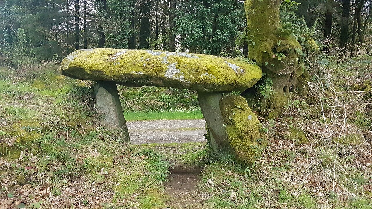
Photo Pymouss · CC BY-SA 4.0Source file on Wikimedia Commons

Overview
About this site
What the sources say
La Noce de Pierres Breton: An Eured Ven (The Wedding Party) is an alignment of 77 standing stones at the foot of Menez Michael (Saint-Michel-de-Brasparts) in the hills of Brittany. Aetiological folk tales say that the stones were originally the members of a drunken wedding party, petrified for their mistreatment of a stranger.
The monument was first documented in 1850 by Jean Bachelot La Pylaie, but it was not studied by archaeologists until 1978. It was classified as a monument historique (historic monument) in 1968 and registered in 1980.
Read on Wikipedia2 min readCC BY-SA 4.0
Where it sits in time
The site's dated range, placed against world reference points.
The scale is logarithmic: each step to the left is about ten times older than the last.
The full article
La Noce de Pierres: the whole story
In briefSources for this section
- Wikipedia (English): La Noce de PierresCC BY-SA 4.0
Sources for this section
- Wikipedia (English): La Noce de PierresCC BY-SA 4.0
La Noce de Pierres (Breton: An Eured Ven, the Wedding Party) is an alignment of 77 standing stones at the foot of Menez Michael (Saint-Michel-de-Brasparts), in the hills of Brittany, France. The catalogue lists it as a stone row with a typological dating estimate of 3300 to 2500 BCE.
Folk tales explaining its origin say that the stones were originally the members of a drunken wedding party, petrified for their mistreatment of a stranger. The name reflects this story.
The monument was first documented in 1850 by Jean Bachelot La Pylaie, but it was not studied by archaeologists until 1978. It was classified as a monument historique, a historic monument, in 1968 and registered in 1980. No excavation results or dated finds are recorded for it.
Brittany holds some of the densest megalithic landscapes in Europe. The Carnac stones, near its south coast, include more than 3,000 prehistoric standing stones hewn from local granite, forming the largest such collection in the world. The stones were erected at some stage in the Neolithic, probably around 3300 BCE, though some may date from as early as 4500 BCE. Three major groups of rows are called Ménec, Kermario and Kerlescan.
How this page was madeSources for this section
- Wikipedia (English): La Noce de PierresCC BY-SA 4.0
Sources for this section
- Wikipedia (English): La Noce de PierresCC BY-SA 4.0
The summary at the top of this page was written by Claude Sonnet 5.5 (2026-11-06) from the cited Wikipedia article “La Noce de Pierres”. The numbers in it were checked automatically against the source text. The rest of the page is the article itself, the structured records and computed distances.
Tradition and region
About this kind of monument
Carnac and the Breton alignments
The Carnac stones, near the south coast of Brittany, are an exceptionally dense collection of megalithic sites, with alignments, dolmens, tumuli and single menhirs. More than 3,000 prehistoric standing stones were hewn from local granite and erected by the pre-Celtic people of Brittany, and form the largest such collection in the world. The stones were erected at some stage in the Neolithic, probably around 3300 BCE, though some may date from as early as 4500 BCE. Most lie in the municipality of Carnac, with some to the east in La Trinité-sur-Mer, and others at Locmariaquer, Arzon and on islands in the Gulf of Morbihan.
There are three major groups of rows, called Ménec, Kermario and Kerlescan. They may once have formed a single group, split up as stones were taken for other purposes. Together they trace a contour line about 20 metres above sea level, and the stones are arranged in rows that stretch across four kilometres.
Three exceptionally large burial mounds of the mid-fifth millennium BCE, the "Carnacéen tumuli" of Saint-Michel, Tumiac and Mané-er-Hroëk, each hold a megalithic chamber with a single individual and numerous large polished stone axes. On the island of Gavrinis a passage tomb built around 4200 to 4000 BCE, one of the world's oldest surviving buildings, has stones covered in megalithic art.
Folklore: a Christian legend held that the stones were pagan soldiers pursuing Pope Cornelius, whom he turned to stone. Modern beliefs associate the rows with Roman and Christian occupation, although the stones date from 4500 to 3300 BCE.
Dating comes from radiocarbon dates on the tombs and from the stratigraphy at the foot of the stones.
When visiting, walk the alignments at Ménec and Kermario, and notice the stones growing taller towards one end.
Paraphrased from Wikipedia: Carnac stones, Wikipedia: Menhir, Wikipedia: Locmariaquer megaliths, Wikipedia: Gavrinis · CC BY-SA 4.0
From the article
Dated moments in the story
- 1850
The monument was first documented in 1850 by Jean Bachelot La Pylaie, but it was not studied by archaeologists until 1978. It was classified as a monument historique (historic monument) in 1968 and registered in 1980.
Source
Photographs
6 photographs, each with its author and licence
More photographs


Lore
Evidence & Lore
What the sources actually support — and, kept apart, what has been claimed.
What the evidence supports
Dates
Est. 3300–2500 BCEHow this date was established: Type comparisonTypical range for stone rows in France; this site has not been dated itself. The stone alignments of Brittany belong to the tradition of stone circles most of which were built between 3300 and 2500 BC.Source for this date
Where it stands
France
The pin marks the monument itself — its exact point.
- Coordinates
- 48°20′44″ N, 3°55′52″ WFor a GPS or map app: 48.34558, -3.93098
Access is as our sources describe it; we have not visited the site to check.
Nearby
The closest sites in the Atlas, by straight line.
 Menhir de Roquinarc'h2800–1800 BCE
 Ti ar Boutiged4000–3000 BCE
 Mougau-Bihan gallery grave4500–3300 BCE
- Menhir (standing stone)menhir de Kerelcun2800–1800 BCE
 Alignement de Leïtan (Brennilis)3300–2500 BCE
 Tumulii de Kerelcun5000–3000 BCE
 Menhir du Cloître (Huelgoat)2800–1800 BCE
 dolmen de Quinoualc'h4000–3000 BCE


Sources
Every record behind this page, with the link it came from.
3 sources behind this page
- 01Wikidata Q6464149wikidata.org
- 02Source for this dateen.wikipedia.org
- 03Wikipedia: La Noce de Pierresen.wikipedia.org
Image files
- Brasparzh - An Eured Vein 20141214-02.jpgPymoussCC BY-SA 4.0
- Brasparzh - An Eured Vein 20141214-03.jpgPymoussCC BY-SA 4.0
- Alignement mégalithique de la Noce de Pierres, Brasparts, France-4.jpgÉdouard Hue ( User:EdouardHue )CC BY-SA 4.0
- Alignement mégalithique de la Noce de Pierres, Brasparts, France-8.jpgÉdouard Hue ( User:EdouardHue )CC BY-SA 4.0
- Alignement mégalithique de la Noce de Pierres, Brasparts, France-7.jpgÉdouard Hue ( User:EdouardHue )CC BY-SA 4.0
- Braspartz-euredvein-erch.jpgHervé QuéréCC BY-SA 3.0
Report a correctionWrong date, name, photograph or source? Tell us and it will be put right.
Around this place
The ten nearest sites, by compass
- Menhir de Roquinarc'h2.8 km NW
- Ti ar Boutiged6.4 km E
- Mougau-Bihan gallery grave6.6 km NW
- menhir de Kerelcun8.4 km NE
- Alignement de Leïtan (Brennilis)8.8 km E
- Tumulii de Kerelcun9.5 km NE
- Menhir du Cloître (Huelgoat)11 km E
- dolmen de Quinoualc'h11 km NE
- Lit de Saint-Eneour12 km N
- menhir de Kerampeulven14 km E
Credit
Text, licence and sources
Text from the Wikipedia article "La Noce de Pierres" (English), licensed CC BY-SA 4.0; authors are listed in the page history. Reused under CC BY-SA 4.0. Read on Wikipedia · Edit history and authors
- Wikipedia (English): La Noce de PierresCC BY-SA 4.0
- Wikidata Q6464149CC0