
Alignement de Kornevec
DatedEst. 3300–2500 BCE
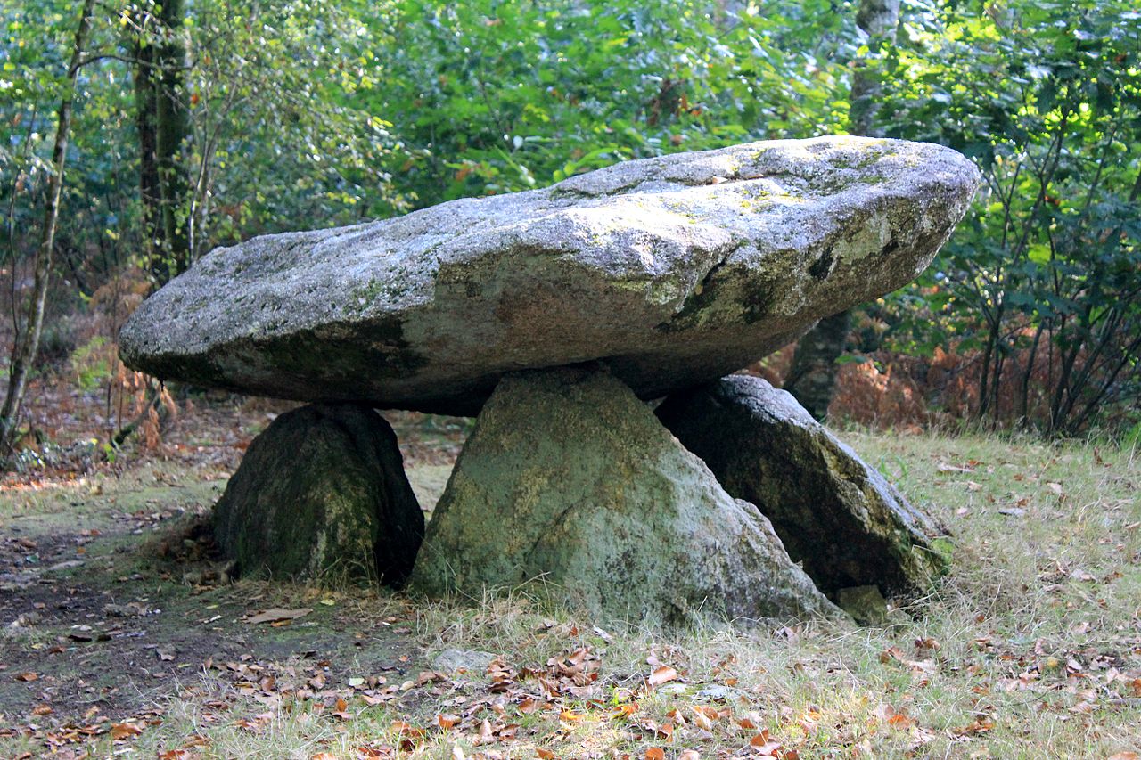
Photo XIIIfromTOKYO · CC BY-SA 3.0Source file on Wikimedia Commons

Overview
About this site
What the sources say
L'alignement de Kornevec (ou Kernevec, Cornevic, Cornévec) est un alignement mégalithique situé à Camors, dans le Morbihan en Bretagne.
Article in FrenchRead on Wikipedia3 min readCC BY-SA 4.0
Where it sits in time
The site's dated range, placed against world reference points.
The scale is logarithmic: each step to the left is about ten times older than the last.
The full article
Alignement de Kornevec: the whole story
In briefSources for this section
- Wikipedia (French): Alignement de KornevecCC BY-SA 4.0
Sources for this section
- Wikipedia (French): Alignement de KornevecCC BY-SA 4.0
The Alignement de Kornevec, also known as Kernevec, Cornevic, or Cornévec, is a megalithic stone row at Camors in Morbihan, Brittany, France. Its menhirs stand in the forêt de Floranges, about 360 m as the crow flies southeast of the hamlet of Lann-Vihan.
Around fifty blocks form a row extending about 200 m along a west/north-east axis. Only two menhirs remain upright; the others were deliberately split or overturned. Their heights range from 1 to 3 m, and they are made of foliated Lanvaux granite.
The menhirs were classified as monuments historiques by decree of 28 August 1934. A typological estimate places the alignment in the period 3300 BCE to 2500 BCE. The surviving arrangement reflects substantial later damage, and the original number and full appearance of the stones are not known.
Stone rows of this kind are part of the dense concentration of megalithic sites around the south coast of Brittany. In general, the Carnac stones include alignments, dolmens, tumuli, and single menhirs, with more than 3,000 prehistoric standing stones made from local granite. They are usually dated to the Neolithic, probably around 3300 BCE, though some may be as early as 4500 BCE.
No English Wikipedia article exists for it; the full text below is the French article "Alignement de Kornevec", shown in the original language.
Summary in EnglishSources for this section
- Wikipedia (French): Alignement de KornevecCC BY-SA 4.0
Sources for this section
- Wikipedia (French): Alignement de KornevecCC BY-SA 4.0
Alignement de Kornevec is a stone row (alignment) in Camors, France. A typological estimate: 3300 BCE to 2500 BCE. No English Wikipedia article exists for it; the full text below is the French article "Alignement de Kornevec", shown in the original language.
LocalisationSources for this section
- Wikipedia (French): Alignement de KornevecCC BY-SA 4.0
Sources for this section
- Wikipedia (French): Alignement de KornevecCC BY-SA 4.0
Les menhirs sont situés dans la forêt de Floranges, à environ 360 m à vol d'oiseau au sud-est du hameau de Lann-Vihan.
HistoriqueSources for this section
- Wikipedia (French): Alignement de KornevecCC BY-SA 4.0
Sources for this section
- Wikipedia (French): Alignement de KornevecCC BY-SA 4.0
Les menhirs sont classés au titre des monuments historiques par arrêté du 28 août 1934.
DescriptionSources for this section
- Wikipedia (French): Alignement de KornevecCC BY-SA 4.0
Sources for this section
- Wikipedia (French): Alignement de KornevecCC BY-SA 4.0
L'alignement est composé d'une cinquantaine de blocs alignés sur une distance d'environ 200 m selon un axe ouest/nord-est. Seuls deux menhirs sont encore dressés, les autres ont été volontairement débités ou renversés. Leur hauteur varie de 1 à 3 m. Les pierres sont en granite feuilleté de Lanvaux.
AnnexesSources for this section
- Wikipedia (French): Alignement de KornevecCC BY-SA 4.0
Sources for this section
- Wikipedia (French): Alignement de KornevecCC BY-SA 4.0
Bibliographie
: document utilisé comme source pour la rédaction de cet article.
Philippe Gouézin, Les mégalithes du Morbihan intérieur, Rennes, Institut culturel de Bretagne et Centre régional d'archéologie d'Alet, coll. « Patrimoine archéologique de Bretagne », 1994, 127 p. (ISBN 9782868220547), p. 45-46
Liens internes
Sites mégalithiques du Morbihan
Liste des monuments historiques de l'arrondissement de Lorient
Reconstitution 3D
Menhir de l'Alignement de Cornevec (construit par photogrammétrie)
Portail du mégalithisme Portail des monuments historiques français Portail du Morbihan
How this page was madeSources for this section
- Wikipedia (French): Alignement de KornevecCC BY-SA 4.0
Sources for this section
- Wikipedia (French): Alignement de KornevecCC BY-SA 4.0
The summary at the top of this page was written by MiniMax-M3 (2026-11-08) from the cited Wikipedia article “Alignement de Kornevec”, translated from French. The numbers in it were checked automatically against the source text. The rest of the page is the article itself, the structured records and computed distances.
Tradition and region
About this kind of monument
Carnac and the Breton alignments
The Carnac stones, near the south coast of Brittany, are an exceptionally dense collection of megalithic sites, with alignments, dolmens, tumuli and single menhirs. More than 3,000 prehistoric standing stones were hewn from local granite and erected by the pre-Celtic people of Brittany, and form the largest such collection in the world. The stones were erected at some stage in the Neolithic, probably around 3300 BCE, though some may date from as early as 4500 BCE. Most lie in the municipality of Carnac, with some to the east in La Trinité-sur-Mer, and others at Locmariaquer, Arzon and on islands in the Gulf of Morbihan.
There are three major groups of rows, called Ménec, Kermario and Kerlescan. They may once have formed a single group, split up as stones were taken for other purposes. Together they trace a contour line about 20 metres above sea level, and the stones are arranged in rows that stretch across four kilometres.
Three exceptionally large burial mounds of the mid-fifth millennium BCE, the "Carnacéen tumuli" of Saint-Michel, Tumiac and Mané-er-Hroëk, each hold a megalithic chamber with a single individual and numerous large polished stone axes. On the island of Gavrinis a passage tomb built around 4200 to 4000 BCE, one of the world's oldest surviving buildings, has stones covered in megalithic art.
Folklore: a Christian legend held that the stones were pagan soldiers pursuing Pope Cornelius, whom he turned to stone. Modern beliefs associate the rows with Roman and Christian occupation, although the stones date from 4500 to 3300 BCE.
Dating comes from radiocarbon dates on the tombs and from the stratigraphy at the foot of the stones.
When visiting, walk the alignments at Ménec and Kermario, and notice the stones growing taller towards one end.
Paraphrased from Wikipedia: Carnac stones, Wikipedia: Menhir, Wikipedia: Locmariaquer megaliths, Wikipedia: Gavrinis · CC BY-SA 4.0
From the article
Dated moments in the story
- 1934
Les menhirs sont classés au titre des monuments historiques par arrêté du 28 août 1934.
Source - 1994
Philippe Gouézin, Les mégalithes du Morbihan intérieur, Rennes, Institut culturel de Bretagne et Centre régional d'archéologie d'Alet, coll. « Patrimoine archéologique de Bretagne », 1994, 127 p.
Source
Photographs
4 photographs, each with its author and licence
More photographs


Lore
Evidence & Lore
What the sources actually support — and, kept apart, what has been claimed.
What the evidence supports
Dates
Est. 3300–2500 BCEHow this date was established: Type comparisonTypical range for stone rows in France; this site has not been dated itself. The stone alignments of Brittany belong to the tradition of stone circles most of which were built between 3300 and 2500 BC.Source for this date
Where it stands
France
The pin marks the monument itself — its exact point.
- Coordinates
- 47°49′53″ N, 2°57′51″ WFor a GPS or map app: 47.83151, -2.96419
Access is as our sources describe it; we have not visited the site to check.
Nearby
The closest sites in the Atlas, by straight line.
 Dolmen du Roh-Du4000–3000 BCE
 Allée couverte de Lann-et-Vein4500–3300 BCE
 Men Bras2800–1800 BCE
 menhir de Lambel2800–1800 BCE
- Menhir (standing stone)Men Bihan2800–1800 BCE
- Menhir (standing stone)menhir de Kerigo2800–1800 BCE
 Allée couverte du Prieuré4500–3300 BCE
- Menhir (standing stone)Menhir von Cosquéro2800–1800 BCE


Sources
Every record behind this page, with the link it came from.
2 sources behind this page
- 01Wikidata Q22927281wikidata.org
- 02Source for this dateen.wikipedia.org
Image files
- Alignement de Kornevec 5318.JPGXIIIfromTOKYOCC BY-SA 3.0
- Alignement de Kornevec 5282.JPGXIIIfromTOKYOCC BY-SA 3.0
- Alignement de Kornevec 5292.JPGXIIIfromTOKYOCC BY-SA 3.0
- Alignement de Kornevec 5283.JPGXIIIfromTOKYOCC BY-SA 3.0
Report a correctionWrong date, name, photograph or source? Tell us and it will be put right.
Around this place
The ten nearest sites, by compass
Credit
Text, licence and sources
Text from the Wikipedia article "Alignement de Kornevec" (French), licensed CC BY-SA 4.0; authors are listed in the page history. Reused under CC BY-SA 4.0. Read on Wikipedia · Edit history and authors
- Wikipedia (French): Alignement de KornevecCC BY-SA 4.0
- Wikidata Q22927281CC0