.jpg/1920px-Dolmen_de_San_Mart%C3%ADn_(49272911472).jpg 1920w)
Dolmen San Martin
DatedEst. 4000–3000 BCE
Photo Ángel M. Felicísimo from Mérida, España · CC BY 2.0Source file on Wikimedia Commons
Overview
About this site
Overview
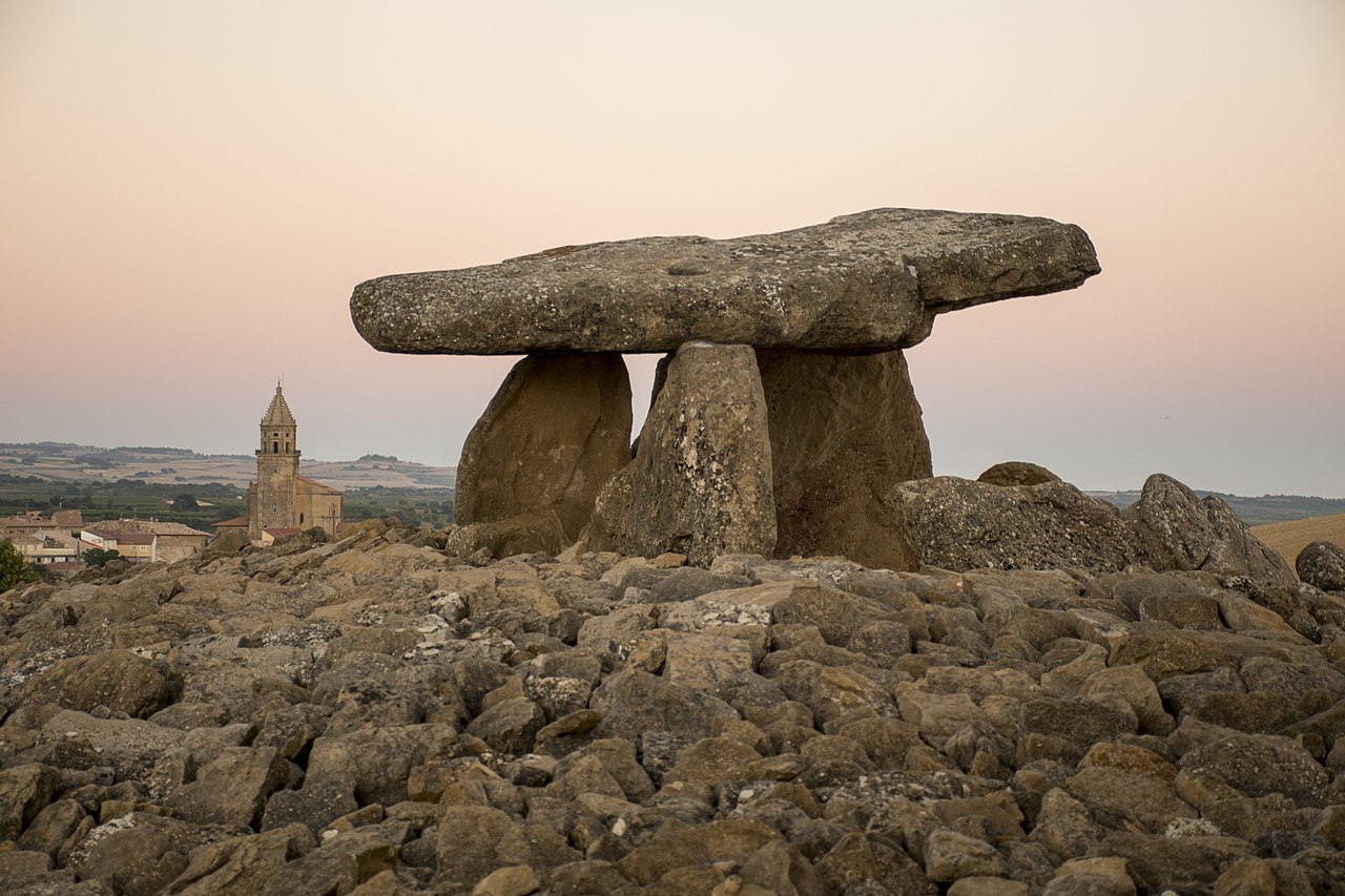
The dolmen of San Martín is a passage tomb beside the N-232a road at kilometre point 63, between Laguardia and Leza, in Rioja Alavesa, Álava, in the Basque Country, Spain. It has a burial chamber and a corridor covered with flat slabs, surrounded by a circular mound of earth and stones.
It was built at the end of the Neolithic and reused until the end of the Chalcolithic or the beginning of the Bronze Age. Its excavation in 1964 revealed two distinct levels of burial and had a wide resonance in Spanish archaeology.
Read on Wikipedia5 min readCC BY-SA 4.0
Where it sits in time
The site's dated range, placed against world reference points.
The scale is logarithmic: each step to the left is about ten times older than the last.
Article
Dolmen San Martin
One of the five large slabs that form it carries a series of holes or cup marks of the kind found in megalithic art.
DescriptionSources for this section
- Wikipedia (Spanish): Dolmen de San MartínCC BY-SA 4.0
Sources for this section
- Wikipedia (Spanish): Dolmen de San MartínCC BY-SA 4.0
The burial chamber is polygonal and is formed of 10 large sandstone slabs. It measures 5.75 metres by 3.10 metres and has a maximum height of 1.90 metres. The corridor is almost 5 metres long, 1.20 metres wide and 1.30 metres high. It was covered with slabs, one of which remains. One of the five large slabs that form it carries a series of holes or cup marks of the kind found in megalithic art.
The mound, of stone and earth, measures 26 by 14 metres and is 2.15 metres high. Its northern part has disappeared, damaged by agricultural work in the field where it stands. The mound is estimated to have had a cover of white limestone from the nearby Sierra de Cantabria; this hypothesis rests on the fact that stones of that type still remain in the mound and in the shepherd's hut built over the dolmen, which rests on the north-western orthostats of the chamber and reuses stones from the mound.
ExcavationsSources for this section
- Wikipedia (Spanish): Dolmen de San MartínCC BY-SA 4.0
Sources for this section
- Wikipedia (Spanish): Dolmen de San MartínCC BY-SA 4.0
The dolmen was located by José Miguel de Barandiaran and Domingo Fernández Medrano in April 1956 and was excavated by them, together with Juan María Apellániz, in July and August 1964. Several layers of stratification were detected. Two fallen slabs in the chamber sealed two distinct levels of occupation, one Neolithic and the other Chalcolithic.
After the excavation and study, the monument was restored: the fallen slabs were put back in place and mortar was placed between the orthostats. The only lintel still in its original position in the corridor was also secured.
FindsSources for this section
- Wikipedia (Spanish): Dolmen de San MartínCC BY-SA 4.0
Sources for this section
- Wikipedia (Spanish): Dolmen de San MartínCC BY-SA 4.0
The first level, 190 cm of earth beneath the fallen orthostats, contained the remains of 21 individuals with grave goods of typically Neolithic character: two knives, two blades, thirty-two flakes, sixteen triangles, sixteen trapezes, two scrapers, five denticulates, a borer, a side scraper, a large rock crystal worked into a goat's-hoof scraper, five polished axes and chisels and two fragments of ophite axe, a callaïs bead, a rock crystal, sherds of plain pottery, one sherd decorated with bands, and six decorated bone fragments belonging to four spatula idols.
The second level held the remains of only one individual. The finds, all of flint unless stated, were three simple blades, two bladelets, two points with marginal retouch, three tanged and winged arrowheads and the tang of another, three triangles, two scrapers, four denticulates, a sphere and thirty-four flakes, together with a polished axe, a bar of ochre, a cube of pyrite, a callaïs bead, a fragment of a ring of white stone, 14 hemispherical bone buttons with V-shaped perforations, a bronze plate and a bronze dagger, and seven sherds of Ciempozuelos-type Bell Beaker pottery, one incised and the others plain.
Beneath one of the fallen slabs in the chamber were found three funerary stelae of sandstone, which must have been set in a row, oriented south to north and side by side. They have given rise to the hypothesis that the three stelae presided over the place where the individuals buried in the first phase of use were deposited. Each stela measures about 60 centimetres in width, 65 in height and 15 in thickness.
DatingSources for this section
- Wikipedia (Spanish): Dolmen de San MartínCC BY-SA 4.0
Sources for this section
- Wikipedia (Spanish): Dolmen de San MartínCC BY-SA 4.0
Radiocarbon dating of human bone and of grave goods made of bone gave two distinct periods. The human remains belong to the late Neolithic, about 4900 years ago. Of the spatula idols, some could not be dated because they contained no collagen; one piece gave 5920 + 40 BP, placing it in the early Neolithic, and another gave 5380 + 40 BP, placing it in the middle Neolithic. An awl gave 4650 + 30 BP, placing it in the Chalcolithic.
The dates of the objects assigned to the early and middle Neolithic raise a question about their use. One hypothesis is that the pieces were kept within the community for more than 1000 years and deposited as offerings in some of the burials; another is that they were made from bones already 1000 years old. The hypothesis considered most likely is that they belong to burials made at that time and that the site continued in use afterwards, giving the place a special, sacred character for the community over time.
Later historySources for this section
- Wikipedia (Spanish): Dolmen de San MartínCC BY-SA 4.0
Sources for this section
- Wikipedia (Spanish): Dolmen de San MartínCC BY-SA 4.0
The monument was built at the end of the Neolithic on a small hill that had a sacred character for the community. Two of the slabs forming the burial chamber fell around the end of the Neolithic or the beginning of the Chalcolithic, and the dolmen continued in use until the end of the Chalcolithic or the beginning of the Bronze Age. A hut for vine-watchers was later built on the dolmen.
ConservationSources for this section
- Wikipedia (Spanish): Dolmen de San MartínCC BY-SA 4.0
Sources for this section
- Wikipedia (Spanish): Dolmen de San MartínCC BY-SA 4.0
The dolmen was declared a cultural asset in the category of monument, with the protection grade of calificado, by Decree 183/2011 of 26 July 2011, together with the other dolmens that make up the monumental ensemble of the lowland dolmens of the Historic Territory of Álava.
Tradition and region
About this kind of monument
Dolmens of Andalusia, Extremadura and Galicia
Spain has a great many megalithic tombs, and the Atlas's Spanish dolmens run from Andalusia in the south to Galicia in the north-west. The finest are at Antequera in Andalusia, where the Dolmen of Menga, dated to about 3750 to 3650 BCE, is among the largest ancient megalithic structures in Europe. It is 27.5 metres long, 6 metres wide and 3.5 metres high, built with thirty-two megaliths, the largest weighing about 180 tonnes. After the chamber was finished it was covered with soil and built up into the hill seen today; when it was opened in the nineteenth century archaeologists found the skeletons of several hundred people. The Dolmen of Viera stands 70 metres away, and the tholos of El Romeral lies about 4 kilometres off; the three were inscribed as the Antequera Dolmens Site, a UNESCO World Heritage Site, in 2016.
In the south-west, the Dolmen de Soto at Trigueros in Huelva province is a Neolithic tomb estimated to date between 3000 and 2500 BCE, one of about 200 Neolithic burial sites in the province. It was found in 1922 when its owner, Armando de Soto Morillas, wanted to build a house; the German archaeologist Hugo Obermaier found eight bodies in a fetal position with artefacts, and its engraved and painted uprights have been studied more recently.
In Galicia and Portugal a dolmen is an anta, and in Catalan-speaking areas dolmens have folk names such as cova (cave), caixa (crate or coffin), taula (table) and arca (chest). These names are tradition: they record what people made of the monuments, not what they were built for.
When visiting Menga, look at the great capstones from inside the corridor, and at the way the mound was built up over the chamber.
Paraphrased from Wikipedia: Dolmen of Menga, Wikipedia: Dolmen of Viera, Wikipedia: Antequera Dolmens Site, Wikipedia: Dolmen de Soto, Wikipedia: Dolmen · CC BY-SA 4.0
From the article
Dated moments in the story
- 1956
Fue localizado por José Miguel de Barandiaran y Domingo Fernández Medrano en abril de 1956 y excavado por ellos junto con Juan María Apellániz entre julio y agosto de 1964, en ella se detectaron varias capas de estratificación que dieron pie a una gran resonancia dentro del ámbito arqueológico español.
Source - 2011
Fue declarado bienes cultural en la categoría de monumento y obtuvo el grado de protección de calificado por el Decreto 183/2011, del 26 de julio de 2011 junto a los otros dólmenes que conforman el "Conjunto de monumentos" de los dólmenes de las tierras bajas del Territorio Histórico de Álava.
Source
See it in 3D
An interpretive reconstruction of the monument, standing on the real ground at its exact point, under the sun for that place and season. Drag to look around it.
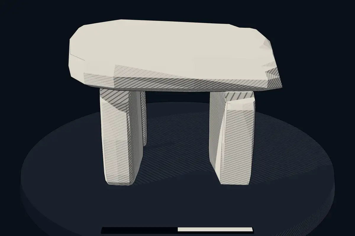
The reconstruction is ours, not a survey: it shows what a monument of this type looks like, at the size the record gives for this one.
Photographs
7 photographs, each with its author and licence
More photographs
Lore
Evidence & Lore
What the sources actually support — and, kept apart, what has been claimed.
What the evidence supports
Dates
Est. 4000–3000 BCEHow this date was established: Type comparisonTypical range for dolmens in Spain; this site has not been dated itself. Most dolmens date from the Late Neolithic period (4000-3000 BCE); the Dolmen of Menga in Andalusia dates to about 3750-3650 BCE.Source for this date
Where it stands
Spain
The pin marks the monument itself — its exact point.
- Coordinates
- 42°33′43″ N, 2°35′39″ WFor a GPS or map app: 42.56193, -2.59419
Access is as our sources describe it; we have not visited the site to check.
Nearby
The closest sites in the Atlas, by straight line.




Sources
Every record behind this page, with the link it came from.
2 sources behind this page
- 01Wikidata Q50689185wikidata.org
- 02Source for this dateen.wikipedia.org
Image files
- Dolmen de San Martín (49272911472).jpgÁngel M. Felicísimo from Mérida, EspañaCC BY 2.0
- Laguardia - Dolmen San Martín 02.jpgBasotxerriCC BY-SA 4.0
- Laguardia - Dolmen San Martín 03.jpgBasotxerriCC BY-SA 4.0
- Laguardia Dolmen de San Martín 1.jpgTxoCC BY-SA 4.0
- Laguardia Dolmen de San Martín 2.jpgTxoCC BY-SA 4.0
- Dolmen de San Martín (49272246648).jpgÁngel M. Felicísimo from Mérida, EspañaCC BY 2.0
- San Martin trikuharria, Guardian.jpgJosuCC BY-SA 4.0
Report a correctionWrong date, name, photograph or source? Tell us and it will be put right.
Around this place
The ten nearest sites, by compass
Credit
Text, licence and sources
Adapted from the Wikipedia article "Dolmen de San Martín" (Spanish), licensed CC BY-SA 4.0; authors are listed in the page history. Reused under CC BY-SA 4.0. Read on Wikipedia · Edit history and authors
- Wikipedia (Spanish): Dolmen de San MartínCC BY-SA 4.0
- Wikidata Q50689185CC0