
Dolmen del Alto de la Huesera
DatedEst. 4000–3000 BCE
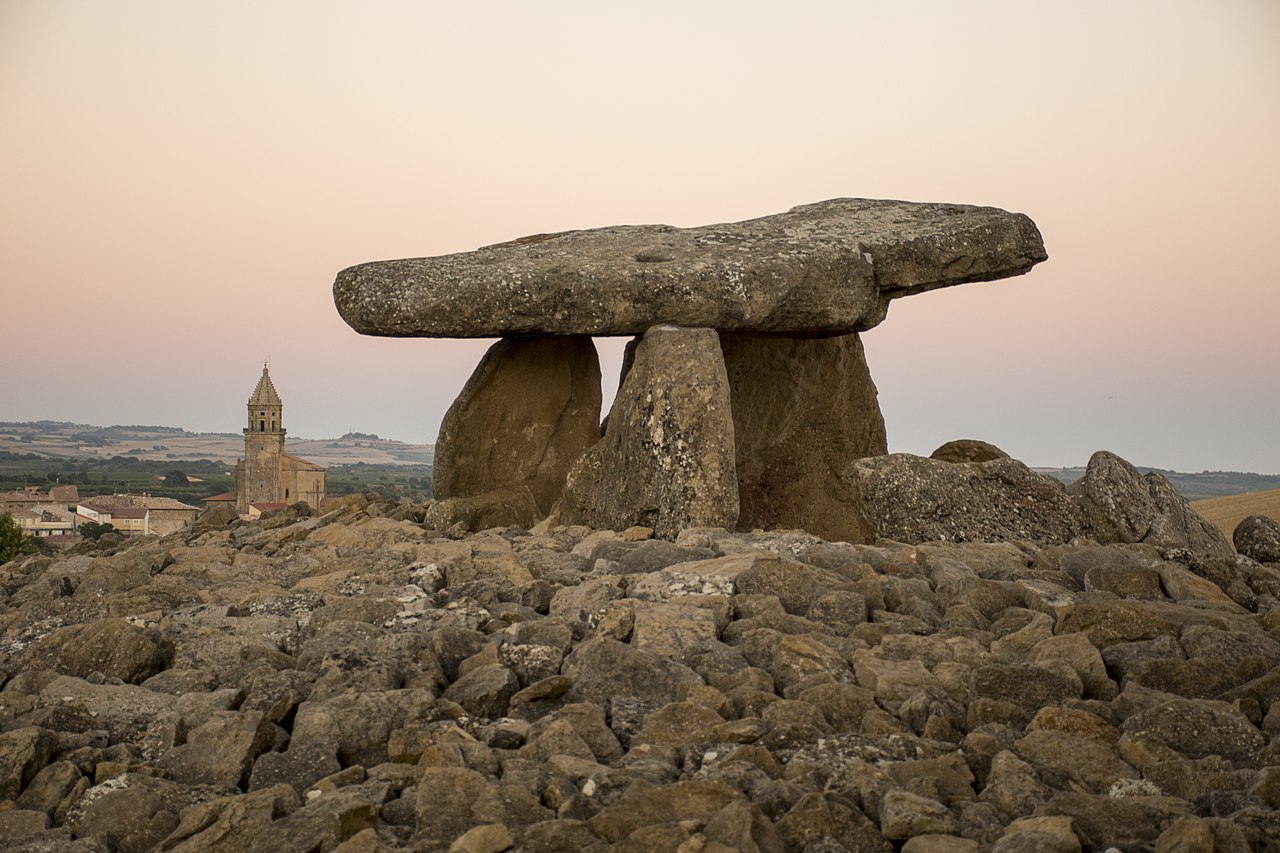
Photo Ángel M. Felicísimo from Mérida, España · CC BY 2.0Source file on Wikimedia Commons
Overview
About this site
Overview
The Dolmen del Alto de la Huesera is a passage grave on the Alto de la Huesera, on the hill of El Gancho, in the municipality of Laguardia in Álava, in the Basque Country, Spain. It is dated to the Chalcolithic and the Bronze Age and is regarded as the best dolmen of the Rioja Alavesa.
It was found in 1947 by Domingo Fernández de Medrano and was excavated, studied and reconstructed between 2010 and 2014. It consists of a corridor 8 m long and a polygonal chamber, and it held as many as one hundred and thirty-five bodies. A carved anthropomorphic stele found on the tumulus is unique in the Basque Country.
Read on Wikipedia4 min readCC BY-SA 4.0
Where it sits in time
The site's dated range, placed against world reference points.
The scale is logarithmic: each step to the left is about ten times older than the last.
Article
Dolmen del Alto de la Huesera
The monument stands in the Rioja Alavesa, between the Sierra de Codés and the Sierra de Cantabria, in the depression of the Ebro.
DescriptionSources for this section
Sources for this section
The monument stands in the Rioja Alavesa, between the Sierra de Codés and the Sierra de Cantabria, in the depression of the Ebro. The surrounding land was occupied from the Early Neolithic until Roman times. The corridor is 8 m long and is divided into two zones, one roofed with lintels and one lying within the tumulus; it keeps some of its roof slabs. The chamber is polygonal and formed of six sandstone orthostats with a cover slab. Trenches cut in the tumulus showed that it was circular and not oval, built of sandstone with a lighter limestone covering, and about 20 metres across.
ExcavationsSources for this section
Sources for this section
Fernández de Medrano excavated the dolmen the year after he found it. The work of 2010 to 2014 was commissioned by the Servicio de Museos y Arqueología of the Diputación Foral de Álava from the professors Javier Fernández Eraso and José Antonio Mujika Alustiza of the University of the Basque Country. Study began with the burial chamber, where the fallen cover slab had protected the deposit and kept it undisturbed. In the campaigns of 2010 and 2011 an excavation depth of about 40 cm was reached, with human remains of at least 106 individuals and their grave goods.
FindsSources for this section
Sources for this section
The stone tools include 10 arrowheads of various types, a trapeze with abrupt retouch, three complete sickle blades, three medial fragments and a scraper. Ornaments include bevelled discoidal bone beads of washer type, barrel-shaped beads of different stones and a perforated shell. The pottery includes Bell Beaker and corded wares. An awl and a tanged, winged arrowhead of bronze were also found.
On the surface of the original tumulus, outside strata 5 and 6 of the corridor, a sandstone stele with engravings was found and dated to the Chalcolithic. It is a human silhouette with five horizontal lines representing a hand, engravings that support a halberd and, at shoulder height, two engraved daggers. It is 14 cm thick on average. Its original place is thought to have been the top of the tumulus above the corridor. The two geometric figures, one triangular and one rhomboidal, are thought to represent tanged daggers, which would place the stone between about 5050 and 4450 cal bp, in the Final Chalcolithic. It was probably made during one of the alterations of the monument, when a new access to the chamber was opened on the east side and the corridor closed.
DatingSources for this section
Sources for this section
Radiocarbon dates on the bones, from 4520 ± 30 bp to 3550 ± 30 bp, show a long use of the structure, from the early Chalcolithic and the end of the Neolithic through the whole Chalcolithic to the advanced Bronze Age. Two phases are distinguished: a first from the foundation to the collapse of the original structure, and a second from the alteration of the chamber, when the corridor went out of use and the monument served as a simple dolmen until its final abandonment.
ConservationSources for this section
Sources for this section
The monument was declared a cultural asset in the category of monument, with the protection grade of calificado, by Decree 183/2011 of 26 July 2011, together with the other dolmens of the lowlands of the Historical Territory of Álava. Restoration was carried out in two phases. The first, from July 2010 to April 2011, stabilised and reinforced the orthostats so that they could bear the cover slab, which was put back in its original position. The second, in 2014 and 2015, was given to a building firm without restoration experience and has been criticised by those who excavated and studied the monument, who state that their instructions were not followed and that the tumulus, originally of interlocking stones, was rebuilt as a simple heap ringed by large stones.
ContextSources for this section
Sources for this section
Spain has a great many megalithic tombs. The finest are at Antequera in Andalusia, where the Dolmen of Menga, dated to about 3750 to 3650 BCE, is among the largest ancient megalithic structures in Europe.
Tradition and region
About this kind of monument
Dolmens of Andalusia, Extremadura and Galicia
Spain has a great many megalithic tombs, and the Atlas's Spanish dolmens run from Andalusia in the south to Galicia in the north-west. The finest are at Antequera in Andalusia, where the Dolmen of Menga, dated to about 3750 to 3650 BCE, is among the largest ancient megalithic structures in Europe. It is 27.5 metres long, 6 metres wide and 3.5 metres high, built with thirty-two megaliths, the largest weighing about 180 tonnes. After the chamber was finished it was covered with soil and built up into the hill seen today; when it was opened in the nineteenth century archaeologists found the skeletons of several hundred people. The Dolmen of Viera stands 70 metres away, and the tholos of El Romeral lies about 4 kilometres off; the three were inscribed as the Antequera Dolmens Site, a UNESCO World Heritage Site, in 2016.
In the south-west, the Dolmen de Soto at Trigueros in Huelva province is a Neolithic tomb estimated to date between 3000 and 2500 BCE, one of about 200 Neolithic burial sites in the province. It was found in 1922 when its owner, Armando de Soto Morillas, wanted to build a house; the German archaeologist Hugo Obermaier found eight bodies in a fetal position with artefacts, and its engraved and painted uprights have been studied more recently.
In Galicia and Portugal a dolmen is an anta, and in Catalan-speaking areas dolmens have folk names such as cova (cave), caixa (crate or coffin), taula (table) and arca (chest). These names are tradition: they record what people made of the monuments, not what they were built for.
When visiting Menga, look at the great capstones from inside the corridor, and at the way the mound was built up over the chamber.
Paraphrased from Wikipedia: Dolmen of Menga, Wikipedia: Dolmen of Viera, Wikipedia: Antequera Dolmens Site, Wikipedia: Dolmen de Soto, Wikipedia: Dolmen · CC BY-SA 4.0
From the article
Dated moments in the story
- 1600
La datación de la ejecución de los grabados es complicada y queda enmarcada, en principio, dentro del periodo de uso del monumento, casi 1600 años, entre hace 5310 y 3720 cal bp.
Source - 1947
Fue descubierto en 1947 por Domingo Fernández de Medrano y excavado por él mismo al año siguiente.
Source - 2010
Entre los años 2010 y 2014 se excavó, estudió y reconstruyó.
Source - 2010
En las campañas de 2010 y 2011 se llegó a un nivel de excavación de unos 40 cm en el que se hallaron restos humanos de al menos 106 individuos acompañados por sus respectivos ajuares.
Source - 2010
Entre los años 2010 y 2014 se excavó, estudio y reconstruyó el monumento.
Source - 2010
La primera, entre julio de 2010 y abril de 2011, fue realizada por la empresa Petra S.
Source - 2011
Fue declarado bienes cultural en la categoría de monumento y obtuvo el grado de protección de calificado por el Decreto 183/2011, del 26 de julio de 2011 junto a los otros dólmenes que conforman el "Conjunto de monumentos" de los dólmenes de las tierras bajas del Territorio Histórico de Álava.
Source - 2014
En ella se estabilizaron los ortostatos y se reforzaron para que soportaran el peso de la losa cobertera que se volvió a ubicar en su posición original, y se realizaron uniones entre ortostatos con morteros de cal y arena. La segunda, entre 2014 y 2015, se encargó a una empresa de construcción no especializada en...
Source
See it in 3D
An interpretive reconstruction of the monument, standing on the real ground at its exact point, under the sun for that place and season. Drag to look around it.
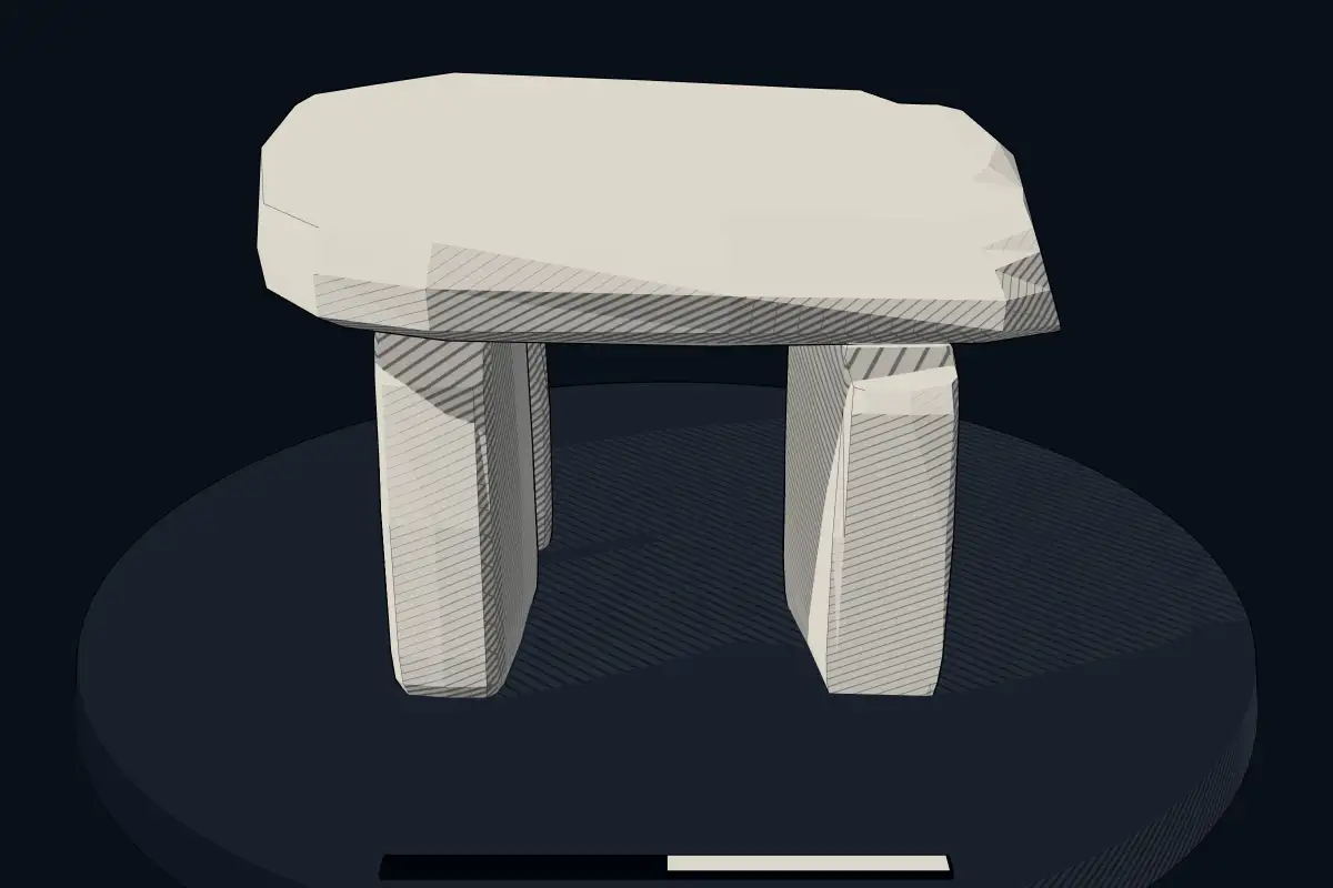
The reconstruction is ours, not a survey: it shows what a monument of this type looks like, at the size the record gives for this one.
Photographs
8 photographs, each with its author and licence
More photographs
Lore
Evidence & Lore
What the sources actually support — and, kept apart, what has been claimed.
What the evidence supports
Dates
Est. 4000–3000 BCEHow this date was established: Type comparisonTypical range for dolmens in Spain; this site has not been dated itself. Most dolmens date from the Late Neolithic period (4000-3000 BCE); the Dolmen of Menga in Andalusia dates to about 3750-3650 BCE.Source for this date
Where it stands
Spain
The pin marks the monument itself — its exact point.
- Coordinates
- 42°34′10″ N, 2°33′58″ WFor a GPS or map app: 42.56950, -2.56607
Access is as our sources describe it; we have not visited the site to check.
Nearby
The closest sites in the Atlas, by straight line.


Sources
Every record behind this page, with the link it came from.
2 sources behind this page
- 01Wikidata Q28662974wikidata.org
- 02Source for this dateen.wikipedia.org
Image files
- Dolmen del Alto de la Huesera (49005673683).jpgÁngel M. Felicísimo from Mérida, EspañaCC BY 2.0
- Laguardia dolmen del alto de la huesera 2.jpgTxoCC BY-SA 4.0
- Laguardia dolmen del alto de la huesera 5.jpgTxoCC BY-SA 4.0
- Dolmen del Alto de la Huesera, Laguardia (32688).jpgMentxuwikiCC BY-SA 4.0
- Dolmen del Alto de la Huesera, Laguardia (77963).jpgMentxuwikiCC BY-SA 4.0
- Lagar y dolmen en el Alto de la Huesera, Laguardia.jpgMentxuwikiCC BY-SA 4.0
- Laguardia dolmen del alto de la huesera 3.jpgTxoCC BY-SA 4.0
- Lagar en el Alto de la Huesera, Laguardia.jpgMentxuwikiCC BY-SA 4.0
Report a correctionWrong date, name, photograph or source? Tell us and it will be put right.
Around this place
The ten nearest sites, by compass
Credit
Text, licence and sources
Adapted from the Wikipedia article "Dolmen del Alto de la Huesera" (Spanish), licensed CC BY-SA 4.0; authors are listed in the page history. Reused under CC BY-SA 4.0. Read on Wikipedia · Edit history and authors