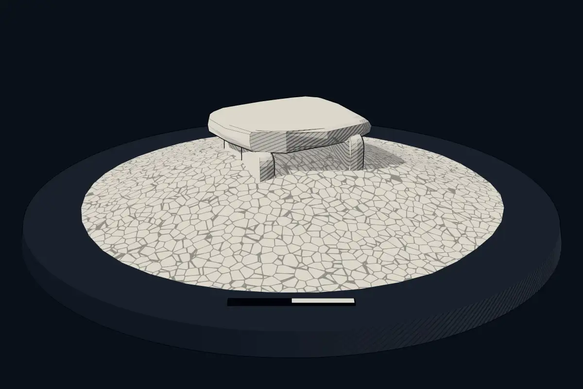
Großsteingrab Wangels LA 69
DatedEst. 3500–2800 BCE
No licensed photograph yetWe have no photograph we may publish for this site, so the interpretive 3D view leads instead.
Overview
About this site
Overview
Wangels LA 69 is a Neolithic megalithic tomb in the municipality of Wangels in Ostholstein, Schleswig-Holstein, Germany. It consists of a long mound about 43 × 16 m in size, at one end of which a Holstein chamber was built. It was erected in the second half of the fourth millennium BCE and is associated with the Funnel Beaker culture.
The grave was investigated in 2010-2014 as part of the DFG priority programme 1400 “Early Monumentality and Social Differentiation”. Few Neolithic megalithic graves have been excavated with modern methods in a research excavation with ample time, and although most boulders had been removed, the chamber had not been plundered. It held a large assemblage of grave goods, including pottery vessels, amber artefacts, transverse arrowheads, a few flint axes and a basalt battle axe.
Read on Wikipedia6 min readCC BY-SA 4.0
Where it sits in time
The site's dated range, placed against world reference points.
The scale is logarithmic: each step to the left is about ten times older than the last.
Article
Großsteingrab Wangels LA 69
Three further Neolithic graves have been documented within 500 m, and several Bronze Age barrows were observed within 2 km.
SettingSources for this section
- Wikipedia (German): Großsteingrab Wangels LA 69CC BY-SA 4.0
Sources for this section
- Wikipedia (German): Großsteingrab Wangels LA 69CC BY-SA 4.0
The tomb lies on a natural rise in the municipality of Wangels. Three further Neolithic graves have been documented within 500 m, and several Bronze Age barrows were observed within 2 km. The region of the western Oldenburger Graben has many other prehistoric sites, among them Oldenburg-Dannau LA 77.
Research historySources for this section
- Wikipedia (German): Großsteingrab Wangels LA 69CC BY-SA 4.0
Sources for this section
- Wikipedia (German): Großsteingrab Wangels LA 69CC BY-SA 4.0
The grave was first recorded in 1962 in the Schleswig-Holstein state survey, which noted a length of 43 m, a width of 16 m and a maximum height of 1.6 m and classified it as destroyed. The later excavations confirmed the destruction. Many of the boulders of the capstones, supporting stones and kerb were probably removed in the 19th century. A funnel-shaped excavation shaft, many stone splinters from boulders, pieces of iron (remains of a hammer and chisel) and blasting channels on the remaining stones point to this.
The excavation formed part of the sub-project “Megalithic monuments and settlement patterns in Funnel Beaker period Ostholstein (3500-2700 BCE)”, led by Johannes Müller, with excavation direction by Jan Piet Brozio. Geophysical measurements (ground-penetrating radar) were made in 2010, and four excavation campaigns followed from 2012 to 2014. The analyses are continuing and are now supported by the Collaborative Research Centre SFB 1266. A reconstruction of the grave chamber was built on the CAU Kiel campus to mark a 350th anniversary.
ExcavationsSources for this section
- Wikipedia (German): Großsteingrab Wangels LA 69CC BY-SA 4.0
Sources for this section
- Wikipedia (German): Großsteingrab Wangels LA 69CC BY-SA 4.0
The aim was to reconstruct the monument by stratigraphic methods and to document the extent of damage to the chamber. One longitudinal trench and six cross trenches were laid across the long mound, together with further large-area trenches to examine its architecture. Of the two large anomalies found by the geophysical survey, the north-western one proved to be the structure of the mound fill, and the south-eastern one proved to be the burial chamber.
ConstructionSources for this section
- Wikipedia (German): Großsteingrab Wangels LA 69CC BY-SA 4.0
Sources for this section
- Wikipedia (German): Großsteingrab Wangels LA 69CC BY-SA 4.0
The oval long mound consists of a primary mound fill to the southeast of the chamber and a secondary fill that extended the originally round mound into a long bed and is connected with a stone-packing grave. The fill was built partly from layered turves, as also seen in the long bed Albersdorf LA 56. The mound was originally surrounded by a slightly trapezoidal row of stones, 32 m long and 9 to 12 m wide, enclosing about 300 m². Because it runs round the whole long mound and is absent between the primary and secondary fills, it probably belongs to the secondary building phase. Today the row consists of many small stones; no stand marks of boulders remain, but comparison with other monuments indicates that they existed.
Beside the chamber, features interpreted as plough marks were found. Some researchers associate such marks with ritual ploughing, but a new study links them, on the evidence of pollen they contain, with earlier (early Neolithic) settlement and arable farming, so that they would not be ritual.
Within the secondary fill a stone packing of up to six stacked stones was uncovered, and beneath it a long oval discolouration interpreted as a burial without grave goods. This grave was dated directly to 3330-3095 BCE, and three suitable short-lived samples from the mound extension gave 3321-3018, 3336-3105 and 3333-3101 cal BC. A phase model that took stratigraphy into account postulated a young date of 3120-3100 BCE within this range. Single graves are rare in the late fourth millennium, and several authors see this one as an early sign of the later single-grave societies of the Late Neolithic.
Two supporting stones of the chamber survived while the remaining boulders were removed. From discolourations in the ground, the number and position of the supporting stones could be reconstructed: 13 boulders originally formed the chamber, which was 6 m long, and four more marked the entrance. The plan was rectangular with rounded narrow ends, which identifies the chamber as a Holstein chamber. The passage was 2 m long and 0.7-1 m wide, and the transition from passage to chamber was marked by a threshold stone. A possible closing stone lay nearby. Under one of the surviving boulders a pit held a complete pottery vessel, which can be regarded as a foundation deposit.
The chamber floor was divided into three parts: the two outer areas had stone paving and the middle area a layer of compacted clay. The northern paving was separated from the clay by a row of upright slabs. A layer of burnt flint had been placed over the chamber floor.
FindsSources for this section
- Wikipedia (German): Großsteingrab Wangels LA 69CC BY-SA 4.0
Sources for this section
- Wikipedia (German): Großsteingrab Wangels LA 69CC BY-SA 4.0
Across all trenches, 1635 flint artefacts (204.4 kg) were found, including 1,515 flakes, of which 47 were modified. These included 23 transverse arrowheads and a few other tools such as borers and scrapers. There were also 51 blades and 69 cores. Three flint axe blades came from the chamber, two thick-butted thin-bladed and one thick-butted thick-bladed. Two flint daggers were found, one of them a handle fragment with a rhombic cross-section.
Amber objects numbered 69. The most frequent were 21 tubular pendants, followed by 13 double-axe-shaped beads, types that belong to the known repertoire of Middle Neolithic megalithic graves.
A basalt battle axe of the double-axe form, type DII after Zápotocký (also called the Amazon axe), dates to the Middle Neolithic (MN I-III, ca. 3300-3000 BCE). Axes of this type are most common in what is now northern Germany.
In all trenches 1435 pottery sherds weighing 137.4 kg were found, 74 % of them from the chamber (chamber floor and flint layer). Distinctive rim and wall sherds (590 pieces, 7 kg) allowed a minimum of 38 vessel units to be reconstructed. Ten complete and nine nearly complete vessels were added, so that the chamber was furnished with at least 57 vessels. They comprise 19 cone-rim vessels, 19 cylinder-rim vessels, six funnel-rim vessels, six globular amphorae and one giant beaker.
DatingSources for this section
- Wikipedia (German): Großsteingrab Wangels LA 69CC BY-SA 4.0
Sources for this section
- Wikipedia (German): Großsteingrab Wangels LA 69CC BY-SA 4.0
Vessel shapes and decoration, together with the relative chronology of the features and radiocarbon-dated samples, allowed the use of the chamber to be divided into phases. Fifty-one samples were collected, and seven phases, Wangels 1-7, were distinguished, giving a period of use of about 1500 years (>3400-1900 BCE). A black layer beneath the chamber is Wangels 1 (3640-3360 cal BC) and includes the ploughing. Wangels 2 (3360-3280 cal BC) comprises the supporting stones, stone paving, entrance area and primary mound. Wangels 3 (3280-3120 cal BC) is the secondary extension into a long bed and the stone kerb. Wangels 4 (3120-3100 cal BC) is the burial pit without grave goods. Wangels 5 (3120-3000 cal BC) is the first burial phase traceable in the pottery, together with the flint layer, and Wangels 6-7 (3000-1900 cal BC) are the later burial phases. Most of the vessels probably belong to Wangels 5; Wangels 6-7 is characterised by the globular amphorae. Besides Funnel Beaker finds there are finds of the Globular Amphora culture and of the Late Neolithic (dagger period).
ContextSources for this section
- Wikipedia (German): Großsteingrab Wangels LA 69CC BY-SA 4.0
Sources for this section
- Wikipedia (German): Großsteingrab Wangels LA 69CC BY-SA 4.0
Across the plain from the Netherlands to Poland, the Funnel Beaker culture left thousands of megalithic tombs. Nordic megalith architecture emerged in northern Europe mainly between 3500 and 2800 BCE. Schleswig-Holstein now reports 3,212 megalithic monuments and 958 long mounds, and Mecklenburg-Vorpommern 5,991 megaliths.
Tradition and region
About this kind of monument
Megalithic tombs of the North European Plain
Across the plain from the Netherlands to Poland, the Funnel Beaker culture left thousands of megalithic tombs. Nordic megalith architecture emerged in northern Europe mainly between 3500 and 2800 BCE. Counts have risen as surveys improved: Schleswig-Holstein now reports 3,212 megalithic monuments and 958 long mounds, Mecklenburg-Vorpommern 5,991 megaliths (against 648 in 2010), and Lower Saxony 1,155. Altogether 11,162 megaliths are known in these three regions, and with Brandenburg and Saxony-Anhalt the figure for northern Germany rises to 11,648. Denmark has 5,001 registered monuments, the Netherlands 101, Sweden 639 and Poland 18. Johannes Müller has suggested that originally more than 75,000 megaliths were built.
Monuments are classed by type: simple dolmens, extended dolmens, passage graves, great dolmens, unchambered long barrows and stone cists. The oldest are the simple dolmens, which appeared around 3500 BCE and are found across almost the whole area of Nordic megalith architecture. Their entrances were built to be reopened. A megalithic entrance had to seal the tomb, yet allow the community to gain access to the interior again, even after a long time, to perform rituals.
In the Netherlands the hunebedden were built between 3470 and 3250 BCE and used until about 2760 BCE; 54 of the original 100 survive, 52 of them in Drenthe. Poland has only 18 registered monuments, and the long barrows in parts of Poland were typically earthen rather than megalithic.
Dating combines radiocarbon dates from bone and pottery. The tombs were used by later cultures too, so a single tomb can hold remains from different periods.
When visiting, look at how the capstones sit on the supporting stones, how the entrance is built, and the frame of kerbstones around the mound.
Paraphrased from Wikipedia: Nordic megalith architecture, Wikipedia: Megaliths in the Netherlands, Wikipedia: Funnel beaker culture, Wikipedia: Megaliths in Mecklenburg-Vorpommern · CC BY-SA 4.0
From the article
Dated moments in the story
- 3100 BCE
Anhand Brozios Phasenmodell (s. u.), in das stratigraphische Überlegungen mithineinflossen, wurde innerhalb des durch die absoluten Datierungen vorgegebenen Alters ein junges Datum (3120–3100 v. Chr.) postuliert.
Source - 3095 BCE
Das Einzelgrab aus Wangels wurde mit einer direkten Probe absolutchronologisch auf 3330–3095 v. Chr. datiert.
Source - 3000 BCE
Sie datieren ins Mittelneolithikum (MN I–III, ca. 3300–3000 v. Chr.). Insgesamt in allen Grabungsschnitten wurden 1435 Keramikscherben mit einem Gewicht von 137,4 kg gefunden.
Source - 2800 BCE
Trichterbecherkultur (4100–2800 v. Chr.) assoziiert, wie auch tausende weitere Anlagen in der Norddeutschen Tiefebene (von den östlichen Niederlanden, über Schleswig-Holstein und Sachsen-Anhalt bis ins nordwestliche Polen), Dänemark, Schweden und Norwegen (s. auch Nordische Megalitharchitektur).
Source - 2700 BCE
Im Rahmen des von Johannes Müller geleiteten SPP-Teilprojektes „Megalithanlagen und Siedlungsmuster im trichterbecherzeitlichen Ostholstein (3500–2700 v. Chr.): Mittleres Travetal und Westlicher Oldenburger Graben“, wurde das Grab unter der Grabungsleitung von Jan Piet Brozio untersucht.
Source - 2250 BCE
Erster Beiltyp ist im nordischen Früh- bis Jungneolithikum (FN II–JN, ca. 3500–2250 v. Chr.), letzter vom Mittel- bis zum Spätneolithikum (MN II–SN, ca. 3200–1700 v. Chr.) belegt.
Source - 1700 BCE
Generell gehören die beidseitig (bifaziell) flächig retuschierten Silexdolche zum Fundgut des nordischen Spätneolithikums (Dolchzeit) (ca. 2350–1700 v. Chr.) und der Nordischen Älteren Bronzezeit (1700–1100 v. Chr.), wobei auch während des Früh- und Mittelneolithikums Geräte mit beidseitig flächigen Retuschen...
Source - 590 CE
Anhand von distinktiven Rand- und Wandscherben (590 Stück, 7 kg) konnte eine Mindestanzahl von 38 Gefäßeinheiten rekonstruiert werden.
Source - 1266
Interdisziplinäre Forschungen (Archäologie und Biochemie) des Sonderforschungsbereichs SFB 1266 haben mit sog.
Source - 1266
Das im Kontext des Sonderforschungsbereichs SFB 1266 erzielte Ergebnis zu den Rinderprodukten (s. o.) ist ein neues und wichtiges Ergebnis für die rezente Forschung.
Source - 1400
Mit dem Grab Wangels und dem DFG geförderten SPP 1400 ergab sich solch eine Chance.
Source - 1400
Zudem wird die Umwelt während der Jungsteinzeit, die Entstehung und Entwicklung von Monumentalbauten und von Siedlungen erklärt und die Projekte des von der DFG geförderten Sonderforschungsbereichs SPP 1400 vorgestellt.
Source - 1635
In allen Schnitten zusammen wurden 1635 Artefakte (Grundformen und Geräte) aus Silex gefunden (204,4 kg).
Source - 1900
Wangels 6–7 sind die nachfolgenden anhand der Keramik nachzuzeichnenden Bestattungsphasen (3000–1900 calBC).
Source
Lore
Evidence & Lore
What the sources actually support — and, kept apart, what has been claimed.
What the evidence supports
Dates
Est. 3500–2800 BCEHow this date was established: Type comparisonTypical range for megalithic tombs in Germany; this site has not been dated itself. German stone tombs (Grosssteingraber) belong to the Nordic megalith tradition which emerged predominantly between 3500 and 2800 BC.Source for this date
Where it stands
Germany
The pin marks the monument itself — its exact point.
- Coordinates
- 54°16′41″ N, 10°51′36″ EFor a GPS or map app: 54.27805, 10.85998
Access is as our sources describe it; we have not visited the site to check.
Nearby
The closest sites in the Atlas, by straight line.
 Steinkammer von Grammdorf3500–2800 BCE
- DolmenGanggrab von Wangels-Meischenstorf3500–2800 BCE
- Megalithic tombGroßsteingrab Meischenstorf3500–2800 BCE
- Megalithic tombGroßsteingrab Putlos VIII3500–2800 BCE
- Megalithic tombGroßsteingrab Lensahn3500–2800 BCE
- DolmenDolmen von Putlos3500–2800 BCE
- Megalithic tombGroßsteingrab Testorf3500–2800 BCE
 Großsteingräber bei Hansühn3500–2800 BCE


Sources
Every record behind this page, with the link it came from.
2 sources behind this page
- 01Wikidata Q109614090wikidata.org
- 02Source for this dateen.wikipedia.org
Report a correctionWrong date, name, photograph or source? Tell us and it will be put right.
Around this place
The ten nearest sites, by compass
- Steinkammer von Grammdorf2.4 km SW
- Ganggrab von Wangels-Meischenstorf4.8 km SW
- Großsteingrab Meischenstorf4.8 km SW
- Großsteingrab Putlos VIII6.0 km N
- Großsteingrab Lensahn6.5 km SE
- Dolmen von Putlos6.6 km N
- Großsteingrab Testorf7.0 km W
- Großsteingräber bei Hansühn8.0 km SW
- Großsteingräber bei Neutestorf8.1 km SW
- Großsteingrab Neu-Testorf I8.1 km SW
Credit
Text, licence and sources
Adapted from the Wikipedia article "Großsteingrab Wangels LA 69" (German), licensed CC BY-SA 4.0; authors are listed in the page history. Reused under CC BY-SA 4.0. Read on Wikipedia · Edit history and authors