.jpg/1920px-Stara_Zagora_Province_-_Kazanlak_Municipality_-_Village_of_Buzovgrad_-_Megalith_(3).jpg 1920w)
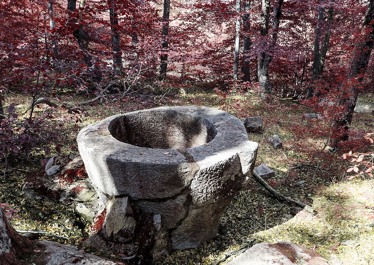
Buzovgrad Megalith
Photo Камен Ханджиев · CC BY-SA 4.0Source file on Wikimedia Commons
Overview
About this site
Overview
The Buzovgrad Megalith (Врата на богинята Майка, “Gate of the Mother Goddess”; also Бащин камък, “Father’s Stone”, and Бубакая) is an ancient sanctuary of the Late Eneolithic and the beginning of the Bronze Age. It lies on the northern slopes of Sarnena Sredna Gora, near the village of Buzovgrad in Kazanlak municipality, Bulgaria.
It is a rock group with a worked opening about 1.80 m high, so arranged that the Sun appears in the “window” at sunset. It was probably built in the period 1800 – 1600 BCE, and on 28 May 2013 it was declared a natural landmark.
Read on Wikipedia3 min readCC BY-SA 4.0
Article
Buzovgrad Megalith
It consists of two horizontally placed stone blocks resting on two others that are part of the main rock massif, and so forms a trilithon.
DescriptionSources for this section
Sources for this section
The megalith is a rock group in which an opening about 1.80 m high has been cut out. It consists of two horizontally placed stone blocks resting on two others that are part of the main rock massif, and so forms a trilithon. Many other rock structures lie on the hill, including a so-called throne to the east. The throne stands about 5.80 m east of the opening, and the rock on which it is carved lies on the line between the Balkan Range peak Triglav and the opening of the trilithon. A steep drop lies at the opposite end of the window.
The Roman fortress Buzovo kale stands to the east, nearby.
Astronomical alignmentSources for this section
Sources for this section
The structure is built so that the Sun falls into the window at sunset. At the summer solstice (21 June) the rays pass exactly through the opening formed by the stone blocks and fall on the rock opposite. It is therefore thought that the monument was probably used to measure the length of the astronomical year and the seasons, and to keep the calendar of the Thracians.
DatingSources for this section
Sources for this section
Archaeologists determine that the structure was already used by the population of the Bulgarian lands before the Thracians, and later passed to the Thracians themselves. It was probably built in the period 1800 – 1600 BCE. Archaeologists suppose that an ancient necropolis should exist in the surroundings, but none has been found.
InterpretationSources for this section
Sources for this section
In the ancient religion and beliefs of the Thracians, sunrise symbolised birth and sunset symbolised death and the world of the dead. For this reason the megalith probably symbolised a “gate to the beyond”, and it is supposed to have been used in cult rituals and in the burials of Thracian aristocrats and priests.
In a wider landscape, the megalith lies at one corner of a triangle whose other corners are Seuthopolis, the capital of the Odrysae, and the mound Golyama Kosmatka. According to Alexander Fol, similar installations exist on the opposite Balkan hills visible through the window. It is possible that, besides serving as cult installations, they were used as military lookouts and communication points, linked in clear weather by bronze solar mirrors and at night by fires.
Later historySources for this section
Sources for this section
Work is under way to give the megalith the status of a monument of national significance and to promote it as the “Bulgarian Stonehenge”. Part of the ashes of the Thracologist Alexander Fol, who died in 2006, were scattered in the area, and in 2009 a stone plaque in his honour was placed on one of the large stones on the day of the summer solstice. Nearby is another rock formation, the Father’s Stone, which is probably a natural rock group.
VisitingSources for this section
Sources for this section
An eco-trail to the megalith was built in 2005. It enters wooded country and climbs steeply for about two kilometres, a walk of about one hour.
Tradition and region
About this kind of monument
Thracian rock sanctuaries of Bulgaria
In the Eastern Rhodope and Strandzha mountains of Bulgaria, rocks have been cut, carved and used as sanctuaries for thousands of years, and the Atlas lists many of them as "megaliths". The Thracians were an Indo-European-speaking people who inhabited large parts of south-eastern Europe in ancient times, including modern Bulgaria, Romania, North Macedonia, northern Greece and European Turkey, and they reused many of the sites. Strandzha has a large concentration of ruins of Thracian sanctuaries, sacrificial altars and dolmens.
Perperikon, in the Eastern Rhodope Mountains 15 kilometres north-east of Kardzhali, is an ancient Thracian city on a rocky hill 470 metres high, thought to have been a sacred place; it is described as the largest megalith ensemble site in the Balkans. In the Middle Ages it served as a fortress. Beglik Tash, a prehistoric rock sanctuary on the southern Black Sea coast north of Primorsko, was reused by Thracian tribes in the Iron Age.
Many of the places listed as megaliths here are natural rock formations. Beglik Tash is a natural rock formation of megaliths of hardened magma, from a volcano of the Mesozoic era; most of the megaliths have traces of carving for Thracian rituals, and there are the remains of a labyrinth and a "Thracian sun-clock" formed of huge stones, as well as a 150-ton rock. It is often hard to tell where nature ends and human work begins.
Dating depends on the finds in the few excavated parts, and most sites are listed with a broad range.
When visiting, look for traces of carving on the rock, and for steps and niches.
Paraphrased from Wikipedia: Thracians, Wikipedia: Perperikon, Wikipedia: Beglik Tash, Wikipedia: Strandzha · CC BY-SA 4.0
From the article
Dated moments in the story
- 2005
През 2005 г. към мегалита е изградена екопътека. В центъра на селото има указателни табели, които водят на юг в посока към село Средногорово. Непосредствено преди края на селото се завива вляво. От там, пътеката навлиза в гориста местност и се изкачва стръмно около два километра. Разстоянието се взима за около един...
Source - 2016
Мегалитът – профил в Изпълнителна агенция по околна среда // Архивиран от оригинала на 5 март 2016. Посетен на 28 юли 2014. Мегалитът – Пътепис „Мегалитът... мистерия и тайни“ от Николина Милкова Мегалитът – Туристически пътеки към мегалита над село Бузовград
Source
Photographs
6 photographs, each with its author and licence
More photographs
Where it stands
Bulgaria
The pin marks the monument itself — its exact point.
- Coordinates
- 42°34′14″ N, 25°22′36″ EFor a GPS or map app: 42.57049, 25.37666
Access is as our sources describe it; we have not visited the site to check.
Nearby
The closest sites in the Atlas, by straight line.



Sources
Every record behind this page, with the link it came from.
1 source behind this page
- 01Wikidata Q12286356wikidata.org
Image files
- Stara Zagora Province - Kazanlak Municipality - Village of Buzovgrad - Megalith (3).jpgКамен ХанджиевCC BY-SA 4.0
- Stara Zagora Province - Kazanlak Municipality - Village of Buzovgrad - Megalith (1).jpgКамен ХанджиевCC BY-SA 4.0
- Buzovgrad.megalit.01.jpgZlatanZlatanovPublic domain
- Buzovgrad Megalith.jpgPredavatelCC BY 3.0
- Buzovgrad.megalit.02.JPGZlatanZlatanovPublic domain
- Buzovgrad.megalit.03.JPGZlatan.ZlatanovPublic domain
Report a correctionWrong date, name, photograph or source? Tell us and it will be put right.
Around this place
The ten nearest sites, by compass
Credit
Text, licence and sources
Adapted from the Wikipedia article "Мегалит над село Бузовград" (Bulgarian), licensed CC BY-SA 4.0; authors are listed in the page history. Reused under CC BY-SA 4.0. Read on Wikipedia · Edit history and authors