.jpg/1920px-Ancient_Town_Khulbuk%2C_Tajikistan_(28912838827).jpg 1920w)
MegalithFringe site
Hulbuk
Also known asVose'
DatedEst. 4000 BCE–600 CE
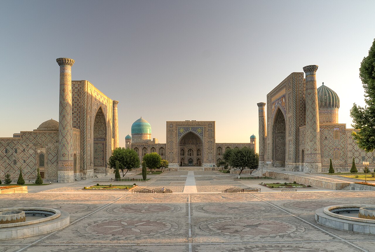
Photo Ninara from Helsinki, Finland · CC BY 2.0Source file on Wikimedia Commons
Overview
About this site
Overview
Hulbuk (Tajik: Ҳулбук), formerly Vose' (Восеъ) and Poytug (Пойтуғ), is the capital of the Vose' District of the Khatlon Region, Tajikistan, and the site of a medieval town. It had an estimated population of 24,500 as of 2020.
Read on Wikipedia1 min readCC BY-SA 4.0
Where it sits in time
The site's dated range, placed against world reference points.
The scale is logarithmic: each step to the left is about ten times older than the last.
Article
Hulbuk
SettingSources for this section
- Wikipedia (English): HulbukCC BY-SA 4.0
Sources for this section
- Wikipedia (English): HulbukCC BY-SA 4.0
Hulbuk lies in the southern part of Tajikistan, 26 kilometres (16 mi) southwest of Kulob and 174 km (108 mi) south of Dushanbe, the capital of Tajikistan. It has a cold semi-arid climate. The average annual temperature is 16.4 °C (61.5 °F), with July the warmest month at an average of 29 °C (84.2 °F) and January the coolest at 2.8 °C (37 °F). The average annual precipitation is 414.3 millimetres (16.31 in).
It is suspected that the medieval town of Hulbuk housed the Banijurids, a Turco-Iranian dynasty from the eastern region of Central Asia.
HistorySources for this section
- Wikipedia (English): HulbukCC BY-SA 4.0
Sources for this section
- Wikipedia (English): HulbukCC BY-SA 4.0
It is suspected that the medieval town of Hulbuk housed the Banijurids, a Turco-Iranian dynasty from the eastern region of Central Asia. The palatial and monumental architecture found in the region suggests that it supported a rich and powerful court. Excavation began in 1953 and continued for more than 40 years, uncovering a citadel. No topographical map of the site has been drawn. The citadel is thought to have been built as a stronghold, which lends support to the view that the dynasty used it.
Tradition and region
About this kind of monument
Other prehistoric stone monuments
The Atlas uses the heading "other" for stone monuments that fit none of its other types, and the same article serves for underground chambers that have no regional article. The records are varied. Many are ziggurats, Egyptian temples and pyramids, and Maya and Andean sites, which are treated in their own articles. What remains is a scatter of single sites in many countries whose descriptions do not allow a closer classification.
Several of these are underground. A hypogeum is literally an "underground" temple or tomb, often with niches for cremated remains or loculi for buried remains. An early example is found at the Minoan Bronze Age site of Knossos on Crete, a beehive-shaped vault cut into soft rock. The Hypogeum of Ħal Saflieni in Paola, Malta, is the oldest example of a prehistoric hypogeum, with its earliest phase dated to 3600 to 3300 BCE. It is a complex of underground chambers, halls and passages covering about 500 square metres on three levels, partly carved to imitate temple architecture and containing extensive prehistoric art.
A rock-cut tomb is cut into an existing rock formation, usually a cliff or sloping rock face, and was a common burial form for the wealthy in several parts of the world. Famous clusters are in Egypt, Iran, Lycia in Turkey, Petra in Jordan and Sicily. Phrygian rock-cut tombs such as the Midas monument date to about 700 BCE, and Etruscan ones to about 500 BCE.
The general rule for these records is that the type tells you how a monument was made, not who made it or when. Dating is taken from the source for each site where a source gives one, and otherwise left as a broad range.
When visiting, read the site's own description first, since the Atlas can offer only a general frame.
Paraphrased from Wikipedia: Megalith, Wikipedia: Hypogeum, Wikipedia: Rock-cut tomb, Wikipedia: Stele · CC BY-SA 4.0
From the article
Dated moments in the story
- 1953
In 1953, the initial excavation took place for more than 40 years and uncovered a citadel.
Source - 2020
It had an estimated population of 24,500 as of 2020. It is located in the southern portion of Tajikistan 26 kilometres (16 mi) southwest of Kulob and 174 km (108 mi) south of Dushanbe, capital of Tajikistan.
Source
Photographs
5 photographs, each with its author and licence
More photographs
Lore
Evidence & Lore
What the sources actually support — and, kept apart, what has been claimed.
What the evidence supports
Dates
Est. 4000 BCE–600 CEHow this date was established: Type comparisonTypological estimate, not a date for this site: a other in Central Asia is normally dated between 4000 BCE and 600 CE (Atlas typological table).Source for this date
Measured facts
- Mainstream position
- The citadel is thought to have been built as a stronghold, lending support to the possibility that the dynasty used it.Source: Mainstream position
- Former names
- Vose' and PoytugSource: Former names
- District capital
- Vose' DistrictSource: District capital
- Region
- Khatlon RegionSource: Region
- Estimated population
- 24,500 in 2020Source: Estimated population
- Excavation began
- 1953Source: Excavation began
- Archaeological find
- a citadelSource: Archaeological find
Alternative claims
Alternative claims about this site, kept in their own block and labelled with where they stand.
Hulbuk housed the Banijurids and supported a rich and powerful court.
UntestedSource for this claim: Hulbuk housed the Banijurids and supported a rich and powerful court.
Where it stands
Tajikistan
The pin marks the monument itself — its exact point.
- Coordinates
- 37°48′18″ N, 69°38′47″ EFor a GPS or map app: 37.80500, 69.64639
Access is as our sources describe it; we have not visited the site to check.
Nearby
The closest sites in the Atlas, by straight line.


Sources
Every record behind this page, with the link it came from.
2 sources behind this page
- 01Wikidata Q4126089wikidata.org
- 02Fringe claim sourceen.wikipedia.org
Image files
- Ancient Town Khulbuk, Tajikistan (28912838827).jpgNinara from Helsinki, FinlandCC BY 2.0
- Ancient Town Khulbuk, Tajikistan (43800770652).jpgNinara from Helsinki, FinlandCC BY 2.0
- Ancient Town Khulbuk, Tajikistan (43800799082).jpgNinara from Helsinki, FinlandCC BY 2.0
- Hulbuk,bath.jpgBertramzCC BY-SA 3.0
- Hulbuk,floorN.jpgBertramzCC BY-SA 3.0
Report a correctionWrong date, name, photograph or source? Tell us and it will be put right.
Lore, kept apart
Legends and claims
These are stories and claims reported by the sources. They are not evidence, and they never stand in for the dating above.
- Tested: not supported
Hulbuk housed the Banijurids and supported a rich and powerful court.
Source
Credit
Text, licence and sources
Adapted from the Wikipedia article "Hulbuk" (English), licensed CC BY-SA 4.0; authors are listed in the page history. Reused under CC BY-SA 4.0. Read on Wikipedia · Edit history and authors
- Wikipedia (English): HulbukCC BY-SA 4.0
- Wikidata Q4126089CC0