Menir de São Bartolomeu do Mar
DatedEst. 2800–1800 BCE
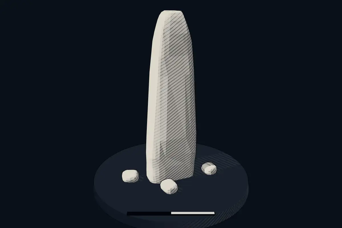
No licensed photograph yetWe have no photograph we may publish for this site, so the interpretive 3D view leads instead.
Overview
About this site
What the sources say
A Estátua-menir de São Bartolomeu do Mar é um megálito datado do Calcolítico ou Idade do Bronze situado no concelho de Esposende, no distrito de Braga.
Article in PortugueseRead on Wikipedia3 min readCC BY-SA 4.0
Where it sits in time
The site's dated range, placed against world reference points.
The scale is logarithmic: each step to the left is about ten times older than the last.
The full article
Menir de São Bartolomeu do Mar: the whole story
In briefSources for this section
Sources for this section
The Estátua-menir de São Bartolomeu do Mar is a megalith dated to the Chalcolithic or the Bronze Age, in the municipality of Esposende, in the district of Braga, Portugal.
It stands in the former parish of Mar, about five kilometres north of Esposende, near the church of São Bartolomeu and about 750 m from the Atlantic coast. A few kilometres to the north-east rises the menhir of São Paio de Antas.
The monolith, whose top end is broken, measures approximately 2,15 m in height and has a vaguely anthropomorphic, human-like appearance. It is engraved with several small cup marks and has three flattened faces.
According to tradition, the stone was raised by the seaside and protects against the advance of the waters. It is said that when it falls, the sea will advance. The menhir was declared a Property of Public Interest in 1992.
In the wider region, menhirs of the western European megalithic type are usually found standing alone or in small groups, in elevated places. Most appear to date back to the Stone Age, and they are not usually associated with burials. In Portugal the highest concentration of menhirs is in the Alentejo, where the Menhir of Meada is the largest on the Iberian Peninsula. The Atlas gives only a typological estimate for the age of this stone, and no excavation is described.
No English Wikipedia article exists for it; the full text below is the Portuguese article "Estátua-menir de São Bartolomeu do Mar", shown in the original language.
Summary in EnglishSources for this section
Sources for this section
Menir de São Bartolomeu do Mar is a menhir (standing stone) in Belinho e Mar, Portugal. Wikidata describes it as: menhir in Mar, Portugal. A typological estimate: 2800 BCE to 1800 BCE. No English Wikipedia article exists for it; the full text below is the Portuguese article "Estátua-menir de São Bartolomeu do Mar", shown in the original language.
LocalizaçãoSources for this section
Sources for this section
A Estátua-menir situa-se na antiga freguesia de Mar, a cerca de cinco quilómetros a norte de Esposende ; perto da igreja de São Bartolomeu, cerca de 750 m da costa atlântica .
DescriçãoSources for this section
Sources for this section
O monólito, cuja extremidade foi partida, mede aproximadamente 2,15 m de altura e tem um aspeto vagamente antropomórfico . Foi gravado com varias covinhas e tem três faces aplainadas.
A poucos quilómetros a nordeste ergue-se o menir de São Paio de Antas .
LendaSources for this section
Sources for this section
Segundo a tradição, a pedra foi levantada à beira-mar e protege contra o avanço das águas ; Diz-se que quando cair o mar avançará.
O menir foi declarado Imóvel de Interesse Público em 1992.
How this page was madeSources for this section
Sources for this section
The summary at the top of this page was written by Claude Sonnet 5.5 (2026-11-06) from the cited Wikipedia article “Estátua-menir de São Bartolomeu do Mar”, translated from Portuguese. The numbers in it were checked automatically against the source text. The rest of the page is the article itself, the structured records and computed distances.
Tradition and region
About this kind of monument
Iberian menhirs
In Spain menhirs of the western European megalithic type are relatively unusual compared with dolmens, but are common sights in the northern half of the country, where at least 500 have been reported. They are particularly common in the Basque Country, Navarre, northern Burgos and Palencia, Cantabria and the Pyrenees, usually standing alone or in small groups (cromlechs) in elevated places. Most appear to date back to the Stone Age. They are not usually associated with burials, though at the Menhir of Cuesta del Molino in Burgos burials were made at least 2,000 years after the menhir was raised. The Arlobi menhir is one of the most recent examples.
Portugal's highest concentration is in the Alentejo, where the Menhir of Meada is the largest on the Iberian Peninsula. The Menhir of Outeiro, near Reguengos de Monsaraz in the district of Évora, is the second largest in Portugal: a granite monolith 5.6 metres high, about a metre across and an estimated eight tonnes. It was found lying on its side in 1969 by Henrique Leonor Pina and José Pires Gonçalves and re-erected about 1970, and was classified as a national monument in 1971. A hollow in its top has been read as a urethra, so that the stone is taken as phallic; that is an interpretation, not a fact.
The Almendres Cromlech near Évora is the largest group of structured menhirs on the Iberian Peninsula, and one of the largest in Europe. It belongs to the "megalithic universe of Évora", with parallels in the Portela de Mogos cromlech. Its beginnings have been put as far back as the sixth millennium BCE, which would make it extremely early, and it was rediscovered in 1966 by Henrique Leonor Pina.
When visiting, look for stones on high ground and note which way they face.
Paraphrased from Wikipedia: Menhir, Wikipedia: Menhir of Outeiro, Wikipedia: Almendres Cromlech, Wikipedia: List of menhirs · CC BY-SA 4.0
From the article
Dated moments in the story
- 1992
O menir foi declarado Imóvel de Interesse Público em 1992.
Source
See it in 3D
An interpretive reconstruction of the monument, standing on the real ground at its exact point, under the sun for that place and season. Drag to look around it.
The reconstruction is ours, not a survey: it shows what a monument of this type looks like, at the size the record gives for this one.
Lore
Evidence & Lore
What the sources actually support — and, kept apart, what has been claimed.
What the evidence supports
Dates
Est. 2800–1800 BCEHow this date was established: Type comparisonTypical range for menhirs in Portugal; this site has not been dated itself. Standing stones are associated with the Beaker people of the European late Neolithic and early Bronze Age c. 2800-1800 BC.Source for this date
Where it stands
Portugal
The pin marks the monument itself — its exact point.
- Coordinates
- 41°34′25″ N, 8°47′28″ WFor a GPS or map app: 41.57360, -8.79110
Access is as our sources describe it; we have not visited the site to check.
Nearby
The closest sites in the Atlas, by straight line.


Sources
Every record behind this page, with the link it came from.
2 sources behind this page
- 01Wikidata Q1654338wikidata.org
- 02Source for this dateen.wikipedia.org
Report a correctionWrong date, name, photograph or source? Tell us and it will be put right.
Around this place
The ten nearest sites, by compass
- Anta da Portelagem e Mamoas do Rápido2.5 km E
- Rapído dolmen2.5 km E
- Menir de São Paio de Antas3.6 km NE
- Mamoa do Chão da Pica24 km N
- Mamoa de Eireira25 km N
- Mamoa de Aspra26 km N
- Dólmen de Vile27 km N
- Anta da Barrosa27 km N
- Via romana de Braga a Tui - 14 marcos miliários (série capela)29 km NE
- Nécropole mégalithique de Bustelo31 km NE
Credit
Text, licence and sources
Text from the Wikipedia article "Estátua-menir de São Bartolomeu do Mar" (Portuguese), licensed CC BY-SA 4.0; authors are listed in the page history. Reused under CC BY-SA 4.0. Read on Wikipedia · Edit history and authors