
Menir de Aspradantes
Also known asAspradantes menhir · Menhir de Aspradantes · Padrao menhir
DatedEst. 2800–1800 BCE
Photo Rmatospi · CC BY-SA 4.0Source file on Wikimedia Commons

Overview
About this site
What the sources say
O Menir de Aspadrantes é um monumento pré-histórico na freguesia de Vila do Bispo e Raposeira, no município de Vila do Bispo, na região do Algarve, no Sul de Portugal.
Foi classificado como Imóvel de Interesse Público em 1992.
Article in PortugueseRead on Wikipedia5 min readCC BY-SA 4.0
Where it sits in time
The site's dated range, placed against world reference points.
The scale is logarithmic: each step to the left is about ten times older than the last.
The full article
Menir de Aspradantes: the whole story
In briefSources for this section
- Wikipedia (Portuguese): Menir de AspradantesCC BY-SA 4.0
Sources for this section
- Wikipedia (Portuguese): Menir de AspradantesCC BY-SA 4.0
The Menir de Aspradantes, also called the Padrão menhir, is a prehistoric monument in the parish of Vila do Bispo e Raposeira, in the municipality of Vila do Bispo, in the Algarve region of southern Portugal. It was classified as a Property of Public Interest in 1992. It stands near the village of Hortas do Tabual, on a fold of land at a height of about 95 m, beside the Ribeira de Vale Pocilgão and about two kilometres from the coast.
The monument is an upright, roughly cylindrical menhir carved from the local white limestone. It measures about two metres above ground, but it was originally taller, because its upper part was cut off. Its two thickest axes measure about 1.25 by 0.63 m, and it is very fractured in its middle and far portions.
It belongs to an alignment running from northwest to southeast, together with three monoliths each about one metre high. The first is 7.25 m from the menhir and is of flattened globular shape, with small hollows on its upper surface. The second lies about 4.20 m from the first, and the third at a similar distance.
The menhir was probably raised about five thousand years ago, in the Neo-Chalcolithic period, although some researchers have proposed a much older date, which could make it one of the first structures of this type on the European continent. It was studied archaeologically in 1987 and in 1989, and again between June and July 2025 as part of the international programme Megalithic Origins: the emergence of monumentality in Neolithic Western Europe, led by Marta Diaz-Guardamino of Durham University, with the Portuguese team coordinated by Mário Varela Gomes.
The 2025 work aimed to investigate the structure in which the menhir was set, the cause of its deep cutting, and to sample sediments for luminescence dating of its foundation and its partial destruction. Two other monoliths on a nearby ridge were identified as fragments of a second menhir that was destroyed and moved, probably associated with this one. Preliminary results were described as very positive and promising.
No English Wikipedia article exists for it; the full text below is the Portuguese article "Menir de Aspradantes", shown in the original language.
Summary in EnglishSources for this section
- Wikipedia (Portuguese): Menir de AspradantesCC BY-SA 4.0
Sources for this section
- Wikipedia (Portuguese): Menir de AspradantesCC BY-SA 4.0
Menir de Aspradantes is a menhir (standing stone) in Vila do Bispo e Raposeira, Portugal. Wikidata describes it as: standing stone in Vila do Bispo, Portugal. A typological estimate: 2800 BCE to 1800 BCE. Material: calcite. No English Wikipedia article exists for it; the full text below is the Portuguese article "Menir de Aspradantes", shown in the original language.
Descrição e históriaSources for this section
- Wikipedia (Portuguese): Menir de AspradantesCC BY-SA 4.0
Sources for this section
- Wikipedia (Portuguese): Menir de AspradantesCC BY-SA 4.0
O monumento situa-se nas imediações da povoação de Hortas do Tabual, na antiga freguesia da Raposeira. Está implantado no alto de uma dobra de terreno, a cerca de 95 m de altura, junto da Ribeira de Vale Pocilgão, a cerca de dois quilómetros da costa. Nas imediações situa-se a povoação de Hortas do Tabula
Consiste num menir erecto, de forma subcilíndrica, esculpido em calcário branco da região. Mede cerca de dois metros de altura a partir do solo, embora originalmente fosse mais alto, uma vez que a parte superior foi amputada, e tem cerca de 1.25 por 0,63 m nos dois eixos de maior espessura. Está muito fracturado nos volumes mesial e distal. Faz parte de um alinhamento no sentido de Noroeste para Sudeste, em conjunto com três monólitos, tendo cada um cerca de um metro de altura. O primeiro está situado a 7,25 m do menir, e é de forma globular achatada, sendo de destacar a presença de pequenas covas na sua superfície superior. O segundo localiza-se a cerca de 4,20 m do primeiro, e o terceiro a uma distância similar.
Foi provavelmente erguido há cerca de cinco mil anos atrás, durante o período neo-calcolítico, embora alguns investigadores tenham apontado uma cronologia muito mais antiga para a sua implantação, podendo ter sido uma das primeira estruturas deste tipo no continente europeu. Foi alvo de trabalhos arqueológicos em 1987, no âmbito do programa de Levantamento Arqueológico do Algarve, e em 1989, como parte do programa de Levantamento Arqueológico da Área de Paisagem Protegida do Sudoeste Alentejano e Costa Vicentina.
Foi novamente investigado entre Junho e Julho de 2025, como parte do programa internacional Megalithic Origins: the emergence of monumentality in Neolithic Western Europe, que tinha como finalidade estudar os monumentos megalíticos na Europa Ocidental, no sentido de compreender melhor os vários processos socioculturais associados à implantação destas estruturas. O programa internacional era liderado por Marta Diaz-Guardamino, da Universidade de Durham, enquanto que a equipa portuguesa foi coordenada por Mário Varela Gomes, da Universidade Nova de Lisboa, e conta com os arqueólogos Ricardo Soares Ramiro Santos, do Museu Municipal de Vila do Bispo. No caso do menir de Aspradantes, procurou-se investigar a estrutura em que foi implantado, a causa do profundo corte do qual foi alvo, e recolher amostras de sedimentos na plataforma de implantação e da metade que ficou tombada, quando se deu a tentativa de destruir o monumento. Estas amostras iriam depois ser estudadas no laboratório da Universidade de Durham, no Reino Unido, por meio de um processo de estimulação optica por luminescência, que iria permitir identificar melhor as datas de fundação e de destruição parcial. Foram igualmente investigados dois outros monólitos situados numa cumeada a curta distância, que foram identificados como fragmentos de um segundo menir, que foi destruído e deslocado do seu ponto original, estando provavelmente associado com o monumento de Aspradantes.
Segundo o arqueólogo Ricardo Soares, «os dados preliminares desta pioneira e inédita campanha arqueológica no menir de Aspradantas são bastante positivos e muito promissores para a compreensão do fenómeno megalítico europeu, que, como se espera confirmar, terá tido nas paisagens pré-históricas de Vila do Bispo as suas primeiras manifestações monumentais».
Leitura recomendadaSources for this section
- Wikipedia (Portuguese): Menir de AspradantesCC BY-SA 4.0
Sources for this section
- Wikipedia (Portuguese): Menir de AspradantesCC BY-SA 4.0
VICENTE, Eduardo Prescott; MARTINS, Adolfo António da Silveira (1979). «Menires de Portugal». Ethnos (8). Lisboa. p. 107-138
How this page was madeSources for this section
- Wikipedia (Portuguese): Menir de AspradantesCC BY-SA 4.0
Sources for this section
- Wikipedia (Portuguese): Menir de AspradantesCC BY-SA 4.0
The summary at the top of this page was written by Claude Sonnet 5.5 (2026-11-06) from the cited Wikipedia article “Menir de Aspradantes”, translated from Portuguese. The numbers in it were checked automatically against the source text. The rest of the page is the article itself, the structured records and computed distances.
Tradition and region
About this kind of monument
Iberian menhirs
In Spain menhirs of the western European megalithic type are relatively unusual compared with dolmens, but are common sights in the northern half of the country, where at least 500 have been reported. They are particularly common in the Basque Country, Navarre, northern Burgos and Palencia, Cantabria and the Pyrenees, usually standing alone or in small groups (cromlechs) in elevated places. Most appear to date back to the Stone Age. They are not usually associated with burials, though at the Menhir of Cuesta del Molino in Burgos burials were made at least 2,000 years after the menhir was raised. The Arlobi menhir is one of the most recent examples.
Portugal's highest concentration is in the Alentejo, where the Menhir of Meada is the largest on the Iberian Peninsula. The Menhir of Outeiro, near Reguengos de Monsaraz in the district of Évora, is the second largest in Portugal: a granite monolith 5.6 metres high, about a metre across and an estimated eight tonnes. It was found lying on its side in 1969 by Henrique Leonor Pina and José Pires Gonçalves and re-erected about 1970, and was classified as a national monument in 1971. A hollow in its top has been read as a urethra, so that the stone is taken as phallic; that is an interpretation, not a fact.
The Almendres Cromlech near Évora is the largest group of structured menhirs on the Iberian Peninsula, and one of the largest in Europe. It belongs to the "megalithic universe of Évora", with parallels in the Portela de Mogos cromlech. Its beginnings have been put as far back as the sixth millennium BCE, which would make it extremely early, and it was rediscovered in 1966 by Henrique Leonor Pina.
When visiting, look for stones on high ground and note which way they face.
Paraphrased from Wikipedia: Menhir, Wikipedia: Menhir of Outeiro, Wikipedia: Almendres Cromlech, Wikipedia: List of menhirs · CC BY-SA 4.0
From the article
Dated moments in the story
- 1979
VICENTE, Eduardo Prescott; MARTINS, Adolfo António da Silveira (1979). «Menires de Portugal».
Source - 1987
Foi alvo de trabalhos arqueológicos em 1987, no âmbito do programa de Levantamento Arqueológico do Algarve, e em 1989, como parte do programa de Levantamento Arqueológico da Área de Paisagem Protegida do Sudoeste Alentejano e Costa Vicentina.
Source - 1992
Foi classificado como Imóvel de Interesse Público em 1992.
Source - 2025
Foi novamente investigado entre Junho e Julho de 2025, como parte do programa internacional Megalithic Origins: the emergence of monumentality in Neolithic Western Europe, que tinha como finalidade estudar os monumentos megalíticos na Europa Ocidental, no sentido de compreender melhor os vários processos...
Source
See it in 3D
An interpretive reconstruction of the monument, standing on the real ground at its exact point, under the sun for that place and season. Drag to look around it.
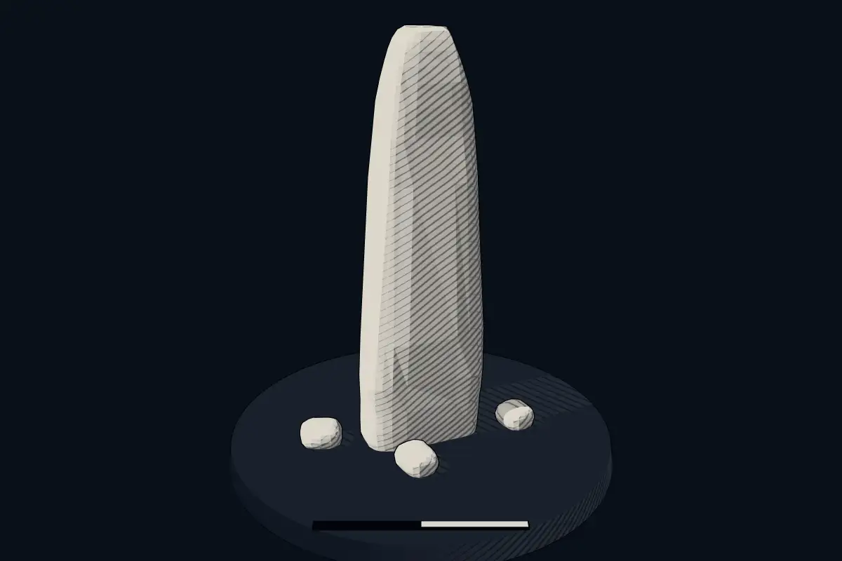
The reconstruction is ours, not a survey: it shows what a monument of this type looks like, at the size the record gives for this one.
Photographs
3 photographs, each with its author and licence
More photographs


Lore
Evidence & Lore
What the sources actually support — and, kept apart, what has been claimed.
What the evidence supports
Dates
Est. 2800–1800 BCEHow this date was established: Type comparisonTypical range for menhirs in Portugal; this site has not been dated itself. Standing stones are associated with the Beaker people of the European late Neolithic and early Bronze Age c. 2800-1800 BC.Source for this date
Where it stands
Portugal
The pin marks the monument itself — its exact point.
- Coordinates
- 37°04′18″ N, 8°51′52″ WFor a GPS or map app: 37.07178, -8.86449
Access is as our sources describe it; we have not visited the site to check.
Nearby
The closest sites in the Atlas, by straight line.
- Menhir (standing stone)Menhires de Milrei2800–1800 BCE
 Conjunto de menires de Milrei e do Padrão4000–1000 BCE
 Menhire von Vila do Bispo e Raposeira2800–1800 BCE
- Stone circleCrómlech de Amantes 23300–2500 BCE
 Menires do Cerro do Camacho2800–1800 BCE
- Stone circleCrómlech de Amantes 13300–2500 BCE
- Menhir (standing stone)Menhires de Casa do Francês2800–1800 BCE
 Conjunto de menires de Vila do Bispo (Pedra Escorregadia; Casa do Francês; Amantes I; Amantes II; Cerro do Camacho)2800–1800 BCE


Sources
Every record behind this page, with the link it came from.
2 sources behind this page
- 01Wikidata Q10328698wikidata.org
- 02Source for this dateen.wikipedia.org
Image files
Report a correctionWrong date, name, photograph or source? Tell us and it will be put right.
Around this place
The ten nearest sites, by compass
- Menhires de Milrei1.9 km W
- Conjunto de menires de Milrei e do Padrão2.4 km SW
- Menhire von Vila do Bispo e Raposeira2.4 km SW
- Crómlech de Amantes 24.5 km W
- Menires do Cerro do Camacho4.6 km W
- Crómlech de Amantes 14.6 km W
- Menhires de Casa do Francês4.8 km W
- Conjunto de menires de Vila do Bispo (Pedra Escorregadia; Casa do Francês; Amantes I; Amantes II; Cerro do Camacho)4.8 km W
- Rosa dos Ventos11 km SW
- Menir da Cabeça do Rochedo15 km NE
Credit
Text, licence and sources
Text from the Wikipedia article "Menir de Aspradantes" (Portuguese), licensed CC BY-SA 4.0; authors are listed in the page history. Reused under CC BY-SA 4.0. Read on Wikipedia · Edit history and authors