
Anta de Fonte Coberta
DatedEst. 4000–3000 BCE
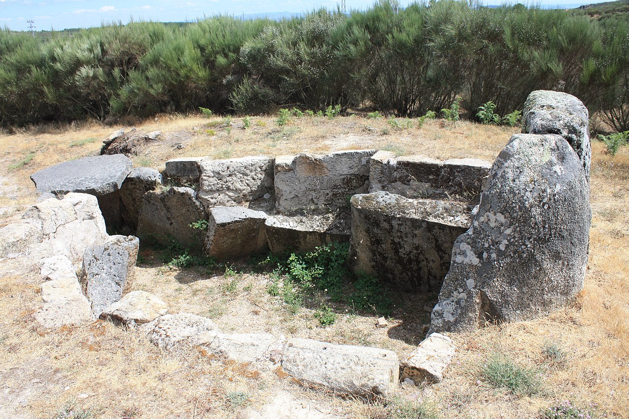
Photo João Carvalho · CC BY-SA 3.0Source file on Wikimedia Commons
Overview
About this site
Overview
The Anta de Fonte Coberta is a megalithic monument about a kilometre from Vila Chã, in the municipality of Alijó, Portugal. It is a dolmen with seven orthostats, a capstone and a short corridor, classified as a National Monument on 23 June 1910.
The capstone and several orthostats carry cup marks and engravings, and one orthostat preserves traces of red paint.
Read on Wikipedia2 min readCC BY-SA 4.0
Where it sits in time
The site's dated range, placed against world reference points.
The scale is logarithmic: each step to the left is about ten times older than the last.
Article
Anta de Fonte Coberta
The monument has been restored, and some orthostats that had fallen were set upright again.
DescriptionSources for this section
- Wikipedia (Portuguese): Anta de Fonte CobertaCC BY-SA 4.0
Sources for this section
- Wikipedia (Portuguese): Anta de Fonte CobertaCC BY-SA 4.0
The anta consists of seven orthostats (esteios), a slab and a small corridor formed by two orthostats lying flat and oriented to the east. The monument has been restored, and some orthostats that had fallen were set upright again. Traces of a mound (mamoa) have been identified, showing that the anta was partly buried; this structure has also been partly restored.
The slab, or capstone, measures two metres by three and a half metres.
FindsSources for this section
- Wikipedia (Portuguese): Anta de Fonte CobertaCC BY-SA 4.0
Sources for this section
- Wikipedia (Portuguese): Anta de Fonte CobertaCC BY-SA 4.0
The capstone bears some pecked cup marks (covinhas). Identical cup marks, as well as some engravings, were found on rocks near the dolmen. Some of the orthostats carry engraved cup marks and grooves. On one orthostat, the third counting from the left side of the polygonal chamber, there are traces of red painted decoration.
DatingSources for this section
- Wikipedia (Portuguese): Anta de Fonte CobertaCC BY-SA 4.0
Sources for this section
- Wikipedia (Portuguese): Anta de Fonte CobertaCC BY-SA 4.0
A typological estimate in the catalogue places the monument between 4000 and 3000 BCE.
Tradition and region
About this kind of monument
Portuguese antas of the Alentejo
Around Évora, in the Alentejo, megalithic tombs are called antas, and some of the largest in Iberia stand here. The Great Dolmen of Zambujeiro, near Valverde in the municipality of Évora, is considered one of the biggest such structures in Iberia. Research has dated it to between 4000 and 3000 BCE, concurrent with the megalithic building of the Évora region, and it is linked to the Great Dolmen of Comenda da Igreja at Montemor-o-Novo. Henrique Leonor Pina excavated it in 1965, and although his methods caused some controversy, the work recovered slate tablets, necklaces, crosiers, copper objects, ceramics and carinated bowls. The Portuguese government declared it a national monument in 1971.
The finds show that the tombs were used for generations: slate tablets, personal ornaments and copper objects in the chambers reach into the Chalcolithic, so one anta can carry evidence for several centuries of burial custom. Excavated anta chambers are the main source for dating, since the stones themselves cannot be dated.
Nearby, the Almendres Cromlech is a large group of standing stones, a reminder that the Alentejo's megalithic landscape also includes open-air stone enclosures and single menhirs, not only tombs.
The Atlas's records here include small antas, some reduced to a few standing slabs, and many lack a secure excavation date. They are labelled with a typological range.
When visiting, look for the chamber and the passage that leads to it, and for the way the monument sits in its field. Check access in advance.
Paraphrased from Wikipedia: Great Dolmen of Zambujeiro, Wikipedia: Great Dolmen of Comenda da Igreja, Wikipedia: Almendres Cromlech, Wikipedia: Dolmen · CC BY-SA 4.0
From the article
Dated moments in the story
- 1910
Esta anta foi classificada como Monumento nacional em 23 de Junho de 1910.
Source
See it in 3D
An interpretive reconstruction of the monument, standing on the real ground at its exact point, under the sun for that place and season. Drag to look around it.
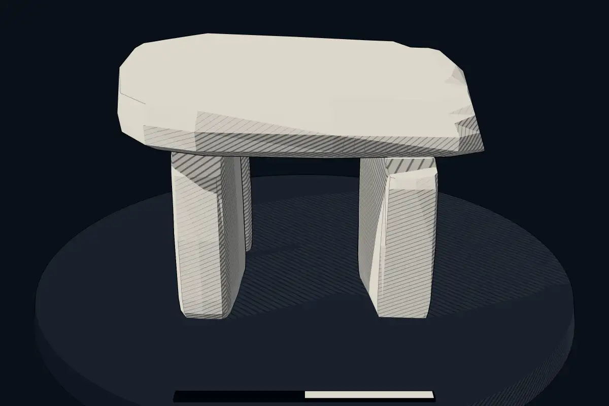
The reconstruction is ours, not a survey: it shows what a monument of this type looks like, at the size the record gives for this one.
Photographs
4 photographs, each with its author and licence
More photographs
Lore
Evidence & Lore
What the sources actually support — and, kept apart, what has been claimed.
What the evidence supports
Dates
Est. 4000–3000 BCEHow this date was established: Type comparisonTypical range for dolmens in Portugal; this site has not been dated itself. Most dolmens date from the Late Neolithic period (4000-3000 BCE); megalithic tombs at Algarve in Portugal date to c. 2500 BC.Source for this date
Where it stands
Portugal
The pin marks the monument itself — its exact point.
- Coordinates
- 41°20′05″ N, 7°28′18″ WFor a GPS or map app: 41.33481, -7.47157
Access is as our sources describe it; we have not visited the site to check.
Nearby
The closest sites in the Atlas, by straight line.


Sources
Every record behind this page, with the link it came from.
2 sources behind this page
- 01Wikidata Q16490864wikidata.org
- 02Source for this dateen.wikipedia.org
Image files
- Anta da Fonte Coberta Cha 02.jpgJoão CarvalhoCC BY-SA 3.0
- Anta da Fonte Coberta Cha 04.jpgJoão CarvalhoCC BY-SA 3.0
- Anta da Fonte Coberta Cha 06.jpgJoão CarvalhoCC BY-SA 3.0
- Dolmen in the landscape (4782192947).jpgVarun Shiv Kapur from New Delhi, IndiaCC BY 2.0
Report a correctionWrong date, name, photograph or source? Tell us and it will be put right.
Around this place
The ten nearest sites, by compass
Credit
Text, licence and sources
Adapted from the Wikipedia article "Anta de Fonte Coberta" (Portuguese), licensed CC BY-SA 4.0; authors are listed in the page history. Reused under CC BY-SA 4.0. Read on Wikipedia · Edit history and authors