
MegalithFringe site
Huari
Also known asWari
DatedEst. 1500 BCE–900 CE
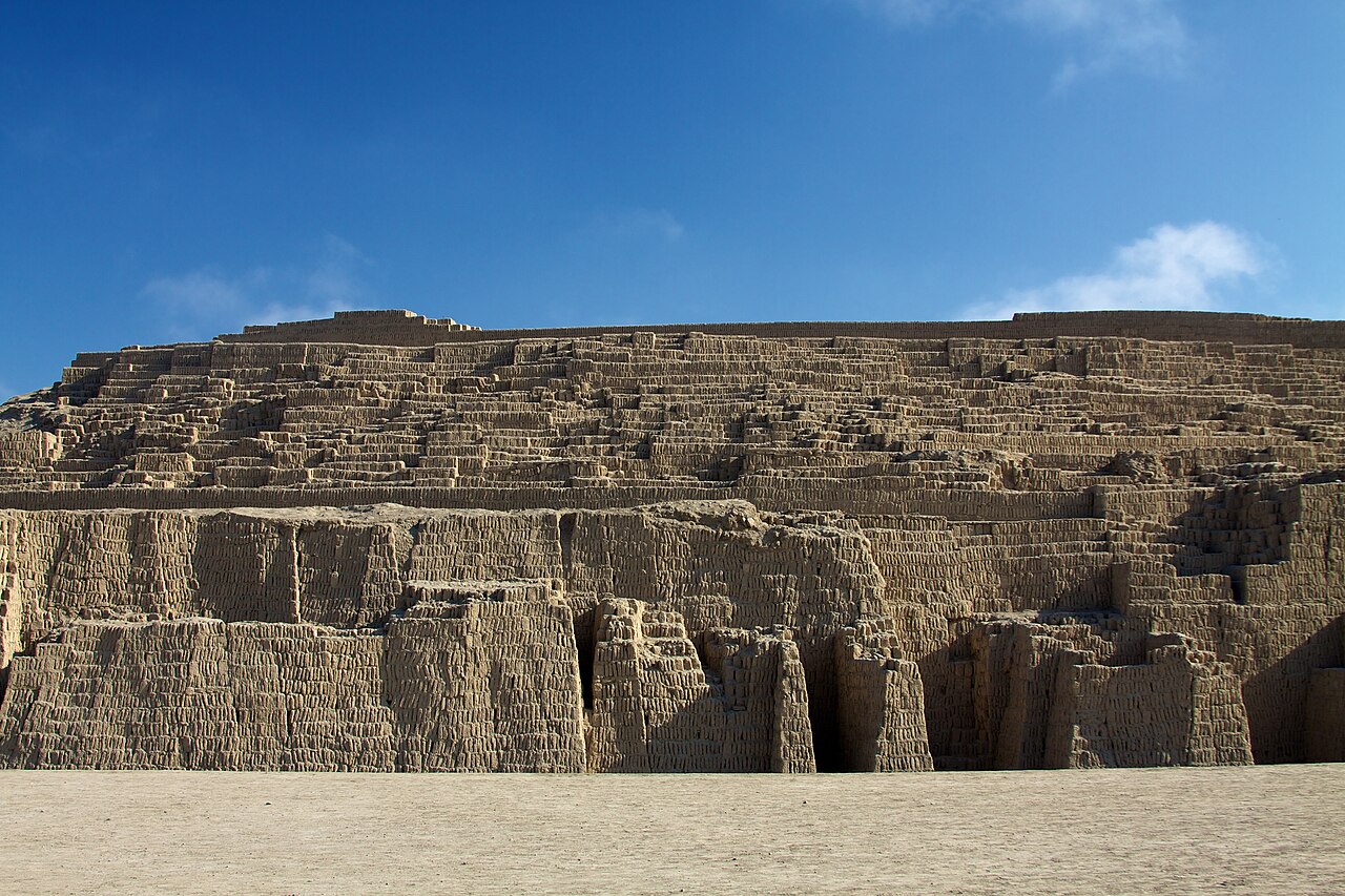
Photo Waterloo1883 · CC BY-SA 4.0Source file on Wikimedia Commons
Overview
About this site
Overview
Huari is a small town in the Ancash Region of central Peru and the capital of the Huari Province. It is situated on the eastern slope of the Andean range known as the Cordillera Blanca.
Read on Wikipedia2 min readCC BY-SA 4.0
Where it sits in time
The site's dated range, placed against world reference points.
The scale is logarithmic: each step to the left is about ten times older than the last.
Article
Huari
The economy of the province is primarily agricultural, with at least half the population engaged in subsistence horticulture.
SettingSources for this section
- Wikipedia (English): Huari, PeruCC BY-SA 4.0
Sources for this section
- Wikipedia (English): Huari, PeruCC BY-SA 4.0
The economy of the province is primarily agricultural, with at least half the population engaged in subsistence horticulture. Crops include potatoes, sweet potatoes, other native tubers, quinoa, maize, wheat, barley, tomatoes, peppers and various vegetables. Many households also raise a few animals, including goats, sheep, pigs, occasionally cattle, guinea pigs (cuy), rabbits, chickens and ducks. Much of the trade in this rural area is conducted through barter.
Huari is connected to the electric grid, and in 2005 some of the surrounding villages were just beginning to be connected.
HistorySources for this section
- Wikipedia (English): Huari, PeruCC BY-SA 4.0
Sources for this section
- Wikipedia (English): Huari, PeruCC BY-SA 4.0
In the mid-1960s electricity in Huari was generated locally by a small hydroelectric plant, which supplied power from dusk to dawn. Electricity and running water were available to fewer than a hundred businesses, government offices, private residences and the public school, as well as the Diocese of the Roman Catholic Bishop of Huari. Several streets, mostly no wider than four metres, were cobbled and maintained for vehicular traffic.
In fair weather the drive from Huari westward to the Pan-American Highway, reached on the Pacific coast near the town of Comas, took six to eight hours on packed-earth and graveled roads. The Cordillera Blanca was crossed by a one-lane tunnel approximately 800 metres in length, a 5-meter cylindrical tube blasted and cut through rock. From Huari, the city of Huaraz was a journey of about four hours by motor vehicle, and the distance to the ancient town of Recuay was somewhat less.
Tradition and region
About this kind of monument
Andean megalithic stonework
The Andes have some of the finest stonework in the world. Tiwanaku is a pre-Columbian archaeological site in western Bolivia, near Lake Titicaca, and one of the largest in South America. Its surface remains cover around 4 square kilometres and include decorated ceramics, monumental structures and megalithic blocks. The site was conservatively estimated to have been inhabited by 10,000 to 20,000 people in 800 CE. Pumapunku, "Gate of the Puma", is a sixth-century T-shaped terraced platform mound with a sunken court and a monumental structure on top, part of the Tiwanaku site, which is a UNESCO World Heritage Site. Its foundation platform supported as many as eight andesite gateways. In Inca tradition, Tiwanaku is believed to be the site where the world was created.
The Inca inherited an architectural legacy from Tiwanaku, which was founded in the second century BCE, and a core characteristic of the style was to use the topography and existing materials of the land as part of the design. Sacsayhuamán, a citadel on the northern outskirts of Cusco, the capital of the Inca Empire, stands at 3,701 metres and is an important example of Inca architecture. The name comes from Quechua and means "fortress of the royal falcon or hawk". Many walls of Inca masonry at Cusco have been incorporated into Spanish colonial buildings.
Earlier still, Chavín de Huántar in Peru contains ruins and artefacts built as early as 1200 BCE and occupied until around 400 to 500 BCE by the Chavín, a major pre-Inca culture; it is at 3,180 metres in the Ancash Region and is a UNESCO World Heritage Site.
When visiting, look at how the blocks fit together, and allow time to adjust to the altitude.
Paraphrased from Wikipedia: Tiwanaku, Wikipedia: Pumapunku, Wikipedia: Sacsayhuamán, Wikipedia: Chavín de Huántar, Wikipedia: Inca architecture · CC BY-SA 4.0
From the article
Dated moments in the story
- 2005
Huari is connected to the electric grid, and in 2005, some of the surrounding villages were just beginning to be connected to the grid.
Source
Photographs
7 photographs, each with its author and licence
More photographs
Lore
Evidence & Lore
What the sources actually support — and, kept apart, what has been claimed.
What the evidence supports
Dates
Est. 1500 BCE–900 CEHow this date was established: Type comparisonTypological estimate, not a date for this site: a other in the Andes and Amazonia is normally dated between 1500 BCE and 900 CE (Atlas typological table).Source for this date
Measured facts
- Region
- Ancash, central PeruSource: Region
- Administrative role
- Capital of Huari ProvinceSource: Administrative role
- Landscape
- Eastern slope of the Cordillera BlancaSource: Landscape
- Economic base
- Primarily agricultural subsistence horticultureSource: Economic base
- Trade method
- BarterSource: Trade method
- Electricity
- Connected to the gridSource: Electricity
Where it stands
Peru
The pin marks the monument itself — its exact point.
- Coordinates
- 9°20′50″ S, 77°10′15″ WFor a GPS or map app: -9.34722, -77.17083
Access is as our sources describe it; we have not visited the site to check.
Nearby
The closest sites in the Atlas, by straight line.




Sources
Every record behind this page, with the link it came from.
4 sources behind this page
- 01Wikidata Q3322143wikidata.org
- 02Fringe claim sourceen.wikipedia.org
- 03Wikipedia (en)en.wikipedia.org
- 04Wikipedia: Huarien.wikipedia.org
Image files
- Calle de Huari 01164.jpgWaterloo1883CC BY-SA 4.0
- Huari mercado 01233.jpgWaterloo1883CC BY-SA 4.0
- Huari Parque Vigil 01172.jpgWaterloo1883CC BY-SA 4.0
- Huari Parque Vigil 01173.jpgWaterloo1883CC BY-SA 4.0
- Huari.jpgNo machine-readable author provided. GGBE~commonswiki assumed (based on copyright claims).CC BY-SA 3.0
- Iglesia San MArcos, Huari.jpgLamderCC0
- Location of the province Huari in Ancash.PNGAgainErickCC BY-SA 3.0
Report a correctionWrong date, name, photograph or source? Tell us and it will be put right.
Around this place
The ten nearest sites, by compass
Credit
Text, licence and sources
Adapted from the Wikipedia article "Huari, Peru" (English), licensed CC BY-SA 4.0; authors are listed in the page history. Reused under CC BY-SA 4.0. Read on Wikipedia · Edit history and authors
- Wikipedia (English): Huari, PeruCC BY-SA 4.0
- Wikidata Q3322143CC0
- Fringe claim sourceCC BY-SA 4.0