
MegalithUNESCO World Heritage
Chankillo
Also known asThirteen Towers · Chankillo solar observatory
Datedc. 300–200 BCE
Photo Txolo · CC BY-SA 4.0Source file on Wikimedia Commons
Overview
About this site
Overview
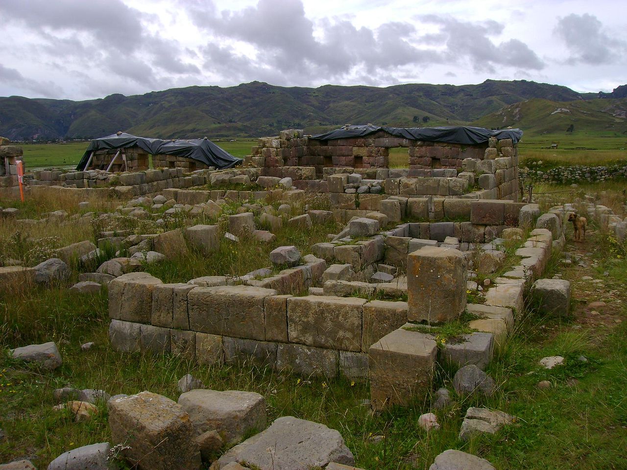
Chankillo is an ancient monumental complex in the Peruvian coastal desert, in the Casma-Sechin basin in the Áncash Department of Peru. The ruins include the hilltop Chankillo fort, the nearby Thirteen Towers solar observatory, and residential and gathering areas. The Thirteen Towers have been interpreted as an astronomical observatory built in the third century BC, and the site was awarded UNESCO World Heritage status in July 2021.
Read on Wikipedia2 min readCC BY-SA 4.0
Age sources
How old this site is, and who says so.
Range across all claimsc. 300–200 BCE
EstimatedWhat this badge means
A reading of this site: what its style says, or a statement published about it.
- 300–200 BCEPublished sourceThirteen Towers built in the 3rd century BCESource: en.wikipedia.org
- 300–201 BCEAtlas research notesThirteen Towers built in the 3rd century BCESource: en.wikipedia.org
- 250 BCEWikipedia: Chanquillo (infobox)Source: en.wikipedia.org
Where it sits in time
The site's dated range, placed against world reference points.
The scale is logarithmic: each step to the left is about ten times older than the last.
Article
Chankillo
The culture that produced Chankillo is called the Casma/Sechin culture or the Sechin Complex.
DescriptionSources for this section
- Wikipedia (English): ChanquilloCC BY-SA 4.0
Sources for this section
- Wikipedia (English): ChanquilloCC BY-SA 4.0
The site covers about four square kilometres (1.5 square miles) and has been interpreted as a fortified temple. The culture that produced Chankillo is called the Casma/Sechin culture or the Sechin Complex.
Astronomical alignmentSources for this section
- Wikipedia (English): ChanquilloCC BY-SA 4.0
Sources for this section
- Wikipedia (English): ChanquilloCC BY-SA 4.0
The regularly spaced thirteen towers were constructed atop the ridge of a low hill running near north to south, forming a "toothed" horizon with narrow gaps at regular intervals. To the east and west, investigators designated two possible observation points. From these vantages, the 300m long spread of the towers along the horizon corresponds very closely to the rising and setting positions of the sun over the year, although not all of the towers are visible. On the winter solstice, the sun would rise behind the leftmost tower and then behind each of the towers in turn until it reached the rightmost tower six months later, on the summer solstice, marking the passage of time. Inhabitants of Chankillo would have been able to determine an accurate date, with an error of a day or two, by observing the sunrise or sunset from the correct tower. The Thirteen Towers could be the earliest known observatory in the Americas. A contemporary site in the Chincha Valley, Peru, of the late Paracas culture, which also marked the solstice, has recently been examined.
Research historySources for this section
- Wikipedia (English): ChanquilloCC BY-SA 4.0
Sources for this section
- Wikipedia (English): ChanquilloCC BY-SA 4.0
The towers had been known to travellers for 200 years but were not determined to be an astronomical site until 2007, by Iván Ghezzi and Clive Ruggles.
Tradition and region
About this kind of monument
Andean megalithic stonework
The Andes have some of the finest stonework in the world. Tiwanaku is a pre-Columbian archaeological site in western Bolivia, near Lake Titicaca, and one of the largest in South America. Its surface remains cover around 4 square kilometres and include decorated ceramics, monumental structures and megalithic blocks. The site was conservatively estimated to have been inhabited by 10,000 to 20,000 people in 800 CE. Pumapunku, "Gate of the Puma", is a sixth-century T-shaped terraced platform mound with a sunken court and a monumental structure on top, part of the Tiwanaku site, which is a UNESCO World Heritage Site. Its foundation platform supported as many as eight andesite gateways. In Inca tradition, Tiwanaku is believed to be the site where the world was created.
The Inca inherited an architectural legacy from Tiwanaku, which was founded in the second century BCE, and a core characteristic of the style was to use the topography and existing materials of the land as part of the design. Sacsayhuamán, a citadel on the northern outskirts of Cusco, the capital of the Inca Empire, stands at 3,701 metres and is an important example of Inca architecture. The name comes from Quechua and means "fortress of the royal falcon or hawk". Many walls of Inca masonry at Cusco have been incorporated into Spanish colonial buildings.
Earlier still, Chavín de Huántar in Peru contains ruins and artefacts built as early as 1200 BCE and occupied until around 400 to 500 BCE by the Chavín, a major pre-Inca culture; it is at 3,180 metres in the Ancash Region and is a UNESCO World Heritage Site.
When visiting, look at how the blocks fit together, and allow time to adjust to the altitude.
Paraphrased from Wikipedia: Tiwanaku, Wikipedia: Pumapunku, Wikipedia: Sacsayhuamán, Wikipedia: Chavín de Huántar, Wikipedia: Inca architecture · CC BY-SA 4.0
From the article
Dated moments in the story
- 2007
The towers had been known to travellers for 200 years but were not determined to be an astronomical site until 2007 by Iván Ghezzi and Clive Ruggles.
Source - 2021
The site was awarded UNESCO World Heritage status in July 2021. The site covers about four square kilometres (1.5 square miles) and has been interpreted as a fortified temple.
Source
Photographs
3 photographs, each with its author and licence
More photographs
Lore
Evidence & Lore
What the sources actually support — and, kept apart, what has been claimed.
What the evidence supports
Dates
300–200 BCEHow this date was established: Stated by the sourceThirteen Towers built in the 3rd century BCESource for this date
Measured facts
- Location
- Casma-Sechin basin, Áncash Department, PeruSource: Location
- Main structures
- Hilltop fort, Thirteen Towers, and residential and gathering areasSource: Main structures
- Associated culture
- Casma/Sechin culture or Sechin ComplexSource: Associated culture
- Area
- About four square kilometresSource: Area
- Interpretation
- Fortified templeSource: Interpretation
- Heritage status
- UNESCO World Heritage Site since July 2021Source: Heritage status
- Heritage designation
- World Heritage SiteSource: Heritage designation
Where it stands
Peru
The pin marks the monument itself — its exact point.
- Coordinates
- 9°33′25″ S, 78°14′09″ WFor a GPS or map app: -9.55690, -78.23590
Access is as our sources describe it; we have not visited the site to check.
Nearby
The closest sites in the Atlas, by straight line.




Sources
Every record behind this page, with the link it came from.
3 sources behind this page
- 01Q108016068wikidata.org
- 02Chanquilloen.wikipedia.org
- 03World Heritage List entry 1624whc.unesco.org
Image files
Report a correctionWrong date, name, photograph or source? Tell us and it will be put right.
Around this place
The ten nearest sites, by compass
Credit
Text, licence and sources
Adapted from the Wikipedia article "Chanquillo" (English), licensed CC BY-SA 4.0; authors are listed in the page history. Reused under CC BY-SA 4.0. Read on Wikipedia · Edit history and authors
- Wikipedia (English): ChanquilloCC BY-SA 4.0
- Q108016068CC0