
MegalithFringe siteUNESCO World Heritage
Anjar
Datedc. 700–714 CE
Photo Vyacheslav Argenberg · CC BY 4.0Source file on Wikimedia Commons
Overview
About this site
What the sources say
Anjar (meaning "unresolved or running river"; Arabic: عنجر / ALA-LC: ‘Anjar), also known as Hawsh Mousa (Arabic: حوش موسى / Ḥawsh Mūsá), is a town of Lebanon, near the Syrian border, located in the Bekaa Valley. The population is 2,400, consisting almost entirely of Armenians. The total area is about twenty square kilometers (7.7 square miles).
Since 1984, the ruins of the Umayyad settlement of Anjar have been recognized by UNESCO as a World Heritage Site.
Read on Wikipedia7 min readCC BY-SA 4.0
Where it sits in time
The site's dated range, placed against world reference points.
The scale is logarithmic: each step to the left is about ten times older than the last.
The full article
Anjar: the whole story
In briefSources for this section
- Wikipedia (English): Anjar, LebanonCC BY-SA 4.0
Sources for this section
- Wikipedia (English): Anjar, LebanonCC BY-SA 4.0
Anjar, also known as Hawsh Mousa, is a town in Lebanon, near the Syrian border, located in the Bekaa Valley. Its name means unresolved or running river. The population is 2,400, consisting almost entirely of Armenians, and the total area is about twenty square kilometers (7.7 square miles). Since 1984 the ruins of the Umayyad settlement of Anjar have been recognized by UNESCO as a World Heritage Site.
The town's foundation is generally attributed to the Umayyad caliph al-Walid I, at the beginning of the 8th century, as a palace-city. Syriac graffiti found in the quarry from which the best stone was taken give the year 714. The Byzantine chronicler Theophanes the Confessor recorded that Walid's son, al-Abbas, began building the town in 709–10. Although earlier materials were re-used, much of the city is built on virgin soil.
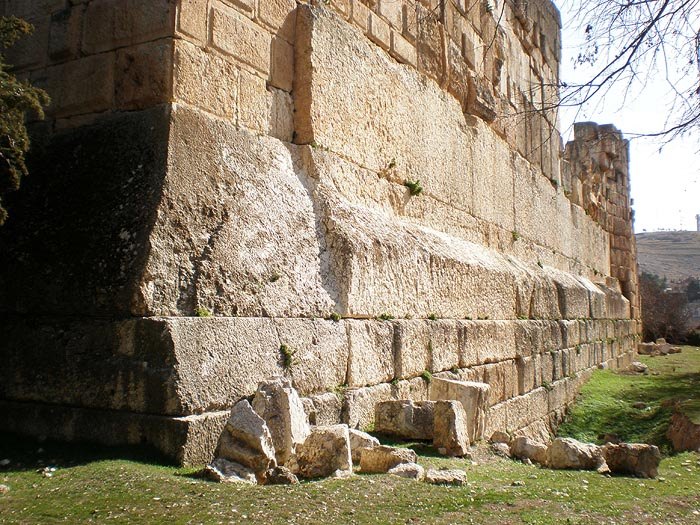
The Umayyad ruins cover 114,000 square meters and are surrounded by large fortified stone walls over two meters thick and seven meters high. The rectangular city design of 370 m by 310 m is based on Roman city planning and architecture, with stonework borrowed from the Byzantines. Two large avenues, the Cardo maximum running north to south and the Decumanus Maximus running east to west, divide the city into four quadrants. They are decorated with colonnades, flanked by about 600 shops, and cross under a tetrapylon.
The main monuments include the partially rebuilt Grand Palace, 59 m by 70 m, with a central courtyard surrounded by a peristyle, and the Small Palace, 46 m by 47 m, noted for its ornamental fragments. A Mosque, 45 m by 32 m, lies between the two palaces, and there are thermal baths built on the Roman model.
After being abandoned in later years, Anjar was resettled in 1939 with several thousand Armenian refugees from the Musa Dagh area. Its neighborhoods are named after the six villages of Musa Dagh. During the civil war the Syrian Army made it one of its main bases in the Beqaa Valley. In November 2024 UNESCO gave Anjar enhanced protection to safeguard the archaeological site.
History and datingSources for this section
- Wikipedia (English): Anjar, LebanonCC BY-SA 4.0
Sources for this section
- Wikipedia (English): Anjar, LebanonCC BY-SA 4.0
The town's foundation is generally attributed to the Umayyad caliph al-Walid I, at the beginning of the 8th century, as a palace-city. Syriac graffiti found in the quarry from which the best stone was extracted offer the year 714, and Byzantine and Syriac sources attribute the establishment of the town to Umayyad princes, with one Syriac chronicle mentioning Walid I by name, while the Byzantine chronicler Theophanes the Confessor recorded that it was Walid's son, al-Abbas, who started building the town in 709–10. Historian Jere L. Bacharach accepts Theophanes' date. Although earlier materials were re-used, much of the city is built on virgin soil.
After being abandoned in later years, Anjar was resettled in 1939 with several thousand Armenian refugees from the Musa Dagh area. Its neighborhoods are named after the six villages of Musa Dagh: Haji Habibli, Kebusiyeh, Vakif, Kheder Bek, Yoghunoluk and Bitias.
During the civil war, the Syrian Army chose Anjar as one of its main military bases in the Beqaa Valley and the headquarters of its intelligence services.
Following the civil war, Anjar started to rebuild economically. Many of its inhabitants emigrated to other countries, mainly to Europe, Canada, and the United States. Nevertheless, today Anjar is an example to many other entities in the region because of its low crime rate, reduced air pollution, and living standards. During the 2020 COVID-19 pandemic, the village rapidly imposed strict measures and set an example for the rest of the country.
In November 2024, UNESCO gave Anjar enhanced protection to safeguard against damage to the archaeological site during the Israeli invasion of Lebanon.
Umayyad ruinsSources for this section
- Wikipedia (English): Anjar, LebanonCC BY-SA 4.0
Sources for this section
- Wikipedia (English): Anjar, LebanonCC BY-SA 4.0
The Umayyad city ruins cover 114,000 square meters and are surrounded by large, fortified stone walls over two meters thick and seven meters high. The rectangular city design of 370 m by 310 m is based on Roman city planning and architecture with stonework borrowed from the Byzantines. Two large avenues, the Cardo maximum, running north to south, and the Decumanus Maximus, running east to west, divide the city into four quadrants. The two main avenues, decorated with colonnades and flanked by about 600 shops, intersect under
a tetrapylon. The plinths, shafts and capitals of the tetrapylon are spolia reused in the Umayyad period. Smaller streets subdivide the western half of the city in quarters of different size.
Main monuments:
The partially rebuilt Grand Palace, 59 m by 70 m, includes a wall and is preceded by a series of arcades. Its central hosh (courtyard) is surrounded by a peristyle.
The almost square Small Palace, 46 m by 47 m, stands out for its numerous ornamental fragments and its richly decorated central entrance.
A Mosque, 45 m by 32 m, is located between the two palaces.
Thermal baths, built on the Roman model.
DemographicsSources for this section
- Wikipedia (English): Anjar, LebanonCC BY-SA 4.0
Sources for this section
- Wikipedia (English): Anjar, LebanonCC BY-SA 4.0
The majority of Anjar's Armenians are Armenian Apostolics (Orthodox) who belong to the Armenian Apostolic Church and Holy See of Cilicia. Armenian Apostolic Saint Paul Church is the second largest Armenian church in Lebanon.
The Armenian Apostolic community has its own school, Haratch Calouste Gulbenkian Secondary School. In 1940, the chief editor of the Armenian newspaper Haratch in Paris, Shavarsh Missakian, organized a fundraising campaign among the Armenians living in France which enabled the building of the "Haratch" Elementary School next to the newly established St. Paul Armenian Apostolic Church. The official opening of the school took place in 1941. The administration of the Calouste Gulbenkian Foundation contributed to the expansion of the school, which was named in honor of Calouste Gulbenkian.
Our Lady of the Rosary Armenian Catholic Church in Anjar serves as church for the Armenian Catholics, who also run the Armenian Catholic Sisters School. In the beginning, the school had two divisions, St. Hovsep for the male students and Sisters of Immaculate Conception for the female students. In 1954, these departments were united. 1973 saw the official opening of the Aghajanian Orphan House, already serving as an Armenian Catholic orphanage since 1968.
The Armenian Evangelical Church of Anjar is in operation to serve Anjar's small Armenian Evangelical community. The Protestant community school was established in 1948 by Sister Hedwig Aenishänslein as part of her missionary work in Anjar. In 1953, the school, which had already become an intermediate school, was promoted into a secondary school. It has day classes as well as boarding facilities for students from other regions who stay there throughout the winter.
EconomySources for this section
- Wikipedia (English): Anjar, LebanonCC BY-SA 4.0
Sources for this section
- Wikipedia (English): Anjar, LebanonCC BY-SA 4.0
Anjar's economy is mostly based on services, with very few agricultural and industrial activities. The biggest private employer is the company "Shams" (literally "Sun"), a local family-run business that started out as a small restaurant in the 1960s.
The municipality is also an important employer. It pays salaries for teachers, public servants, and law enforcement personnel. Unlike the rest of the country, where policing is provided by the central government, Anjar has its own municipal police wearing dark green uniforms and reporting to the municipality instead of the ministry of internal affairs.
LanguageSources for this section
- Wikipedia (English): Anjar, LebanonCC BY-SA 4.0
Sources for this section
- Wikipedia (English): Anjar, LebanonCC BY-SA 4.0
Most residents of Anjar are polyglots, speaking Western Armenian, Lebanese Arabic, American English, and the Mousadaghian dialect of Armenian.
The Mousadaghian dialect was the spoken dialect of the Armenians of Sanjak. The Armenians of the region in different villages like Bitias, Haji hababli, Kheder Beg, Vakef, Kebusiye, Yoghun Olukh, in addition to several smaller villages used the Mousadaghian dialect which was called "Kistinek,” meaning "language of the Christians".
Notable peopleSources for this section
- Wikipedia (English): Anjar, LebanonCC BY-SA 4.0
Sources for this section
- Wikipedia (English): Anjar, LebanonCC BY-SA 4.0
Zakar Keshishian, Armenian musician
How this page was madeSources for this section
- Wikipedia (English): Anjar, LebanonCC BY-SA 4.0
Sources for this section
- Wikipedia (English): Anjar, LebanonCC BY-SA 4.0
The summary at the top of this page was written by Claude Sonnet 5.5 (2026-11-06) from the cited Wikipedia article “Anjar, Lebanon”. The numbers in it were checked automatically against the source text. The rest of the page is the article itself, the structured records and computed distances.
Tradition and region
About this kind of monument
Other prehistoric stone monuments
The Atlas uses the heading "other" for stone monuments that fit none of its other types, and the same article serves for underground chambers that have no regional article. The records are varied. Many are ziggurats, Egyptian temples and pyramids, and Maya and Andean sites, which are treated in their own articles. What remains is a scatter of single sites in many countries whose descriptions do not allow a closer classification.
Several of these are underground. A hypogeum is literally an "underground" temple or tomb, often with niches for cremated remains or loculi for buried remains. An early example is found at the Minoan Bronze Age site of Knossos on Crete, a beehive-shaped vault cut into soft rock. The Hypogeum of Ħal Saflieni in Paola, Malta, is the oldest example of a prehistoric hypogeum, with its earliest phase dated to 3600 to 3300 BCE. It is a complex of underground chambers, halls and passages covering about 500 square metres on three levels, partly carved to imitate temple architecture and containing extensive prehistoric art.
A rock-cut tomb is cut into an existing rock formation, usually a cliff or sloping rock face, and was a common burial form for the wealthy in several parts of the world. Famous clusters are in Egypt, Iran, Lycia in Turkey, Petra in Jordan and Sicily. Phrygian rock-cut tombs such as the Midas monument date to about 700 BCE, and Etruscan ones to about 500 BCE.
The general rule for these records is that the type tells you how a monument was made, not who made it or when. Dating is taken from the source for each site where a source gives one, and otherwise left as a broad range.
When visiting, read the site's own description first, since the Atlas can offer only a general frame.
Paraphrased from Wikipedia: Megalith, Wikipedia: Hypogeum, Wikipedia: Rock-cut tomb, Wikipedia: Stele · CC BY-SA 4.0
From the article
Dated moments in the story
- 600 CE
The two main avenues, decorated with colonnades and flanked by about 600 shops, intersect under a tetrapylon.
Source - 714 CE
Syriac graffiti found in the quarry from which the best stone was extracted offer the year 714, and Byzantine and Syriac sources attribute the establishment of the town to Umayyad princes, with one Syriac chronicle mentioning Walid I by name, while the Byzantine chronicler Theophanes the Confessor recorded that it...
Source - 1939
After being abandoned in later years, Anjar was resettled in 1939 with several thousand Armenian refugees from the Musa Dagh area.
Source - 1940
In 1940, the chief editor of the Armenian newspaper Haratch in Paris, Shavarsh Missakian, organized a fundraising campaign among the Armenians living in France which enabled the building of the "Haratch" Elementary School next to the newly established St.
Source - 1941
The official opening of the school took place in 1941. The administration of the Calouste Gulbenkian Foundation contributed to the expansion of the school, which was named in honor of Calouste Gulbenkian.
Source - 1948
The Protestant community school was established in 1948 by Sister Hedwig Aenishänslein as part of her missionary work in Anjar.
Source - 1953
In 1953, the school, which had already become an intermediate school, was promoted into a secondary school.
Source - 1954
In 1954, these departments were united.
Source - 1973
1973 saw the official opening of the Aghajanian Orphan House, already serving as an Armenian Catholic orphanage since 1968. The Armenian Evangelical Church of Anjar is in operation to serve Anjar's small Armenian Evangelical community.
Source - 1984
Since 1984, the ruins of the Umayyad settlement of Anjar have been recognized by UNESCO as a World Heritage Site.
Source - 2020
During the 2020 COVID-19 pandemic, the village rapidly imposed strict measures and set an example for the rest of the country.
Source - 2024
In November 2024, UNESCO gave Anjar enhanced protection to safeguard against damage to the archaeological site during the Israeli invasion of Lebanon.
Source
Photographs
8 photographs, each with its author and licence
More photographs
Lore
Evidence & Lore
What the sources actually support — and, kept apart, what has been claimed.
What the evidence supports
Dates
700–714 CEHow this date was established: Historical sourcesThe range is based on the reported Umayyad foundation and the dated Syriac graffiti.Source for this date
Measured facts
- Location
- Bekaa Valley near the Syrian borderSource: Location
- Population
- 2,400, consisting almost entirely of ArmeniansSource: Population
- Area
- About twenty square kilometersSource: Area
- World Heritage status
- Recognized by UNESCO since 1984Source: World Heritage status
- Armenian resettlement
- Resettled in 1939 with several thousand Armenian refugees from the Musa Dagh areaSource: Armenian resettlement
- Enhanced protection
- Granted by UNESCO in November 2024Source: Enhanced protection
- Heritage designation
- World Heritage SiteSource: Heritage designation
Where it stands
Lebanon
The pin marks the monument itself — its exact point.
- Coordinates
- 33°43′33″ N, 35°55′47″ EFor a GPS or map app: 33.72583, 35.92972
Access is as our sources describe it; we have not visited the site to check.
Nearby
The closest sites in the Atlas, by straight line.




Sources
Every record behind this page, with the link it came from.
5 sources behind this page
- 01Wikidata Q60977wikidata.org
- 02Fringe claim sourceen.wikipedia.org
- 03Wikipedia (en)en.wikipedia.org
- 04Wikipedia: Anjaren.wikipedia.org
- 05World Heritage List entry 293whc.unesco.org
Image files
- Anjar, Lebanon, Ancient ruins of the city of Anjar.jpgVyacheslav ArgenbergCC BY 4.0
- Anjar vu du palais.jpgEusebiusCC BY 3.0
- Anjar - Cardo vu du nord 2.jpgEusebiusCC BY 3.0
- Smartkids.jpgAnjarEducationSocietyCC BY-SA 4.0
- Anjar 1.jpgLeon petrosyanCC BY-SA 4.0
- Anjar 2.jpgLeon petrosyanCC BY-SA 4.0
- Anjar, Lebanon, Umayyad palace of Anjar.jpgVyacheslav ArgenbergCC BY 4.0
- Anjar Calouste Gulbenkian Hall, March 2017.jpgBdxCC BY-SA 4.0
Report a correctionWrong date, name, photograph or source? Tell us and it will be put right.
Around this place
The ten nearest sites, by compass
Credit
Text, licence and sources
Text from the Wikipedia article "Anjar, Lebanon" (English), licensed CC BY-SA 4.0; authors are listed in the page history. Reused under CC BY-SA 4.0. Read on Wikipedia · Edit history and authors
- Wikipedia (English): Anjar, LebanonCC BY-SA 4.0
- Wikidata Q60977CC0
- Fringe claim sourceCC BY-SA 4.0