
MegalithFringe site
Sawran
Also known asSauran
Datedc. 501–999 CE
Photo Yakov Fedorov · CC BY-SA 4.0Source file on Wikimedia Commons
Overview
About this site
Overview
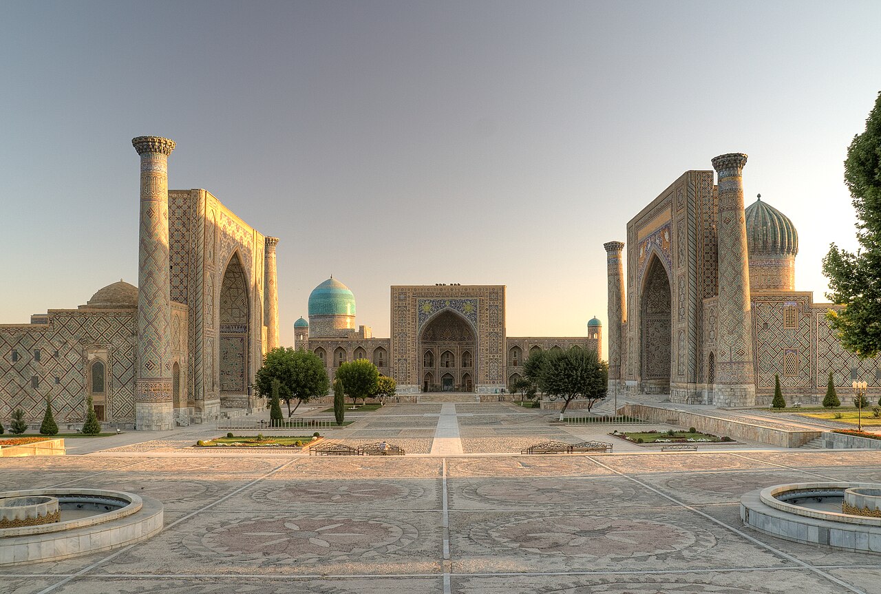
Sawran or Sauran (Kazakh: Сауран) is an ancient city in Southern Kazakhstan, 43 kilometres (27 mi) north-west of the city of Turkistan and near the river Syr Darya.
It is recorded in sources from the 10th century onward and, like Otrar, declined with the Silk Road.
Read on Wikipedia2 min readCC BY-SA 4.0
Age sources
How old this site is, and who says so.
Range across all claimsc. 501–999 CE
MeasuredWhat this badge means
A physical measurement of this site: a radiocarbon date, a tree-ring count, a luminescence date, or a record that can itself be dated.
- 900–999 CEHistorical recordThe date follows the earliest dated description of the city in the source.Source: en.wikipedia.org
- 501–600 CEWikipedia: Sawran (Kazakhstan) (infobox)Source: en.wikipedia.org
Where it sits in time
The site's dated range, placed against world reference points.
The scale is logarithmic: each step to the left is about ten times older than the last.
Article
Sawran
In 1065 the city submitted to the Seljuq dynasty, as part of the transformation of the Kara-Khanid Khanate into a Seljuq vassal.
HistorySources for this section
- Wikipedia (English): Sawran (Kazakhstan)CC BY-SA 4.0
Sources for this section
- Wikipedia (English): Sawran (Kazakhstan)CC BY-SA 4.0
One of the earliest mentions of the city comes from the Arab geographer Al-Muqaddasi, who in the 10th century described it as a large city surrounded by seven walls, with a mosque in the inner city. In 1065 the city submitted to the Seljuq dynasty, as part of the transformation of the Kara-Khanid Khanate into a Seljuq vassal.
Around the 1370s, when the region was under the control of Urus Khan, Tokhtamysh of the blue horde, heavily supported by Amir Timur, tried to conquer the region, aiming to rule the cities of Sawran, Otrar, Saganac, Seiram, Serai and others. The city provided the brick and tile for the Mausoleum of Khoja Ahmed Yasawi, commissioned by Amir Timur in 1389 and located 25 miles (40 km) away.
By the 15th century the city had established diplomatic relations with the Ming dynasty, which recorded its name in the Ming Shilu as 掃蘭 (saolan). The poet Zayn al-Din Mahmud Vasifi visited the city from 1514 to 1515 and described its karez water infrastructure. Like Otrar, the city suffered with the decline of the Silk Road and with struggles for power in the region.
Tradition and region
About this kind of monument
Other prehistoric stone monuments
The Atlas uses the heading "other" for stone monuments that fit none of its other types, and the same article serves for underground chambers that have no regional article. The records are varied. Many are ziggurats, Egyptian temples and pyramids, and Maya and Andean sites, which are treated in their own articles. What remains is a scatter of single sites in many countries whose descriptions do not allow a closer classification.
Several of these are underground. A hypogeum is literally an "underground" temple or tomb, often with niches for cremated remains or loculi for buried remains. An early example is found at the Minoan Bronze Age site of Knossos on Crete, a beehive-shaped vault cut into soft rock. The Hypogeum of Ħal Saflieni in Paola, Malta, is the oldest example of a prehistoric hypogeum, with its earliest phase dated to 3600 to 3300 BCE. It is a complex of underground chambers, halls and passages covering about 500 square metres on three levels, partly carved to imitate temple architecture and containing extensive prehistoric art.
A rock-cut tomb is cut into an existing rock formation, usually a cliff or sloping rock face, and was a common burial form for the wealthy in several parts of the world. Famous clusters are in Egypt, Iran, Lycia in Turkey, Petra in Jordan and Sicily. Phrygian rock-cut tombs such as the Midas monument date to about 700 BCE, and Etruscan ones to about 500 BCE.
The general rule for these records is that the type tells you how a monument was made, not who made it or when. Dating is taken from the source for each site where a source gives one, and otherwise left as a broad range.
When visiting, read the site's own description first, since the Atlas can offer only a general frame.
Paraphrased from Wikipedia: Megalith, Wikipedia: Hypogeum, Wikipedia: Rock-cut tomb, Wikipedia: Stele · CC BY-SA 4.0
From the article
Dated moments in the story
- 1389
The city provided the brick and tile for the construction of Mausoleum of Khoja Ahmed Yasawi, which was commissioned by Amir Timur in 1389 and is located 25 miles (40 km) from the city.
Source - 1514
The poet Zayn al-Din Mahmud Vasifi visited the city from 1514 to 1515, and described the city's karez water infrastructure.
Source
Photographs
8 photographs, each with its author and licence
More photographs
Lore
Evidence & Lore
What the sources actually support — and, kept apart, what has been claimed.
What the evidence supports
Dates
900–999 CEHow this date was established: Historical sourcesThe date follows the earliest dated description of the city in the source.Source for this date
Measured facts
- Alternative name
- SauranSource: Alternative name
- Location
- near the Syr Darya in southern KazakhstanSource: Location
- Distance from Turkistan
- 43 kilometresSource: Distance from Turkistan
- Walls described in the 10th century
- sevenSource: Walls described in the 10th century
- Mausoleum material supplied
- brick and tileSource: Mausoleum material supplied
- Mausoleum commission
- Amir Timur in 1389Source: Mausoleum commission
Where it stands
Kazakhstan
The pin marks the monument itself — its exact point.
- Coordinates
- 43°30′55″ N, 67°46′07″ EFor a GPS or map app: 43.51528, 67.76861
Access is as our sources describe it; we have not visited the site to check.
Nearby
The closest sites in the Atlas, by straight line.



Sources
Every record behind this page, with the link it came from.
4 sources behind this page
- 01Wikidata Q4409147wikidata.org
- 02Fringe claim sourceen.wikipedia.org
- 03Wikipedia (en)en.wikipedia.org
- 04Wikipedia: Sawranen.wikipedia.org
Image files
- Sauran 1.jpgYakov FedorovCC BY-SA 4.0
- Sauran 2.jpgYakov FedorovCC BY-SA 4.0
- Syr-dar'inskaia oblast'. Razvaliny goroda Saurana. Sniato v 1871 g. LCCN2007676455.jpgMiscellaneous Items in High Demand, PPOC, Library of CongressPublic domain
- Kazakhstan P9150401 165 (40076699041).jpgt_y_lCC BY-SA 2.0
- Kazakhstan P9150401 207 (26202795388).jpgt_y_lCC BY-SA 2.0
- Kazakhstan P9150407 231 (40043642392).jpgt_y_lCC BY-SA 2.0
- Sawran, Kazakhstan 01.jpgMan77CC BY-SA 3.0
- Sawran, Kazakhstan 02.jpgMan77CC BY-SA 3.0
Report a correctionWrong date, name, photograph or source? Tell us and it will be put right.
Around this place
The ten nearest sites, by compass
Credit
Text, licence and sources
Adapted from the Wikipedia article "Sawran (Kazakhstan)" (English), licensed CC BY-SA 4.0; authors are listed in the page history. Reused under CC BY-SA 4.0. Read on Wikipedia · Edit history and authors
- Wikipedia (English): Sawran (Kazakhstan)CC BY-SA 4.0
- Wikidata Q4409147CC0
- Fringe claim sourceCC BY-SA 4.0