Okdae Dolmen
DatedEst. 700–300 BCE
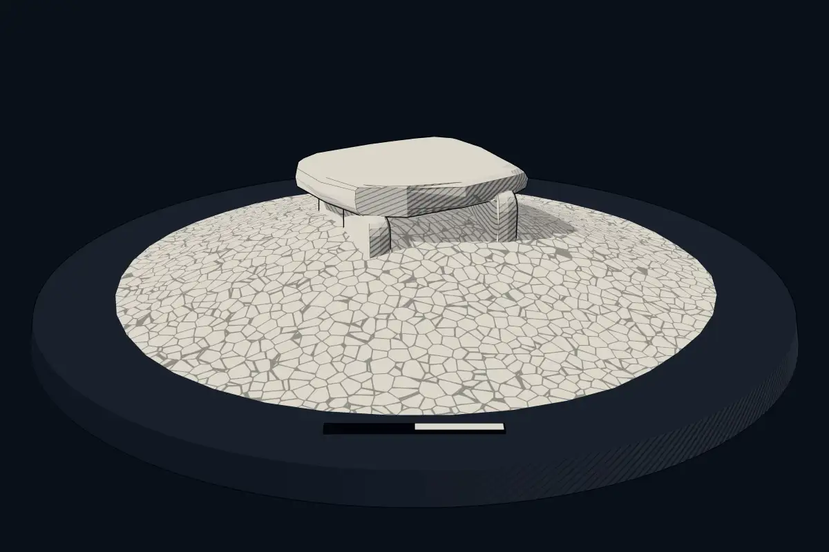
No licensed photograph yetWe have no photograph we may publish for this site, so the interpretive 3D view leads instead.
Overview
About this site
What the sources say
옥대고인돌은 전라남도 진도군 의신면 옥대리에 있는 고인돌이다. 2001년 10월 30일 진도군의 향토문화유산(유형유산) 제2호로 지정되었다.
Article in KoreanRead on Wikipedia2 min readCC BY-SA 4.0
Where it sits in time
The site's dated range, placed against world reference points.
The scale is logarithmic: each step to the left is about ten times older than the last.
The full article
Okdae Dolmen: the whole story
In briefSources for this section
- Wikipedia (Korean): 옥대고인돌군CC BY-SA 4.0
Sources for this section
- Wikipedia (Korean): 옥대고인돌군CC BY-SA 4.0
Okdae Dolmen is a megalithic tomb group in Okdae-ri, Uisin-myeon, Jindo-gun, Jeollanam-do, South Korea. The site consists of 21 dolmens arranged in an oval on a hill beside the village, approached along Donji-ri. It was investigated by a surface survey carried out by Mokpo National University Museum in 1987.
The lower parts of the dolmens have been buried or damaged, so their original construction cannot be confirmed. The group mixes medium-sized and small dolmens of uneven scale. The largest is 330cm long, 220cm wide and 70cm thick; across the group, lengths range from 110~330cm, widths from 70~280cm and thicknesses from 30~140cm.
The site is dated typologically to 700 BCE to 300 BCE, within the Bronze Age. Its tombs were built from stones scattered around the hill, whose lower parts are thought to have been destroyed. One polished stone arrowhead was recovered near the dolmens. Polished stone swords found nearby are held by the Jindo-gun Local History Museum.
Dolmens of this kind in South Korea are generally associated with the Bronze Age and early Iron Age, particularly the Mumun pottery period. They are commonly known as goindol, meaning “propped stone.” Such monuments are especially dense in the west coast area and river basins such as the Han and Nakdong, where many examples remain across the Korean Peninsula.
No English Wikipedia article exists for it; the full text below is the Korean article "옥대고인돌군", shown in the original language.
Summary in EnglishSources for this section
- Wikipedia (Korean): 옥대고인돌군CC BY-SA 4.0
Sources for this section
- Wikipedia (Korean): 옥대고인돌군CC BY-SA 4.0
Okdae Dolmen is a megalithic tomb (unclassified) in South Jeolla, South Korea. Wikidata describes it as: cultural heritage. A typological estimate: 700 BCE to 300 BCE. No English Wikipedia article exists for it; the full text below is the Korean article "옥대고인돌군", shown in the original language.
개요Sources for this section
- Wikipedia (Korean): 옥대고인돌군CC BY-SA 4.0
Sources for this section
- Wikipedia (Korean): 옥대고인돌군CC BY-SA 4.0
옥대고인돌군은 진도군 의신면 옥대리에 있는 청동기시대의 돌무덤이다.
돈지리에서 옥대리로 가다 보면 옥대리 마을 좌측 구릉상에 21기의 지석묘가 타원형을 이루며 모여 있다. 주변에 많은 석재가 널려 있어 지석묘의 아래쪽이 파괴된 것으로 추측된다. 이 고인돌군은 1987년 목포대학교 박물관에서 지표조사를 실시했을 때 조사되었다.
지석묘의 아래쪽이 매몰되고 파괴되어 확실한 형식을 알 수 없다. 규모는 일정치 않으며 중·소형 지석묘들이 뒤섞여 있다. 가장 규모가 큰 것은 길이 330cm, 폭 220cm, 두께 70cm이며, 전체적으로는 길이 110~330cm, 폭 70~280cm, 두께 30~140cm의 크기이다.
지석묘 주변에서 마제석촉 1점이 수습되었다.
주변에 많은 석재가 널려 있으며, 주변에서 수습된 마제석검은 진도군 향토관에 소장되어 있다.
How this page was madeSources for this section
- Wikipedia (Korean): 옥대고인돌군CC BY-SA 4.0
Sources for this section
- Wikipedia (Korean): 옥대고인돌군CC BY-SA 4.0
The summary at the top of this page was written by MiniMax-M3 (2026-11-08) from the cited Wikipedia article “옥대고인돌군”, translated from Korean. The numbers in it were checked automatically against the source text. The rest of the page is the article itself, the structured records and computed distances.
Tradition and region
About this kind of monument
Korean dolmens (goindol)
The Korean Peninsula has more dolmens than anywhere else: about 40,000 are found throughout the peninsula, which is approximately 40 percent of the world's total. In Korean they are called goindol, "propped stone", and they were built from the Bronze Age to the early Iron Age, during the Mumun pottery period of about 1500 to 300 BCE. They are distributed mainly along the west coast and on large rivers from the Liaodong Peninsula in China to Jeollanam-do. In North Korea they are concentrated around the Taedong and Jaeryeong rivers; in South Korea they are dense in river basins such as the Han and Nakdong and in the west coast area.
The great stones marked the graves of the ruling elite. Pottery, comma-shaped jewels, bronzes and stone tools have been excavated from the dolmens, and the stones show how rock was quarried, transported and used to build them. In 2000 UNESCO designated the Gochang, Hwasun and Ganghwa Dolmen Sites a World Heritage Site: Jukrim-ri and Dosan-ri at Gochang, Hyosan-ri and Daesin-ri at Hwasun, and Bujeong-ri, Samgeori and Osang-ri on Ganghwa. Together they hold over 1,000 dolmens, the highest concentrations anywhere in the world.
Dolmens in Korea have been dated to the seventh century BCE at places such as Gochang, and the practice ended around the third century BCE. Excavation at the sites did not begin until 1965. Where the dolmens came from is debated: one theory has the knowledge arriving from Southeast Asia along with rice culture, another from Neolithic peoples north of the peninsula, and a third holds that they arose on the peninsula itself.
When visiting, look for the way the rows follow a river terrace, and compare the table-like dolmens with those where the capstone sits low over the ground.
Paraphrased from Wikipedia: Gochang, Hwasun and Ganghwa Dolmen Sites, Wikipedia: Dolmen, Wikipedia: Mumun pottery period · CC BY-SA 4.0
Lore
Evidence & Lore
What the sources actually support — and, kept apart, what has been claimed.
What the evidence supports
Dates
Est. 700–300 BCEHow this date was established: Type comparisonTypical range for megalithic tombs in South Korea; this site has not been dated itself. Korean dolmens have been dated to the seventh century BCE in places such as Gochang and the practice ended around the third century BCE.Source for this date
Where it stands
South Korea
The pin marks the monument itself — its exact point.
- Coordinates
- 34°26′29″ N, 126°17′12″ EFor a GPS or map app: 34.44132, 126.28673
Access is as our sources describe it; we have not visited the site to check.
Nearby
The closest sites in the Atlas, by straight line.
 Haenam Yongduri Gobun
 Haenam Bangsan-ri Janggobong Kofun
- SteleWando Gogumdo Gwanwangmyo Stele
- Megalithic mound (tumulus with integral stones)Yeongam Taegan-ri Jarabong Gobun
- Megalithic mound (tumulus with integral stones)咸平長鼓山古墳
 Gochang, Hwasun and Ganghwa Dolmen Sites1500 BCE–300 CE
 Hwasun Dolmen Site1000–1 BCE
 Gwangju Myeonghwa-dong Janggobun


Sources
Every record behind this page, with the link it came from.
2 sources behind this page
- 01Wikidata Q65275863wikidata.org
- 02Source for this dateen.wikipedia.org
Report a correctionWrong date, name, photograph or source? Tell us and it will be put right.
Around this place
The ten nearest sites, by compass
- Haenam Yongduri Gobun30 km E
- Haenam Bangsan-ri Janggobong Kofun37 km E
- Wando Gogumdo Gwanwangmyo Stele53 km E
- Yeongam Taegan-ri Jarabong Gobun54 km NE
- 咸平長鼓山古墳77 km N
- Gochang, Hwasun and Ganghwa Dolmen Sites83 km NE
- Hwasun Dolmen Site84 km NE
- Gwangju Myeonghwa-dong Janggobun86 km NE
- Gwangju Samgeo-dong Dolmen Group87 km NE
- Hampyeong Yedeok-ri Sindeok Gobungun91 km N
Credit
Text, licence and sources
Text from the Wikipedia article "옥대고인돌군" (Korean), licensed CC BY-SA 4.0; authors are listed in the page history. Reused under CC BY-SA 4.0. Read on Wikipedia · Edit history and authors
- Wikipedia (Korean): 옥대고인돌군CC BY-SA 4.0
- Wikidata Q65275863CC0