
MegalithFringe site
Aguateca
Datedc. 300 BCE–350 CE
Photo Sébastian Homberger · CC BY 2.5Source file on Wikimedia Commons
Overview
About this site
Overview
Aguateca is a Maya site in the Petexbatun Basin, in the department of Petén in northern Guatemala. The first settlements date to the Late Preclassic period (300 BC - AD 350), and the centre was occupied from about 200 B.C. until about 800 A.D., when the city was attacked and ransacked.
Because the city was rapidly abandoned, Pompeii-style assemblages were left scattered on the floors of elite residences. The ruins are considered to be among the best preserved in Guatemala.
Read on Wikipedia3 min readCC BY-SA 4.0
Where it sits in time
The site's dated range, placed against world reference points.
The scale is logarithmic: each step to the left is about ten times older than the last.
Article
Aguateca
The Main Chasm is a naturally formed deep fracture of limestone karst running NE-SW through the middle of the site, approximately 850 m long and 10–70 m deep.
DescriptionSources for this section
- Wikipedia (English): AguatecaCC BY-SA 4.0
Sources for this section
- Wikipedia (English): AguatecaCC BY-SA 4.0
Aguateca sits on top of a 90 metres (300 ft) tall limestone bluff, a highly defensible position. The steep escarpment overlooks Petexbatun Lagoon and is accessible by boat. An extensive system of defensive walls, over 3 miles (4.8 km) in length, surrounds the city. Its centre consisted of the Palace Group, which was probably a royal residential compound, and the Main Plaza, connected by a causeway along which lay a densely occupied elite residential area.
The Main Chasm is a naturally formed deep fracture of limestone karst running NE-SW through the middle of the site, approximately 850 m long and 10–70 m deep. It has strong evidence of ritual practices, which suggests that chasms, like caves, were places where ancestral and supernatural spirits could be reached.
HistorySources for this section
- Wikipedia (English): AguatecaCC BY-SA 4.0
Sources for this section
- Wikipedia (English): AguatecaCC BY-SA 4.0
Aguateca and the nearby city of Dos Pilas were the twin capitals of a powerful dynasty claiming descent from the rulers of Tikal. Around 700 AD, Dos Pilas Rulers 3 and 4 appear to have shifted the focus of the dynasty from Dos Pilas to Aguateca, and in 761 AD the rulers of Dos Pilas appear to have abandoned their city and relocated to Aguateca. Aguateca became a large, densely populated city, with a higher density of structures than most other lowland Maya sites.
During the reign of Tan Te' K'inich the city was invaded and burned, and it was completely abandoned around 830 AD. A 6-metre (20 ft) tall temple was left unfinished, the centre of the city was destroyed by fire, valuables were left scattered in elite residences, and ceramics were left in their original domestic positions, all of which demonstrate the sudden abandonment. It appears that before the final attack the royal family cleaned out the rooms of the palace and left the centre.
ArchaeologySources for this section
- Wikipedia (English): AguatecaCC BY-SA 4.0
Sources for this section
- Wikipedia (English): AguatecaCC BY-SA 4.0
Horizontal excavation of the elite residences has revealed ancient elite activity and household-level craft production areas. Houses in the elite residential area commonly consist of three main rooms and smaller additions, and contained serving vessels, grinding stones and a variety of stone tools, as well as obsidian blades, probably used for bloodletting, and stone mortars for pigment preparation. Seven bone needles and seven spindle whorls found in one room suggest textile production. No structures dedicated solely to food storage have been found within the elite residential groups or the royal palace, which indicates that food storage was not centralized.
Elite men and women engaged in artistic creation and craft production, including luxury goods, weaponry, wood carvings and hide or leather goods. Pieces representing the "Jester God" were found burned in one of the elite residences. Obsidian was a highly valued material, and its main access appears to have been controlled by the rulers; its presence indicates participation in long-distance trade. Dominant species for consumption include white-tailed deer, river turtles, dog, agouti, paca, peccaries, large birds and riverine fish, while marine shells and wild cats such as jaguars, margays and ocelots were used as luxury goods.
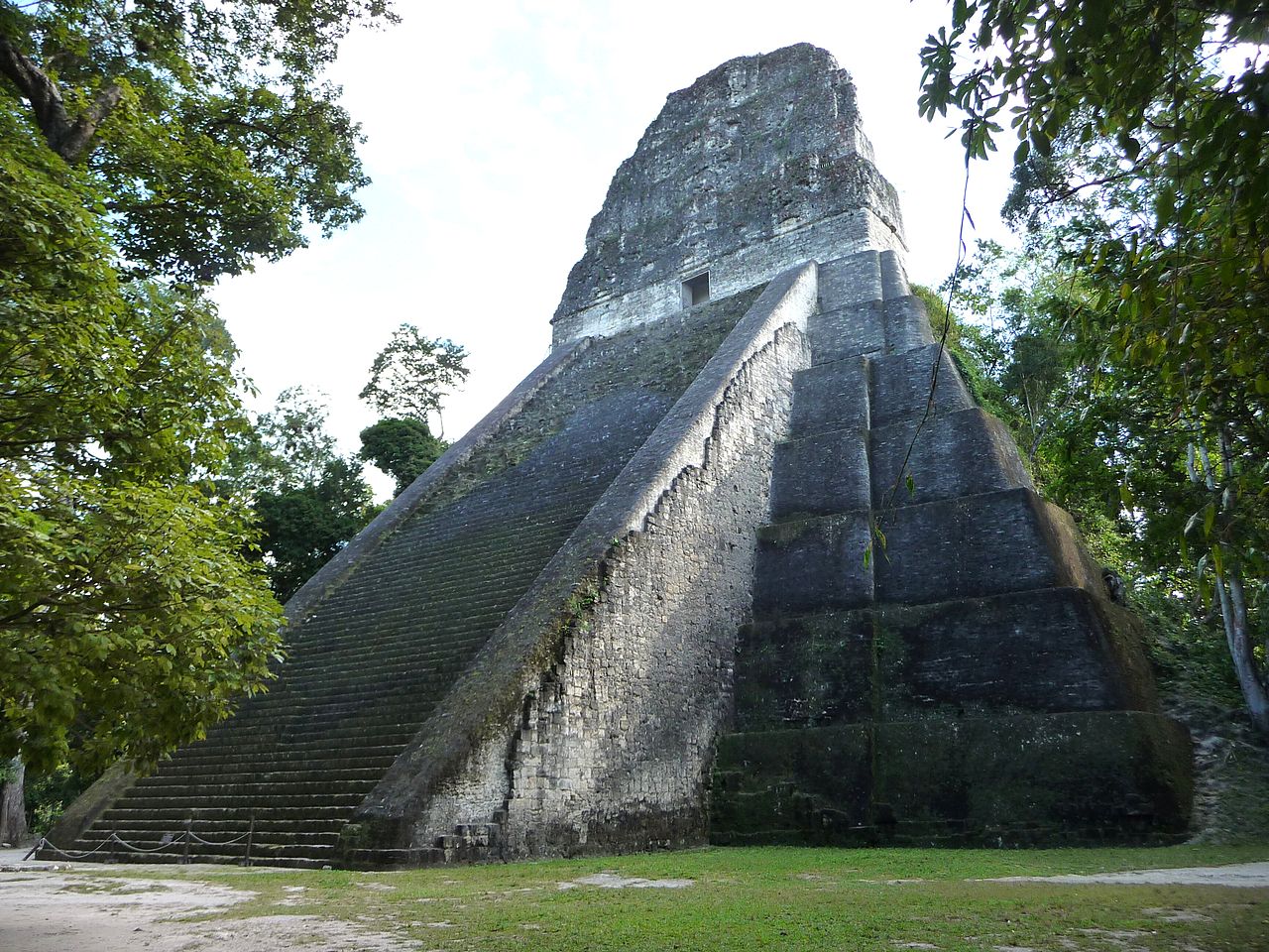
An unfinished temple has been identified, thought to have been under construction when the city was attacked and abandoned at the beginning of the 9th century. It provides information on Maya building methods and on the possible organisation of construction labour.
Tradition and region
About this kind of monument
Mesoamerican stelae and carved stone
Mesoamerica's civilisations raised carved stone monuments. Maya stelae are tall sculpted stone shafts, often paired with low circular stones called altars, though their actual function is uncertain. Many stelae are carved in low relief, though plain ones are found throughout the Maya region. The sculpting of these monuments spread across the Maya area in the Classic Period (about 250 to 900 CE), and the pairing of sculpted stela and altar is a hallmark of Classic Maya civilisation. The earliest dated stela found in place in the Maya lowlands comes from Tikal in Guatemala, and during the Classic Period almost every Maya kingdom in the southern lowlands raised stelae in its ceremonial centre.
The Olmec colossal heads, much older, are stone representations of heads carved from large basalt boulders, from 1.17 to 3.4 metres high. They date from at least 900 BCE and are a distinctive feature of Olmec civilisation. All portray individuals with distinctive features of the people who still live in Tabasco and Veracruz, and the backs are often flat. The boulders came from the Sierra de los Tuxtlas mountains in Veracruz, and given the weight of the stone, which was moved over 150 kilometres, much labour was needed.
Many Maya stelae carry inscriptions in hieroglyphs with dates in the Long Count calendar, and so can be dated to the day. This makes them among the most precisely dated monuments in the Atlas. They commemorate rulers and events, not the dead in general.
The Atlas's records in Mexico, Guatemala and Belize are mostly Maya sites with stelae, altars and carved monuments.
When visiting, look at the carved figure on the front, which is usually a ruler, and at the glyphs on the sides and back. Many stelae are now protected by roofs.
Paraphrased from Wikipedia: Maya stelae, Wikipedia: Olmec colossal heads, Wikipedia: Stele · CC BY-SA 4.0
From the article
Dated moments in the story
- 300 BCE
The first settlements at Aguateca date to the Late Preclassic period (300 BC - AD 350).
Source - 200 BCE
The center was occupied from about 200 B.C. until about 800 A.D., when the city was attacked and ransacked.
Source - 700 CE
Around 700 AD, it appears that Dos Pilas Rulers 3 and 4 were responsible for shifting the focus of the dynasty from Dos Pilas to Aguateca, as can be determined from stelas and monuments.
Source - 761 CE
In 761 AD, the rulers of Dos Pilas appear to have abandoned their city and relocated to Aguateca.
Source - 830 CE
The city was completely abandoned around 830 AD.
Source
Photographs
7 photographs, each with its author and licence
More photographs
Lore
Evidence & Lore
What the sources actually support — and, kept apart, what has been claimed.
What the evidence supports
Dates
300 BCE–350 CEHow this date was established: Historical sourcesThe range follows the source's stated span for the earliest settlements at the site.Source for this date
Measured facts
- Location
- Petexbatun Basin, Petén department, northern GuatemalaSource: Location
- Bluff height
- 90 metresSource: Bluff height
- Defensive wall length
- over 3 milesSource: Defensive wall length
- Abandonment
- around 830 ADSource: Abandonment
- Unfinished structure
- a 6-metre tall templeSource: Unfinished structure
- Preservation
- among the best preserved ruins in GuatemalaSource: Preservation
- Culture
- Maya civilizationSource: Culture
Where it stands
Guatemala
The pin marks the monument itself — its exact point.
- Coordinates
- 16°24′43″ N, 90°11′18″ WFor a GPS or map app: 16.41194, -90.18833
Access is as our sources describe it; we have not visited the site to check.
Nearby
The closest sites in the Atlas, by straight line.






Sources
Every record behind this page, with the link it came from.
2 sources behind this page
- 01Wikidata Q398094wikidata.org
- 02Fringe claim sourceen.wikipedia.org
Image files
- Aguateca-plaza.jpgSébastian HombergerCC BY 2.5
- Aguateca M7-26-2.jpgHJPDCC BY 3.0
- Aguateca M7-26-1.jpgHJPDCC BY 3.0
- Aguateca 1.jpgSimon BurchellCC BY-SA 3.0
- Aguateca-temple.jpgSébastian HombergerCC BY 2.5
- Maqueta Aguateca.jpgClemens SchmillenCC BY-SA 4.0
- Aguateca falla microclima.jpgClemens SchmillenCC BY-SA 4.0
Report a correctionWrong date, name, photograph or source? Tell us and it will be put right.
Around this place
The ten nearest sites, by compass
Credit
Text, licence and sources
Adapted from the Wikipedia article "Aguateca" (English), licensed CC BY-SA 4.0; authors are listed in the page history. Reused under CC BY-SA 4.0. Read on Wikipedia · Edit history and authors
- Wikipedia (English): AguatecaCC BY-SA 4.0
- Wikidata Q398094CC0