
Megalith (abstract root)UNESCO World Heritage
Stonehenge, Avebury and Associated Sites
DatedEst. 4500 BCE–600 CE
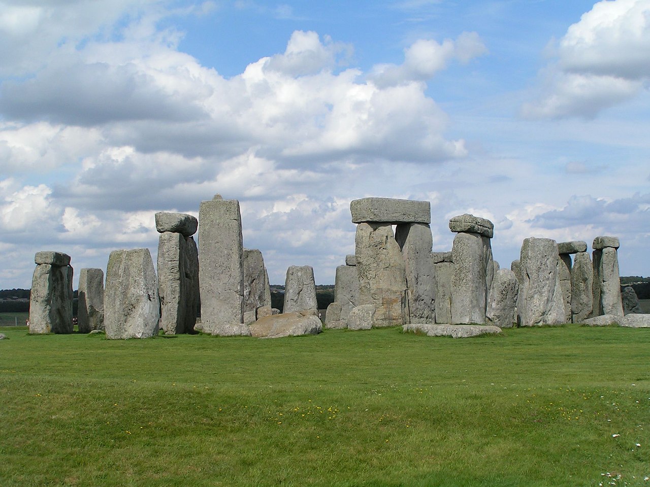
Photo Fernando Losada Rodríguez · CC BY-SA 4.0Source file on Wikimedia Commons

Overview
About this site
Overview
Stonehenge, Avebury and Associated Sites is a UNESCO World Heritage Site in Wiltshire, England, inscribed as a co-listing in 1986. It covers two large areas of land separated by about 24 kilometres (15 mi), rather than a specific monument or building.
The area has an exceptionally high density of small-scale archaeological sites, particularly from the prehistoric period. More than 700 individual archaeological features have been identified, and there are 160 separate scheduled monuments, covering 415 items or features.
Read on Wikipedia2 min readCC BY-SA 4.0
Where it sits in time
The site's dated range, placed against world reference points.
The scale is logarithmic: each step to the left is about ten times older than the last.
Article
Stonehenge, Avebury and Associated Sites
The Stonehenge area of the site lies in south Wiltshire, covers 26 square km and is centred on the prehistoric monument of Stonehenge.
DescriptionSources for this section
Sources for this section
The Stonehenge area of the site lies in south Wiltshire, covers 26 square km and is centred on the prehistoric monument of Stonehenge. Ownership is shared between English Heritage, the National Trust, the Ministry of Defence, the RSPB, Wiltshire Council and private individuals and farmers. Monuments within it include Stonehenge Avenue, the Stonehenge Cursus, the Lesser Cursus, the Cursus Barrows, Durrington Walls, Woodhenge, the Cuckoo Stone, Coneybury Henge (which has been ploughed flat), King Barrow Ridge, the Winterbourne Stoke Barrows, the Normanton Down Barrows (including Bush Barrow), Vespasian's Camp and West Amesbury Henge, also known as Bluestonehenge. Robin Hood's Ball is an associated monument just north of the boundary.
The Avebury area covers 22.5 km2 and is centred on the prehistoric Avebury Henge, about 17 miles (27 km) north of Stonehenge. Its monuments include the West Kennet Avenue, the Beckhampton Avenue, West Kennet Long Barrow, The Sanctuary, Silbury Hill and Windmill Hill.
FindsSources for this section
Sources for this section
The main museums holding material are the Alexander Keiller Museum at Avebury, Salisbury Museum and Wiltshire Museum in Devizes. Other museums with material from Stonehenge and Avebury include the British Museum, the National Museum of Wales, the Cambridge University Museum of Archaeology and Anthropology and the Ashmolean Museum. Archives are held by the Historic England Archive in Swindon, the Wiltshire and Swindon History Centre in Chippenham and the Bodleian Library at Oxford.
Tradition and region
About this kind of monument
Prehistoric rock art and standing stones of Scotland
Most of the "megalith" records for Britain in the Atlas come from the Scottish register of monuments, and many are not standing stones at all but carved rocks. Cup and ring marks are a form of prehistoric art found along the Atlantic seaboard of Europe, in Ireland, Wales, northern England, Scotland, Brittany, Portugal and Galicia. They consist of a concave depression no more than a few centimetres across, pecked into a rock surface and often surrounded by concentric circles; sometimes a linear channel, called a gutter, leads out from the middle. They occur as petroglyphs on natural boulders and outcrops, and also as an element of megalithic art on worked stones, such as the slab cists of the Food Vessel culture, some stone circles and passage graves, and the capstones at Newgrange.
The richest area is Kilmartin Glen in Argyll, which has the most important concentration of Neolithic and Bronze Age remains in mainland Scotland. There are more than 800 ancient monuments within a ten-kilometre radius of the village, with 150 of them prehistoric, including standing stones, a henge, numerous cists and a linear cemetery of five burial cairns that runs over five kilometres. Several of the cairns, and many natural rocks, are decorated with cup and ring marks.
The meaning of the carvings is unknown. Megalithic art tends to be highly abstract, and its meaning is the subject of much debate. On natural outcrops the marks can be dated only broadly, so the Atlas gives a range from the Neolithic to the Bronze Age; on a worked stone of a dated monument they are at least as old as the monument.
When visiting, low light brings out the cups best. Please do not chalk or rub the carvings.
Paraphrased from Wikipedia: Cup and ring mark, Wikipedia: Kilmartin Glen, Wikipedia: Megalithic art, Wikipedia: Rock art · CC BY-SA 4.0
From the article
Dated moments in the story
- 700 CE
More than 700 individual archaeological features have been identified.
Source - 1986
The sites were inscribed as co-listings in 1986. Some large and well known monuments within the WHS are listed below, but the area also has an exceptionally high density of small-scale archaeological sites, particularly from the prehistoric period.
Source
Photographs
7 photographs, each with its author and licence
More photographs


Lore
Evidence & Lore
What the sources actually support — and, kept apart, what has been claimed.
What the evidence supports
Dates
Est. 4500 BCE–600 CEHow this date was established: Type comparisonTypological estimate, not a date for this site: a megalith in the British Isles is normally dated between 4500 BCE and 600 CE (Atlas typological table).Source for this date
Measured facts
- Location
- Wiltshire, EnglandSource: Location
- Separation between the two areas
- about 24 kilometres (15 mi)Source: Separation between the two areas
- Inscription
- 1986Source: Inscription
- Identified archaeological features
- More than 700Source: Identified archaeological features
- Scheduled monuments
- 160Source: Scheduled monuments
- Items or features covered
- 415Source: Items or features covered
- Heritage designation
- World Heritage SiteSource: Heritage designation
Where it stands
United Kingdom
The pin marks the monument itself — its exact point.
- Coordinates
- 51°10′44″ N, 1°49′31″ WFor a GPS or map app: 51.17890, -1.82528
Access is as our sources describe it; we have not visited the site to check.
Nearby
The closest sites in the Atlas, by straight line.
 Heel Stone3200–2500 BCE
 Stonehenge3100–1600 BCE
 Altar Stone4000–2400 BCE
- Menhir (standing stone)Station Stones2800–1800 BCE
- Megalithic mound (tumulus with integral stones)Bell barrow 100m east of Stonehenge immediately south of the A3444000–800 BCE
- Megalithic mound (tumulus with integral stones)Five bowl barrows forming the greater part of a round barrow cemetery 200m south west of Stonehenge on Stonehenge Down4000–800 BCE
- Megalithic mound (tumulus with integral stones)Disc barrow 220m south west of Stonehenge forming part of a round barrow cemetery on Stonehenge Down4000–800 BCE
- Megalithic mound (tumulus with integral stones)Bowl barrow 230m west of Stonehenge forming part of a round barrow cemetery on Stonehenge Down4000–800 BCE


Sources
Every record behind this page, with the link it came from.
4 sources behind this page
- 01Wikidata Q587584wikidata.org
- 02Wikipedia (en)en.wikipedia.org
- 03Wikipedia: Stonehenge, Avebury and Associated Sitesen.wikipedia.org
- 04World Heritage List entry 373whc.unesco.org
Image files
- Neolithic house.001 - Stonehenge.jpgFernando Losada RodríguezCC BY-SA 4.0
- Barrow Cemetery south of Woodhenge.jpgEthan Doyle WhiteCC BY-SA 4.0
- The Cuckoo Stone, Wiltshire.jpgEthan Doyle WhiteCC BY-SA 4.0
- The Cuckoo Stone facing East.jpgEthan Doyle WhiteCC BY-SA 4.0
- Stone in the center of Woodhenge.jpgEthan Doyle WhiteCC BY-SA 4.0
- Winterbourne Stoke Barrow Cemetery as seen from the A303.jpgEthan Doyle WhiteCC BY-SA 4.0
- Stonehenge back wide.jpgFrédéric VincentCC BY-SA 2.0
Report a correctionWrong date, name, photograph or source? Tell us and it will be put right.
Around this place
The ten nearest sites, by compass
- Heel Stone<0.1 km N
- Stonehenge<0.1 km W
- Altar Stone<0.1 km W
- Station Stones<0.1 km W
- Bell barrow 100m east of Stonehenge immediately south of the A3440.1 km E
- Five bowl barrows forming the greater part of a round barrow cemetery 200m south west of Stonehenge on Stonehenge Down0.3 km W
- Disc barrow 220m south west of Stonehenge forming part of a round barrow cemetery on Stonehenge Down0.4 km SW
- Bowl barrow 230m west of Stonehenge forming part of a round barrow cemetery on Stonehenge Down0.4 km W
- Bowl barrow 300m WSW of Stonehenge, forming part of a round barrow cemetery on Stonehenge Down0.4 km W
- A twin bell barrow and a bell barrow forming the eastern part of The Cursus round barrow cemetery0.7 km NW
Credit
Text, licence and sources
Adapted from the Wikipedia article "Stonehenge, Avebury and Associated Sites" (English), licensed CC BY-SA 4.0; authors are listed in the page history. Reused under CC BY-SA 4.0. Read on Wikipedia · Edit history and authors