
Long Stone, standing stone, Frotoft, Rousay
DatedEst. 2800–1800 BCE
Photo Colin Kinnear · CC BY-SA 2.0Source file on Wikimedia Commons

Overview
About this site
Overview
The Long Stone of Frotoft, also known as Langsteen, South Shore Stone or Westova, is a standing stone beside the farm complex of Frotoft on the Orkney island of Rousay, Scotland, north of the coastal road along Wyre Sound. It is a scheduled monument.
It probably dates from the Late Neolithic or the Bronze Age, in the late 3rd or early 2nd millennium BCE. The stone was broken at some time, but the pieces have been joined together again.
Read on Wikipedia2 min readCC BY-SA 4.0
Where it sits in time
The site's dated range, placed against world reference points.
The scale is logarithmic: each step to the left is about ten times older than the last.
Article
Long Stone, standing stone, Frotoft, Rousay
DescriptionSources for this section
- Wikipedia (German): Long Stone (Frotoft)CC BY-SA 4.0
Sources for this section
- Wikipedia (German): Long Stone (Frotoft)CC BY-SA 4.0
The stone is about 2.25 m high and stands about 20 m above sea level on its original site. It is 0.8 m wide and 0.3 m thick at the base and tapers towards the top to a width of 0.6 m and a thickness of 0.18 m. On its north-west face, 1.5 m above the ground, there is a small notch.
The monument was first protected in 1936, but the documentation did not meet current standards.
Research historySources for this section
- Wikipedia (German): Long Stone (Frotoft)CC BY-SA 4.0
Sources for this section
- Wikipedia (German): Long Stone (Frotoft)CC BY-SA 4.0
The monument was first protected in 1936, but the documentation did not meet current standards.
SettingSources for this section
- Wikipedia (German): Long Stone (Frotoft)CC BY-SA 4.0
Sources for this section
- Wikipedia (German): Long Stone (Frotoft)CC BY-SA 4.0
The Knowe of Yarso and the broch Knowe of Burrian lie nearby, while the Broch of Burrian is on North Ronaldsay.
ContextSources for this section
- Wikipedia (German): Long Stone (Frotoft)CC BY-SA 4.0
Sources for this section
- Wikipedia (German): Long Stone (Frotoft)CC BY-SA 4.0
Standing stones in Britain and Ireland are usually difficult to date. They were put up in many periods of prehistory as part of the wider megalithic cultures, and any single stone may be Neolithic, Bronze Age or later. Theories about their purpose remain speculative and include rituals, territorial markers and markers in a system of belief.
Tradition and region
About this kind of monument
British and Irish standing stones
Britain and Ireland are rich in standing stones; the Atlas records many hundreds. Together with Brittany they hold about 50,000 examples across the Atlantic fringe of Europe, and many stand singly in fields. In Ireland they are usually in farmers' fields and are heavily worn by weather and by livestock rubbing against them. The stones are usually difficult to date. They were put up in many periods of prehistory as part of the wider megalithic cultures, and any single stone may be Neolithic, Bronze Age or later. Theories about their purpose remain speculative: rituals, territorial markers, or markers in a system of belief.
Some stand in groups. The Calanais Stones on the Isle of Lewis, built around 2750 BCE, form a circle with a tall central monolith and several rows extending outwards in a cross-shaped plan, on a ridge overlooking Loch Roag. The Rollright Stones in Oxfordshire include the King's Men, the King Stone and the Whispering Knights, three monuments built in the Neolithic and Bronze Age.
Folklore: the names of the Rollright Stones come from stories told since the early modern period; legend holds that the King Stone comes alive at the stroke of midnight. At Calanais one tradition says the stones were giants who would not convert to Christianity, and in the seventeenth century the people of Lewis called them fir bhrèige, "false men". Another legend says that on midsummer morning an entity known as the Shining One walks the length of the avenue. These are traditions, not memories of the builders.
The Atlas treats isolated stones as undated unless they have been excavated.
When visiting, look at how a stone stands in relation to the landscape and to any nearby monument.
Paraphrased from Wikipedia: Menhir, Wikipedia: Callanish Stones, Wikipedia: Rollright Stones, Wikipedia: List of menhirs · CC BY-SA 4.0
From the article
Dated moments in the story
- 1936
Das Monument wurde erstmals 1936 geschützt, aber die Dokumentation entsprach nicht den Standards.
Source
See it in 3D
An interpretive reconstruction of the monument, standing on the real ground at its exact point, under the sun for that place and season. Drag to look around it.
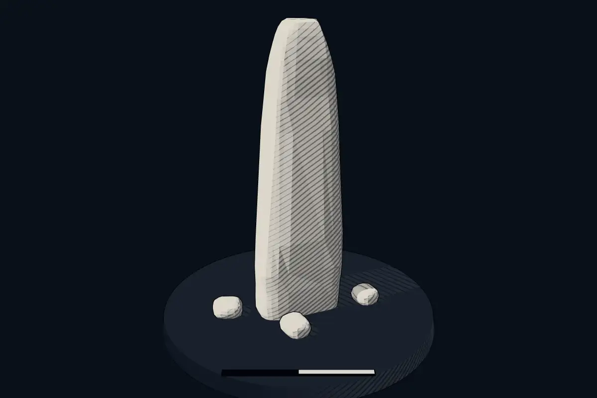
The reconstruction is ours, not a survey: it shows what a monument of this type looks like, at the size the record gives for this one.
Photographs
2 photographs, each with its author and licence
More photographs

Lore
Evidence & Lore
What the sources actually support — and, kept apart, what has been claimed.
What the evidence supports
Dates
Est. 2800–1800 BCEHow this date was established: Type comparisonTypical range for menhirs in United Kingdom; this site has not been dated itself. Standing stones are associated with the Beaker people of the European late Neolithic and early Bronze Age c. 2800-1800 BC.Source for this date
Where it stands
United Kingdom
The pin marks the monument itself — its exact point.
- Coordinates
- 59°07′48″ N, 3°02′35″ WFor a GPS or map app: 59.13008, -3.04295
Access is as our sources describe it; we have not visited the site to check.
Nearby
The closest sites in the Atlas, by straight line.
 Knowe of Burrian, broch 190m SSW of Burrian, Rousay390 BCE–200 CE
 Knowe of Ramsay2455–2290 BCE
- Chambered cairnKnowe of Lairo2621–2553 BCE
 Blackhammer Chambered Cairn4000–2500 BCE
 Knowe of Hunclett, broch ESE of Hunclett, Frotoft, Rousay390 BCE–200 CE
- Megalithic mound (tumulus with integral stones)Geord of Nears, cairn 90m SW of Cairn House, Rousay4000–800 BCE
 Ness of Woodwick, broch, 970m E of Lower Bisgarth390 BCE–200 CE
- Megalithic mound (tumulus with integral stones)cairn 230m N of Loch of Knitchin, Brinvar4000–800 BCE


Sources
Every record behind this page, with the link it came from.
2 sources behind this page
- 01Wikidata Q56294705wikidata.org
- 02Source for this dateen.wikipedia.org
Image files
Report a correctionWrong date, name, photograph or source? Tell us and it will be put right.
Around this place
The ten nearest sites, by compass
- Knowe of Burrian, broch 190m SSW of Burrian, Rousay0.3 km W
- Knowe of Ramsay0.6 km NW
- Knowe of Lairo0.7 km NW
- Blackhammer Chambered Cairn1.0 km E
- Knowe of Hunclett, broch ESE of Hunclett, Frotoft, Rousay1.1 km E
- Geord of Nears, cairn 90m SW of Cairn House, Rousay1.9 km E
- Ness of Woodwick, broch, 970m E of Lower Bisgarth2.7 km S
- cairn 230m N of Loch of Knitchin, Brinvar2.9 km NE
- Cubbie Roo's Burden, chambered cairn, Rousay3.5 km E
- Knowe Stenso,broch N of Dyke4.1 km W
Credit
Text, licence and sources
Adapted from the Wikipedia article "Long Stone (Frotoft)" (German), licensed CC BY-SA 4.0; authors are listed in the page history. Reused under CC BY-SA 4.0. Read on Wikipedia · Edit history and authors
- Wikipedia (German): Long Stone (Frotoft)CC BY-SA 4.0
- Wikidata Q56294705CC0