
Dolmen des Pierres-Gouffier
DatedEst. 4000–3000 BCE
Photo Liberliger · CC BY-SA 4.0Source file on Wikimedia Commons

Overview
About this site
Overview
The dolmen des Pierres-Gouffier, later known as the dolmen de la Saudraie or the Trois-Roches des Champs Morgan, is a megalithic site at Mauron, in the department of Morbihan, France, whose real nature remains uncertain. It consists of three large schist slabs, one of them standing upright.
Read on Wikipedia3 min readCC BY-SA 4.0
Where it sits in time
The site's dated range, placed against world reference points.
The scale is logarithmic: each step to the left is about ten times older than the last.
Article
Dolmen des Pierres-Gouffier
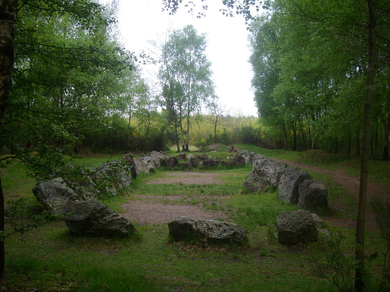
On one of the two slabs lying flat, the former position of the commemorative plaque of a monument is still visible.
DescriptionSources for this section
- Wikipedia (French): Dolmen des Pierres GouffierCC BY-SA 4.0
Sources for this section
- Wikipedia (French): Dolmen des Pierres GouffierCC BY-SA 4.0
The present site has three large schist slabs, one of which is set vertically. On one of the two slabs lying flat, the former position of the commemorative plaque of a monument is still visible. The megalithic character of the site is not in question, but nothing allows it to be asserted that it was a dolmen.
Research historySources for this section
- Wikipedia (French): Dolmen des Pierres GouffierCC BY-SA 4.0
Sources for this section
- Wikipedia (French): Dolmen des Pierres GouffierCC BY-SA 4.0
The site was first reported in 1863 by the archaeologist Louis Rosenzweig under the name dolmen des Pierres Gouffier, and he mentioned it again in a lecture at the Sorbonne in 1868. According to Rosenzweig it was a destroyed dolmen. In 1889 Joseph-Marie Le Mené placed the Pierres-Gouffier near the hamlet of La Saudraie.
In his inventory of the megalithic sites of the forest of Paimpont, made in 1896, Félix Bellamy does not name the site under this name but records a destroyed megalithic monument called the Trois-Roches, near the Champs Morgan and close to the hamlet of Folle-Pensée. He describes three large flat stones of red schist, one standing and the other two lying at its foot, and he judged that it must have been a dolmen. The table stone, shaped like a very elongated parallelogram, measured about 2.80 m in its greatest length. His description and location correspond exactly to the site shown as dolmen des Pierres Gouffier on the IGN map.
In his inventory of 1994 Philippe Gouezin records, for the commune of Mauron, a former dolmen east-south-east of La Saudraie that was said to have been destroyed by land consolidation. The dolmen de la Saudraie no longer existed as such in 1994, since its stones then formed the monument to the battle of Mauron.
Later historySources for this section
- Wikipedia (French): Dolmen des Pierres GouffierCC BY-SA 4.0
Sources for this section
- Wikipedia (French): Dolmen des Pierres GouffierCC BY-SA 4.0
In 1974 the blocks of stone making up the site were taken to the centre of Mauron to build a memorial to the battle of Mauron. In 1997 that monument was replaced by a more contemporary one, and the stones were moved to where they stand today.
FolkloreSources for this section
- Wikipedia (French): Dolmen des Pierres GouffierCC BY-SA 4.0
Sources for this section
- Wikipedia (French): Dolmen des Pierres GouffierCC BY-SA 4.0
According to tradition, the stones were carried to the place by a fairy or by the Virgin Mary, one under each arm and the third on her back. The third stone, when it fell to the ground, stuck upright in the soil.
ContextSources for this section
- Wikipedia (French): Dolmen des Pierres GouffierCC BY-SA 4.0
Sources for this section
- Wikipedia (French): Dolmen des Pierres GouffierCC BY-SA 4.0
A dolmen is a single-chamber megalithic tomb with two or more upright stones carrying a great capstone. In France most dolmens date to the Late Neolithic, about 4000 to 3000 BCE, and many were covered with earth or smaller stones to form a mound.
Tradition and region
About this kind of monument
French dolmens
France is the dolmen country of Europe: the Dolmen de Bagneux at Saumur is the largest of some 4,500 dolmens scattered across 60 French departments, and one of the largest in Europe. A dolmen is a single-chamber megalithic tomb with two or more upright stones carrying a great capstone. Most date to the Late Neolithic, about 4000 to 3000 BCE, and many were covered with earth or smaller stones to form a mound.
Some of the oldest megalithic monuments in Europe are in western France. The Cairn of Barnenez in Finistère dates to the early Neolithic, around 4000 BCE, and with the Tumulus of Bougon and the Locmariaquer megaliths it is among the earliest megalithic monuments in Europe; it also has megalithic art. La Roche-aux-Fées near Essé in Ille-et-Vilaine is a covered corridor about 20 metres long, built of some 48 blocks, the heaviest around 45 tonnes, and divided into two chambers. It is thought to date from 3000 to 2500 BCE, and its entrance is aligned on sunrise at the winter solstice.
Folklore: the name of La Roche-aux-Fées, "the fairies' rock", comes from a legend that fairies placed the stones. Such stories are traditions about the monuments, not evidence of how they were built.
Because the Atlas draws on national inventories, its French records include many small and ruined dolmens, often reduced to a capstone resting on a few supports. Dates rest on the typology of the monument and, where a dolmen has been excavated, on radiocarbon dating of material from the chamber.
When visiting, look for the capstone and its supports, for the low rise of the old mound around the stones, and for the direction in which the entrance faces.
Paraphrased from Wikipedia: Dolmen, Wikipedia: Dolmen de Bagneux, Wikipedia: La Roche-aux-Fées, Wikipedia: Barnenez, Wikipedia: Carnac stones · CC BY-SA 4.0
From the article
Dated moments in the story
- 1863
Le site est signalé une première fois en 1863 par l'archéologue Louis Rosenzweig sous le nom de dolmen des Pierres Gouffier, puis mentionné par le même auteur lors d'une conférence à la Sorbonne en 1868. Selon Rosenzweig, il s'agit d'un dolmen détruit.
Source - 1889
En 1889, Joseph-Marie Le Mené indique que les Pierres-Gouffier sont situées près du hameau de la Saudraie.
Source - 1896
Hervé, 1896, 603 p. (lire en ligne), p.
Source - 1974
En 1974, les blocs de pierre constituant le site sont transportés dans le bourg de Mauron pour réaliser un monument commémoratif de la bataille de Mauron.
Source - 1994
Dans son inventaire de 1994, Philippe Gouezin mentionne pour la commune de Mauron, l'existence ancienne d'un dolmen situé à l'est-sud-est du hameau de la Saudraie qui aurait été détruit par le remembrement.
Source - 1994
De même, le dolmen de la Saudraie n'existait plus en tant que tel en 1994 puisque les pierres constituaient alors le monument de la bataille de Mauron.
Source - 1994
175. Philippe Gouézin, Les mégalithes du Morbihan intérieur, Rennes, Institut culturel de Bretagne et Centre régional d'archéologie d'Alet, coll. « Patrimoine archéologique de Bretagne », 1994, 127 p.
Source - 1997
En 1997, le monument ainsi constitué est remplacé par un monument plus contemporain et les pierres sont déplacées là où elles se trouvent actuellement.
Source
See it in 3D
An interpretive reconstruction of the monument, standing on the real ground at its exact point, under the sun for that place and season. Drag to look around it.
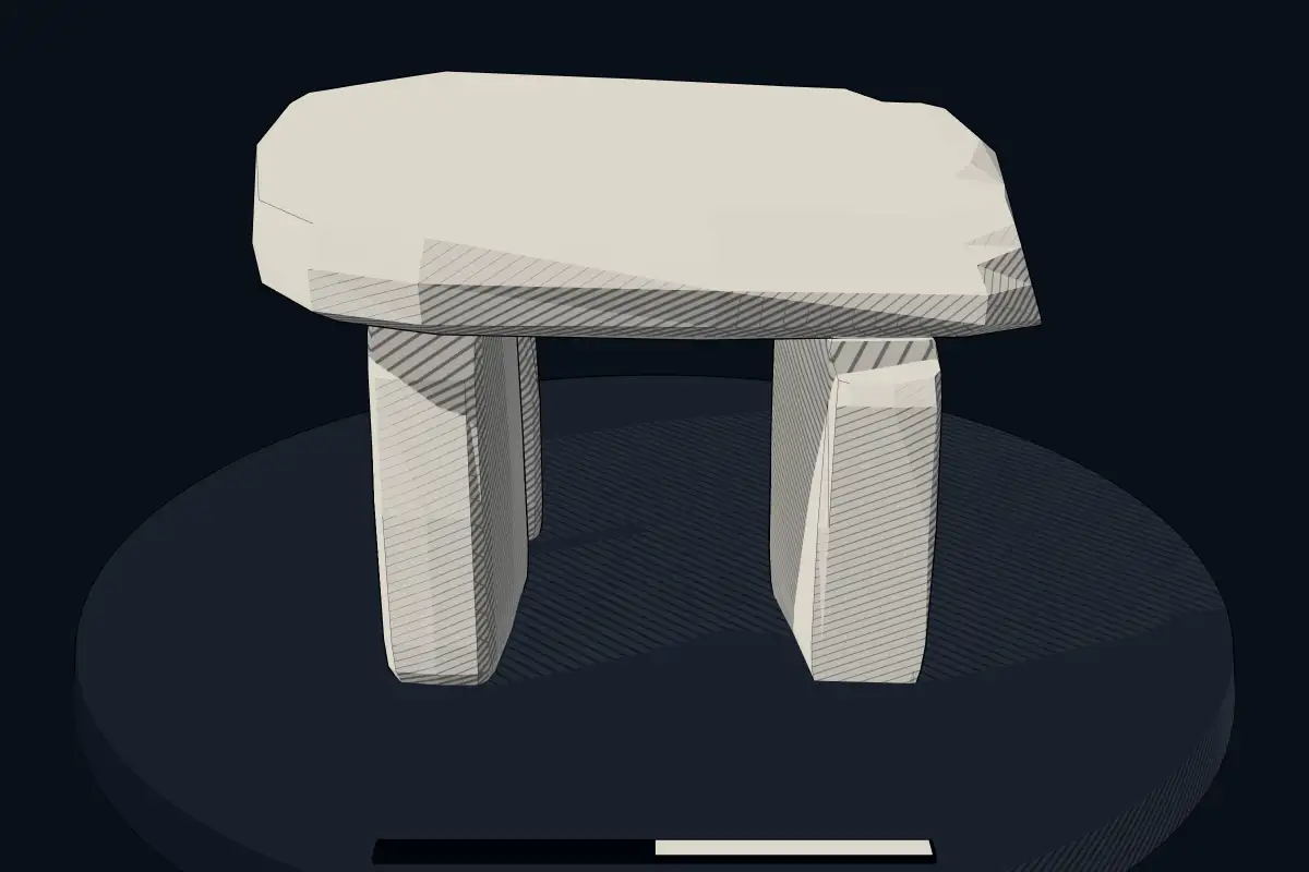
The reconstruction is ours, not a survey: it shows what a monument of this type looks like, at the size the record gives for this one.
Photographs
3 photographs, each with its author and licence
More photographs


Lore
Evidence & Lore
What the sources actually support — and, kept apart, what has been claimed.
What the evidence supports
Dates
Est. 4000–3000 BCEHow this date was established: Type comparisonTypical range for dolmens in France; this site has not been dated itself. Most dolmens date from the Late Neolithic period (4000-3000 BCE).Source for this date
Where it stands
France
The pin marks the monument itself — its exact point.
- Coordinates
- 48°02′48″ N, 2°15′30″ WFor a GPS or map app: 48.04675, -2.25829
Access is as our sources describe it; we have not visited the site to check.
Nearby
The closest sites in the Atlas, by straight line.
 Jardin aux Moines5000–3000 BCE
- MegalithSteinkiste von La Guette4500–3300 BCE
 Hotié de Viviane4000–1200 BCE
 Tombeau des Géants4500–3300 BCE
- Gallery grave (allée couverte)Allée couverte von Orgeril4500–3300 BCE
 Butte von Tiot5000–3000 BCE
 Alignements de la Prise de Comper2800–1800 BCE
- MegalithAllée couverte du tombeau des Anglais4500–3300 BCE


Sources
Every record behind this page, with the link it came from.
2 sources behind this page
- 01Wikidata Q108337640wikidata.org
- 02Source for this dateen.wikipedia.org
Image files
Report a correctionWrong date, name, photograph or source? Tell us and it will be put right.
Lore, kept apart
Legends and claims
These are stories and claims reported by the sources. They are not evidence, and they never stand in for the dating above.
- Tradition
Selon la tradition, les pierres auraient été transportées sur place par une fée ou la sainte Vierge, une sous chaque bras, et la troisième sur son dos, qui en tombant au sol se ficha verticalement dans le sol.
Source
Around this place
The ten nearest sites, by compass
- Jardin aux Moines3.8 km SW
- Steinkiste von La Guette4.9 km S
- Hotié de Viviane5.2 km S
- Tombeau des Géants6.2 km S
- Allée couverte von Orgeril6.6 km SE
- Butte von Tiot6.9 km S
- Alignements de la Prise de Comper7.3 km NE
- Allée couverte du tombeau des Anglais9.9 km NE
- roche Trébulente11 km NE
- Tombeau de Merlin11 km E
Credit
Text, licence and sources
Adapted from the Wikipedia article "Dolmen des Pierres Gouffier" (French), licensed CC BY-SA 4.0; authors are listed in the page history. Reused under CC BY-SA 4.0. Read on Wikipedia · Edit history and authors