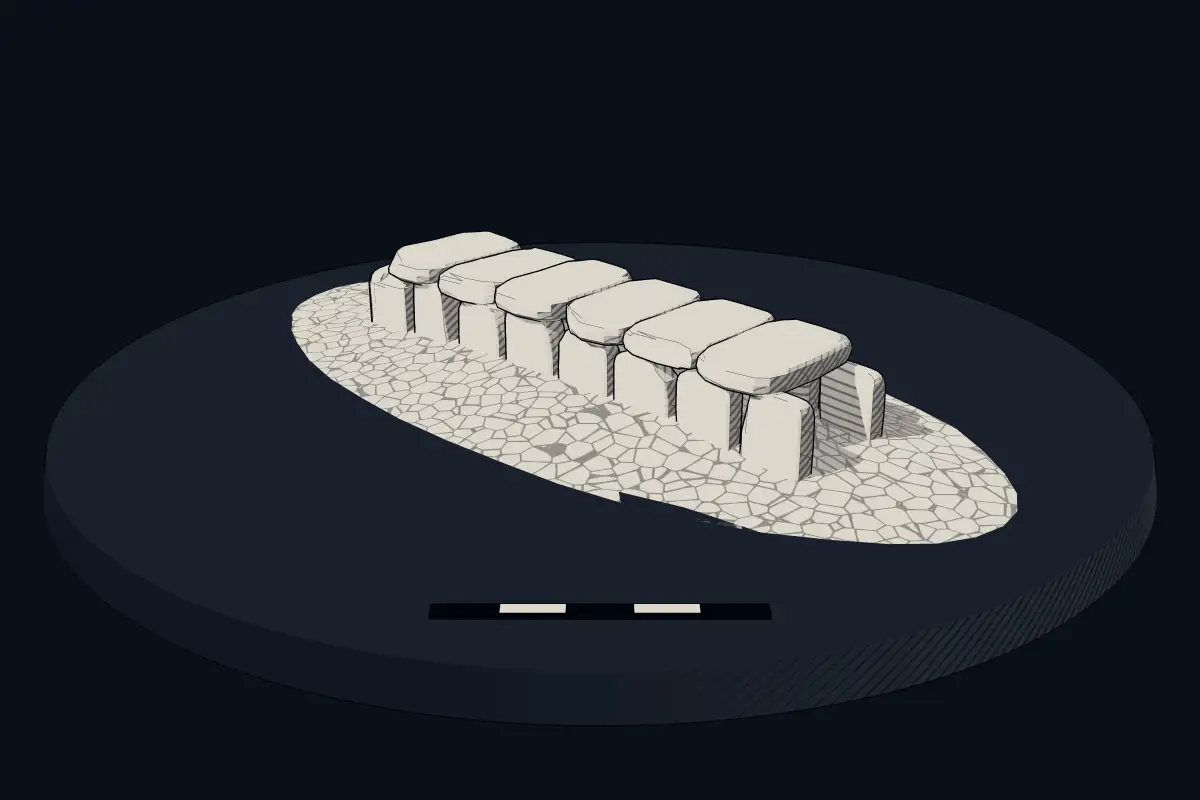
Gallery grave (allée couverte)
Allée couverte von Orgeril
DatedEst. 4500–3300 BCE
No licensed photograph yetWe have no photograph we may publish for this site, so the interpretive 3D view leads instead.
Overview
About this site
Overview
The Allée couverte de l'Orgeril is a gallery grave (allée couverte) in the forest of Paimpont, west of Paimpont in the département of Ille-et-Vilaine, Brittany, France, close to the boundary with the département of Morbihan. It was discovered in the 1980s and in 1988 was classified as a gallery grave of the final Neolithic. The archaeologist Jacques Briard dates it between 2500 and 2000 BC.
Read on Wikipedia2 min readCC BY-SA 4.0
Where it sits in time
The site's dated range, placed against world reference points.
The scale is logarithmic: each step to the left is about ten times older than the last.
Article
Allée couverte von Orgeril
Near the village of Orgeril, three kilometres south-west of Paimpont, in the southern part of the forest, lie the remains of a gallery oriented north-south.
DescriptionSources for this section
- Wikipedia (German): Allée couverte von OrgerilCC BY-SA 4.0
Sources for this section
- Wikipedia (German): Allée couverte von OrgerilCC BY-SA 4.0
Near the village of Orgeril, three kilometres south-west of Paimpont, in the southern part of the forest, lie the remains of a gallery oriented north-south. The end slab at the northern end survives: a block of slate 1.2 m wide at the base and 1.25 m high. About 6.0 m from it are three stones of the west wall, and 7.0 m away is a slab measuring 2.65 × 1.0 m. A central pit is evidence of a robbers' dig.
SettingSources for this section
- Wikipedia (German): Allée couverte von OrgerilCC BY-SA 4.0
Sources for this section
- Wikipedia (German): Allée couverte von OrgerilCC BY-SA 4.0
The gallery stands at the end of an outcrop of purple slate within Armorican sandstone. It lies in the Haute-Forêt du Paimpont together with the dolmen of Noës Ridelles, which was discovered in 2014. According to Bernard Bigot, the galleries of Orgeril and of Le Rocher near Concoret document the existence of megalithic monuments on the edge of the legendary forest of Brocéliande, whereas they are absent from the higher parts of the forest.
ContextSources for this section
- Wikipedia (German): Allée couverte von OrgerilCC BY-SA 4.0
Sources for this section
- Wikipedia (German): Allée couverte von OrgerilCC BY-SA 4.0
A gallery grave is a megalithic tomb built mainly in the Neolithic in which the main gallery is entered directly, with no antechamber or passage in front. Monuments of this kind may be covered with an earthen mound or a cairn. According to the archaeologist T. Douglas Price, gallery graves were a form of community burial site, and those placed in them were most likely members of the same family or hamlet.
Tradition and region
About this kind of monument
Gallery graves (allées couvertes)
A gallery grave is a megalithic tomb built mainly in the Neolithic in which the main gallery is entered directly, with no antechamber or passage in front. The French term is allée couverte, "covered alley". There are at least four major types: complex, transepted, segmented and wedge-shaped, and they may be covered with an earthen mound or a cairn.
According to the archaeologist T. Douglas Price, the gallery grave was a form of community burial site. Those placed in it were most likely members of the same family or hamlet, and the burial probably served to reinforce community. Gallery graves are found at sites in the Loire valley of France, in south-west Great Britain and in Ireland, and it is thought that the builders had cultural links with one another.
In Germany the Wartberg culture of northern Hesse, southern Lower Saxony and western Thuringia, which lasted from about 3600 to 2800 BCE, built stone gallery graves. In Britain and Ireland the same idea appears in the Irish wedge tombs and the Severn-Cotswold tombs of Wales and south-west England.
Along with the dolmen and passage grave, the gallery grave is the most common megalithic tomb in western Europe. Most were built in the Neolithic, but some date to the Middle and Late Bronze Age. Dating is difficult, since a tomb built in the Late Neolithic or Early Bronze Age may have been reopened and used for burials until the Late Bronze Age.
When visiting, look for the long rectangular chamber and its capstones.
Paraphrased from Wikipedia: Gallery grave, Wikipedia: Allée couverte, Wikipedia: Wartberg culture · CC BY-SA 4.0
From the article
Dated moments in the story
- 2000 BCE
Der Archäologe Jacques Briard datiert sie zwischen 2500 und 2000 v. Chr.
Source - 1988
Die Allée couverte von Orgeril, westlich von Paimpont im Département Ille-et-Vilaine, nahe der Grenze zum Département Morbihan, in der Bretagne in Frankreich wurde in den 1980er Jahren entdeckt und 1988 als endneolithisches Galeriegrab eingestuft.
Source - 2014
Die Allée couverte von Orgeril, die sich am Ende eines Aufschlusses von violettem Schiefer im Armorica-Sandstein befindet, liegt zusammen mit dem 2014 entdeckten Dolmen von Noës Ridelles im Haute-Forêt du Paimpont.
Source
Lore
Evidence & Lore
What the sources actually support — and, kept apart, what has been claimed.
What the evidence supports
Dates
Est. 4500–3300 BCEHow this date was established: Type comparisonTypical range for gallery graves in France; this site has not been dated itself. The gallery graves (allees couvertes) of north-west France belong to the tradition of the Carnac stones which date from 4500-3300 BC.Source for this date
Where it stands
France
The pin marks the monument itself — its exact point.
- Coordinates
- 47°59′49″ N, 2°12′34″ WFor a GPS or map app: 47.99696, -2.20931
Access is as our sources describe it; we have not visited the site to check.
Nearby
The closest sites in the Atlas, by straight line.
- MegalithSteinkiste von La Guette4500–3300 BCE
 Hotié de Viviane4000–1200 BCE
 Tombeau des Géants4500–3300 BCE
 Butte von Tiot5000–3000 BCE
 Jardin aux Moines5000–3000 BCE
 Dolmen des Pierres-Gouffier4000–3000 BCE
 Allée couverte de Roherman4500–3300 BCE
Photo: J. Berthaux, photo éditeur - Bellevue Coëtquidan · CC BY-SA 4.0
 Alignements de la Prise de Comper2800–1800 BCE


Sources
Every record behind this page, with the link it came from.
2 sources behind this page
- 01Wikidata Q124218140wikidata.org
- 02Source for this dateen.wikipedia.org
Report a correctionWrong date, name, photograph or source? Tell us and it will be put right.
Around this place
The ten nearest sites, by compass
- Steinkiste von La Guette3.6 km W
- Hotié de Viviane4.4 km W
- Tombeau des Géants4.5 km W
- Butte von Tiot4.6 km W
- Jardin aux Moines6.5 km NW
- Dolmen des Pierres-Gouffier6.6 km NW
- Allée couverte de Roherman7.9 km S
- Alignements de la Prise de Comper9.1 km N
- Allée couverte du tombeau des Anglais11 km NE
- Tombeau de Merlin11 km NE
Credit
Text, licence and sources
Adapted from the Wikipedia article "Allée couverte von Orgeril" (German), licensed CC BY-SA 4.0; authors are listed in the page history. Reused under CC BY-SA 4.0. Read on Wikipedia · Edit history and authors