DolmenFringe site
Dolmen of Guadalperal
Datedc. 4000–2000 BCE
Photo Pleonr · CC BY-SA 4.0Source file on Wikimedia Commons
Overview
About this site
Overview
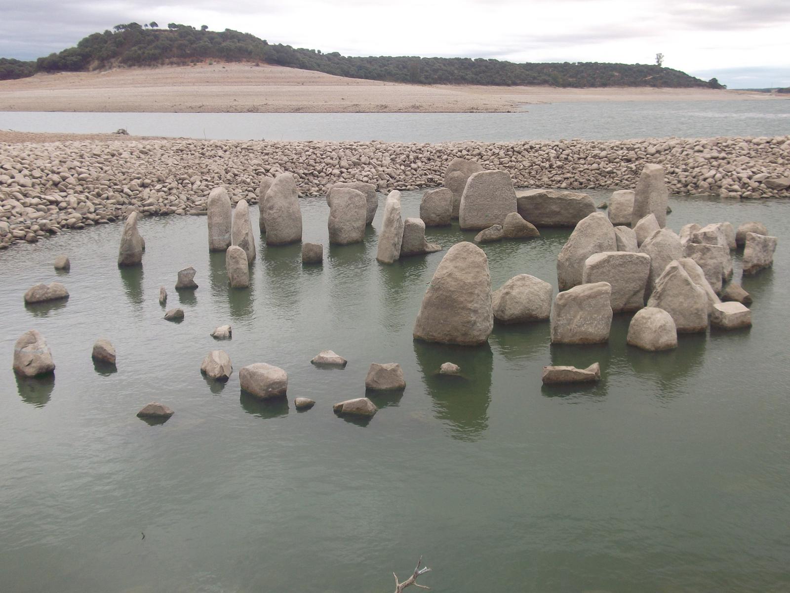
The Dolmen of Guadalperal, also known as the Treasure of Guadalperal and as the Spanish Stonehenge for its resemblance to the English Stonehenge, is a megalithic monument dating from around 3000 BC. It is located in Peraleda de la Mata, in the region of Campo Arañuelo in eastern Extremadura, Spain, and is a bien de interés cultural.
The monument lies within the Valdecañas reservoir in the Tagus River and is only visible when the water level allows it.
Read on Wikipedia3 min readCC BY-SA 4.0
Age sources
How old this site is, and who says so.
Range across all claimsc. 4000–2000 BCE
EstimatedWhat this badge means
A reading of this site: what its style says, or a statement published about it.
- 3050–2950 BCEPublished sourceThe source dates the monument to around 3000 BC. The source gives one year, so it is shown as a 100-year window (D-08).Source: en.wikipedia.org
- 3000 BCEAtlas research notesc. 3000 BCESource: en.wikipedia.org
- 4000–2000 BCEWikidata inceptionSource: wikidata.org
Where it sits in time
The site's dated range, placed against world reference points.
The scale is logarithmic: each step to the left is about ten times older than the last.
Article
Dolmen of Guadalperal
At the end of the corridor, at the entrance of the chamber, stands a menhir about two metres high with carving that might be a snake and several cups.
DescriptionSources for this section
- Wikipedia (English): Dolmen of GuadalperalCC BY-SA 4.0
Sources for this section
- Wikipedia (English): Dolmen of GuadalperalCC BY-SA 4.0
The dolmen consists of 150 granite stones, called orthostats, placed in a vertical arrangement to form an ovoid chamber 5 metres (16 ft) in diameter. They are preceded by an access corridor about 21 metres (69 ft) long and 1.4 metres (4.6 ft) wide. The chamber, of the Anta type common in the west of the Iberian Peninsula, consists of 140 stones and was covered with a mound of earth and gravel; it is surrounded by another circular ring that contained the upper mound.
At the end of the corridor, at the entrance of the chamber, stands a menhir about two metres high with carving that might be a snake and several cups. According to the latest research, its elongated and wavy engraving is believed to be a representation of the Tagus River as it passes through the area. These figures may have served as protection for the site.
ArchaeologySources for this section
- Wikipedia (English): Dolmen of GuadalperalCC BY-SA 4.0
Sources for this section
- Wikipedia (English): Dolmen of GuadalperalCC BY-SA 4.0
The monument was discovered in 1926 during a research and excavation campaign led by the German archaeologist Hugo Obermaier between 1925 and 1927. It could have been a solar temple and also have been used as a burial enclave. Roman remains found there, a coin, ceramic fragments and a grinding stone, indicate that at that time it was safely preserved from looting. Eleven axes, ceramics, flint knives and a copper punch were found in a nearby dump. A settlement dating to the time of construction was also found, which presumably housed the builders; Obermaier discovered houses, charcoal and ash stains, pottery, mills and stones to sharpen axes.
ConservationSources for this section
- Wikipedia (English): Dolmen of GuadalperalCC BY-SA 4.0
Sources for this section
- Wikipedia (English): Dolmen of GuadalperalCC BY-SA 4.0
In 1963 construction of the Valdecañas reservoir inundated the monument, and it is visible only when water levels are low. Drought conditions in the last decade have exposed it in several summers. The inundation has caused irreparable damage by eroding the stones and their engravings. Obermaier's team made reproductions of the engravings, which were published in 1960 by the German archaeologists Georg and Vera Leisner. The association Raices de Peraleda is requesting the monument's recovery because of the deterioration observed. The structure was seen fully for the first time in 50 years in July 2019, when a NASA satellite photograph taken during a drought revealed its 150 stones.
Tradition and region
About this kind of monument
Dolmens of Andalusia, Extremadura and Galicia
Spain has a great many megalithic tombs, and the Atlas's Spanish dolmens run from Andalusia in the south to Galicia in the north-west. The finest are at Antequera in Andalusia, where the Dolmen of Menga, dated to about 3750 to 3650 BCE, is among the largest ancient megalithic structures in Europe. It is 27.5 metres long, 6 metres wide and 3.5 metres high, built with thirty-two megaliths, the largest weighing about 180 tonnes. After the chamber was finished it was covered with soil and built up into the hill seen today; when it was opened in the nineteenth century archaeologists found the skeletons of several hundred people. The Dolmen of Viera stands 70 metres away, and the tholos of El Romeral lies about 4 kilometres off; the three were inscribed as the Antequera Dolmens Site, a UNESCO World Heritage Site, in 2016.
In the south-west, the Dolmen de Soto at Trigueros in Huelva province is a Neolithic tomb estimated to date between 3000 and 2500 BCE, one of about 200 Neolithic burial sites in the province. It was found in 1922 when its owner, Armando de Soto Morillas, wanted to build a house; the German archaeologist Hugo Obermaier found eight bodies in a fetal position with artefacts, and its engraved and painted uprights have been studied more recently.
In Galicia and Portugal a dolmen is an anta, and in Catalan-speaking areas dolmens have folk names such as cova (cave), caixa (crate or coffin), taula (table) and arca (chest). These names are tradition: they record what people made of the monuments, not what they were built for.
When visiting Menga, look at the great capstones from inside the corridor, and at the way the mound was built up over the chamber.
Paraphrased from Wikipedia: Dolmen of Menga, Wikipedia: Dolmen of Viera, Wikipedia: Antequera Dolmens Site, Wikipedia: Dolmen de Soto, Wikipedia: Dolmen · CC BY-SA 4.0
From the article
Dated moments in the story
- 3000 BCE
The Dolmen of Guadalperal, also known as the Treasure of Guadalperal and as the Spanish Stonehenge for its resemblance to the English Stonehenge, is a megalithic monument dating from around 3000 BC.
Source - 1926
The monument was discovered in 1926, during a research and excavation campaign led by the German archaeologist Hugo Obermaier between 1925 and 1927. It could have been a solar temple, and also been used as a burial enclave.
Source - 1960
Hugo Obermaier's team made reproductions of the engravings, which were published in 1960 by German archaeologists Georg and Vera Leisner.
Source - 1963
In 1963, construction of the Valdecañas reservoir inundated the monument; and thus, it is only visible when water levels are low.
Source - 2019
The structure was seen fully for the first time in 50 years in July 2019, when a NASA satellite photograph during a drought revealed its 150 stones.
Source
See it in 3D
An interpretive reconstruction of the monument, standing on the real ground at its exact point, under the sun for that place and season. Drag to look around it.
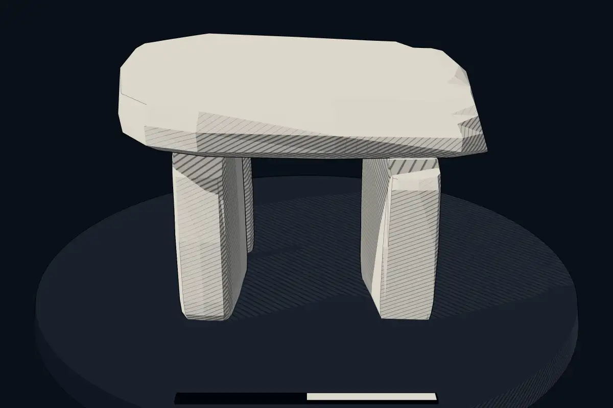
The reconstruction is ours, not a survey: it shows what a monument of this type looks like, at the size the record gives for this one.
Photographs
6 photographs, each with its author and licence
More photographs
Lore
Evidence & Lore
What the sources actually support — and, kept apart, what has been claimed.
What the evidence supports
Dates
3050–2950 BCEHow this date was established: Stated by the sourceThe source dates the monument to around 3000 BC. The source gives one year, so it is shown as a 100-year window (D-08).Source for this date
Measured facts
- Mainstream position
- The source describes the dolmen as a megalithic monument with an ovoid granite chamber, access corridor, and original earth-and-gravel covering.Source: Mainstream position
- Location
- Peraleda de la Mata, eastern Extremadura, SpainSource: Location
- Total stones
- 150 granite orthostatsSource: Total stones
- Chamber
- ovoid, 5 metres in diameterSource: Chamber
- Access corridor
- about 21 metres long and 1.4 metres wideSource: Access corridor
- Discovery
- 1926Source: Discovery
- Reservoir inundation
- 1963Source: Reservoir inundation
- Inception
- 4000s BCE, 2000s BCESource: Inception
- Heritage designation
- bien de interés culturalSource: Heritage designation
Alternative claims
Alternative claims about this site, kept in their own block and labelled with where they stand.
The monument may have served as a solar temple as well as a burial enclave.
UntestedSource for this claim: The monument may have served as a solar temple as well as a burial enclave.
Where it stands
Spain
The pin marks the monument itself — its exact point.
- Coordinates
- 39°50′09″ N, 5°24′16″ WFor a GPS or map app: 39.83574, -5.40448
Access is as our sources describe it; we have not visited the site to check.
Nearby
The closest sites in the Atlas, by straight line.


_Guadalperal_in_2019_(flooded)._B)_Azut%C3%A1n_during_excavation_(not_flooded)._C)_Area_of_Guadancil_1_in_2012_(flooded)._D)_Dolmen_of_Navalc%C3%A1n_during_excavation_(flooded)._40494_2021_590_Fig3_HTML.webp)


Sources
Every record behind this page, with the link it came from.
3 sources behind this page
- 01Wikidata Q20170929wikidata.org
- 02Fringe claim sourceen.wikipedia.org
- 03Wikipedia (en)en.wikipedia.org
Image files
- Dolmen Guadalperal verano 2012.jpgPleonrCC BY-SA 4.0
- Dolmen Guadalperal Verano 2019.jpgPleonrCC BY-SA 4.0
- Number of days that its location have been emerged between 1970 and 2019. Historic data - Tagus River Hydrographic authority. 40494 2021 590 Fig10 HTML.webpCerrillo-Cuenca, E., de Sanjosé Blasco, J.J., Bueno-Ramírez, P. et al. Emergent heritage: the digital conservation of archaeological sites in reservoirs and the case of the Dolmen de Guadalperal (Spain). Herit Sci 9, 114 (2021).CC BY-SA 4.0
- Mentioned megaliths - A) Guadalperal in 2019 (flooded). B) Azután during excavation (not flooded). C) Area of Guadancil 1 in 2012 (flooded). D) Dolmen of Navalcán during excavation (flooded). 40494 2021 590 Fig3 HTML.webpCerrillo-Cuenca, E., de Sanjosé Blasco, J.J., Bueno-Ramírez, P. et al. Emergent heritage: the digital conservation of archaeological sites in reservoirs and the case of the Dolmen de Guadalperal (Spain). Herit Sci 9, 114 (2021).CC BY-SA 4.0
- Orthoimage of Dolmen de Guadalperal, images taken during September 2019. The image has been composed using the procedures described in this paper. 40494 2021 590 Fig1 HTML.webpCerrillo-Cuenca, E., de Sanjosé Blasco, J.J., Bueno-Ramírez, P. et al. Emergent heritage: the digital conservation of archaeological sites in reservoirs and the case of the Dolmen de Guadalperal (Spain). Herit Sci 9, 114 (2021).CC BY-SA 4.0
- The main architectural parts of the Guadalperal dolmen (Spain) described in the text on an aerial image of the year 2019. 40494 2021 590 Fig4 HTML.webpCerrillo-Cuenca, E., de Sanjosé Blasco, J.J., Bueno-Ramírez, P. et al. Emergent heritage: the digital conservation of archaeological sites in reservoirs and the case of the Dolmen de Guadalperal (Spain). Herit Sci 9, 114 (2021).CC BY-SA 4.0
Report a correctionWrong date, name, photograph or source? Tell us and it will be put right.
Lore, kept apart
Legends and claims
These are stories and claims reported by the sources. They are not evidence, and they never stand in for the dating above.
- Tested: not supported
The monument may have served as a solar temple as well as a burial enclave.
Source
Around this place
The ten nearest sites, by compass
Credit
Text, licence and sources
Adapted from the Wikipedia article "Dolmen of Guadalperal" (English), licensed CC BY-SA 4.0; authors are listed in the page history. Reused under CC BY-SA 4.0. Read on Wikipedia · Edit history and authors
- Wikipedia (English): Dolmen of GuadalperalCC BY-SA 4.0
- Wikidata Q20170929CC0
- Fringe claim sourceCC BY-SA 4.0