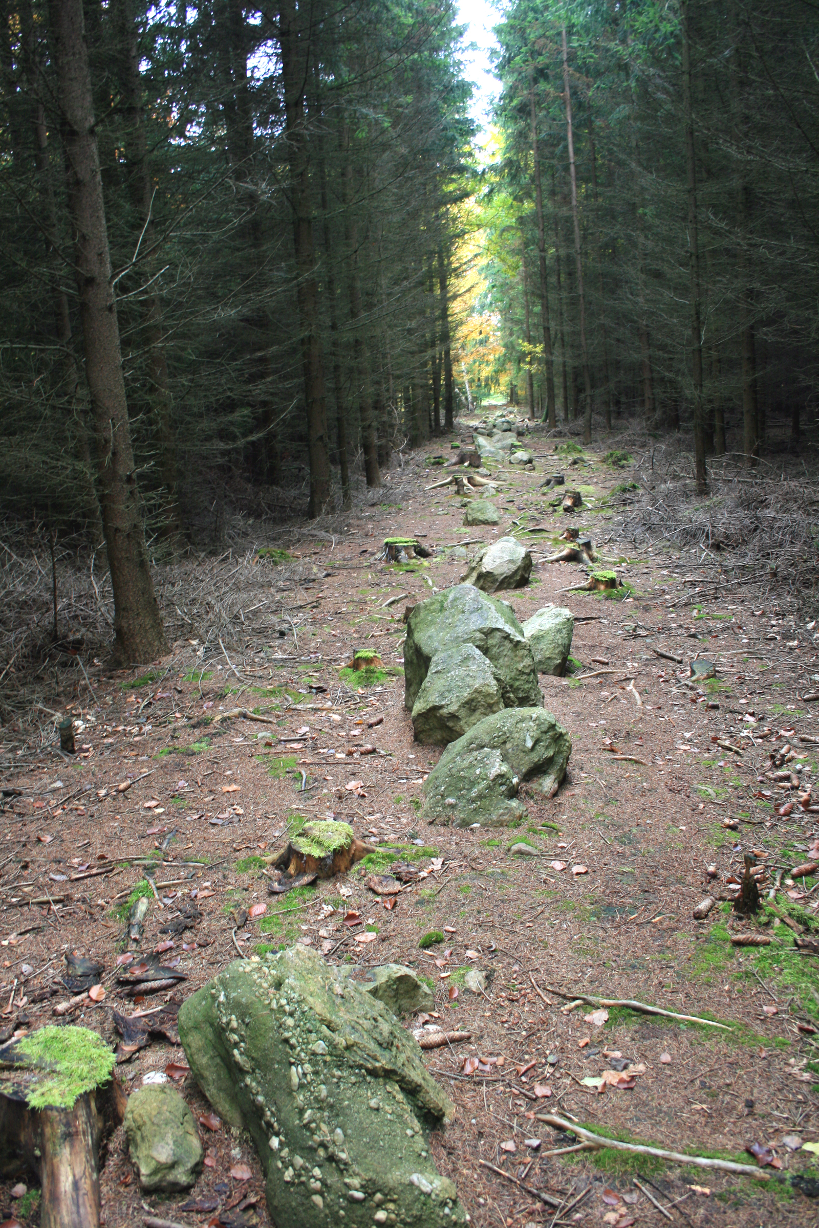
Kounovské řady
Photo Karelj · Public domainSource file on Wikimedia Commons
Overview
About this site
What the sources say
Kounovské řady is a stone row recorded in Czech Republic. Its entries are Wikidata item Q37180000; the position in the catalogue is 50.2251° N, 13.6935° E.
Built from structured records, not from an articleSources and licences
The full article
About Kounovské řady
This kind of monument hereSources for this section
- en.wikipedia.orgCC BY-SA 4.0
- en.wikipedia.orgCC BY-SA 4.0
- en.wikipedia.orgCC BY-SA 4.0
- en.wikipedia.orgCC BY-SA 4.0
Sources for this section
- en.wikipedia.orgCC BY-SA 4.0
- en.wikipedia.orgCC BY-SA 4.0
- en.wikipedia.orgCC BY-SA 4.0
- en.wikipedia.orgCC BY-SA 4.0
A stone row, or stone alignment, is a line of megalithic standing stones set at intervals along a common axis, or several axes, usually dating from the later Neolithic or Bronze Age. Three or more aligned stones can make a row. Rows may be single or grouped, and range from a few metres to several kilometres long, with stones up to about 2 metres tall, though most are smaller. Archaeologists treat each row as a discrete feature, and the word "alignment" means only that the stones line up with each other, not that they point to anything. The full article, “Stone rows and alignments”, follows below under About this kind of monument.
Dating
This site is undated in the open records the Atlas draws on, and the Atlas does not guess a date for it. Where a regional range exists for this kind of monument it is given in the notes on this page, as background and not as a date for this site.
Landscape and neighbours
The catalogue holds no other site within 10 km, so this one stands alone in its surroundings. The nearest is Zakletý mnich, 10.5 km to the north. In Czech Republic, 1 of the 7 catalogued sites are classed as stone row.
The closest catalogued sites are Zakletý mnich (10.5 km north, menhir); Menhir v Selibicích (14.4 km north-west, menhir); Zakletá dívka (15.4 km north-west, menhir); Kamenný kruh v Zichovci (17.5 km east, menhir). The catalogue is assembled from open records and is not complete, so unrecorded monuments may lie closer.
Records and protectionSources for this section
Sources for this section
Wikidata lists the site with the heritage status cultural monument of the Czech Republic. The open records for it are Wikidata (Q37180000), where corrections and further identifiers can be added. Many such sites stand on private land; check local access rules and respect the monument and its surroundings.
How this page was madeSources for this section
Sources for this section
Nothing on this page was written by an AI model: it is assembled by program from Wikidata (CC0), the heritage register named above and the regional article “Stone rows and alignments”, written for the Atlas from the Wikipedia articles it cites (CC BY-SA 4.0), with distances and counts calculated from the catalogue coordinates.
Tradition and region
About this kind of monument
Stone rows and alignments
A stone row, or stone alignment, is a line of megalithic standing stones set at intervals along a common axis, or several axes, usually dating from the later Neolithic or Bronze Age. Three or more aligned stones can make a row. Rows may be single or grouped, and range from a few metres to several kilometres long, with stones up to about 2 metres tall, though most are smaller. Archaeologists treat each row as a discrete feature, and the word "alignment" means only that the stones line up with each other, not that they point to anything.
Dartmoor in Devon has some of the best British examples, and its Upper Erme stone row, 3,300 metres long, is the longest on Dartmoor and in fact in the world. A triple stone row stands at Challacombe near the prehistoric settlement of Grimspound. In Caithness, at the Hill o' Many Stanes near Mid Clyth, about 200 upright stones, none more than a metre high, are set out in fan-shaped rows running up the slope; the arrangement is believed to be a relic of the Bronze Age. In his 1971 book Megalithic Lunar Observatories, Alexander Thom argued that the rows were a Bronze Age lunar observatory. That is a hypothesis that remains debated, and not an established fact. At Calanais on Lewis, rows of stones radiate outwards from a circle, forming a cross-shaped plan.
Dating is difficult, because rows are rarely associated with datable deposits; most are given a general Neolithic to Bronze Age range.
When visiting, walk the length of a row and notice how the stones diminish or grow in height, and which landmark lies at either end.
Paraphrased from Wikipedia: Stone row, Wikipedia: Dartmoor, Wikipedia: Hill o' Many Stanes, Wikipedia: Callanish Stones · CC BY-SA 4.0
Photographs
8 photographs, each with its author and licence
More photographs
Where it stands
Czech Republic
The pin marks the monument itself — its exact point.
- Coordinates
- 50°13′30″ N, 13°41′37″ EFor a GPS or map app: 50.22506, 13.69348
Access is as our sources describe it; we have not visited the site to check.
Nearby
The closest sites in the Atlas, by straight line.


Sources
Every record behind this page, with the link it came from.
1 source behind this page
- 01Wikidata Q37180000wikidata.org
Image files
- Kounov kamenné řady 1.jpgKareljPublic domain
- Kounovské řady (04) - Gibon.jpgCzevaCC BY-SA 3.0
- Kounovské řady, odpočívadlo.jpgcs:ŠJůCC BY-SA 3.0
- NS Kounovské řady - zastavení 06 detail.jpgcs:ŠJůCC BY-SA 3.0
- NS Kounovské řady - zastavení 07 detail.jpgcs:ŠJůCC BY-SA 3.0
- Stone Gibbon.jpgVáclav ŠtorekCC BY-SA 4.0
- Kounovske kamenne rady.jpgVáclav ŠtorekCC BY-SA 4.0
- Kounovské kamenné řady1.jpgVáclav ŠtorekCC BY-SA 4.0
Report a correctionWrong date, name, photograph or source? Tell us and it will be put right.
Around this place
The ten nearest sites, by compass
Credit
Text, licence and sources
This page is assembled from open records (Wikidata, CC0; OpenStreetMap, ODbL) and a tradition article paraphrasing Wikipedia (CC BY-SA 4.0). No article exists for this site, and nothing here is written by a model.
- Wikidata Q37180000CC0
- en.wikipedia.orgCC BY-SA 4.0
- en.wikipedia.orgCC BY-SA 4.0
- en.wikipedia.orgCC BY-SA 4.0
- en.wikipedia.orgCC BY-SA 4.0