
Турската куля
Photo Filipov Ivo · CC BY-SA 4.0Source file on Wikimedia Commons
Overview
About this site
Overview
The cromlech at the locality of Turskata kulya (Турската куля), in the Smolyan region, Banite Municipality, Bulgaria, is an ancient cult stone circle and the westernmost monument of its type in the Western Rhodopes.
It has a diameter of 15 m and is dated in general terms to the first half of the first millennium BC. It has been recorded in field survey but not excavated.
Read on Wikipedia3 min readCC BY-SA 4.0
Article
Турската куля
SettingSources for this section
- Wikipedia (Bulgarian): Турската куляCC BY-SA 4.0
Sources for this section
- Wikipedia (Bulgarian): Турската куляCC BY-SA 4.0
The locality lies 1,5 km north of the hamlet of Bachvata, part of the village of Planinsko, near the boundary of Banite Municipality with Asenovgrad Municipality (Plovdiv Province), between the villages of Mostovo (2 km to the west) and Bor (1,7 km to the east). The monument is close to the Topolovo pass, along the line of the watershed ridge.
Research historySources for this section
- Wikipedia (Bulgarian): Турската куляCC BY-SA 4.0
Sources for this section
- Wikipedia (Bulgarian): Турската куляCC BY-SA 4.0
The site was found in 2007 during field survey by Assoc. Prof. Dr Ivan Hristov. Its date is placed in general terms in the first half of the first millennium BC.
The cromlech stands on the northern side of the peak of Turskata kulya and has a diameter of 15 m.
DescriptionSources for this section
- Wikipedia (Bulgarian): Турската куляCC BY-SA 4.0
Sources for this section
- Wikipedia (Bulgarian): Турската куляCC BY-SA 4.0
The cromlech stands on the northern side of the peak of Turskata kulya and has a diameter of 15 m. It was built of massive rectangular stone blocks set into the ground around a low rock. The west side is best preserved, with ten of the blocks surviving, and the stones rise to 0,80 m above the surface. Pottery of the first century BC was found near the centre of the structure.
The monument is not maintained and is overgrown with vegetation, but parts of it are visible above ground.
ContextSources for this section
- Wikipedia (Bulgarian): Турската куляCC BY-SA 4.0
Sources for this section
- Wikipedia (Bulgarian): Турската куляCC BY-SA 4.0
Although registered in field survey and not studied by excavation, the circle has parallels among cult monuments of the nearby Eastern Rhodope region. The closest in form and position is the cromlech at Dolni Glavanak, Haskovo region, which likewise shows an internal diameter of 10 m outlined by set stones of similar size. It is very probable that the arc of stones at Turskata kulya was interrupted on the south-east. The monument is undoubtedly connected with the nearby sanctuaries of Belintash, In kaya, Haydut kaya, Kaz kaya (Momin kamak) and Karadzhov kamak.
The sanctuaries in this part of the Rhodope Mountains lie in an area that was a kind of boundary between ethnic territories in antiquity. One covers the Eastern Rhodopes, held by the Odrysians; the other, the higher parts of the mountain, is associated in written sources with the ethnonym of the Thracian tribes of the Satrae and the Bessi. According to Hristov, the watershed ridge running south from the Topolovo pass can be taken as the limit of distribution of rock-cut trapezoidal niches and of specific megalithic monuments in the Rhodopes.
The engineer Lyubomir Tsonev holds that the structure should be classed as a megalith-like stone circle rather than a classic cromlech, because it is formed not of widely spaced column-like menhirs set in a circle but of huge slabs set vertically in a circle and leaning on one another along their side edges.
Tradition and region
About this kind of monument
Stone circles in other regions
Stone circles are found far beyond their north-western European heartland. The most famous Asian example is the Ōyu Stone Circles in Kazuno, Akita Prefecture, in northern Japan, a late Jōmon period site of about 2000 to 1500 BCE. It consists of two large stone circles built on an artificially flattened plateau on the left bank of the Ōyu River. The site was discovered in 1931, excavated in detail in 1946 and in 1951 to 1952, and designated a Special National Historic Site in 1956. Each circle is made of rounded river stones brought from a river about 7 kilometres away, set in two concentric rings. The larger, called Manza, is the largest stone circle found in Japan; its clusters of stones have been read as a sundial pointing to the summer solstice sunset.
The word cromlech is also applied to large stone circles such as those in Odry in Poland and among the Carnac stones in Brittany, and in many languages, including Azerbaijani, Armenian, Greek, Indonesian, Italian and Spanish, it is the usual term for a megalithic stone circle. Odry is the Polish cromlech. Elsewhere in Europe the Atlas has small numbers of circles in the Czech Republic, Bulgaria and Germany. Some structures are called stone circles for historic reasons or by mistake, so labels need care. The Senegambian stone circles of West Africa have their own article.
Often similar structures are called stone circles by historic habit or by mistake, and the name alone does not show that a ring is prehistoric. The Atlas does not guess, and gives each circle the range of the culture it belongs to.
When visiting, compare the circle with the landscape, and look at what is visible from its centre.
Paraphrased from Wikipedia: Ōyu Stone Circles, Wikipedia: Stone circle, Wikipedia: Cromlech · CC BY-SA 4.0
From the article
Dated moments in the story
- 2007
Археологическият обект е открит в рамките на теренно проучване от доц. д-р Иван Христов през 2007 г. Датировката на мегалитното съоръжение е отнесена най-общо към първата половина на І хил. пр. Хр.
Source
See it in 3D
An interpretive reconstruction of the monument, standing on the real ground at its exact point, under the sun for that place and season. Drag to look around it.
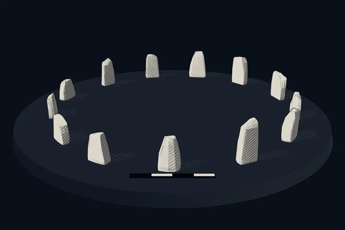
The reconstruction is ours, not a survey: it shows what a monument of this type looks like, at the size the record gives for this one.
Photographs
1 photograph, each with its author and licence
Where it stands
Bulgaria
The pin marks the monument itself — its exact point.
- Coordinates
- 41°49′50″ N, 24°59′49″ EFor a GPS or map app: 41.83050, 24.99690
Access is as our sources describe it; we have not visited the site to check.
Nearby
The closest sites in the Atlas, by straight line.


Sources
Every record behind this page, with the link it came from.
1 source behind this page
- 01Wikidata Q20499194wikidata.org
Image files
- Turskata kulya BG.jpgFilipov IvoCC BY-SA 4.0
Report a correctionWrong date, name, photograph or source? Tell us and it will be put right.
Around this place
The ten nearest sites, by compass
Credit
Text, licence and sources
Adapted from the Wikipedia article "Турската куля" (Bulgarian), licensed CC BY-SA 4.0; authors are listed in the page history. Reused under CC BY-SA 4.0. Read on Wikipedia · Edit history and authors
- Wikipedia (Bulgarian): Турската куляCC BY-SA 4.0
- Wikidata Q20499194CC0