
Прав камин
Photo Filipov Ivo · CC BY-SA 4.0Source file on Wikimedia Commons
Overview
About this site
What the sources say
Прав камин (Прав каминь) е мегалитно светилище, разположено на около 500 m северно от скално-култовия комплекс Градище, село Долно Дряново, община Гърмен, България.
Article in BulgarianRead on Wikipedia5 min readCC BY-SA 4.0
The full article
Прав камин: the whole story
In briefSources for this section
- Wikipedia (Bulgarian): Прав каминCC BY-SA 4.0
Sources for this section
- Wikipedia (Bulgarian): Прав каминCC BY-SA 4.0
Прав камин, also called Прав каминь, is a megalithic sanctuary about 500 m north of the rock-cult complex Градище near the village of Долно Дряново in Garmen municipality, Bulgaria. It is easily reached about 250 meters left of the road Гърмен - Сатовча, shortly after Долно Дряново, and stands immediately above the Градище historical and landscape park.
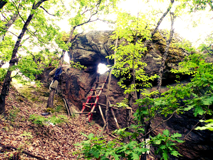
The sanctuary consists of monolithic stone blocks arranged in three distinct groups. Natural blocks on the left and right form a dromos leading to a P-shaped group with an opening of 0.60 m. Beyond it lies a stone platform with a natural layer of 0.30 m humus. On the left is an imposing megalith about 3.80 m high, marked by visible traces of burning and shaped to resemble a human head, with eyes, mouth, a natural nose, a cap-like form, and a pedestal. Scarcity of lichen on worked areas supports the presence of deliberate secondary shaping.
The site was discovered in 2005 by Тодор Узунов of „САТО“. In 2007 he made drawings and reported the location to the Inspectorate under the Ministry of Culture, keeping it publicly undisclosed for several years because it could not be protected from treasure hunters. Press reports were followed by several further incursions. Uзунов regarded the monument as an integral part of the complex „Градище“ and its highest point; a modern road separates them, although both stand on the same rocky ridge.
Ceramic finds found in the area led Узунов to place the beginning of the ridge’s ritual use in the Chalcolithic and its later structural additions in the Early Iron Age. Offerings pits in the P-shaped group and a quern exposed after treasure-hunter damage indicate that rites were performed on the site. In the wider Bulgarian tradition, rocks were cut, carved, and used as sanctuaries for thousands of years, and the Thracians reused many such places.
No English Wikipedia article exists for it; the full text below is the Bulgarian article "Прав камин", shown in the original language.
Summary in EnglishSources for this section
- Wikipedia (Bulgarian): Прав каминCC BY-SA 4.0
Sources for this section
- Wikipedia (Bulgarian): Прав каминCC BY-SA 4.0
Прав камин is a megalith (abstract root) in Dolno Dryanovo, Bulgaria. No English Wikipedia article exists for it; the full text below is the Bulgarian article "Прав камин", shown in the original language.
ОткритиеSources for this section
- Wikipedia (Bulgarian): Прав каминCC BY-SA 4.0
Sources for this section
- Wikipedia (Bulgarian): Прав каминCC BY-SA 4.0
Светилището е открито през 2005 година от Тодор Узунов („САТО“ - Сдружение за опазване паметници на културата), който две години по-късно през 2007 г. прави рисунки и подава информация за обекта в Инспектората към МК. Местоположението на обекта не е разгласявано публично няколко поредни години. Сдружение „САТО“ взема такова решение поради невъзможността обектът да се охранява от иманярски набези. Независимо от тези усилия след публикации в пресата са регистрирани няколко подобни посегателства.
Описание и особеностиSources for this section
- Wikipedia (Bulgarian): Прав каминCC BY-SA 4.0
Sources for this section
- Wikipedia (Bulgarian): Прав каминCC BY-SA 4.0
Светилището представлява мегалитно съоръжение от монолитни каменни блокове разположени в три обособени групи. Първата група представлява естествено ситуирани отляво и дясно каменни блокове, образуващи своеобразен подход - дромос, Той води към втората група, която се състои от П-образно разположени блокове, с отвор-проход от 0.60 м., който играе основна роля в провеждането на ритуала и ориентиран в посока - Изток.
След „преминаването“ се излиза на каменна площадка с естествен насип от 0.30 m хумус, образувал се вероятно след излизането на съоръженията от употреба. От лявата страна на площадката се намира импозантен мегалитен блок, също ориентиран на изток с обща височина около 3.80 m. По средата, откъм лицевата му част се наблюдават видими, високи следи от обгаряния, вероятно следствие от обредна дейност.
Според Узунов, този блок не е природен феномен за разлика от многото други примери в страната, а е умишлено, вторично оформен във форма на човешка глава. Видимо наподобени са очи и уста, а за нос е използвана естествена извивка в скалата. Други естествени извивки в горната част на мегалитния блок са оформени като своеобразна шапка, която според Узунов завършва с характерната „кирбазия“ - известна още като фригийска шапка, достатъчно популярна от формата на бронзовите шлемове от с. Плетена, Ковачевица и Сатовча.. В долната част на блока е оформен пиедестал. Вторичната намеса върху скалата се потвърждава от оскъдното количество скален лишей в местата където е обработвана тя - лишеят се възстановява изключително трудно след разрушаване на биологичната му среда.
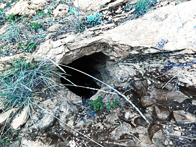
Според него обектът е неделима част от комплексът „Градище“ и е негова най-горна точка. Прокарването на модерен път помежду им ги отделя, но те всъщност имат за основа един и същи скален хребет. Той свързва мегалитът с извършване на ритуали по пречистване, като във връзка с откритата на терена керамика определя неговото начало във времето на енеолита и допълнително конструктивно допълване във времето на ранножелязната епоха.[1] Обредния характер е подкрепен от наличието на ями за приношение върху П-образната скална група, както и част от хромел за стриване на зърно, разкрит на повърхността след иманярските набези., което говори, че тези ритуали са били извършвани на място.
Указания за местоположениетоSources for this section
- Wikipedia (Bulgarian): Прав каминCC BY-SA 4.0
Sources for this section
- Wikipedia (Bulgarian): Прав каминCC BY-SA 4.0
Обектът Прав камин е изключително лесно достъпен. Той се намира на около 250 метра вляво от автомобилния път Гърмен - Сатовча, малко след село Долно Дряново,
точно над Ландшафтно-историческия парк Градище. Прав камен (Прав каминь, м.н.) се намира непосредствено вляво на стария път между селата Долно Дряново и Долен. На главния път, вляво има билборд и няколко указателни табели за мястото поставени по дърветата край пътя.
Вижте същоSources for this section
- Wikipedia (Bulgarian): Прав каминCC BY-SA 4.0
Sources for this section
- Wikipedia (Bulgarian): Прав каминCC BY-SA 4.0
Градище (Долно Дряново)
Кара кая
Каялийските скали
Цареви порти
Скрибина
Таш капи
Али алан
Кара таш
Кози камък (Ковачевица)
Герилица (светилище)
Селанов бук
How this page was madeSources for this section
- Wikipedia (Bulgarian): Прав каминCC BY-SA 4.0
Sources for this section
- Wikipedia (Bulgarian): Прав каминCC BY-SA 4.0
The summary at the top of this page was written by MiniMax-M3 (2026-11-07) from the cited Wikipedia article “Прав камин”, translated from Bulgarian. The numbers in it were checked automatically against the source text. The rest of the page is the article itself, the structured records and computed distances.
Tradition and region
About this kind of monument
Thracian rock sanctuaries of Bulgaria
In the Eastern Rhodope and Strandzha mountains of Bulgaria, rocks have been cut, carved and used as sanctuaries for thousands of years, and the Atlas lists many of them as "megaliths". The Thracians were an Indo-European-speaking people who inhabited large parts of south-eastern Europe in ancient times, including modern Bulgaria, Romania, North Macedonia, northern Greece and European Turkey, and they reused many of the sites. Strandzha has a large concentration of ruins of Thracian sanctuaries, sacrificial altars and dolmens.
Perperikon, in the Eastern Rhodope Mountains 15 kilometres north-east of Kardzhali, is an ancient Thracian city on a rocky hill 470 metres high, thought to have been a sacred place; it is described as the largest megalith ensemble site in the Balkans. In the Middle Ages it served as a fortress. Beglik Tash, a prehistoric rock sanctuary on the southern Black Sea coast north of Primorsko, was reused by Thracian tribes in the Iron Age.
Many of the places listed as megaliths here are natural rock formations. Beglik Tash is a natural rock formation of megaliths of hardened magma, from a volcano of the Mesozoic era; most of the megaliths have traces of carving for Thracian rituals, and there are the remains of a labyrinth and a "Thracian sun-clock" formed of huge stones, as well as a 150-ton rock. It is often hard to tell where nature ends and human work begins.
Dating depends on the finds in the few excavated parts, and most sites are listed with a broad range.
When visiting, look for traces of carving on the rock, and for steps and niches.
Paraphrased from Wikipedia: Thracians, Wikipedia: Perperikon, Wikipedia: Beglik Tash, Wikipedia: Strandzha · CC BY-SA 4.0
Photographs
1 photograph, each with its author and licence
Where it stands
Bulgaria
The pin marks the monument itself — its exact point.
- Coordinates
- 41°35′58″ N, 23°54′46″ EFor a GPS or map app: 41.59940, 23.91270
Access is as our sources describe it; we have not visited the site to check.
Nearby
The closest sites in the Atlas, by straight line.






Sources
Every record behind this page, with the link it came from.
1 source behind this page
- 01Wikidata Q25483615wikidata.org
Image files
Report a correctionWrong date, name, photograph or source? Tell us and it will be put right.
Around this place
The ten nearest sites, by compass
Credit
Text, licence and sources
Text from the Wikipedia article "Прав камин" (Bulgarian), licensed CC BY-SA 4.0; authors are listed in the page history. Reused under CC BY-SA 4.0. Read on Wikipedia · Edit history and authors
- Wikipedia (Bulgarian): Прав каминCC BY-SA 4.0
- Wikidata Q25483615CC0