
Скельские менгиры
Photo Участник panzerturm · CC BY-SA 3.0Source file on Wikimedia Commons

Overview
About this site
What the sources say
Скельские менгиры (крымскотат. Tekli-Tash, Текли-Таш, что означает «поставленный камень») — вертикально поставленные глыбы мраморовидного известняка, памятник археологии бронзового века в селе Родниковое, в 120 метрах к югу от берега Чернореченского водохранилища. Скельские менгиры являются классическими мегалитами, названы по историческому названию села — Скеля. Объект культурного наследия народов Российской Федерации регионального значения.
Article in RussianRead on Wikipedia4 min readCC BY-SA 4.0
The full article
Скельские менгиры: the whole story
In briefSources for this section
- Wikipedia (Russian): Скельские менгирыCC BY-SA 4.0
Sources for this section
- Wikipedia (Russian): Скельские менгирыCC BY-SA 4.0
Скельские менгиры, also known as Tekli-Tash and Текли-Таш, meaning “поставленный камень,” are a group of upright limestone blocks in the village of Родниковое, 120 metres south of the shore of Чернореченского водохранилища. They are a Bronze Age archaeological monument and a regional cultural heritage site of the peoples of the Russian Federation. The name “Скельские менгиры” comes from the former name of the village, Скеля.
The largest central stone rises to 2,8 м and weighs about six tons. Its average cross-section is 1 м x 0,7 м, and its regular shape resembles a modern pyramidal obelisk. The southern stone is lower and broader, measuring about 1,5 м high, 1,2 м wide and 0,55 м thick; it now stands inside the fence of a burial place for Red Army soldiers and partisans of the Великая Отечественная война. Two further stones form the northern side of the group.
The monument was first brought into scholarly circulation by archaeologist Н. И. Репников in 1907. He recorded three menhirs. The third was excavated in the 1960s during water-main construction, while a fourth stone, already fallen in antiquity, was discovered during earthworks. А. А. Щепинский studied the site in 1978, dated its creation to the III — beginning of the II millennium BCE, and proposed that the stones had cult significance.
The third and fourth menhirs were returned to their places on 26 ноября 2010. The central stone is one of the most prominent surviving monuments of this kind in south-eastern Europe, having remained on its original site. Its protection was confirmed on 9 февраля 2017 by Sevastopol government decree 98-ПП, which designated it a regional cultural heritage object.
No English Wikipedia article exists for it; the full text below is the Russian article "Скельские менгиры", shown in the original language.
Summary in EnglishSources for this section
- Wikipedia (Russian): Скельские менгирыCC BY-SA 4.0
Sources for this section
- Wikipedia (Russian): Скельские менгирыCC BY-SA 4.0
Скельские менгиры is a menhir (standing stone) in Rodnikivske, Russia. No English Wikipedia article exists for it; the full text below is the Russian article "Скельские менгиры", shown in the original language.
ИсследованияSources for this section
- Wikipedia (Russian): Скельские менгирыCC BY-SA 4.0
Sources for this section
- Wikipedia (Russian): Скельские менгирыCC BY-SA 4.0
Информацию о Скельских менгирах впервые ввел в научный оборот археолог Н. И. Репников в 1907 году. В частности, он указывает, что менгиров было три. Третий менгир был выкопан в 1960-х годах при прокладке водопровода. Четвёртый менгир, поваленный ещё в древности, был обнаружен во время земляных работ.
Известный крымский археолог А. А. Щепинский, изучавший объект в 1978 году, указывает, что Скельские менгиры — не только самые крупные, но явственные памятники этого рода на территории юго-восточной Европы, которые не потревожены в последующие века и стоят на своем первоначальном месте. Учёный утверждает, что Скельские менгиры имели культовое значение и относит их появление к III — началу II тысячелетия до нашей эры. Таким образом, этим памятникам древности более 4 тысяч лет.
Современное состояниеSources for this section
- Wikipedia (Russian): Скельские менгирыCC BY-SA 4.0
Sources for this section
- Wikipedia (Russian): Скельские менгирыCC BY-SA 4.0
Охраняются Решением исполкома Севастопольского городского Совета депутатов трудящихся «Об утверждении списков памятников истории и культуры города Севастополя по состоянию на 1 июля 1975 года» № 856.
Н. И. Репников оставил зарисовки и описания, что помогло в современное время восстановить первоначальное состояние памятника. По инициативе общественной организации «Туристический актив Крыма», Орлиновский сельский Совет принял решение о возвращении третьего и четвёртого Скельских менгиров на свои места. Работы по установке менгиров выполнены 26 ноября 2010 года.
Большой центральный менгир возвышается на 2,8 м. При размерах в среднем поперечном сечении 1 м х 0,7 м он имеет довольно правильную форму и приближается к типу современного пирамидального обелиска. Вес его составляет около шести тонн. Второй, южный — массивен и приземист, его высота почти в два раза меньше — около 1,5 м, при ширине 1,2 м и толщине 0,55 м. Этот менгир сейчас попал внутрь ограды захоронения воинов Красной армии и партизан Великой Отечественной войны. На северной стороне условного треугольника находятся ещё два камня. Третий представляет собой обломок менгира, высотой только 0,85 м (в поперечном сечении 0,77 м х 0,55 м). Он выкопан в 1960-х годах XX века при прокладке водопровода. Теперь установлен на свое прежнее место. Ещё один, четвёртый найденный поваленным, также установлен вертикально. Все камни находятся в непосредственной близости от Родниковского сельского клуба.
После присоединения Крыма к России статус подтверждён Постановлением Правительства Севастополя «Об отнесении объектов культурного наследия к объектам культурного наследия регионального значения и выявленным объектам культурного наследия» 98-ПП от 9 февраля 2017.
How this page was madeSources for this section
- Wikipedia (Russian): Скельские менгирыCC BY-SA 4.0
Sources for this section
- Wikipedia (Russian): Скельские менгирыCC BY-SA 4.0
The summary at the top of this page was written by MiniMax-M3 (2026-11-07) from the cited Wikipedia article “Скельские менгиры”, translated from Russian. The numbers in it were checked automatically against the source text. The rest of the page is the article itself, the structured records and computed distances.
Tradition and region
About this kind of monument
Menhirs
A menhir, also called a standing stone, orthostat or lith, is a large upright stone placed by humans, typically dating from the European middle Bronze Age, although many are far older. They stand singly or in groups, vary greatly in size, and often taper toward the top. Menhirs are found across Europe, Africa and Asia, with a concentration in Western Europe, notably in Ireland, Great Britain and Brittany. Theories about their purpose remain speculative and include rituals, territorial markers and elements of an ideological system. Some bear engravings, including human figures and symbols, and are often associated with ancient religious ceremonies and burial chambers. Because the great majority are on coasts, islands and peninsulas, it is believed that practitioners of megalithic religions travelled by sea.
Armenia has numerous menhirs known as vishapakar, "dragon stones", which are cigar-shaped, typically 3 to 6 metres tall and often found in the mountains near the sources of rivers or lakes. Many are carved in the shape of a fish. An inscription in Urartian cuneiform on one at the temple of Garni shows that they were made before the Urartian kingdom, before the eighth century BCE, and the earliest are thought to date to the eighteenth to sixteenth centuries BCE.
In Bulgaria several menhirs are known in villages such as Ovcharovo and Pethocladentsi. Standing stones in Indonesia and India are described in their own articles.
Dating is a standing difficulty: standing stones are usually hard to date, since they were raised during many different periods of prehistory. The Atlas gives a broad range and marks it as an estimate.
When visiting, look for the shape and surface of the stone, its setting on a rise or by water, and any carving.
Paraphrased from Wikipedia: Menhir, Wikipedia: List of menhirs, Wikipedia: Statue menhir · CC BY-SA 4.0
See it in 3D
An interpretive reconstruction of the monument, standing on the real ground at its exact point, under the sun for that place and season. Drag to look around it.
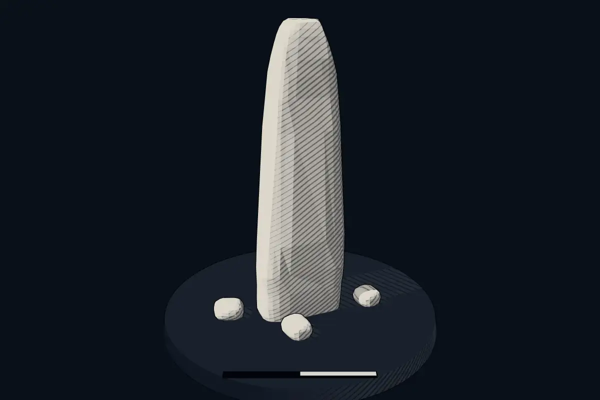
The reconstruction is ours, not a survey: it shows what a monument of this type looks like, at the size the record gives for this one.
Photographs
1 photograph, each with its author and licence
Where it stands
Russia
The pin marks the monument itself — its exact point.
- Coordinates
- 44°27′55″ N, 33°50′56″ EFor a GPS or map app: 44.46528, 33.84879
Access is as our sources describe it; we have not visited the site to check.
Nearby
The closest sites in the Atlas, by straight line.
- Hypogeum (rock-cut)Devlet Saray Mezarlığı
- Megalithic mound (tumulus with integral stones)Yuz-Oba
 Oguz Kurgan
- Hypogeum (rock-cut)Kalekapı Kaya Mezarı
- Megalithic mound (tumulus with integral stones)Tepe Arkası Mevkii Tümülüsü700–50 BCE
- Megalithic mound (tumulus with integral stones)Tınartepe Tümülüsü700–50 BCE
- Hypogeum (rock-cut)Ekinören Kaya Mezarı
- Megalithic mound (tumulus with integral stones)Kabaderesi Tümülüsü700–50 BCE

Sources
Every record behind this page, with the link it came from.
1 source behind this page
- 01Wikidata Q16698273wikidata.org
Image files
Report a correctionWrong date, name, photograph or source? Tell us and it will be put right.
Around this place
The ten nearest sites, by compass
Credit
Text, licence and sources
Text from the Wikipedia article "Скельские менгиры" (Russian), licensed CC BY-SA 4.0; authors are listed in the page history. Reused under CC BY-SA 4.0. Read on Wikipedia · Edit history and authors
- Wikipedia (Russian): Скельские менгирыCC BY-SA 4.0
- Wikidata Q16698273CC0