
Pedra Moirinha
Also known asPedra Moirinha na Rua da Pedra
DatedEst. 2800–1800 BCE
Photo Bextrel · CC BY 4.0Source file on Wikimedia Commons

Overview
About this site
What the sources say
A Pedra Moirinha é um monumento megalítico situado nas imediações da cidade de Portimão, na região do Algarve, em Portugal.
Article in PortugueseRead on Wikipedia5 min readCC BY-SA 4.0
Where it sits in time
The site's dated range, placed against world reference points.
The scale is logarithmic: each step to the left is about ten times older than the last.
The full article
Pedra Moirinha: the whole story
In briefSources for this section
- Wikipedia (Portuguese): Pedra MoirinhaCC BY-SA 4.0
Sources for this section
- Wikipedia (Portuguese): Pedra MoirinhaCC BY-SA 4.0
Pedra Moirinha is a standing stone, or menhir, near the city of Portimão in the Algarve region of Portugal. It stands on Rua da Pedra in the Alfarrobal area, northwest of Portimão, close to the Estrada Nacional 124 and the Algarve railway line. It is also known as Pedra Moirinha na Rua da Pedra.
The menhir is made of nepheline syenite from the Serra de Monchique, about twenty kilometres away. Carlos Teixeira placed it in the category of shaped stones found in megalithic monuments in the Évora region and found evidence of very rough working. When first identified, it stood alone on an outcrop of Miocene limestone. It was later moved because of work on a house, and one end was damaged during the move.
Pedra Moirinha probably dates from the Neo-Chalcolithic period. Its dating is given as 2800 BCE to 1800 BCE, based on a typological estimate. António Rebello da Silva was the first to study it, after alerting the media to its presence. Carlos Teixeira later investigated it more fully and sought its protection. It was classified as an Imóvel de Interesse Público in 1970.
Teixeira argued that the distance from the Serra de Monchique means that moving the stone would have required a considerable group effort. Manuel Bentes proposed instead that it was a rock transported by glaciers, a theory Teixeira strongly criticized. Although Pedra Moirinha was once associated with popular legends and an Islamic origin, it was understood to be a prehistoric monument.
No English Wikipedia article exists for it; the full text below is the Portuguese article "Pedra Moirinha", shown in the original language.
Summary in EnglishSources for this section
- Wikipedia (Portuguese): Pedra MoirinhaCC BY-SA 4.0
Sources for this section
- Wikipedia (Portuguese): Pedra MoirinhaCC BY-SA 4.0
Pedra Moirinha is a menhir (standing stone) in Portimão, Portugal. Wikidata describes it as: Great boulder of nepheline syenite. A typological estimate: 2800 BCE to 1800 BCE. No English Wikipedia article exists for it; the full text below is the Portuguese article "Pedra Moirinha", shown in the original language.
História e descriçãoSources for this section
- Wikipedia (Portuguese): Pedra MoirinhaCC BY-SA 4.0
Sources for this section
- Wikipedia (Portuguese): Pedra MoirinhaCC BY-SA 4.0
O menir é formado por sienito nefelínico, com origem na Serra de Monchique, situada a cerca de vinte quilómetros de distância. O investigador Carlos Teixeira integrou o menir na categoria de pedra talha, encontrada nos monumentos megalíticos na região de Évora. Apresenta provas de ter sido trabalhado, de forma muito rudimentar. Quando foi identificado, encontrava-se isolado, sobre um afloramento de calcário miocénico.
Situa-se na Rua da Pedra, na área do Alfarrobal, a Noroeste da cidade de Portimão, e nas imediações da Estrada Nacional 124 e da linha férrea do Algarve.
Devido à grande distância entre Portimão e Monchique, o seu transporte terá exigido um considerável esforço para os meios disponíveis às povoações pré-históricas, tendo Carlos Teixeira avançado a teoria que terá sido deslocado como parte de um esforço de grupo, método que então era habitual nos trabalhos de interesse comum. Uma teoria alternativa foi apresentada pelo Dr. Manuel Bentes durante um conjunto de conferências sobre o monumento em 1969, organizadas pelo grupo dos Rotários de Portimão, onde afirmou que não era um monumento megalítico, mas um penedo que tinha sido levado desde a serra de Monchique devido ao efeito de glaciares. Manuel Bentes sustentou esta teoria com a presença de vários depósitos detríticos no Barlavento, que segundo a sua interpretação teriam sido formadas por glaciares, apesar de já então se saber que as glaciações quaternárias não tinham chegado à região, tendo o ponto mais meridional que atingiram no território português sido a Serra da Estrela. Esta opinião foi duramente criticada por Carlos Teixeira, que colocou em causa as qualificações do médico em termos de geologia, tendo então explicado que na região não existiam quaisquer vestígios de glaciações, nem depósitos de origem torrencial.
O menir data provavelmente do período neo-calcolítico, apesar da sua denominação, que terá advindo do costume de considerar os monumentos mais antigos como de origem islâmica, tendo figurado em várias lendas populares. Terá sido pela primeira vez estudado pelo Dr. António Rebello da Silva, que alertou a comunicação social da sua presença. Foi depois investigado por Carlos Teixeira, que tinha sido informado pelo Dr. Rodrigo Boto da existência do menir. Carlos Teixeira fez várias diligências para o estudar a fundo e proteger, a primeira ainda antes da Revolução de 25 de Abril de 1974, junto da Câmara Municipal de Portimão, embora sucesso. Um artigo publicado no jornal Correio do Sul em 6 de Fevereiro de 1969 pediu que o menir fosse protegido como Imóvel de Interesse Público, tendo sido oficialmente classificado pelo Ministério da Educação Nacional em 1970. Já no período democrático, escreveu ao Ministro do Comércio, que lhe concedeu dois funcionários da Direcção-Geral de Turismo, além de um subsídio à autarquia para a construção de um monumento integrando o menir, com uma placa informativa. Porém, Carlos Teixeira criticou o monumento, uma vez que foi concebido de forma a deixar o menir deitado, tendo avançado com uma nova proposta onde ficaria de pé, considerando que era uma configuração mais comum para elementos daquele tipo. O monumento acabou por não ser construído, e o menir foi entretanto mudado devido a obras numa vivenda, processo que levou à sua mutilação numa das pontas.
How this page was madeSources for this section
- Wikipedia (Portuguese): Pedra MoirinhaCC BY-SA 4.0
Sources for this section
- Wikipedia (Portuguese): Pedra MoirinhaCC BY-SA 4.0
The summary at the top of this page was written by MiniMax-M3 (2026-11-07) from the cited Wikipedia article “Pedra Moirinha”, translated from Portuguese. The numbers in it were checked automatically against the source text. The rest of the page is the article itself, the structured records and computed distances.
Tradition and region
About this kind of monument
Iberian menhirs
In Spain menhirs of the western European megalithic type are relatively unusual compared with dolmens, but are common sights in the northern half of the country, where at least 500 have been reported. They are particularly common in the Basque Country, Navarre, northern Burgos and Palencia, Cantabria and the Pyrenees, usually standing alone or in small groups (cromlechs) in elevated places. Most appear to date back to the Stone Age. They are not usually associated with burials, though at the Menhir of Cuesta del Molino in Burgos burials were made at least 2,000 years after the menhir was raised. The Arlobi menhir is one of the most recent examples.
Portugal's highest concentration is in the Alentejo, where the Menhir of Meada is the largest on the Iberian Peninsula. The Menhir of Outeiro, near Reguengos de Monsaraz in the district of Évora, is the second largest in Portugal: a granite monolith 5.6 metres high, about a metre across and an estimated eight tonnes. It was found lying on its side in 1969 by Henrique Leonor Pina and José Pires Gonçalves and re-erected about 1970, and was classified as a national monument in 1971. A hollow in its top has been read as a urethra, so that the stone is taken as phallic; that is an interpretation, not a fact.
The Almendres Cromlech near Évora is the largest group of structured menhirs on the Iberian Peninsula, and one of the largest in Europe. It belongs to the "megalithic universe of Évora", with parallels in the Portela de Mogos cromlech. Its beginnings have been put as far back as the sixth millennium BCE, which would make it extremely early, and it was rediscovered in 1966 by Henrique Leonor Pina.
When visiting, look for stones on high ground and note which way they face.
Paraphrased from Wikipedia: Menhir, Wikipedia: Menhir of Outeiro, Wikipedia: Almendres Cromlech, Wikipedia: List of menhirs · CC BY-SA 4.0
From the article
Dated moments in the story
- 1969
Manuel Bentes durante um conjunto de conferências sobre o monumento em 1969, organizadas pelo grupo dos Rotários de Portimão, onde afirmou que não era um monumento megalítico, mas um penedo que tinha sido levado desde a serra de Monchique devido ao efeito de glaciares.
Source - 1974
Carlos Teixeira fez várias diligências para o estudar a fundo e proteger, a primeira ainda antes da Revolução de 25 de Abril de 1974, junto da Câmara Municipal de Portimão, embora sucesso.
Source
See it in 3D
An interpretive reconstruction of the monument, standing on the real ground at its exact point, under the sun for that place and season. Drag to look around it.
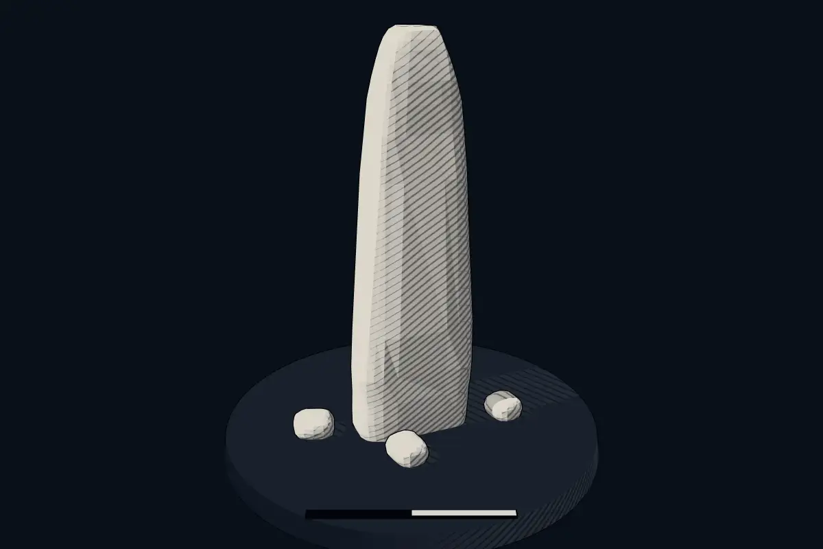
The reconstruction is ours, not a survey: it shows what a monument of this type looks like, at the size the record gives for this one.
Photographs
1 photograph, each with its author and licence
Lore
Evidence & Lore
What the sources actually support — and, kept apart, what has been claimed.
What the evidence supports
Dates
Est. 2800–1800 BCEHow this date was established: Type comparisonTypical range for menhirs in Portugal; this site has not been dated itself. Standing stones are associated with the Beaker people of the European late Neolithic and early Bronze Age c. 2800-1800 BC.Source for this date
Where it stands
Portugal
The pin marks the monument itself — its exact point.
- Coordinates
- 37°08′42″ N, 8°33′12″ WFor a GPS or map app: 37.14487, -8.55332
Access is as our sources describe it; we have not visited the site to check.
Nearby
The closest sites in the Atlas, by straight line.
 Megalithic Monuments of Alcalar4500 BCE–600 CE
- Menhir (standing stone)Sítio arqueológico da Quinta da Queimada2800–1800 BCE
 Menir de Odiáxere2800–1800 BCE
 Menir da Cabeça do Rochedo4000–1000 BCE
- Menhir (standing stone)Menir dos Gregórios ou Pedra dos Cucos2800–1800 BCE
 Menir de Vale Fuzeiros / Horta de Baixo2800–1800 BCE
- Menir da Vilarinha 32800–1800 BCE
- Menir da Vilarinha 22800–1800 BCE


Sources
Every record behind this page, with the link it came from.
2 sources behind this page
- 01Wikidata Q98837482wikidata.org
- 02Source for this dateen.wikipedia.org
Image files
Report a correctionWrong date, name, photograph or source? Tell us and it will be put right.
Lore, kept apart
Legends and claims
These are stories and claims reported by the sources. They are not evidence, and they never stand in for the dating above.
- Tradition
Teixeira argued that the distance from the Serra de Monchique means that moving the stone would have required a considerable group effort.
Teixeira argued that the distance from the Serra de Monchique means that moving the stone would have required a considerable group effort. Manuel Bentes proposed instead that it was a rock transported by glaciers, a theory Teixeira strongly criticized. Although Pedra Moirinha was once associated with popular legends and an Islamic origin, it was understood to be a prehistoric monument.
Source
Around this place
The ten nearest sites, by compass
- Megalithic Monuments of Alcalar6.8 km NW
- Sítio arqueológico da Quinta da Queimada9.3 km W
- Menir de Odiáxere9.7 km W
- Menir da Cabeça do Rochedo15 km W
- Menir dos Gregórios ou Pedra dos Cucos21 km NE
- Menir de Vale Fuzeiros / Horta de Baixo21 km NE
- Menir da Vilarinha 322 km NE
- Menir da Vilarinha 222 km NE
- Menir da Vilarinha 122 km NE
- Anta da Pedreirinha23 km NE
Credit
Text, licence and sources
Text from the Wikipedia article "Pedra Moirinha" (Portuguese), licensed CC BY-SA 4.0; authors are listed in the page history. Reused under CC BY-SA 4.0. Read on Wikipedia · Edit history and authors
- Wikipedia (Portuguese): Pedra MoirinhaCC BY-SA 4.0
- Wikidata Q98837482CC0