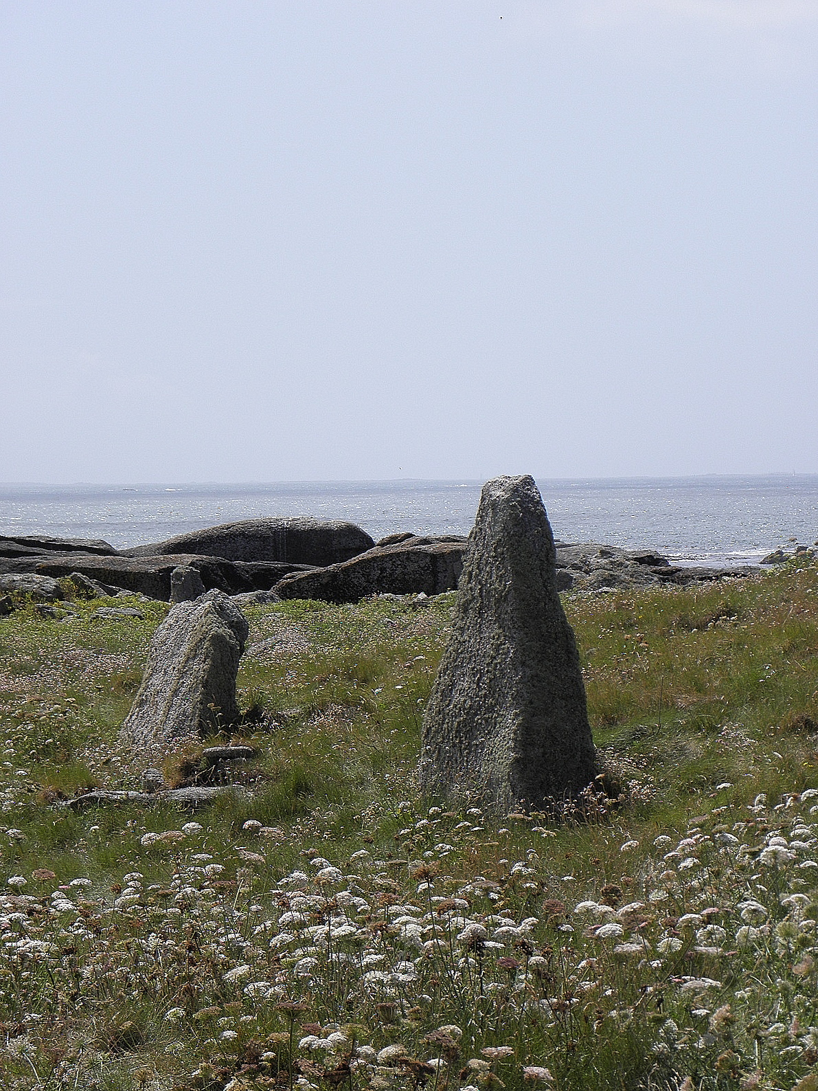
Menhirs of Melon Island
DatedEst. 3470–2760 BCE
Photo GO69 · CC BY-SA 3.0Source file on Wikimedia Commons
Overview
About this site
Overview
The menhirs of the île Melon are a group of four standing stones on the île Melon, in the commune of Porspoder, département of Finistère, France. All are of Aber-Ildut granite, and the island was an important extraction site for this stone. The largest, which once stood 6 m to 7 m high, was dynamited in 1942.
Read on Wikipedia2 min readCC BY-SA 4.0
Where it sits in time
The site's dated range, placed against world reference points.
The scale is logarithmic: each step to the left is about ten times older than the last.
Article
Menhirs of Melon Island
It escaped several attempts to cut it up and was listed as a historic monument on 22 February 1921.
DescriptionSources for this section
- Wikipedia (French): Menhirs de l'île MelonCC BY-SA 4.0
Sources for this section
- Wikipedia (French): Menhirs de l'île MelonCC BY-SA 4.0
The great menhir appears on the cadastral plan of 1842. It escaped several attempts to cut it up and was listed as a historic monument on 22 February 1921. Before it was destroyed it measured between 6 m and 7 m in height, 2.60 to 2.80 m in width and 1.80 m in average thickness. Its circumference was 9.40 m and its weight was estimated at 80 tonnes. It leaned very slightly to the north-east. According to Alfred Devoir its faces had been regularised.
Two further menhirs stand about 5 m apart on a south-south-west to north-north-east axis. The northern one is the larger and is trapezoidal, 1.90 m high, 1.90 m wide at its widest and 0.50 m thick. It has a cup mark on its west face and two small depressions on its north face that are much more recent and may be bullet impacts. The second measures 1.20 m in height, 1.15 m in width and 0.55 m in thickness.
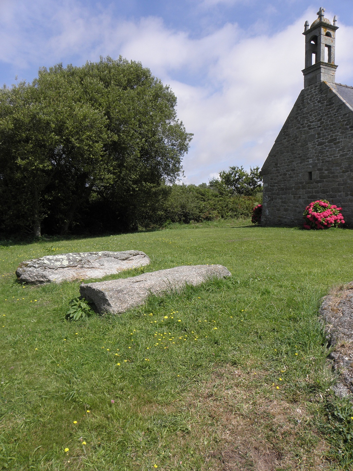
The south menhir was photographed and drawn by Alfred Devoir in the early 20th century. It was still standing in the last quarter of that century but now lies overthrown at the southern tip of the island. It is a granite block 2.40 m long, 1.50 m wide and 0.50 to 0.60 m thick.
Later historySources for this section
- Wikipedia (French): Menhirs de l'île MelonCC BY-SA 4.0
Sources for this section
- Wikipedia (French): Menhirs de l'île MelonCC BY-SA 4.0
On 2 March 1942 the German army dynamited the great menhir, on the pretext that it served as a landmark for enemy ships. The fragments remain on the spot.
ContextSources for this section
- Wikipedia (French): Menhirs de l'île MelonCC BY-SA 4.0
Sources for this section
- Wikipedia (French): Menhirs de l'île MelonCC BY-SA 4.0
Megaliths are large stones used to build prehistoric structures or monuments, either alone or with other stones. The main kinds include single stones such as menhirs and monoliths, stone circles (cromlechs), alignments, dolmens and cists.
Tradition and region
About this kind of monument
Megalith (type not specified)
A megalith is a large stone used to build a prehistoric structure or monument, either alone or with other stones. More than 35,000 megalithic structures have been identified in Europe, from Sweden in the north to the Mediterranean in the south, and megaliths are found worldwide. The word was first used in 1849 by the British antiquarian Algernon Herbert for Stonehenge, and comes from the Greek for "great stone". Most extant megaliths were erected between the Neolithic, with some earlier Mesolithic examples, and the Bronze Age. The oldest known ceremonial structures in the world, Göbekli Tepe and Nevalı Çori in Turkey, are dated to about 9000 BCE.
The most widely known megaliths are not tombs. The main kinds are single stones, such as menhirs and monoliths; multiple stones, such as stone circles (cromlechs) and alignments; dolmens; cists; and megalithic walls, also called cyclopean walls. Megalithic art, painted or carved on kerbstones, orthostats or capstones, is found in many parts of Western Europe, with the main concentrations in England, Malta, Ireland, Brittany and Iberia, and it is highly abstract.
Megaliths were used for a variety of purposes, from boundary markers of territory to reminders of past events, to being part of the religion of a society. Contemporary megalith-building cultures exist in Indonesia, among the Toraja and in the Marapu tradition. In the Atlas, a record marked only "megalith" lacks a more specific type, usually because the source did not say, and it receives a broad date range.
Dating relies on associated finds when a monument is excavated; otherwise it depends on shape and comparison.
When visiting, look first at the setting, and at whether the stone looks worked or natural.
Paraphrased from Wikipedia: Megalith, Wikipedia: Menhir, Wikipedia: Dolmen, Wikipedia: Megalithic art · CC BY-SA 4.0
From the article
Dated moments in the story
Photographs
1 photograph, each with its author and licence
Lore
Evidence & Lore
What the sources actually support — and, kept apart, what has been claimed.
What the evidence supports
Dates
Est. 3470–2760 BCEHow this date was established: Type comparisonTypical range for megaliths in Kingdom of the Netherlands; this site has not been dated itself. Dutch hunebedden were built between 3470 and 3250 BC and were used until about 2760 BC.Source for this date
Where it stands
Kingdom of the Netherlands
The pin marks the monument itself — its exact point.
- Coordinates
- 48°29′04″ N, 4°46′36″ WFor a GPS or map app: 48.48443, -4.77678
Access is as our sources describe it; we have not visited the site to check.
Nearby
The closest sites in the Atlas, by straight line.





Sources
Every record behind this page, with the link it came from.
2 sources behind this page
- 01Wikidata Q109314972wikidata.org
- 02Source for this dateen.wikipedia.org
Image files
Report a correctionWrong date, name, photograph or source? Tell us and it will be put right.
Around this place
The ten nearest sites, by compass
- Grand menhir de l'île Melon (Porspoder)<0.1 km N
- Dolmens of l'île Melon<0.1 km N
- menhir de Saint-Ourzal1.5 km NE
- Alignement de Traonigou1.6 km NE
- Menhir de Calès1.8 km NE
- Kerivoret dolmen1.8 km NE
- Dolmen de Mezou Poulyot2.0 km E
- Menhirs of Mezdoun2.1 km E
- Menhirs de Mesdoun2.1 km E
- Alignement de Saint-Denec2.4 km NE
Credit
Text, licence and sources
Adapted from the Wikipedia article "Menhirs de l'île Melon" (French), licensed CC BY-SA 4.0; authors are listed in the page history. Reused under CC BY-SA 4.0. Read on Wikipedia · Edit history and authors