
Megalithic mound (tumulus with integral stones)
Gwangju Wolgye-dong Janggobun
Photo Saigen Jiro This photo was taken with Nikon D3200 · CC0Source file on Wikimedia Commons

Overview
About this site
Overview
The Gwangju Wolgye-dong Janggobun is a tomb group of the Three Kingdoms period in Wolgye-dong, Gwangsan District, Gwangju Metropolitan City, South Korea. It consists of two keyhole-shaped (square at the front, round at the rear) burial mounds, named janggobun after their resemblance to an hourglass drum, standing on a site of 13,850 square metres.
The mounds are thought to have been built in the 5th to 6th centuries. The group was designated Monument No. 20 of Gwangju Metropolitan City on 18 February 1994.
Read on Wikipedia3 min readCC BY-SA 4.0
Article
Gwangju Wolgye-dong Janggobun
The tombs lie on a low hilly area beside the alluvial plain of the upper Yeongsan River, in the village of Janggu-chon.
DescriptionSources for this section
- Wikipedia (Korean): 광주 월계동 장고분CC BY-SA 4.0
Sources for this section
- Wikipedia (Korean): 광주 월계동 장고분CC BY-SA 4.0
The tombs lie on a low hilly area beside the alluvial plain of the upper Yeongsan River, in the village of Janggu-chon. Both Mound 1 and Mound 2 contain a stone chamber with a passage, entered from the side, and the walls of the chamber were laid from rubble stone like brickwork. A stone chamber was built to hold the body, a mound was heaped over it, and a ditch was dug around the outside of the mound.
The tombs were looted during the Japanese colonial period and much of their structure was lost. They were restored to their present form in 1997.
ExcavationsSources for this section
- Wikipedia (Korean): 광주 월계동 장고분CC BY-SA 4.0
Sources for this section
- Wikipedia (Korean): 광주 월계동 장고분CC BY-SA 4.0
The area was to be developed in the 1990s as the Gwangju Cheomdan Science and Industry Complex, and two campaigns of investigation were carried out in order to preserve the tombs on the spot. The first, in 1993, was a trial excavation that established the extent of the two mounds and fixed the protected zone. In 1995 the second campaign fully excavated the ditches of both mounds.
DatingSources for this section
- Wikipedia (Korean): 광주 월계동 장고분CC BY-SA 4.0
Sources for this section
- Wikipedia (Korean): 광주 월계동 장고분CC BY-SA 4.0
The excavation indicated that the mounds were built in the 5th to 6th centuries, in the Three Kingdoms period.
FindsSources for this section
- Wikipedia (Korean): 광주 월계동 장고분CC BY-SA 4.0
Sources for this section
- Wikipedia (Korean): 광주 월계동 장고분CC BY-SA 4.0
The stone chambers had already been looted, and only a few objects remained. Inside the chambers were one gold earring, one iron arrowhead and potsherds. The large jars contained a variety of pottery, including reddish-brown cylindrical vessels, trumpet-shaped vessels and wide-mouthed jars with holes. Other finds include an iron knife and glass beads. The finds are displayed in the Chonnam National University Museum.
InterpretationSources for this section
- Wikipedia (Korean): 광주 월계동 장고분CC BY-SA 4.0
Sources for this section
- Wikipedia (Korean): 광주 월계동 장고분CC BY-SA 4.0
The tombs provide material for the study of ancient burials and of the history of relations between Korea and Japan, and they bear on the origin of the Japanese keyhole-shaped tomb. Japanese scholars have cited the tombs in support of the theory that the Yamato state, the first unified state of Japan, ruled the southern part of the Korean peninsula from the later 4th century to the 6th. Korean scholars argue instead that they are the tombs of Japanese merchants who traded iron in Mahan.
Tradition and region
About this kind of monument
Silla tumuli of Korea and Asian mounds
In and around Gyeongju, the capital of the Korean kingdom of Silla (57 BCE to 935 CE), great round earth mounds still rise among the modern streets. The main group is Daereungwon, a complex of 23 tombs of kings, queens and nobles of the Silla period. In these tombs the coffin was placed below ground level or partly above it, and then covered first with stones and then with earth, which made the tomb sturdy and hard for looters to enter; a great many relics survived until their rediscovery in the present era. The tombs were first excavated in the Japanese colonial period (Geumgwanchong in 1921, Geumnyeongchong and Singnichong in 1924, Seobongchong in 1926) and later, after 1945, Houchong, Machong, Ssangsangchong and, in 1973, Cheonmachong.
The Gyeongju Historic Areas were designated a World Heritage Site in 2000. Silla was one of the Three Kingdoms of Korea, with Goguryeo and Paekche, and was one of the longest-lasting countries in Korean history. Elsewhere in the south of the peninsula, the Gaya confederacy built its own tumulus cemeteries.
The Atlas has only a few Chinese mounds of this kind.
Dating relies on the objects in the tombs and on pottery styles; some mounds are tied to named rulers on the strength of later tradition, an attribution that is uncertain.
When visiting, look at the smooth grassy domes of the Daereungwon park, at the differences in height and size between royal and noble tombs, and at Cheonmachong, one of the tombs excavated in 1973.
Paraphrased from Wikipedia: Daereungwon, Wikipedia: Cheonmachong, Wikipedia: Silla, Wikipedia: Gaya confederacy, Wikipedia: Gyeongju Historic Areas · CC BY-SA 4.0
See it in 3D
An interpretive reconstruction of the monument, standing on the real ground at its exact point, under the sun for that place and season. Drag to look around it.
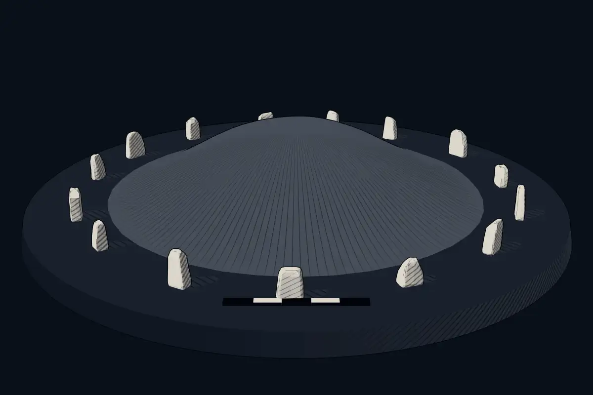
The reconstruction is ours, not a survey: it shows what a monument of this type looks like, at the size the record gives for this one.
Photographs
7 photographs, each with its author and licence
More photographs


Where it stands
South Korea
The pin marks the monument itself — its exact point.
- Coordinates
- 35°12′51″ N, 126°50′31″ EFor a GPS or map app: 35.21417, 126.84194
Access is as our sources describe it; we have not visited the site to check.
Nearby
The closest sites in the Atlas, by straight line.
 Gwangju Myeonghwa-dong Janggobun
- Megalithic tombGwangju Samgeo-dong Dolmen Group700–300 BCE
 Hampyeong Yedeok-ri Sindeok Gobungun
 Hwasun Dolmen Site1000–1 BCE
 Gochang, Hwasun and Ganghwa Dolmen Sites1500 BCE–300 CE
 Gochang Dolmen Site1000–1 BCE
 Jiseok Tombs in Jukrim-ri, Gochang700–300 BCE
- Megalithic mound (tumulus with integral stones)咸平長鼓山古墳


Sources
Every record behind this page, with the link it came from.
1 source behind this page
- 01Wikidata Q16094290wikidata.org
Image files
- Gwangju Wolgye-dong Janggobun.JPGSaigen Jiro This photo was taken with Nikon D3200CC0
- Inside of Tomb One of Gwangju Wolgye-dong Janggobun-2.JPGSaigen JiroCC0
- Tomb One of Gwangju Wolgye-dong Janggobun-2.JPGSaigen JiroCC0
- Tomb Two of Gwangju Wolgye-dong Janggobun-1.JPGSaigen JiroCC0
- Tomb Two of Gwangju Wolgye-dong Janggobun-2.JPGSaigen JiroCC0
- Tomb Two of Gwangju Wolgye-dong Janggobun-3.JPGSaigen JiroCC0
- Tomb One of Gwangju Wolgye-dong Janggobun-1.JPGSaigen Jiro This photo was taken with Nikon D3200CC0
Report a correctionWrong date, name, photograph or source? Tell us and it will be put right.
Around this place
The ten nearest sites, by compass
- Gwangju Myeonghwa-dong Janggobun15 km SW
- Gwangju Samgeo-dong Dolmen Group17 km SW
- Hampyeong Yedeok-ri Sindeok Gobungun21 km W
- Hwasun Dolmen Site28 km S
- Gochang, Hwasun and Ganghwa Dolmen Sites29 km S
- Gochang Dolmen Site31 km NW
- Jiseok Tombs in Jukrim-ri, Gochang31 km NW
- 咸平長鼓山古墳35 km W
- Yeongam Taegan-ri Jarabong Gobun46 km SW
- Dolmens in Guam-ri, Buan58 km N
Credit
Text, licence and sources
Adapted from the Wikipedia article "광주 월계동 장고분" (Korean), licensed CC BY-SA 4.0; authors are listed in the page history. Reused under CC BY-SA 4.0. Read on Wikipedia · Edit history and authors
- Wikipedia (Korean): 광주 월계동 장고분CC BY-SA 4.0
- Wikidata Q16094290CC0