Chunghwa Jiseok-ri Dolmen
DatedEst. 700–300 BCE
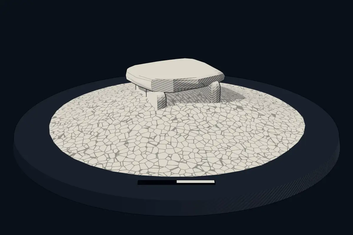
No licensed photograph yetWe have no photograph we may publish for this site, so the interpretive 3D view leads instead.
Overview
About this site
Overview
Chunghwa Jiseok-ri Dolmen (충화 지석리 고인돌) is a group of dolmens in Chunghwa-myeon, Buyeo-gun, Chungcheongnam-do, South Korea. It is dated by typological estimate to the period 700 to 300 BCE.
Three dolmens survive within the grounds of the Palchungsa shrine. The group was designated Local Cultural Heritage No. 26 of Buyeo-gun on 30 December 1998.
Read on Wikipedia2 min readCC BY-SA 4.0
Where it sits in time
The site's dated range, placed against world reference points.
The scale is logarithmic: each step to the left is about ten times older than the last.
Article
Chunghwa Jiseok-ri Dolmen
7 km west of the Chunghwa-myeon office, along the road towards Hongsan, on the north side of the road within the Palchungsa precinct.
SettingSources for this section
- Wikipedia (Korean): 충화 지석리 고인돌CC BY-SA 4.0
Sources for this section
- Wikipedia (Korean): 충화 지석리 고인돌CC BY-SA 4.0
The dolmens lie 1.7 km west of the Chunghwa-myeon office, along the road towards Hongsan, on the north side of the road within the Palchungsa precinct. The area is a mountain alluvial plain that extends about 5 km from east to west, and the Sangjicheon stream flows through it from east to west.
DescriptionSources for this section
- Wikipedia (Korean): 충화 지석리 고인돌CC BY-SA 4.0
Sources for this section
- Wikipedia (Korean): 충화 지석리 고인돌CC BY-SA 4.0
Three dolmens remain. Dolmen 1 measures 300 × 225 × 145 cm and has two supporting stones beneath it. Dolmen 2 lies 6 m east of dolmen 1; it measures 340 × 330 × 120 cm and has three supporting stones. Dolmen 3 lies 13 m south-east of dolmen 2; it measures 255 × 240 × 95 cm and appears to have had two supporting stones.
InterpretationSources for this section
- Wikipedia (Korean): 충화 지석리 고인돌CC BY-SA 4.0
Sources for this section
- Wikipedia (Korean): 충화 지석리 고인돌CC BY-SA 4.0
The dolmens appear to have been built on the strength of the agricultural productivity of this mountain alluvial plain. No settlement site has been firmly identified in the area, but the hills in front of the village of Jiseok 3-ri are presumed to have been the settlement of the time.
ConservationSources for this section
- Wikipedia (Korean): 충화 지석리 고인돌CC BY-SA 4.0
Sources for this section
- Wikipedia (Korean): 충화 지석리 고인돌CC BY-SA 4.0
The dolmens were designated Local Cultural Heritage No. 26 of Buyeo-gun on 30 December 1998. The Palchungsa shrine at Chunghwa is listed as Buyeo-gun Local Cultural Heritage No. 25.
Tradition and region
About this kind of monument
Korean dolmens (goindol)
The Korean Peninsula has more dolmens than anywhere else: about 40,000 are found throughout the peninsula, which is approximately 40 percent of the world's total. In Korean they are called goindol, "propped stone", and they were built from the Bronze Age to the early Iron Age, during the Mumun pottery period of about 1500 to 300 BCE. They are distributed mainly along the west coast and on large rivers from the Liaodong Peninsula in China to Jeollanam-do. In North Korea they are concentrated around the Taedong and Jaeryeong rivers; in South Korea they are dense in river basins such as the Han and Nakdong and in the west coast area.
The great stones marked the graves of the ruling elite. Pottery, comma-shaped jewels, bronzes and stone tools have been excavated from the dolmens, and the stones show how rock was quarried, transported and used to build them. In 2000 UNESCO designated the Gochang, Hwasun and Ganghwa Dolmen Sites a World Heritage Site: Jukrim-ri and Dosan-ri at Gochang, Hyosan-ri and Daesin-ri at Hwasun, and Bujeong-ri, Samgeori and Osang-ri on Ganghwa. Together they hold over 1,000 dolmens, the highest concentrations anywhere in the world.
Dolmens in Korea have been dated to the seventh century BCE at places such as Gochang, and the practice ended around the third century BCE. Excavation at the sites did not begin until 1965. Where the dolmens came from is debated: one theory has the knowledge arriving from Southeast Asia along with rice culture, another from Neolithic peoples north of the peninsula, and a third holds that they arose on the peninsula itself.
When visiting, look for the way the rows follow a river terrace, and compare the table-like dolmens with those where the capstone sits low over the ground.
Paraphrased from Wikipedia: Gochang, Hwasun and Ganghwa Dolmen Sites, Wikipedia: Dolmen, Wikipedia: Mumun pottery period · CC BY-SA 4.0
Lore
Evidence & Lore
What the sources actually support — and, kept apart, what has been claimed.
What the evidence supports
Dates
Est. 700–300 BCEHow this date was established: Type comparisonTypical range for megalithic tombs in South Korea; this site has not been dated itself. Korean dolmens have been dated to the seventh century BCE in places such as Gochang and the practice ended around the third century BCE.Source for this date
Where it stands
South Korea
The pin marks the monument itself — its exact point.
- Coordinates
- 36°06′39″ N, 126°28′33″ EFor a GPS or map app: 36.11083, 126.47583
Access is as our sources describe it; we have not visited the site to check.
Nearby
The closest sites in the Atlas, by straight line.
- Megalithic tombBuyeo Naegok-ri Dolmen700–300 BCE
- Megalithic tombBuyeo Songam-ri Dolmen Group700–300 BCE
- Megalithic tombChunghwa Hyeonmiri Dolmen700–300 BCE
- Megalithic tombBuyeo Anseori Dolmen700–300 BCE
- DolmenBuyeo Oryang-ri Dolmen700–300 BCE
- Megalithic tombBuyeo Nabok-ri Dolmen700–300 BCE
- Megalithic tombJangam Bukgori Dolmen700–300 BCE
- Megalithic tombBuyeo Hamyang-ri Dolmen700–300 BCE
Sources
Every record behind this page, with the link it came from.
2 sources behind this page
- 01Wikidata Q55735180wikidata.org
- 02Source for this dateen.wikipedia.org
Report a correctionWrong date, name, photograph or source? Tell us and it will be put right.
Around this place
The ten nearest sites, by compass
- Buyeo Naegok-ri Dolmen1.3 km N
- Buyeo Songam-ri Dolmen Group2.8 km NE
- Chunghwa Hyeonmiri Dolmen3.0 km SE
- Buyeo Anseori Dolmen3.6 km W
- Buyeo Oryang-ri Dolmen5.2 km SE
- Buyeo Nabok-ri Dolmen7.2 km N
- Jangam Bukgori Dolmen8.4 km NE
- Buyeo Hamyang-ri Dolmen9.0 km NE
- Buyeo Gwideok-ri Dolmen9.5 km E
- Buyeo Taeyang-ri Dolmen Group34 km NE
Credit
Text, licence and sources
Adapted from the Wikipedia article "충화 지석리 고인돌" (Korean), licensed CC BY-SA 4.0; authors are listed in the page history. Reused under CC BY-SA 4.0. Read on Wikipedia · Edit history and authors
- Wikipedia (Korean): 충화 지석리 고인돌CC BY-SA 4.0
- Wikidata Q55735180CC0