nuraghe Cherchizza A
DatedEst. 1900–730 BCE
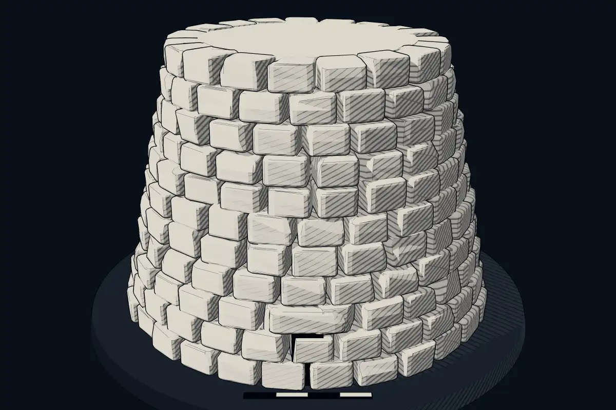
No licensed photograph yetWe have no photograph we may publish for this site, so the interpretive 3D view leads instead.
Overview
About this site
Overview
The nuraghe Cherchizza A is a Nuragic monument in the territory of Siligo, Italy, at the western end of the Nuragic sanctuary of monte Sant'Antonio. It stands along the edge of the plateau, 250 metres from the nuraghe Cherchizza B. The catalogue gives a typological estimate of 1900 to 730 BCE.
It is probably a protonuraghe of irregular quadrangular plan, with later alterations and additions.
Read on Wikipedia2 min readCC BY-SA 4.0
Where it sits in time
The site's dated range, placed against world reference points.
The scale is logarithmic: each step to the left is about ten times older than the last.
Article
nuraghe Cherchizza A
DescriptionSources for this section
- Wikipedia (Italian): Nuraghe Cherchizza ACC BY-SA 4.0
Sources for this section
- Wikipedia (Italian): Nuraghe Cherchizza ACC BY-SA 4.0
The structure measures 20 m along the west-east axis and 10 m on the north-south axis. The wall facing consists of enormous basalt boulders laid in irregular courses. On the west side the blocks rest on the natural rock, which forms the southern profile. On the north a 6 m stretch of masonry is visible, reaching a maximum height of 2.30 m.
The entrance faced east, near a corridor 6.35 m long, 0.90 m wide and 1.30 m high.
The structure has suffered several collapses and is at present abandoned and overgrown with vegetation.
ExcavationsSources for this section
- Wikipedia (Italian): Nuraghe Cherchizza ACC BY-SA 4.0
Sources for this section
- Wikipedia (Italian): Nuraghe Cherchizza ACC BY-SA 4.0
The corridor was brought to light during an excavation campaign in 1988. The structure has suffered several collapses and is at present abandoned and overgrown with vegetation.
Research historySources for this section
- Wikipedia (Italian): Nuraghe Cherchizza ACC BY-SA 4.0
Sources for this section
- Wikipedia (Italian): Nuraghe Cherchizza ACC BY-SA 4.0
The nuraghe is recorded in Antonio Taramelli's archaeological edition of the Carta d'Italia at 1:100,000 (Foglio 193, Bonorva, 1939), in E. Melis, Carta dei nuraghi della Sardegna (1967), and in F. Lo Schiavo's study of the Nuragic sanctuary on monte S. Antonio (Nuovo Bullettino Archeologico Sardo, 1986). A. Sanna reported on the excavation campaigns of 1990-91 at monte S. Antonio.
Tradition and region
About this kind of monument
Sardinian nuraghi
The nuraghe is the main type of ancient megalithic building in Sardinia, and it has become the symbol of the island and of its Nuragic civilization. They were built during the Nuragic Age, between 1900 and 730 BCE. More than 7,000 have been found, and archaeologists believe that originally there were more than 10,000. A nuraghe has the outer shape of a truncated conical tower, rather like a medieval tower, with a tholos-like vault inside.
The finest is Su Nuraxi at Barumini, a UNESCO World Heritage Site since 1997. Its oldest part is a central tower with three superposed chambers, 18.6 metres high, built of basalt blocks between the seventeenth and thirteenth centuries BCE. In the Late Bronze Age four corner towers joined by a curtain wall were added, and a village grew around it, inhabited from the thirteenth to the sixth century BCE. Scholars consider it the most impressive expression of the Nuragic civilization.
There is no consensus on what the nuraghi were for: rulers' residences, military strongholds, meeting halls, temples and ordinary dwellings have all been proposed. The Nuragic civilization lasted from the eighteenth century BCE until the Iron Age or the beginning of Roman colonisation in 238 BCE, and building of nuraghi had stopped by the twelfth or eleventh century BCE. Its origins are disputed: the traditional theory of Giovanni Lilliu, from 1966, saw migrants related to the Beaker culture, while others argue for local development. Even the word nuraghe has an uncertain and disputed etymology.
Many nuraghi have never been excavated, and their dates are inferred from their form.
When visiting, look for the stone courses, the entrance corridor, and the village of huts that often surrounds the tower.
Paraphrased from Wikipedia: Nuraghe, Wikipedia: Nuragic civilization, Wikipedia: Su Nuraxi · CC BY-SA 4.0
From the article
Dated moments in the story
- 1988
1,30, messo in luce durante una campagna di scavo del 1988. La struttura ha avuto diversi crolli ed al momento è in stato di abbandono e invasa dalla vegetazione.
Source
Lore
Evidence & Lore
What the sources actually support — and, kept apart, what has been claimed.
What the evidence supports
Dates
Est. 1900–730 BCEHow this date was established: Type comparisonTypical range for nuraghes in Italy; this site has not been dated itself. The nuraghe is the main type of ancient megalithic edifice of Sardinia developed during the Nuragic Age between 1900 and 730 BC.Source for this date
Where it stands
Italy
The pin marks the monument itself — its exact point.
- Coordinates
- 40°34′20″ N, 8°44′36″ EFor a GPS or map app: 40.57222, 8.74333
Access is as our sources describe it; we have not visited the site to check.
Nearby
The closest sites in the Atlas, by straight line.
Sources
Every record behind this page, with the link it came from.
2 sources behind this page
- 01Wikidata Q112044667wikidata.org
- 02Source for this dateen.wikipedia.org
Report a correctionWrong date, name, photograph or source? Tell us and it will be put right.
Around this place
The ten nearest sites, by compass
Credit
Text, licence and sources
Adapted from the Wikipedia article "Nuraghe Cherchizza A" (Italian), licensed CC BY-SA 4.0; authors are listed in the page history. Reused under CC BY-SA 4.0. Read on Wikipedia · Edit history and authors
- Wikipedia (Italian): Nuraghe Cherchizza ACC BY-SA 4.0
- Wikidata Q112044667CC0