
Overview
About this site
What the sources say
Der Dolmen Placa (auch Lo Zappa genannt) liegt in einem Olivenhain im Ortsteil Lo Zappa in Melendugno in der Provinz Lecce in Apulien in Italien.
Article in GermanRead on Wikipedia2 min readCC BY-SA 4.0
Where it sits in time
The site's dated range, placed against world reference points.
The scale is logarithmic: each step to the left is about ten times older than the last.
The full article
dolmen Placa: the whole story
In briefSources for this section
- Wikipedia (German): Dolmen PlacaCC BY-SA 4.0
Sources for this section
- Wikipedia (German): Dolmen PlacaCC BY-SA 4.0
Dolmen Placa, also called Lo Zappa, stands in an olive grove in the district of Lo Zappa in Melendugno, in the Province of Lecce, Apulia, Italy. It is a small dolmen made from local tufa blocks and is generally classified as a dolmen.
Its roughly square capstone has irregular sides and a hole about 14 cm across on its outer surface. The capstone is of uneven thickness and rests on six monolithic supporting stones. One orthostat is missing from the west side, but fragments of it lie on the ground. The entrance is on the northwest side.
The monument was discovered in 1909 by G. Palumbo. It is 0,9 m high, with a trapezoidal form, 1,25 to 1,96 m wide and 2,15 m long. Its capstone measures 0,17 to 0,4 m thick. A typological estimate places it between 4000 BCE and 3000 BCE.
Dolmens in Italy are found in the south, including Apulia, Sardinia and Sicily. The wider tradition notes that some Apulian dolmens have long passages leading to burial cells, unlike the simple three-stone tables suggested by the word dolmen. Further information specific to this site beyond the stated measurements and description is not provided.
No English Wikipedia article exists for it; the full text below is the German article "Dolmen Placa", shown in the original language.
Summary in EnglishSources for this section
- Wikipedia (German): Dolmen PlacaCC BY-SA 4.0
Sources for this section
- Wikipedia (German): Dolmen PlacaCC BY-SA 4.0
dolmen Placa is a dolmen in Melendugno, Italy. A typological estimate: 4000 BCE to 3000 BCE. No English Wikipedia article exists for it; the full text below is the German article "Dolmen Placa", shown in the original language.
BeschreibungSources for this section
- Wikipedia (German): Dolmen PlacaCC BY-SA 4.0
Sources for this section
- Wikipedia (German): Dolmen PlacaCC BY-SA 4.0
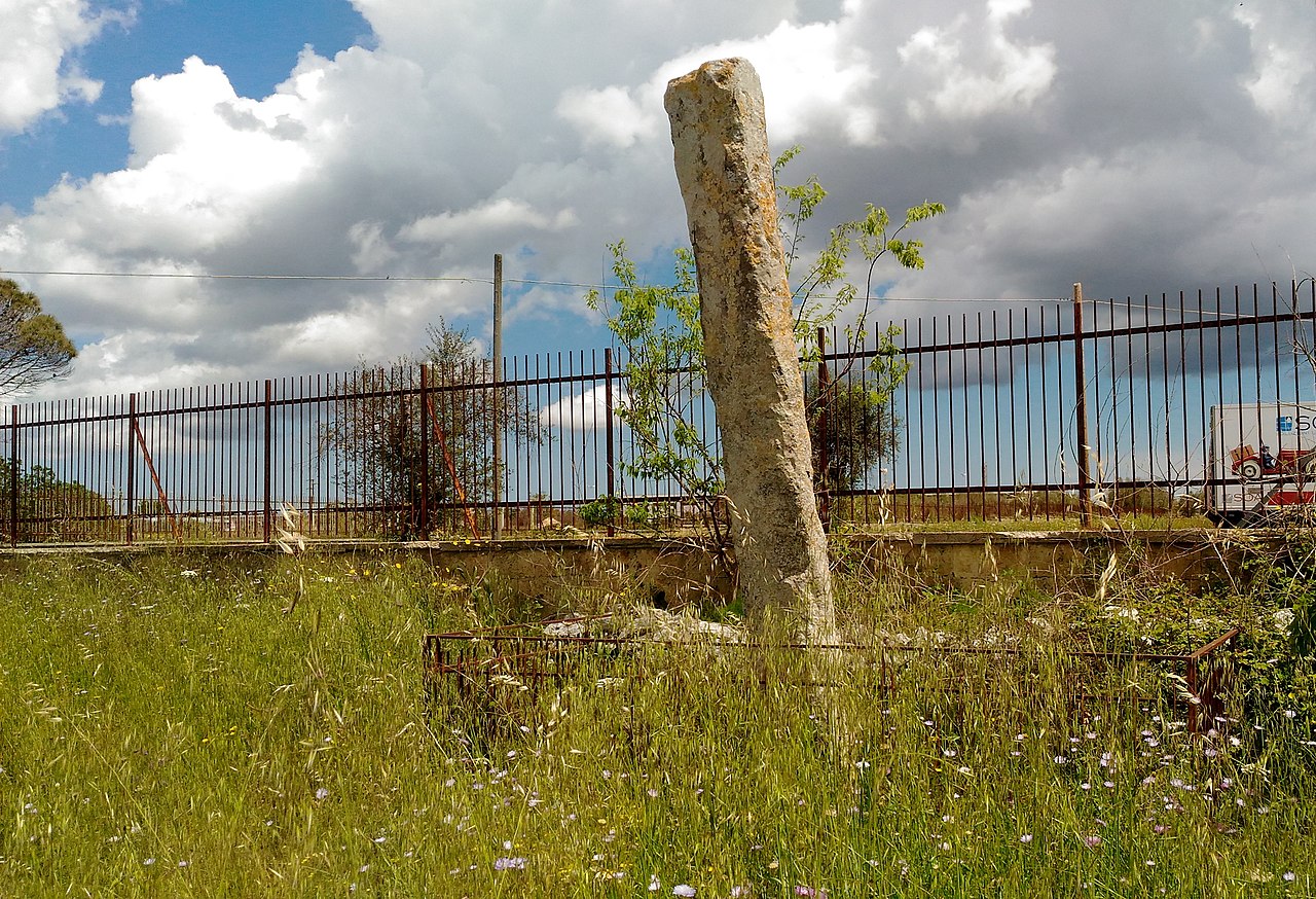
Die Megalithen des kleinen Dolmens sind aus lokalen Tuffsteinblöcken. Die etwa viereckige Deckenplatte mit unregelmäßigen Seiten hat ein Loch von etwa 14 cm Durchmesser an der Außenfläche. Die Platte von ungleichmäßiger Stärke wird von sechs monolithischen Tragsteinen gestützt. An der Westseite fehlt ein Orthostat, dessen Fragmente am Boden liegen.
Der 1909 von G. Palumbo entdeckte, 0,9 m hohe trapezoide Dolmen ist 1,25 bis 1,96 m breit und 2,15 m lang. Die Deckplatte hat eine Dicke von 0,17 bis 0,4 m. Der Zugang liegt im Nordwesten.
How this page was madeSources for this section
- Wikipedia (German): Dolmen PlacaCC BY-SA 4.0
Sources for this section
- Wikipedia (German): Dolmen PlacaCC BY-SA 4.0
The summary at the top of this page was written by MiniMax-M3 (2026-11-08) from the cited Wikipedia article “Dolmen Placa”, translated from German. The numbers in it were checked automatically against the source text. The rest of the page is the article itself, the structured records and computed distances.
Tradition and region
About this kind of monument
Dolmens of Apulia and southern Italy
Italy's dolmens are found in the south, in Apulia, Sardinia and Sicily. In Sicily there are small examples at Mura Pregne near Palermo, at Sciacca, at Monte Bubbonia and at Butera. The most celebrated group lies near Bisceglie, on the Adriatic coast of Apulia, where impressive grave-altars called dolmens were built in the Bronze Age.
The Dolmen della Chianca takes its name from the local dialect word chienghe, meaning stone slab. It has a passage 10 metres long leading to a burial cell of 2 by 1.6 metres. The Italian physiologist and antiquarian Angelo Posso claimed to be the first scientist to describe it, having been directed to it by a local farmer in August 1901, and he called it the largest and best preserved of all Italian dolmens. The long passage makes these Apulian monuments quite different from the simple three-stone tables the word suggests.
A dolmen is a single-chamber megalithic tomb, with upright stones carrying a capstone, and it was often covered by a mound that has since eroded away. The Italian examples are therefore stone skeletons. Their placement in the Bronze Age rests on the form of the monuments and on comparison with similar tombs; it is not tied to radiocarbon dates from the Italian examples themselves, and the Atlas gives a typological range.
Dolmens are only one strand of megalithic building in southern Italy. Sardinia has its own distinct traditions, the domus de janas and the tombs of the giants, which are described in separate articles.
When visiting, look for the long passage and which way it faces, for the roof slabs, and for the way the monument sits in the Apulian countryside close to the coast.
Paraphrased from Wikipedia: Dolmen, Wikipedia: Bisceglie, Wikipedia: List of dolmens · CC BY-SA 4.0
See it in 3D
An interpretive reconstruction of the monument, standing on the real ground at its exact point, under the sun for that place and season. Drag to look around it.
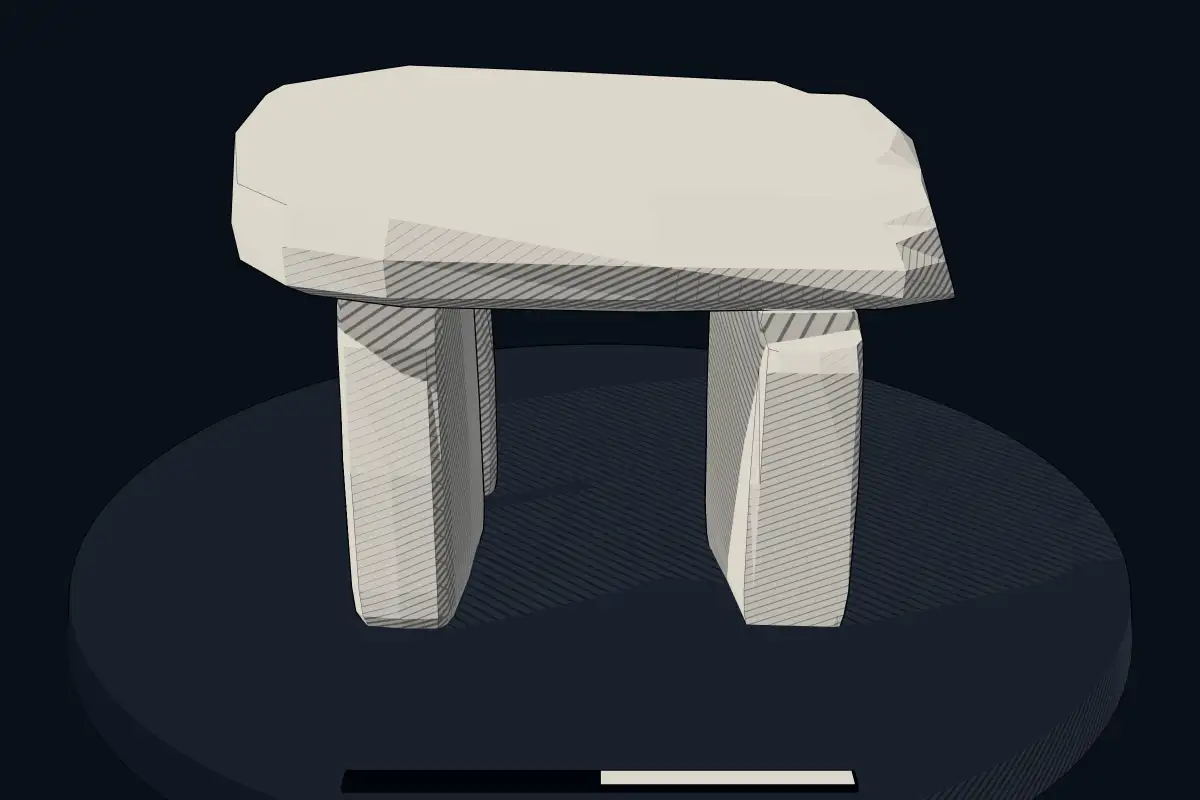
The reconstruction is ours, not a survey: it shows what a monument of this type looks like, at the size the record gives for this one.
Photographs
4 photographs, each with its author and licence
More photographs
Lore
Evidence & Lore
What the sources actually support — and, kept apart, what has been claimed.
What the evidence supports
Dates
Est. 4000–3000 BCEHow this date was established: Type comparisonTypical range for dolmens in Italy; this site has not been dated itself. Most dolmens date from the Late Neolithic period (4000-3000 BCE); the Sardinian stazzoni are a local form of dolmen.Source for this date
Where it stands
Italy
The pin marks the monument itself — its exact point.
- Coordinates
- 40°15′31″ N, 18°18′34″ EFor a GPS or map app: 40.25850, 18.30940
Access is as our sources describe it; we have not visited the site to check.
Nearby
The closest sites in the Atlas, by straight line.




Sources
Every record behind this page, with the link it came from.
2 sources behind this page
- 01Wikidata Q29015308wikidata.org
- 02Source for this dateen.wikipedia.org
Image files
- Dolmen Placa.PNGReameCC BY 2.5
- 10 Dolmen Placa, Melendugno -FG.jpgFabrizio GarrisiCC BY-SA 4.0
- 15 Dolmen Placa, Melendugno -FG.jpgFabrizio GarrisiCC BY-SA 4.0
- 20 Dolmen Placa, Melendugno -FG.jpgFabrizio GarrisiCC BY-SA 4.0
Report a correctionWrong date, name, photograph or source? Tell us and it will be put right.
Around this place
The ten nearest sites, by compass
Credit
Text, licence and sources
Text from the Wikipedia article "Dolmen Placa" (German), licensed CC BY-SA 4.0; authors are listed in the page history. Reused under CC BY-SA 4.0. Read on Wikipedia · Edit history and authors
- Wikipedia (German): Dolmen PlacaCC BY-SA 4.0
- Wikidata Q29015308CC0