
Lettergorman SW
DatedEst. 3300–2500 BCE
Photo Alan Simkins · CC BY-SA 2.0Source file on Wikimedia Commons

Overview
About this site
Overview
Lettergorman SW, also known as Lettergorman S, Leitir Gormáin or Maultanvally, is a five-stone circle of the Cork-Kerry series near Ballygurteen, County Cork, Ireland. A typological estimate places it between 3300 and 2500 BCE.
A sixth block, of white quartz, lies directly beside the circle.
Read on Wikipedia2 min readCC BY-SA 4.0
Where it sits in time
The site's dated range, placed against world reference points.
The scale is logarithmic: each step to the left is about ten times older than the last.
Article
Lettergorman SW
Five-stone circles are made up of a ring-shaped or D-shaped arrangement of medium-sized, individually standing stones, five in number.
DescriptionSources for this section
- Wikipedia (German): Lettergorman SWCC BY-SA 4.0
Sources for this section
- Wikipedia (German): Lettergorman SWCC BY-SA 4.0
The circle consists of four partly very thin stones. A thick fifth stone lies in the south-west of the circle; it is about 1.5 m long, 1.4 m high and over a metre thick. The tallest stones are the so-called portal stones, 1.6 m high, one of which has fallen. Many field-cleared stones are scattered around the circle.
Five-stone circles are made up of a ring-shaped or D-shaped arrangement of medium-sized, individually standing stones, five in number. Their diameters range between 2.3 and 4.0 metres.
NameSources for this section
- Wikipedia (German): Lettergorman SWCC BY-SA 4.0
Sources for this section
- Wikipedia (German): Lettergorman SWCC BY-SA 4.0
Quartz stones (Irish grianchloch, "sun stone") are often associated with stone circles. The name of the townland, Leitir Gormáin, means "cornflower slope".
SettingSources for this section
- Wikipedia (German): Lettergorman SWCC BY-SA 4.0
Sources for this section
- Wikipedia (German): Lettergorman SWCC BY-SA 4.0
At Lettergorman North there is a four-poster stone circle, one of only six in Ireland. It lies on a ridge overlooking the valley of the Glashagloragh River. Its three surviving stones suggest a trapezoid arrangement.
ContextSources for this section
- Wikipedia (German): Lettergorman SWCC BY-SA 4.0
Sources for this section
- Wikipedia (German): Lettergorman SWCC BY-SA 4.0
The best-known type of stone circle in the far south-west of Ireland is the recumbent or axial circle, which incorporates a large monolith lying on its side. Such circles are found only in Aberdeenshire in north-east Scotland and in the counties of Cork and Kerry, where they are now more commonly called Cork-Kerry or axial stone circles.
Tradition and region
About this kind of monument
Irish stone circles
Ireland's best-known type of stone circle is the recumbent or axial circle of the far south-west. A recumbent stone circle incorporates a large monolith, the recumbent, lying on its side. These circles are found in only two regions: Aberdeenshire in north-east Scotland and the counties of Cork and Kerry, where they are now more commonly called Cork-Kerry or axial stone circles. Some archaeologists, such as Aubrey Burl, have linked them with rituals in which moonlight played a central role, since they are aligned with the arc of the southern moon; excavations at Tomnaverie in Scotland have suggested that no alignment was intended, so this remains a hypothesis.
Drombeg, near Glandore in County Cork, is also called the Druid's Altar. It is a small axial stone circle, not an especially significant example, but one of the most visited megalithic sites in Ireland. It originally consisted of seventeen closely spaced stones, of which 13 survive, made of local sandstone, in a circle 9.3 metres across. Two taller entrance stones stand opposite a recumbent axial stone, and the axis points south-west towards the setting sun. The recumbent, 1.9 metres long, has two egg-shaped carved cup marks on it. The circle was excavated in 1958, when the cremated remains of an adolescent were found in a pot at the centre.
Stone circles in the British Isles typically date from the Late Neolithic and Early Bronze Age, with most built between 3300 and 2500 BCE. The name "Druid's Altar" is a later popular one.
When visiting, look for the two tall entrance stones and the recumbent opposite them, and note the direction in which the axis points.
Paraphrased from Wikipedia: Drombeg stone circle, Wikipedia: Recumbent stone circle, Wikipedia: Stone circle · CC BY-SA 4.0
See it in 3D
An interpretive reconstruction of the monument, standing on the real ground at its exact point, under the sun for that place and season. Drag to look around it.
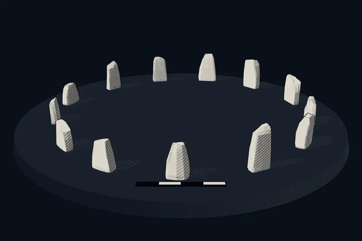
The reconstruction is ours, not a survey: it shows what a monument of this type looks like, at the size the record gives for this one.
Photographs
1 photograph, each with its author and licence
Lore
Evidence & Lore
What the sources actually support — and, kept apart, what has been claimed.
What the evidence supports
Dates
Est. 3300–2500 BCEHow this date was established: Type comparisonTypical range for stone circles in Ireland; this site has not been dated itself. Stone circles are typical of the British Isles and Brittany and most were built between 3300 and 2500 BC.Source for this date
Where it stands
Ireland
The pin marks the monument itself — its exact point.
- Coordinates
- 51°39′31″ N, 9°04′01″ WFor a GPS or map app: 51.65857, -9.06703
Access is as our sources describe it; we have not visited the site to check.
Nearby
The closest sites in the Atlas, by straight line.
- Stone circleKnockawaddra stone circle3300–2500 BCE
 Reanascreena980–910 BCE
- DolmenCaherkirky4000–3000 BCE
- MegalithKnocks3300–2900 BCE
- Menhir (standing stone)Steinmonumente von Burgatia2800–1800 BCE
- Stone circleBohonagh3300–2500 BCE
- DolmenPortal Tomb von Ahaglaslin4000–3000 BCE
 Drombeg stone circle1100–800 BCE


Sources
Every record behind this page, with the link it came from.
2 sources behind this page
- 01Wikidata Q20181974wikidata.org
- 02Source for this dateen.wikipedia.org
Image files
Report a correctionWrong date, name, photograph or source? Tell us and it will be put right.
Around this place
The ten nearest sites, by compass
Credit
Text, licence and sources
Adapted from the Wikipedia article "Lettergorman SW" (German), licensed CC BY-SA 4.0; authors are listed in the page history. Reused under CC BY-SA 4.0. Read on Wikipedia · Edit history and authors
- Wikipedia (German): Lettergorman SWCC BY-SA 4.0
- Wikidata Q20181974CC0