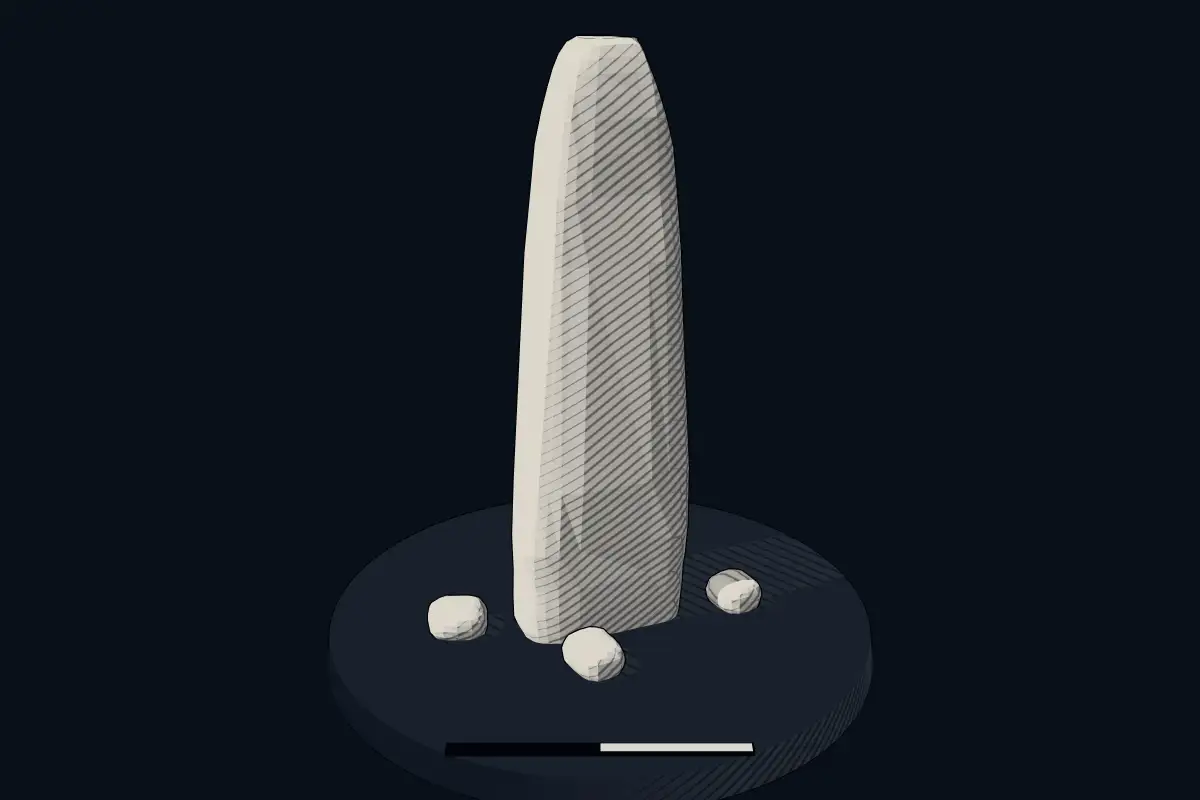
Garryduff Standing Stone
DatedEst. 2800–1800 BCE
No licensed photograph yetWe have no photograph we may publish for this site, so the interpretive 3D view leads instead.
Overview
About this site
Overview
Garryduff Standing Stone is a menhir in Garryduff, Ireland. It lies at 52.3951° N, 7.3152° W.
Catalogue recordSources and licences
Where it sits in time
The site's dated range, placed against world reference points.
The scale is logarithmic: each step to the left is about ten times older than the last.
Article
Garryduff Standing Stone
ContextSources for this section
- en.wikipedia.orgCC BY-SA 4.0
- en.wikipedia.orgCC BY-SA 4.0
- en.wikipedia.orgCC BY-SA 4.0
- en.wikipedia.orgCC BY-SA 4.0
Sources for this section
- en.wikipedia.orgCC BY-SA 4.0
- en.wikipedia.orgCC BY-SA 4.0
- en.wikipedia.orgCC BY-SA 4.0
- en.wikipedia.orgCC BY-SA 4.0
Ireland is rich in menhirs, standing stones that are usually located in farmers' fields and heavily worn by the weather and by livestock. Menhirs are found across Europe, Africa and Asia, with a concentration in Western Europe, notably in Ireland, Great Britain and Brittany. Theories concerning their purpose remain speculative, with hypotheses including rituals, territorial markers and elements of an ideological system. Standing stones are usually difficult to date, because they were set up in many different periods of prehistory. The regional background, “Irish standing stones”, is given below.
DatingSources for this section
- en.wikipedia.orgCC BY-SA 4.0
Sources for this section
- en.wikipedia.orgCC BY-SA 4.0
No scientific date has been published for this site. Monuments of this type in Ireland are generally dated 2800 BCE to 1800 BCE; the site itself may fall inside or outside that range.
Standing stones are associated with the Beaker people of the European late Neolithic and early Bronze Age c. 2800-1800 BC.
Setting
6 other recorded monuments lie within 10 km (0 within 1 km, 4 within 5 km), 1 of them of the same type. In Garryduff, Ireland, 1 of the 1 recorded monuments are of this type.
The nearest recorded monuments are Owning Portal Tomb (1.8 km west, dolmen); Kilmogue standing stone (3.6 km east, menhir); Kilmogue Portal Tomb (3.7 km east, dolmen); Passage Tomb von Baunfree (3.8 km west, passage tomb).
ProtectionSources for this section
Sources for this section
No heritage designation is recorded for the site.
Tradition and region
About this kind of monument
Irish standing stones
Ireland is rich in menhirs, standing stones that are usually located in farmers' fields and heavily worn by the weather and by livestock. Menhirs are found across Europe, Africa and Asia, with a concentration in Western Europe, notably in Ireland, Great Britain and Brittany. Theories concerning their purpose remain speculative, with hypotheses including rituals, territorial markers and elements of an ideological system. Standing stones are usually difficult to date, because they were set up in many different periods of prehistory.
One Irish stone is well dated by its art. The Turoe Stone, a 1.2-metre granite boulder in the village of Bullaun, County Galway, probably dates to about 100 BCE to 100 CE. The top half is covered with a continuous abstract curvilinear design in the La Tène Celtic style, similar to the Castlestrange Stone in County Roscommon. It is National Monument number 327. For centuries the stone was a curiosity at a lios, a "fairy fort", some 3 kilometres away, before it was moved to Turoe Farm; in 2025 it was moved temporarily for conservation. The "fairy fort" name is a folk tradition.
Ogham, the early medieval alphabet of Ireland, was cut on the edges of some standing stones. In Ireland it is traditional to carry a stone up from the bottom of a hill and add it to the cairn at the top.
The Atlas treats isolated Irish stones as undated unless there is excavation or art to show their age.
When visiting, look at the surface for carving.
Paraphrased from Wikipedia: Menhir, Wikipedia: Turoe Stone, Wikipedia: List of menhirs, Wikipedia: Ogham · CC BY-SA 4.0
See it in 3D
An interpretive reconstruction of the monument, standing on the real ground at its exact point, under the sun for that place and season. Drag to look around it.
The reconstruction is ours, not a survey: it shows what a monument of this type looks like, at the size the record gives for this one.
Lore
Evidence & Lore
What the sources actually support — and, kept apart, what has been claimed.
What the evidence supports
Dates
Est. 2800–1800 BCEHow this date was established: Type comparisonTypical range for menhirs in Ireland; this site has not been dated itself. Standing stones are associated with the Beaker people of the European late Neolithic and early Bronze Age c. 2800-1800 BC.Source for this date
Where it stands
Ireland
The pin marks the monument itself — its exact point.
- Coordinates
- 52°23′42″ N, 7°18′55″ WFor a GPS or map app: 52.39508, -7.31520
Access is as our sources describe it; we have not visited the site to check.
Nearby
The closest sites in the Atlas, by straight line.


Sources
Every record behind this page, with the link it came from.
2 sources behind this page
- 01Wikidata Q139920484wikidata.org
- 02Source for this dateen.wikipedia.org
Report a correctionWrong date, name, photograph or source? Tell us and it will be put right.
Around this place
The ten nearest sites, by compass
Credit
Text, licence and sources
Compiled from open records (Wikidata, CC0; OpenStreetMap, ODbL) and a regional background article based on Wikipedia (CC BY-SA 4.0).
- Wikidata Q139920484CC0
- en.wikipedia.orgCC BY-SA 4.0
- en.wikipedia.orgCC BY-SA 4.0
- en.wikipedia.orgCC BY-SA 4.0
- en.wikipedia.orgCC BY-SA 4.0