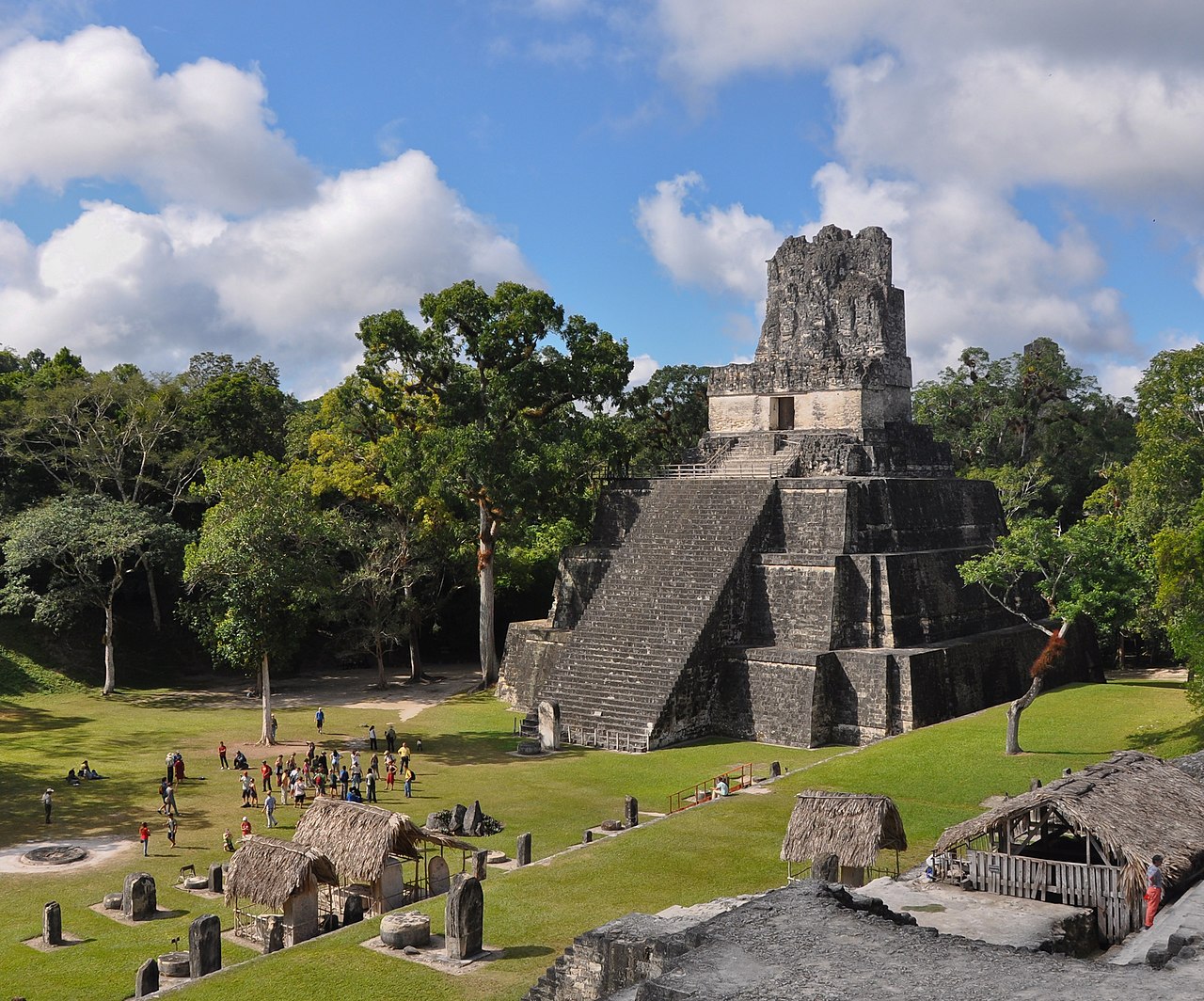
_-_Guatemala_1828_-_La_Danta_at_the_Mayan_site_of_El_Mirador.jpg/1920px-Flickr_-_archer10_(Dennis)_-_Guatemala_1828_-_La_Danta_at_the_Mayan_site_of_El_Mirador.jpg 1920w)
Pyramid of La Danta
Photo Dennis G. Jarvis · CC BY-SA 2.0Source file on Wikimedia Commons
Overview
About this site
Overview
The Pyramid of La Danta is a large Maya structure at the archaeological site of El Mirador, in the department of Petén, Guatemala. Its construction goes back to 300 BCE, within the Preclassic period of Mesoamerica.
The complex stands on a pyramidal platform together with two adjacent pyramids, supports 19 large structures and many smaller buildings, and reaches a total height of 72 metres. Its volume is estimated at 2,800,000 m³, which exceeds the 2,600,000 m³ given for the Great Pyramid of Khufu at Giza by 200,000 m³; only the Great Pyramid of Cholula, in Puebla, Mexico, at 4,500,000 m³, is larger. Like the rest of El Mirador, it lies hidden by forest.
Read on Wikipedia4 min readCC BY-SA 4.0
Article
Pyramid of La Danta
NameSources for this section
- Wikipedia (Spanish): Pirámide de La DantaCC BY-SA 4.0
Sources for this section
- Wikipedia (Spanish): Pirámide de La DantaCC BY-SA 4.0
Danta is a local name for the tapir, the largest mammal of the Petén forest. The pyramid was given the name in reference to its great size.
The complex consists of three levelled platforms of stepped form carrying a triadic acropolis, and has been dated to the Late Preclassic period.
DescriptionSources for this section
- Wikipedia (Spanish): Pirámide de La DantaCC BY-SA 4.0
Sources for this section
- Wikipedia (Spanish): Pirámide de La DantaCC BY-SA 4.0
The complex consists of three levelled platforms of stepped form carrying a triadic acropolis, and has been dated to the Late Preclassic period. It is so large that researchers have considered it possibly a small city near El Mirador rather than a single building of that city. It is not known whether the structure was built on level ground or incorporated a natural hill, as was common in Mesoamerican pyramid building. Its main building faces west and the whole complex rises towards the east, and masks decorate the main facades of its buildings. By height, La Danta is among the tallest pyramids built in pre-Columbian America, exceeding the Pyramid of the Sun at Teotihuacan (66 metres) and the Temple of the Two-Headed Serpent at Tikal (70 metres).
The first platform, also called the base, was the point of public access and was linked to El Mirador by the Danta causeway. It was built of layers of sascab and measures 330 m north to south and 280 m east to west; it is 12 m high and deviates 13°30' from true north. Several major causeways converged on it, linking the structure with the Great Central Acropolis and with Nakbé. Its central stairway is at least 10 metres wide and has seven steps leading to the La Pava group. The La Pava acropolis has a main plaza of 4,400 m², known as the Plaza Pavos, and two levels, the upper one with three buildings in the triadic pattern. To the south-east of the plaza lies a reservoir of 2,190 m² in area and 5 m deep.
The second platform measures 180 m north to south and 240 m east to west, is 10 m high and deviates 9°26' from true north. It carries the Witzizil plaza, the Danta Acropolis and the Saraguate and Barba Amarilla groups. The Danta Acropolis stands on a natural hill and is described as the most important building of El Mirador. Its pyramidal base measures 135 by 130 m and is 25 m high, and carries seven superimposed buildings around a main structure, 2A8-2, which is 26 m high. The total height of the acropolis is 51 m.
ArchaeologySources for this section
- Wikipedia (Spanish): Pirámide de La DantaCC BY-SA 4.0
Sources for this section
- Wikipedia (Spanish): Pirámide de La DantaCC BY-SA 4.0
Structure 2A8-2 is among the most thoroughly investigated buildings of the site; the first excavations there were undertaken by the Brigham Young University project in 1979. Structure 3A8-1 has also been intensively excavated. At the Danta Acropolis, six floors in the plaza correspond to successive Late Preclassic remodellings. Rooms yielded polychrome pottery fragments, including a vessel fragment with a checkerboard motif, and fragments of figurines and whistles with representations associated with gods and mythological beings. Several tombs were found among the fills of the small rooms.
Building 2A6-6 shows a ceremonial process of abandonment: its stone masks were removed and buried at the foot of the structure, and everything was covered with stucco. After El Mirador collapsed at the end of the Late Preclassic, the Danta Acropolis was apparently abandoned in the Early Classic. The small buildings on the second platform were put up in the Late Classic, seven centuries after La Danta and El Mirador had been abandoned, and facade blocks from the Preclassic buildings were reused for benches and room walls. Looting trenches have been recorded in several structures of the Saraguate group.
InterpretationSources for this section
- Wikipedia (Spanish): Pirámide de La DantaCC BY-SA 4.0
Sources for this section
- Wikipedia (Spanish): Pirámide de La DantaCC BY-SA 4.0
The archaeologist Richard D. Hansen, director of research at El Mirador, has stated that the city was the Late Preclassic capital of the Kaan (Snake) kingdom. Only one example of the Kaan emblem glyph has been found, at the peripheral site of La Muerta, and its accompanying text is too eroded to confirm the reading definitively. It is certain that the city of Calakmul, in Campeche, Mexico, was the Late Classic capital of that polity. The scale of La Danta and other recent discoveries in the Mirador Basin are cited as evidence of a highly sophisticated Preclassic Maya culture, contrary to the generally accepted view of that period as one of incipient culture and technology.
Tradition and region
About this kind of monument
Mesoamerican stelae and carved stone
Mesoamerica's civilisations raised carved stone monuments. Maya stelae are tall sculpted stone shafts, often paired with low circular stones called altars, though their actual function is uncertain. Many stelae are carved in low relief, though plain ones are found throughout the Maya region. The sculpting of these monuments spread across the Maya area in the Classic Period (about 250 to 900 CE), and the pairing of sculpted stela and altar is a hallmark of Classic Maya civilisation. The earliest dated stela found in place in the Maya lowlands comes from Tikal in Guatemala, and during the Classic Period almost every Maya kingdom in the southern lowlands raised stelae in its ceremonial centre.
The Olmec colossal heads, much older, are stone representations of heads carved from large basalt boulders, from 1.17 to 3.4 metres high. They date from at least 900 BCE and are a distinctive feature of Olmec civilisation. All portray individuals with distinctive features of the people who still live in Tabasco and Veracruz, and the backs are often flat. The boulders came from the Sierra de los Tuxtlas mountains in Veracruz, and given the weight of the stone, which was moved over 150 kilometres, much labour was needed.
Many Maya stelae carry inscriptions in hieroglyphs with dates in the Long Count calendar, and so can be dated to the day. This makes them among the most precisely dated monuments in the Atlas. They commemorate rulers and events, not the dead in general.
The Atlas's records in Mexico, Guatemala and Belize are mostly Maya sites with stelae, altars and carved monuments.
When visiting, look at the carved figure on the front, which is usually a ruler, and at the glyphs on the sides and back. Many stelae are now protected by roofs.
Paraphrased from Wikipedia: Maya stelae, Wikipedia: Olmec colossal heads, Wikipedia: Stele · CC BY-SA 4.0
From the article
Dated moments in the story
- 1000
Para la construcción del complejo, es posible que se hayan aprovechado algunas de las construcciones ya existentes en el lugar, pues éste estuvo habitado desde el Preclásico Medio —1000 a.
Source
Photographs
1 photograph, each with its author and licence
Where it stands
Guatemala
The pin marks the monument itself — its exact point.
- Coordinates
- 17°45′06″ N, 89°54′10″ WFor a GPS or map app: 17.75170, -89.90269
Access is as our sources describe it; we have not visited the site to check.
Nearby
The closest sites in the Atlas, by straight line.




Sources
Every record behind this page, with the link it came from.
1 source behind this page
- 01Wikidata Q6076801wikidata.org
Image files
Report a correctionWrong date, name, photograph or source? Tell us and it will be put right.
Around this place
The ten nearest sites, by compass
Credit
Text, licence and sources
Adapted from the Wikipedia article "Pirámide de La Danta" (Spanish), licensed CC BY-SA 4.0; authors are listed in the page history. Reused under CC BY-SA 4.0. Read on Wikipedia · Edit history and authors
- Wikipedia (Spanish): Pirámide de La DantaCC BY-SA 4.0
- Wikidata Q6076801CC0