
Stone circleUNESCO World Heritage
Wassu Stone Circles
Also known asSenegambian Stone Circles
Datedc. 300 BCE–1600 CE*
Photo Ikiwaner · CC BY-SA 3.0Source file on Wikimedia Commons
Overview
About this site
Overview
The Wassu Stone Circles are a group of stone circles (cromlechs) and tumuli near the village of Wassu, in the district of Niani, Central River Region, The Gambia. The site has 11 circles of dressed laterite pillars and also an alignment, and the megaliths stand over tombs. It is dated by radiocarbon, and the site as a whole is placed between the third century BCE and the sixteenth century.
In 2006 it was inscribed on the UNESCO World Heritage List as part of the Stone Circles of Senegambia, together with Kerbatch in The Gambia and Sine Ngayène and Wanar in Senegal.
Read on Wikipedia2 min readCC BY-SA 4.0
Age sources
Sources disagree on the age of this site
Sources do not agree on how old this site is. Each claim is listed with where it comes from; the mainstream reading is marked.
Range across all claimsc. 300 BCE–1600 CE*
MeasuredWhat this badge means
A physical measurement of this site: a radiocarbon date, a tree-ring count, a luminescence date, or a record that can itself be dated.
- 300–200 BCERadiocarbon datingSenegambian circles overall 3rd c. BCE–16th c. CE; burial mounds near Wassu 14C-dated AD 927–1305 (relation to the circles unclear)Source: en.wikipedia.org
- 300 BCE–1600 CEAtlas research notesSenegambian circles overall 3rd c. BCE–16th c. CE; burial mounds near Wassu 14C-dated AD 927–1305 (relation to the circles unclear)Source: en.wikipedia.org
- 927–1305 CEAtlas research notesSenegambian circles overall 3rd c. BCE–16th c. CE; burial mounds near Wassu 14C-dated AD 927–1305 (relation to the circles unclear)Source: en.wikipedia.org
Where it sits in time
The site's dated range, placed against world reference points.
The scale is logarithmic: each step to the left is about ten times older than the last.
Article
Wassu Stone Circles
Each of the 11 circles is made of dressed laterite pillars, about 2 m high and weighing 7 t.
DescriptionSources for this section
- Wikipedia (French): Cercles de pierres de WassuCC BY-SA 4.0
Sources for this section
- Wikipedia (French): Cercles de pierres de WassuCC BY-SA 4.0
Each of the 11 circles is made of dressed laterite pillars, about 2 m high and weighing 7 t. The tallest measures 2.59 m. Each circle contains about ten pillars and measures from 4 to 6 m in diameter. The circles are arranged in two rows, one of 4 circles and one of 7. The site covers 1.63 ha, and a laterite quarry lies about 200 m to the east.
DatingSources for this section
- Wikipedia (French): Cercles de pierres de WassuCC BY-SA 4.0
Sources for this section
- Wikipedia (French): Cercles de pierres de WassuCC BY-SA 4.0
The site dates from between the third century BCE and the sixteenth century. The catalogue record gives a radiocarbon range from 300 to 200 BCE.
ContextSources for this section
- Wikipedia (French): Cercles de pierres de WassuCC BY-SA 4.0
Sources for this section
- Wikipedia (French): Cercles de pierres de WassuCC BY-SA 4.0
The Senegambian stone circles, also called the Wassu stone circles, are groups of megalithic circles in The Gambia, north of Janjanbureh, and in central Senegal. They are spread across a region of 30,000 square kilometres. A study of 1982 recorded 1,145 sites, over 1,000 stone circles and tumuli, spread over an area 350 kilometres long and 100 kilometres wide. They are described as the largest concentration of stone circles anywhere in the world, and as an extensive sacred landscape that was used for more than 1,500 years. The monuments are originally upright blocks or pillars, some collapsed, mostly of laterite, with smooth surfaces. The division into Gambian and Senegalese groups is purely a national one.
Tradition and region
About this kind of monument
Senegambian stone circles
The Senegambian stone circles, also called the Wassu stone circles, are groups of megalithic circles in the Gambia, north of Janjanbureh, and in central Senegal. They are spread across a region of 30,000 square kilometres and are sometimes divided into the Wassu (Gambian) and Sine-Saloum (Senegalese) circles, though that is purely a national division. A 1982 study recorded 1,145 sites, over 1,000 stone circles and tumuli, spread over an area 350 kilometres long and 100 kilometres wide. They are the largest concentration of stone circles anywhere in the world, and form an extensive sacred landscape that was used for more than 1,500 years. The sites were inscribed on the UNESCO World Heritage List.
The monuments are originally upright blocks or pillars, some collapsed, mostly of laterite, with smooth surfaces. They are found in circles and double circles, standing apart from circles (usually to the east), in rows, or singly. Stones standing apart are called frontal stones, and when frontal stones form two parallel, connected rows they are called lyre-stones.
Because the long span of use means that no single date applies, the Atlas gives a broad range. The Senegambian circles show that stone circles are not only a north-western European phenomenon.
When visiting, look at how the stones are shaped and how they stand in rings with frontal stones to the east.
Paraphrased from Wikipedia: Senegambian stone circles, Wikipedia: Megalith · CC BY-SA 4.0
From the article
Dated moments in the story
- 2006
En 2006, le site est inscrit sur la liste du patrimoine mondial comme partie des cercles mégalithiques de Sénégambie, avec les cercles de pierres de Kerbatch (Gambie), Sine Ngayène et Wanar (Sénégal).
Source
See it in 3D
An interpretive reconstruction of the monument, standing on the real ground at its exact point, under the sun for that place and season. Drag to look around it.
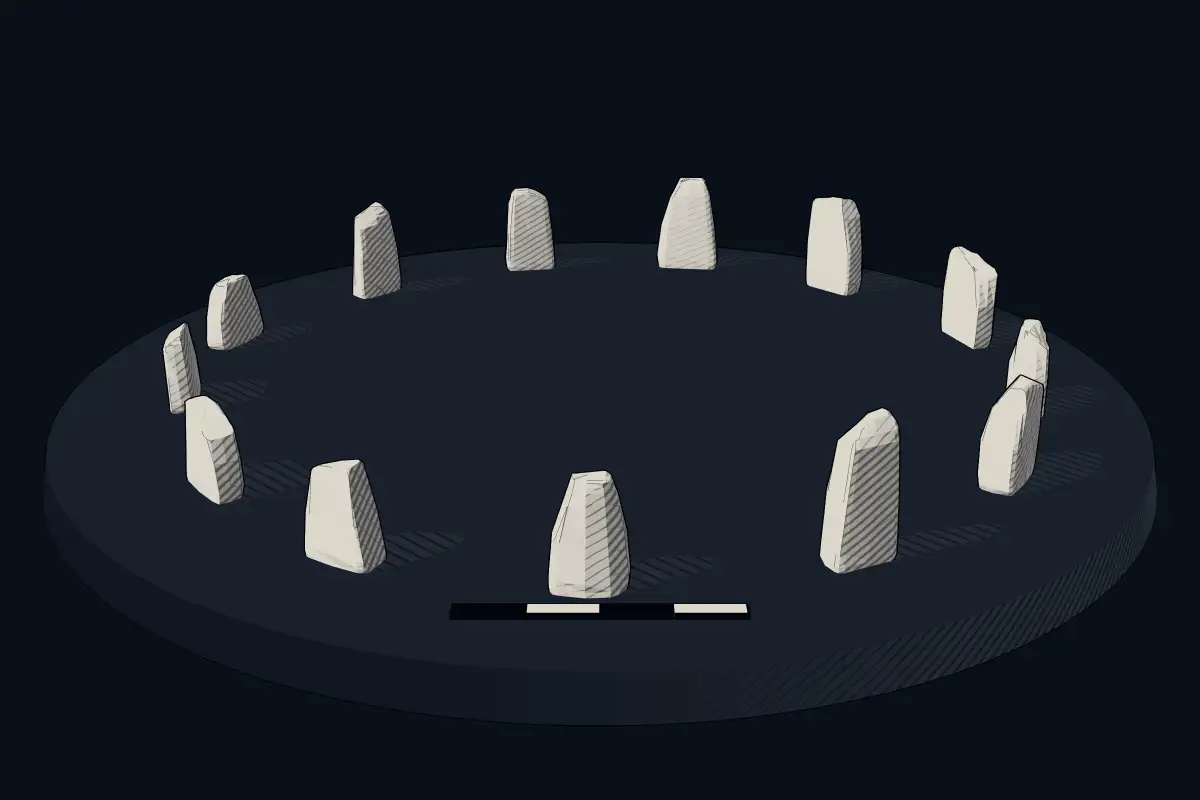
The reconstruction is ours, not a survey: it shows what a monument of this type looks like, at the size the record gives for this one.
Photographs
1 photograph, each with its author and licence
Lore
Evidence & Lore
What the sources actually support — and, kept apart, what has been claimed.
What the evidence supports
Dates
300–200 BCEHow this date was established: Radiocarbon datingSenegambian circles overall 3rd c. BCE–16th c. CE; burial mounds near Wassu 14C-dated AD 927–1305 (relation to the circles unclear)Source for this date
Measured facts
- World Heritage inscription
- 2006Source: World Heritage inscription
- Recorded circles and tumuli
- 1,145 sitesSource: Recorded circles and tumuli
- Approximate stones
- 29,000Source: Approximate stones
- Approximate monuments
- 17,000Source: Approximate monuments
- Individual sites
- 2,000Source: Individual sites
- Principal material
- lateriteSource: Principal material
- Heritage designation
- part of UNESCO World Heritage SiteSource: Heritage designation
Where it stands
The Gambia
The pin marks the monument itself — its exact point.
- Coordinates
- 13°42′00″ N, 14°52′12″ WFor a GPS or map app: 13.70000, -14.87000
Access is as our sources describe it; we have not visited the site to check.
Nearby
The closest sites in the Atlas, by straight line.


Sources
Every record behind this page, with the link it came from.
3 sources behind this page
- 01Q2946555wikidata.org
- 02Senegambian_stone_circlesen.wikipedia.org
- 03World Heritage List entry 1226whc.unesco.org
Image files
Report a correctionWrong date, name, photograph or source? Tell us and it will be put right.
Around this place
The ten nearest sites, by compass
Credit
Text, licence and sources
Adapted from the Wikipedia article "Cercles de pierres de Wassu" (French), licensed CC BY-SA 4.0; authors are listed in the page history. Reused under CC BY-SA 4.0. Read on Wikipedia · Edit history and authors
- Wikipedia (French): Cercles de pierres de WassuCC BY-SA 4.0
- Q2946555CC0
- Senegambian_stone_circlesCC BY-SA 4.0