
Yockenthwaite small stone circle
Also known asYockenthwaite Stone Circle
DatedEst. 3200–2500 BCE
Photo Kognos · CC BY-SA 4.0Source file on Wikimedia Commons

Overview
About this site
Overview
The Yockenthwaite small stone circle is a Bronze Age stone circle at Yockenthwaite, north-west of Kettlewell, in the west of North Yorkshire, England. It is a scheduled monument.
The ring is slightly oval and measures 7.0 by 6.5 m, which makes it relatively small. It consists of 24 stones.
Read on Wikipedia2 min readCC BY-SA 4.0
Where it sits in time
The site's dated range, placed against world reference points.
The scale is logarithmic: each step to the left is about ten times older than the last.
Article
Yockenthwaite small stone circle
The circle stands on the north bank of the upper Wharfe, a river in the Yorkshire Dales that was important to the prehistoric inhabitants.
DescriptionSources for this section
- Wikipedia (German): Steinkreis von YockenthwaiteCC BY-SA 4.0
Sources for this section
- Wikipedia (German): Steinkreis von YockenthwaiteCC BY-SA 4.0
The circle stands on the north bank of the upper Wharfe, a river in the Yorkshire Dales that was important to the prehistoric inhabitants. The Dales Way, a long-distance footpath through the Wharfe valley, passes the stone circle.
The 24 stones include the remains of an outer segment of a circle in the north-west, and there are gaps in the north and the south-east where stones are missing. The massive stones of the ring are mostly no higher than half a metre. An outlier lies about 6 metres to the south-east, and further stones lie to the west.
DatingSources for this section
- Wikipedia (German): Steinkreis von YockenthwaiteCC BY-SA 4.0
Sources for this section
- Wikipedia (German): Steinkreis von YockenthwaiteCC BY-SA 4.0
The monument is described as Bronze Age. The catalogue record gives a typological estimate of 3200 to 2500 BCE, based on the form of the monument rather than on excavated evidence.
InterpretationSources for this section
- Wikipedia (German): Steinkreis von YockenthwaiteCC BY-SA 4.0
Sources for this section
- Wikipedia (German): Steinkreis von YockenthwaiteCC BY-SA 4.0
The circle is probably a stone circle in the narrower sense, that is, a free-standing monument rather than merely a kerb around something in its interior. It could also be the remains of the kerb of a ring cairn.
Tradition and region
About this kind of monument
British and Irish stone circles
Stone circles are rings of standing stones, and the British Isles hold the greatest concentration. Most date from the Late Neolithic and Early Bronze Age, with most built between 3300 and 2500 BCE. The archetypal circle is an uncluttered enclosure, large enough for people to gather inside. Avebury in Wiltshire is the largest: a Neolithic henge monument containing three stone circles, it includes the largest megalithic stone circle in the world and was built over several hundred years in the third millennium BCE. Stonehenge, on Salisbury Plain, has an outer ring of sarsen stones about 4 metres high, topped by lintels held with mortise and tenon joints, with an inner ring of smaller bluestones; the whole is aligned on the summer solstice sunrise and the winter solstice sunset.
Regional types give the landscape its character. The Lake District saw high levels of Neolithic stone circle construction, among them Castlerigg near Keswick, Swinside, Elva Plain and Long Meg and Her Daughters. In south-west Ireland, Drombeg in County Cork is an axial or "Cork-Kerry" circle, 9.3 metres across, with seventeen closely spaced stones of which 13 survive and a recumbent axial stone, its axis pointing south-west to the setting sun. When it was excavated in 1958 the cremated remains of an adolescent were found in a pot at the centre.
Folklore clings to many. The Rollright Stones in Oxfordshire take the names King's Men and Whispering Knights from folklore, and legend holds that the King Stone comes alive at midnight. Drombeg is also called the Druid's Altar.
The purposes of the circles are still debated, though most archaeologists think they were built for ritual or ceremony, much like henges.
When visiting, look at the entrance stones and at the direction in which a circle's axis faces.
Paraphrased from Wikipedia: Stone circle, Wikipedia: Avebury, Wikipedia: Castlerigg stone circle, Wikipedia: Drombeg stone circle, Wikipedia: Stonehenge, Wikipedia: Rollright Stones · CC BY-SA 4.0
See it in 3D
An interpretive reconstruction of the monument, standing on the real ground at its exact point, under the sun for that place and season. Drag to look around it.
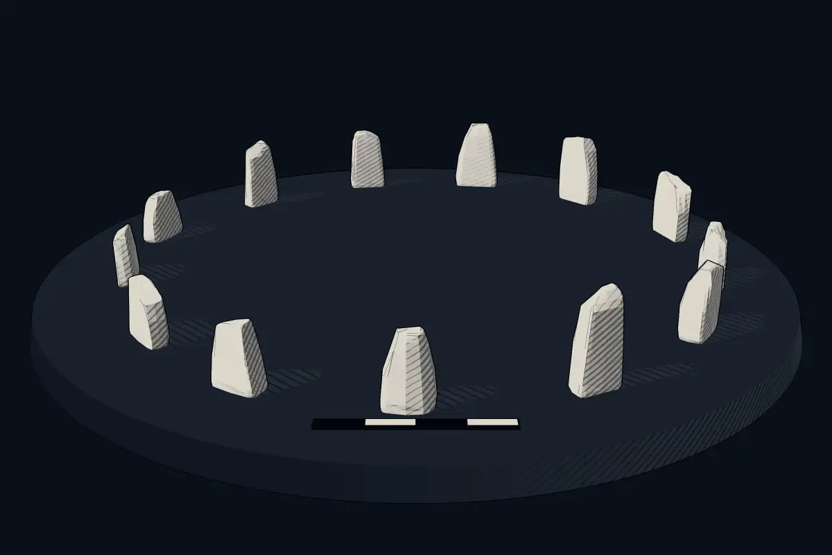
The reconstruction is ours, not a survey: it shows what a monument of this type looks like, at the size the record gives for this one.
Photographs
8 photographs, each with its author and licence
More photographs


Lore
Evidence & Lore
What the sources actually support — and, kept apart, what has been claimed.
What the evidence supports
Dates
Est. 3200–2500 BCEHow this date was established: Type comparisonTypical range for stone circles in United Kingdom; this site has not been dated itself. The earliest stone circles in Britain were erected 3200-2500 BC.Source for this date
Where it stands
United Kingdom
The pin marks the monument itself — its exact point.
- Coordinates
- 54°12′36″ N, 2°09′20″ WFor a GPS or map app: 54.21000, -2.15548
Access is as our sources describe it; we have not visited the site to check.
Nearby
The closest sites in the Atlas, by straight line.
 Cairn on scar above Hubberholme, 380m south east of Slades Swallow Hole4000–800 BCE
 Giants’ Graves2900–800 BCE
- Megalithic mound (tumulus with integral stones)Shorn medieval boundary cross and bowl barrow4000–800 BCE
- Megalithic mound (tumulus with integral stones)Cairn on Green Scar, 470m SE of New Bridge4000–800 BCE
- Megalithic mound (tumulus with integral stones)Cairn above Cam Pasture, 700m NNW of Cam Houses4000–800 BCE
- Megalithic mound (tumulus with integral stones)Cairn on Blue Scar 460m NW of Springs Cave4000–800 BCE
- Megalithic mound (tumulus with integral stones)Bowl barrow 120m north of Tor Dike on Little Hunters Sleets4000–800 BCE
 Cairn on Addlebrough Hill including cup marked boulders.4000–800 BCE


Sources
Every record behind this page, with the link it came from.
2 sources behind this page
- 01Wikidata Q17645606wikidata.org
- 02Source for this dateen.wikipedia.org
Image files
- Yockenthwaite Stone Circle.jpgKognosCC BY-SA 4.0
- Yockenthwaite Stone Circle - geograph.org.uk - 8329720.jpgDS PughCC BY-SA 2.0
- Yockenthwaite stone circle - ring cairn from the east - geograph.org.uk - 3537142.jpgChristine JohnstoneCC BY-SA 2.0
- Yockenthwaite stone circle - ring cairn from the west - geograph.org.uk - 3537138.jpgChristine JohnstoneCC BY-SA 2.0
- Ford on the Wharfe - geograph.org.uk - 1207712.jpgHelen WilkinsonCC BY-SA 2.0
- Yockenthwaite Stone Circle - geograph.org.uk - 549996.jpgJohn IllingworthCC BY-SA 2.0
- Yockenthwaite Stone Circle. - geograph.org.uk - 285596.jpgSteve PartridgeCC BY-SA 2.0
- YockenthwaiteStoneCircle(glamgirl)Sep2004.jpgglamgirlCC BY-SA 2.0
Report a correctionWrong date, name, photograph or source? Tell us and it will be put right.
Around this place
The ten nearest sites, by compass
- Cairn on scar above Hubberholme, 380m south east of Slades Swallow Hole3.1 km E
- Giants’ Graves7.4 km SW
- Shorn medieval boundary cross and bowl barrow8.1 km SE
- Cairn on Green Scar, 470m SE of New Bridge8.3 km N
- Cairn above Cam Pasture, 700m NNW of Cam Houses8.5 km NW
- Cairn on Blue Scar 460m NW of Springs Cave9.4 km SE
- Bowl barrow 120m north of Tor Dike on Little Hunters Sleets9.4 km E
- Cairn on Addlebrough Hill including cup marked boulders.9.9 km NE
- Castle Dykes Henge11 km NE
- Cairn on Great Close Hill13 km S
Credit
Text, licence and sources
Adapted from the Wikipedia article "Steinkreis von Yockenthwaite" (German), licensed CC BY-SA 4.0; authors are listed in the page history. Reused under CC BY-SA 4.0. Read on Wikipedia · Edit history and authors