The Kempe Stones
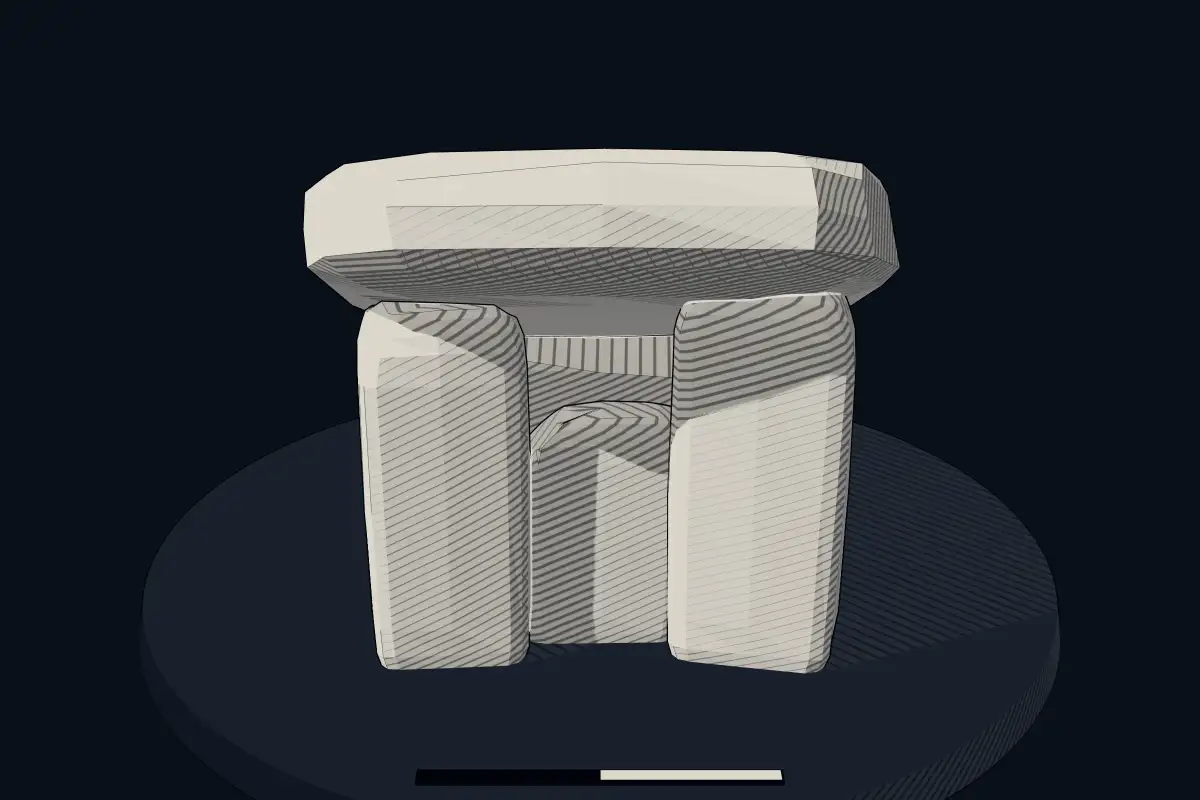
No licensed photograph yetWe have no photograph we may publish for this site, so the interpretive 3D view leads instead.
Overview
About this site
Overview
The Kempe Stones, also known as Greengraves, are a portal tomb in a field near Dundonald, west of Newtownards, County Down, Northern Ireland. The monument is built into a hedge of western gorse (Ulex gallii) and is a Scheduled Monument.
It is a good example of the rarer type of portal tomb with two capstones. Human bones were found in the chamber around 1830.
Read on Wikipedia2 min readCC BY-SA 4.0
Article
The Kempe Stones
The back of this capstone rests on a second, much smaller rear capstone, which in turn rests on the end and side stones.
DescriptionSources for this section
- Wikipedia (German): Kempe StonesCC BY-SA 4.0
Sources for this section
- Wikipedia (German): Kempe StonesCC BY-SA 4.0
The portal stones are of equal height and support the thicker front capstone. The back of this capstone rests on a second, much smaller rear capstone, which in turn rests on the end and side stones. The stones form a polygonal chamber. There is also some stone material around the monument, but it is not known whether it is original.
FindsSources for this section
- Wikipedia (German): Kempe StonesCC BY-SA 4.0
Sources for this section
- Wikipedia (German): Kempe StonesCC BY-SA 4.0
Human bones were found in the monument around 1830.
NameSources for this section
- Wikipedia (German): Kempe StonesCC BY-SA 4.0
Sources for this section
- Wikipedia (German): Kempe StonesCC BY-SA 4.0
The word "Kempe" means a fighter (knight), which suggests that the dolmen was regarded as the grave of a soldier. The name "Green" (in Grenngraves) is a corruption of Gráinne, the figure of legend who was forced to flee with her lover Diarmuid. According to the story, they travelled through Ireland and spent only one night in each place, which gave rise to a large number of "Dermot and Grania's beds" (Irish leaba, anglicised labba) or caves.
ContextSources for this section
- Wikipedia (German): Kempe StonesCC BY-SA 4.0
Sources for this section
- Wikipedia (German): Kempe StonesCC BY-SA 4.0
Other portal tombs of the two-capstone type include Aughnacliff in County Longford, Knockeen in County Waterford, Kilmogue in County Kilkenny and the Haroldstown dolmen. The portal tomb of Ballygraffan lies nearby.
A portal tomb, or portal dolmen, is the Irish and British version of the dolmen: a single-chamber megalithic tomb with two or more upright stones framing a "portal" at the front and a large capstone. Most portal tombs date from the Neolithic, between 4000 and 3000 BCE, and some were covered by a mound of earth or smaller stones which has since eroded away, leaving the stone skeleton.
Tradition and region
About this kind of monument
Portal tombs
A portal tomb, or portal dolmen, is the Irish and British version of the dolmen: a single-chamber megalithic tomb with two or more upright stones framing a "portal" at the front and a large capstone. In the Irish classification of megalithic tombs set out by Seán Ó Nualláin and Rúaidhrí de Valera in 1961, portal dolmens are one of four categories, alongside court cairns, wedge-shaped gallery graves and passage tombs.
Most portal tombs date from the Neolithic, between 4000 and 3000 BCE, and some were covered by a mound of earth or smaller stones which has since eroded away, leaving the stone skeleton. Ireland has about 172 dolmens, of which the best known is Poulnabrone in the Burren, with estimates between 3800 and 3200 BCE. Excavation under Poulnabrone found the remains of about 33 people, adults and children, along with stone and bone objects.
In Wales and Cornwall the form is the cromlech or quoit. Pentre Ifan in Pembrokeshire is the largest and best-preserved Neolithic dolmen in Wales. The names of Irish portal tombs often reflect old tradition: Brownshill, near Carlow, has a capstone reputed to be the heaviest in Europe, estimated at 150 tonnes, and Proleek in County Louth is the subject of a legend of a Scottish giant who carried it there.
Dating rests on the few excavated tombs, and most are dated by comparison.
When visiting, look for the capstone and for the portal stones at the front.
Paraphrased from Wikipedia: Portal dolmen, Wikipedia: Dolmen, Wikipedia: Passage grave, Wikipedia: Poulnabrone dolmen, Wikipedia: Pentre Ifan, Wikipedia: Brownshill Dolmen, Wikipedia: Proleek Dolmen · CC BY-SA 4.0
From the article
Dated moments in the story
- 1830
In der Megalithanlage wurden etwa 1830 menschliche Knochen gefunden.
Source
See it in 3D
An interpretive reconstruction of the monument, standing on the real ground at its exact point, under the sun for that place and season. Drag to look around it.
The reconstruction is ours, not a survey: it shows what a monument of this type looks like, at the size the record gives for this one.
Where it stands
United Kingdom
The pin marks the monument itself — its exact point.
- Coordinates
- 54°35′24″ N, 5°45′53″ WFor a GPS or map app: 54.59010, -5.76472
Access is as our sources describe it; we have not visited the site to check.
Nearby
The closest sites in the Atlas, by straight line.
- Menhir (standing stone)Standing stone2800–1800 BCE
- Menhir (standing stone)Standing Stone, Clandeboye Golf Club, Tower Rd2800–1800 BCE
- Menhir (standing stone)‘Horned Cairn’2800–1800 BCE
 Court Tomb von Ballynichol
- MegalithPortal Tomb von Ballygraffan3300–2900 BCE
 Court Tomb von Ballintaggart
- Menhir (standing stone)Standing Stone, off Hannay’s Hill, Bangor2800–1800 BCE
- CistSteinkiste von Mount Stewart2900–800 BCE


Sources
Every record behind this page, with the link it came from.
1 source behind this page
- 01Wikidata Q1305136wikidata.org
Report a correctionWrong date, name, photograph or source? Tell us and it will be put right.
Around this place
The ten nearest sites, by compass
- Standing stone2.3 km N
- Standing Stone, Clandeboye Golf Club, Tower Rd6.4 km NE
- ‘Horned Cairn’6.9 km S
- Court Tomb von Ballynichol6.9 km S
- Portal Tomb von Ballygraffan7.0 km S
- Court Tomb von Ballintaggart11 km W
- Standing Stone, off Hannay’s Hill, Bangor12 km NE
- Steinkiste von Mount Stewart12 km E
- Standing stone at Kilcoroon House15 km NE
- Standing stone22 km SE
Credit
Text, licence and sources
Adapted from the Wikipedia article "Kempe Stones" (German), licensed CC BY-SA 4.0; authors are listed in the page history. Reused under CC BY-SA 4.0. Read on Wikipedia · Edit history and authors
- Wikipedia (German): Kempe StonesCC BY-SA 4.0
- Wikidata Q1305136CC0