McCole's Castle, chambered cairn
DatedEst. 4000–2500 BCE
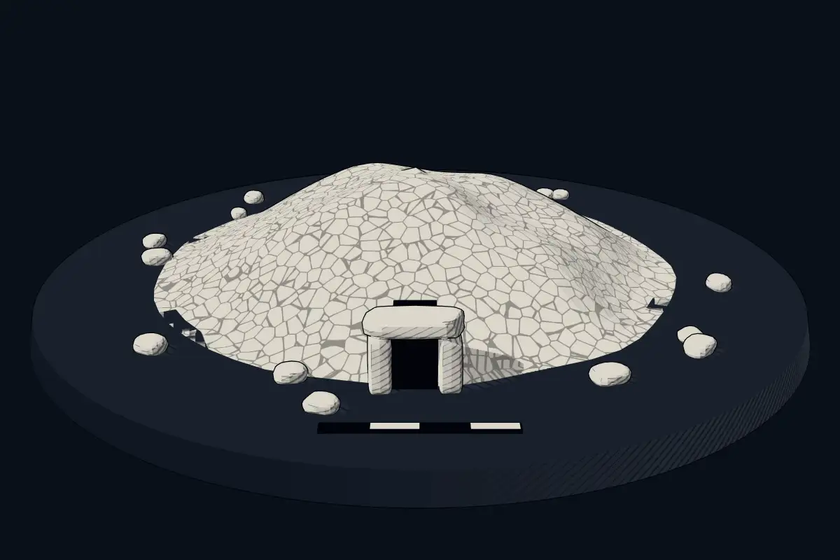
No licensed photograph yetWe have no photograph we may publish for this site, so the interpretive 3D view leads instead.
Overview
About this site
Overview
McCole's Castle, chambered cairn is a chambered cairn in Highland, United Kingdom. It lies at 58.3734° N, 3.1709° W.
Catalogue recordSources and licences
Where it sits in time
The site's dated range, placed against world reference points.
The scale is logarithmic: each step to the left is about ten times older than the last.
Article
McCole's Castle, chambered cairn
ContextSources for this section
- en.wikipedia.orgCC BY-SA 4.0
- en.wikipedia.orgCC BY-SA 4.0
- en.wikipedia.orgCC BY-SA 4.0
- en.wikipedia.orgCC BY-SA 4.0
- en.wikipedia.orgCC BY-SA 4.0
- en.wikipedia.orgCC BY-SA 4.0
- en.wikipedia.orgCC BY-SA 4.0
Sources for this section
- en.wikipedia.orgCC BY-SA 4.0
- en.wikipedia.orgCC BY-SA 4.0
- en.wikipedia.orgCC BY-SA 4.0
- en.wikipedia.orgCC BY-SA 4.0
- en.wikipedia.orgCC BY-SA 4.0
- en.wikipedia.orgCC BY-SA 4.0
- en.wikipedia.orgCC BY-SA 4.0
Scotland, and above all Orkney and Caithness, has many Neolithic tombs. A chambered cairn is a stone mound over one or more burial chambers, entered by a passage. Maeshowe on Mainland Orkney was probably built around 2800 BCE, and gives its name to the Maeshowe type of cairn, which is limited to Orkney; its entrance passage is about 11 metres long, and sunlight enters it at the winter solstice and reaches the rear wall of the chamber. It is part of the Heart of Neolithic Orkney World Heritage Site. In the twelfth century Norse visitors broke in through the roof and left runic inscriptions inside. The regional background, “Orkney, Caithness and Scottish chambered cairns”, is given below.
DatingSources for this section
- en.wikipedia.orgCC BY-SA 4.0
Sources for this section
- en.wikipedia.orgCC BY-SA 4.0
No scientific date has been published for this site. Monuments of this type in United Kingdom are generally dated 4000 BCE to 2500 BCE; the site itself may fall inside or outside that range.
Stone-chambered cairns appear in the early Neolithic (4000-3300 BC) and in the later Neolithic (3300-2500 BC) massive circular enclosures emerge.
Setting
41 other recorded monuments lie within 10 km (5 within 1 km, 27 within 5 km), 9 of them of the same type. In Highland, United Kingdom, 153 of the 556 recorded monuments are of this type.
The nearest recorded monuments are Loch of Yarrows, two cairns 700m ENE of South Yarrows (0.2 km west, megalithic mound); Loch of Yarrows, cairn 550m ENE of South Yarrows (0.4 km west, megalithic mound); Brounaban (0.7 km east, cyclopean masonry); Battle Moss, Loch Of Yarrows, stone row and cairn (0.7 km north-west, megalithic mound).
ProtectionSources for this section
Sources for this section
Heritage status: scheduled monument.
Tradition and region
About this kind of monument
Orkney, Caithness and Scottish chambered cairns
Scotland, and above all Orkney and Caithness, has many Neolithic tombs. A chambered cairn is a stone mound over one or more burial chambers, entered by a passage. Maeshowe on Mainland Orkney was probably built around 2800 BCE, and gives its name to the Maeshowe type of cairn, which is limited to Orkney; its entrance passage is about 11 metres long, and sunlight enters it at the winter solstice and reaches the rear wall of the chamber. It is part of the Heart of Neolithic Orkney World Heritage Site. In the twelfth century Norse visitors broke in through the roof and left runic inscriptions inside.
Orkney also has the Quoyness cairn on Sanday, built about 3000 BCE and similar in design to Maeshowe, where the remains of several people were found in 1867. Unstan, on a promontory into the Loch of Stenness, is an atypical hybrid of the two main types of Orkney cairn and gave its name to Unstan ware, a type of pottery. The Tomb of the Eagles at Isbister on South Ronaldsay stands on a cliff edge.
On the mainland, the Grey Cairns of Camster in Caithness are two large chambered cairns dating to around 3000 BCE, among the oldest structures in Scotland, with central chambers reached by narrow passages. They were excavated and restored by Historic Environment Scotland and are open to the public.
Dating rests on radiocarbon dates from bone and on pottery, but many cairns were opened by antiquarians in the nineteenth century before records were kept. The Atlas gives a typological range of the fourth to third millennium BCE for most.
When visiting, check access in advance, since some cairns have narrow passages and others are open only at set times.
Paraphrased from Wikipedia: Chambered cairn, Wikipedia: Maes Howe, Wikipedia: Quoyness chambered cairn, Wikipedia: Unstan chambered cairn, Wikipedia: Isbister Chambered Cairn, Wikipedia: Midhowe Chambered Cairn, Wikipedia: Grey Cairns of Camster · CC BY-SA 4.0
Lore
Evidence & Lore
What the sources actually support — and, kept apart, what has been claimed.
What the evidence supports
Dates
Est. 4000–2500 BCEHow this date was established: Type comparisonTypical range for chambered cairns in United Kingdom; this site has not been dated itself. Stone-chambered cairns appear in the early Neolithic (4000-3300 BC) and in the later Neolithic (3300-2500 BC) massive circular enclosures emerge.Source for this date
Where it stands
United Kingdom
The pin marks the monument itself — its exact point.
- Coordinates
- 58°22′24″ N, 3°10′15″ WFor a GPS or map app: 58.37338, -3.17093
Access is as our sources describe it; we have not visited the site to check.
Nearby
The closest sites in the Atlas, by straight line.
- Megalithic mound (tumulus with integral stones)Loch of Yarrows, two cairns 700m ENE of South Yarrows4000–800 BCE
- Megalithic mound (tumulus with integral stones)Loch of Yarrows, cairn 550m ENE of South Yarrows4000–800 BCE
- Cyclopean masonryBrounaban390 BCE–200 CE
 Battle Moss, Loch Of Yarrows, stone row and cairn4000–800 BCE
 Broch of Yarrows390 BCE–200 CE
- Chambered cairnCairn Reain, chambered cairn4000–2500 BCE
- Chambered cairnlong cairn 220m NW of South Yarrows4000–2500 BCE
- Cyclopean masonrybroch 260m S of Borrowston390 BCE–200 CE


Sources
Every record behind this page, with the link it came from.
2 sources behind this page
- 01Wikidata Q56661847wikidata.org
- 02Source for this dateen.wikipedia.org
Report a correctionWrong date, name, photograph or source? Tell us and it will be put right.
Around this place
The ten nearest sites, by compass
- Loch of Yarrows, two cairns 700m ENE of South Yarrows0.2 km W
- Loch of Yarrows, cairn 550m ENE of South Yarrows0.4 km W
- Brounaban0.7 km E
- Battle Moss, Loch Of Yarrows, stone row and cairn0.7 km NW
- Broch of Yarrows0.8 km W
- Cairn Reain, chambered cairn1.1 km NW
- long cairn 220m NW of South Yarrows1.1 km W
- broch 260m S of Borrowston1.3 km E
- Cairns of Warehouse, cairns at N end of Warehouse Hill1.6 km SW
- Ormiegill North1.7 km E
Credit
Text, licence and sources
Compiled from open records (Wikidata, CC0; OpenStreetMap, ODbL) and a regional background article based on Wikipedia (CC BY-SA 4.0).
- Wikidata Q56661847CC0
- en.wikipedia.orgCC BY-SA 4.0
- en.wikipedia.orgCC BY-SA 4.0
- en.wikipedia.orgCC BY-SA 4.0
- en.wikipedia.orgCC BY-SA 4.0
- en.wikipedia.orgCC BY-SA 4.0
- en.wikipedia.orgCC BY-SA 4.0
- en.wikipedia.orgCC BY-SA 4.0