Coneybury Henge
Also known asHenge monument 400m south of Stonehenge Cottages
Datedc. 3047–2925 BCE
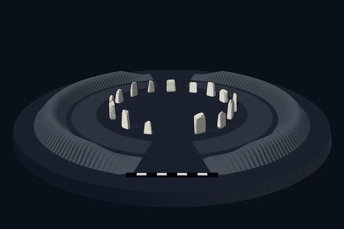
No licensed photograph yetWe have no photograph we may publish for this site, so the interpretive 3D view leads instead.
Overview
About this site
What the sources say
Coneybury Henge is a henge which is part of the Stonehenge Landscape in Wiltshire, England. The henge, which has been almost completely flattened, was only discovered in the 20th century. Geophysical surveys and excavation have uncovered many of its features, which include a northeast entrance, an internal circle of postholes, and fragments of bone and pottery.
Read on Wikipedia4 min readCC BY-SA 4.0
Where it sits in time
The site's dated range, placed against world reference points.
The scale is logarithmic: each step to the left is about ten times older than the last.
The full article
Coneybury Henge: the whole story
In briefSources for this section
- Wikipedia (English): Coneybury HengeCC BY-SA 4.0
Sources for this section
- Wikipedia (English): Coneybury HengeCC BY-SA 4.0
Coneybury Henge is part of the Stonehenge Landscape in Wiltshire, England. It lies around 1.4 kilometres east-by-southeast of Stonehenge, which can be seen from the site. Views extend southeast across the Avon valley and west towards Normanton Down. The site is also known as Henge monument 400m south of Stonehenge Cottages.
The henge has been almost completely flattened by ploughing and is difficult to identify on the ground. It was first noticed from the air in the 1920s and was then thought to be a disc barrow. Later aerial photographs showed an oval ditch around 45 metres by 55 metres in diameter, with an entrance on the longer axis on the northeast side. Traces of an external bank are said to be visible.
Excavation in 1980 as part of the Stonehenge Environs Project revealed a broad oval ditch around 4 metres wide by 3 metres deep. Inside were a few pits and postholes, numerous stakeholes, and an arc of postholes along the inner edge of the enclosure ditch that may have formed a post circle. Finds included pottery ranging from the early Neolithic to middle Bronze Age, animal bone, and a human cremation. Radiocarbon dating places the henge between 3047 BCE and 2925 BCE.
About 12 metres northwest, the Coneybury Anomaly is a pit containing large quantities of early Neolithic pottery and animal bone, together with flint tools of both Mesolithic and Neolithic types. Excavators suggest it represents a gathering organised by a regional community, with participants from different cultures and locations. Henges of this kind typically have an internal ditch surrounded by a bank, with a central flat area more than 20 metres across.
SettingSources for this section
- Wikipedia (English): Coneybury HengeCC BY-SA 4.0
Sources for this section
- Wikipedia (English): Coneybury HengeCC BY-SA 4.0
Coneybury Henge is around 1.4 kilometres east-by-southeast of Stonehenge, which can be seen from the site. The location has extensive views southeast across the Avon valley, and west towards Normanton Down. The henge is difficult to identify on the ground, having been levelled by ploughing, but has been identified on aerial photographs, geophysical survey, and by excavation. The absence of any mention of the henge in historical records suggests that it may have been levelled in medieval times or soon after, and this theory is supported by ridge and furrow marks visible on some aerial photographs.
ArchaeologySources for this section
- Wikipedia (English): Coneybury HengeCC BY-SA 4.0
Sources for this section
- Wikipedia (English): Coneybury HengeCC BY-SA 4.0
The site was first noted from the air in the 1920s and thought to be a disc barrow. Later aerial photographs gave strong indications it was a Class I henge. The photographs show an oval ditch, around 45 metres by 55 metres in diameter. The entrance is on the longer axis on the northeast side. Traces of an external bank are said to be visible.
The henge was excavated in 1980 as part of the Stonehenge Environs Project. The excavations revealed a broad oval ditch around 4 metres wide by 3 metres deep defining the henge. Excavation of internal features included a few pits and postholes, numerous stakeholes, and an arc of postholes inside the inner edge of the enclosure ditch which may have represented a post circle. Some of the internal features may pre-date the henge. Finds included pottery ranging from the early Neolithic to middle Bronze Age, as well as animal bone and a human cremation.
Coneybury AnomalySources for this section
- Wikipedia (English): Coneybury HengeCC BY-SA 4.0
Sources for this section
- Wikipedia (English): Coneybury HengeCC BY-SA 4.0
Around 12 metres northwest of Coneybury Henge, evidence suggests a unique cross-cultural feast held long before the Henge was built. The Anomaly is a pit containing a large amount of early Neolithic pottery together with a large quantity of animal bone, and flint tools of both Mesolithic and Neolithic types. The excavators suggest that the Coneybury Anomaly represents the material remains of a gathering organized by a regional community, with participants coming from different cultures and locations.
How this page was madeSources for this section
- Wikipedia (English): Coneybury HengeCC BY-SA 4.0
Sources for this section
- Wikipedia (English): Coneybury HengeCC BY-SA 4.0
The summary at the top of this page was written by MiniMax-M3 (2026-11-07) from the cited Wikipedia article “Coneybury Henge”. The numbers in it were checked automatically against the source text. The rest of the page is the article itself, the structured records and computed distances.
Tradition and region
About this kind of monument
Henges with stone settings
A henge is a Neolithic earthwork, typically a roughly circular or oval bank with an internal ditch around a central flat area more than 20 metres across. The ditch lies inside the bank, so henges cannot have been built for defence. There is typically little evidence of occupation inside a henge, though they may contain ritual structures such as stone circles or timber settings. The word is taken from Stonehenge, which is not a true henge, because its ditch lies outside its bank.
Many British henges have stone settings. Avebury in Wiltshire is a henge containing three stone circles, built over several hundred years in the third millennium BCE. In Orkney the Standing Stones of Stenness, sited on a promontory between two lochs, may be the oldest henge site in the British Isles, and the Ring of Brodgar, a henge and stone circle, stands on a narrow isthmus between the same lochs; both are part of the Heart of Neolithic Orkney World Heritage Site. In Derbyshire, Arbor Low is a henge with an egg-shaped circle of about 50 limestone blocks, one partly upright and the rest lying flat. In Cumbria, Mayburgh Henge is a large bank on a knoll close to a second henge, King Arthur's Round Table. In Yorkshire the Thornborough Henges are three aligned henges on a plateau above the River Ure, dated between 3500 and 2500 BCE and called the Stonehenge of the North. At Durrington Walls, 3.2 kilometres north-east of Stonehenge, a large Neolithic settlement preceded the henge.
Stone settings inside a henge can be earlier or later than the bank, so a henge and its stones are dated separately.
When visiting, walk the bank to get the sense of the circle, and see how the entrance gaps line up with the landscape.
Paraphrased from Wikipedia: Henge, Wikipedia: Stonehenge, Wikipedia: Avebury, Wikipedia: Thornborough Henges, Wikipedia: Standing Stones of Stenness, Wikipedia: Ring of Brodgar · CC BY-SA 4.0
From the article
Dated moments in the story
- 1980
The henge was excavated in 1980 as part of the Stonehenge Environs Project.
Source
Lore
Evidence & Lore
What the sources actually support — and, kept apart, what has been claimed.
What the evidence supports
Dates
3047–2925 BCEHow this date was established: Radiocarbon dating13 radiocarbon dates in the p3k14c database (Bird et al. 2022, Scientific Data 9:27 (p3k14c radiocarbon database)) between 4200 and 5135 BP; the range shown is the middle half of the measurements; uncalibrated ages, shown as calendar years with the conventional BP + 1950 conversion.Source for this date
Measured facts
- Location
- within the Stonehenge Landscape in WiltshireSource: Location
- Initial identification
- a disc barrow when first noticed from the air in the 1920sSource: Initial identification
- Ditch dimensions
- oval, around 45 metres by 55 metresSource: Ditch dimensions
- Excavated ditch
- around 4 metres wide and 3 metres deepSource: Excavated ditch
- Entrance
- northeast sideSource: Entrance
- Excavation
- 1980, as part of the Stonehenge Environs ProjectSource: Excavation
- Heritage designation
- scheduled monumentSource: Heritage designation
Where it stands
United Kingdom
The pin marks the monument itself — its exact point.
- Coordinates
- 51°10′25″ N, 1°48′33″ WFor a GPS or map app: 51.17350, -1.80922
Access is as our sources describe it; we have not visited the site to check.
Nearby
The closest sites in the Atlas, by straight line.
- Megalithic mound (tumulus with integral stones)Bowl barrow on Coneybury Hill, 450m south of the A3034000–800 BCE
- Megalithic mound (tumulus with integral stones)King Barrow and another bowl barrow on Coneybury Hill4000–800 BCE
- Megalithic mound (tumulus with integral stones)Bowl barrow on Coneybury Hill, 130m NNE of Luxenborough Plantation4000–800 BCE
- Megalithic mound (tumulus with integral stones)Bowl barrow forming part of a round barrow cemetery known as the New King Barrows4000–800 BCE
- Megalithic mound (tumulus with integral stones)Bowl barrow on the north eastern edge of Luxenborough Plantation4000–800 BCE
- Megalithic mound (tumulus with integral stones)Bowl barrow 150m east of Stonehenge Cottages on A3034000–800 BCE
- Megalithic mound (tumulus with integral stones)Bowl barrow on the eastern edge of Luxenborough Plantation4000–800 BCE
- Megalithic mound (tumulus with integral stones)Three bowl barrows 150m south of the A303, north of Luxenborough Plantation4000–800 BCE
Sources
Every record behind this page, with the link it came from.
3 sources behind this page
- 01Wikidata Q17672779wikidata.org
- 02Wikipedia (en)en.wikipedia.org
- 03Source for this datep3k14c.org
Report a correctionWrong date, name, photograph or source? Tell us and it will be put right.
Around this place
The ten nearest sites, by compass
- Bowl barrow on Coneybury Hill, 450m south of the A3030.1 km SE
- King Barrow and another bowl barrow on Coneybury Hill0.2 km SE
- Bowl barrow on Coneybury Hill, 130m NNE of Luxenborough Plantation0.4 km W
- Bowl barrow forming part of a round barrow cemetery known as the New King Barrows0.4 km N
- Bowl barrow on the north eastern edge of Luxenborough Plantation0.5 km W
- Bowl barrow 150m east of Stonehenge Cottages on A3030.5 km NE
- Bowl barrow on the eastern edge of Luxenborough Plantation0.5 km SW
- Three bowl barrows 150m south of the A303, north of Luxenborough Plantation0.5 km NW
- Bowl barrow 300m south west of New King Barrows0.5 km NW
- Bowl barrow 70m south of A3030.6 km NE
Credit
Text, licence and sources
Text from the Wikipedia article "Coneybury Henge" (English), licensed CC BY-SA 4.0; authors are listed in the page history. Reused under CC BY-SA 4.0. Read on Wikipedia · Edit history and authors
- Wikipedia (English): Coneybury HengeCC BY-SA 4.0
- Wikidata Q17672779CC0