
Bellever Tor Cairns
DatedEst. 2900–800 BCE
Photo Guy Wareham · CC BY-SA 2.0Source file on Wikimedia Commons

Overview
About this site
Overview
The Bellever Tor Cairns are a group of ten Bronze Age cairns, some of them with a more or less well preserved stone cist, at Bellever Tor, a rock formation near Postbridge on Dartmoor in the county of Devon, England. A typological estimate places them between 2900 and 800 BCE.
The group was named by Jeremy Butler in the nineteenth century.
Read on Wikipedia3 min readCC BY-SA 4.0
Where it sits in time
The site's dated range, placed against world reference points.
The scale is logarithmic: each step to the left is about ten times older than the last.
Article
Bellever Tor Cairns
SettingSources for this section
- Wikipedia (German): Bellever Tor CairnsCC BY-SA 4.0
Sources for this section
- Wikipedia (German): Bellever Tor CairnsCC BY-SA 4.0
The cairns are confined to the western and south-western slopes of Bellever Tor. This area is free of surface stone, because the stone was gathered for the cairns.
It was described in 1890, when its cist had already been plundered, but mound and cist were then still in good order.
DescriptionSources for this section
- Wikipedia (German): Bellever Tor CairnsCC BY-SA 4.0
Sources for this section
- Wikipedia (German): Bellever Tor CairnsCC BY-SA 4.0
Cairn 1 has a cist and is the best preserved cairn. It was described in 1890, when its cist had already been plundered, but mound and cist were then still in good order. Only three stones of the cist now survive. The cist was examined in 1901 and found empty.
Cairn 2 may be either a clearance heap or a cairn. Jeremy Butler described it in his time as a cairn with kerb stones.
Cairn 3 has a cist. Remains of a kerb ring survive in the form of two pairs of stones on both sides of the cist. The cist is in good condition, and only its cover slab is missing.
Cairn 4 is a ring cairn about 11 m in diameter and about 0.5 m high, enclosing a raised interior.
Cairn 5 is a heap of stones about one metre high and, unexpectedly, shows no sign of a cist.
Cairn 6 has a cist. Seven stones of the kerb survive, but of the cist only an end slab and a side slab remain.
Cairn 7 is of doubtful originality, because stone has been removed and a modern ditch has been dug.
Cairn 8 was described in the report of 1890 as already heavily damaged, and only a few stones remain.
Cairn 9 is a low heap of stones that still has its central cist, lacking only the cover slab.
Cairn 10 has been robbed of all its stones apart from a single slab of the cist.
ContextSources for this section
- Wikipedia (German): Bellever Tor CairnsCC BY-SA 4.0
Sources for this section
- Wikipedia (German): Bellever Tor CairnsCC BY-SA 4.0
In Britain and Ireland a cist is a small stone-built coffin-like box used to hold the dead, and it is one of the commonest finds in prehistoric graves. A cist may once have been covered by a cairn or a long barrow, and several are sometimes found together in the same cairn or barrow. The centre of a round barrow, which in Britain was mostly built between 2200 and 1100 BCE, may hold a stone cist or a cut grave, and the burial may be an inhumation or a cremation placed in a vessel.
Tradition and region
About this kind of monument
British and Irish cists
In Britain and Ireland a cist is a small stone-built coffin-like box used to hold the dead, and it is one of the commonest finds in prehistoric graves. A cist may once have been covered by a cairn or a long barrow, and several are sometimes found together in the same cairn or barrow. Ornaments found in excavated cists point to the wealth or prominence of the person buried. The centre of a round barrow, which in Britain was mostly built between 2200 and 1100 BCE, may hold a stone cist or a cut grave, and the burial may be an inhumation or a cremation placed in a vessel.
The Bell Beaker phenomenon, which reached Britain and Ireland in the late Neolithic, brought individual burials, often under tumuli and with weapons, in place of the collective burials of the earlier Neolithic. Cists of this period are therefore often single graves. The Food Vessel culture of the Early Bronze Age used slab cists, and some of their stones carry cup and ring marks.
Kilmartin Glen in Argyll is the richest area, with numerous cists among its prehistoric monuments, including a linear cemetery of five burial cairns that runs for more than three miles. Several of its cairns and many natural rocks are decorated with cup and ring marks. More than 800 ancient monuments lie within ten kilometres of the village, 150 of them prehistoric.
The Atlas's cists are dated by their position in a barrow, by the pottery or ornaments found with the burial, and by radiocarbon dating of surviving bone. Where none is known, it gives a broad Neolithic to Bronze Age range.
When visiting, look for the slabs set on edge around a pit, and for the cap stone that may have fallen aside.
Paraphrased from Wikipedia: Cist, Wikipedia: Round barrow, Wikipedia: Kilmartin Glen, Wikipedia: Bell Beaker culture · CC BY-SA 4.0
From the article
Dated moments in the story
- 1890
Der besterhaltene Cairn wurde im Jahre 1890 beschrieben und seine Steinkiste war bereits geplündert.
Source - 1890
Der Bericht aus dem Jahre 1890 beschreibt diesen Cairn bereits als schwer beschädigt und heute nur sind nur noch ein paar Steine erhalten.
Source - 1901
1901 wurde die Kiste untersucht, aber leer vorgefunden.
Source
See it in 3D
An interpretive reconstruction of the monument, standing on the real ground at its exact point, under the sun for that place and season. Drag to look around it.
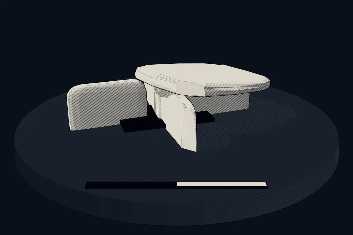
The reconstruction is ours, not a survey: it shows what a monument of this type looks like, at the size the record gives for this one.
Photographs
1 photograph, each with its author and licence
Lore
Evidence & Lore
What the sources actually support — and, kept apart, what has been claimed.
What the evidence supports
Dates
Est. 2900–800 BCEHow this date was established: Type comparisonTypical range for cists in United Kingdom; this site has not been dated itself. British barrows of many types were in use from the late Neolithic until the end of the Bronze Age (2900-800 BC) and many contain a stone cist.Source for this date
Where it stands
United Kingdom
The pin marks the monument itself — its exact point.
- Coordinates
- 50°34′15″ N, 3°55′06″ WFor a GPS or map app: 50.57072, -3.91826
Access is as our sources describe it; we have not visited the site to check.
Nearby
The closest sites in the Atlas, by straight line.
 Ring cairn with cist on Lakehead Hill2900–800 BCE
- Megalithic mound (tumulus with integral stones)Round cairn 400m south east of Higher White Tor4000–800 BCE
 Cairn and cist 875m north west of Arch Tor4000–800 BCE
- Megalithic mound (tumulus with integral stones)Cairn 190m west of Archerton4000–800 BCE
 Sherberton stone circle 315m SSE of Little Sherberton3200–2500 BCE
 Chittaford Down cairn circle and cist4000–800 BCE
- Megalithic mound (tumulus with integral stones)Round cairn 480m south west of Higher White Tor4000–800 BCE
- Megalithic mound (tumulus with integral stones)Cairn 500m NNW of Archerton4000–800 BCE


Sources
Every record behind this page, with the link it came from.
2 sources behind this page
- 01Wikidata Q15787558wikidata.org
- 02Source for this dateen.wikipedia.org
Image files
Report a correctionWrong date, name, photograph or source? Tell us and it will be put right.
Around this place
The ten nearest sites, by compass
- Ring cairn with cist on Lakehead Hill1.2 km N
- Round cairn 400m south east of Higher White Tor2.8 km NW
- Cairn and cist 875m north west of Arch Tor2.9 km NW
- Cairn 190m west of Archerton3.0 km N
- Sherberton stone circle 315m SSE of Little Sherberton3.1 km S
- Chittaford Down cairn circle and cist3.2 km N
- Round cairn 480m south west of Higher White Tor3.3 km NW
- Cairn 500m NNW of Archerton3.4 km N
- Cairnfield and field 1030m north west of Archerton3.8 km N
- Soussons Common stone circle4.0 km NE
Credit
Text, licence and sources
Adapted from the Wikipedia article "Bellever Tor Cairns" (German), licensed CC BY-SA 4.0; authors are listed in the page history. Reused under CC BY-SA 4.0. Read on Wikipedia · Edit history and authors
- Wikipedia (German): Bellever Tor CairnsCC BY-SA 4.0
- Wikidata Q15787558CC0