
Barbrook One
Also known asBarbrook I · Barbrook No. 1
DatedEst. 4000–1200 BCE
Photo John Knight · CC BY 2.0Source file on Wikimedia Commons

Overview
About this site
What the sources say
Barbrook One (grid reference SK27857558) is a stone circle on Ramsley Moor in the Peak District.
Read on Wikipedia3 min readCC BY-SA 4.0
Where it sits in time
The site's dated range, placed against world reference points.
The scale is logarithmic: each step to the left is about ten times older than the last.
The full article
Barbrook One: the whole story
In briefSources for this section
- Wikipedia (English): Barbrook OneCC BY-SA 4.0
Sources for this section
- Wikipedia (English): Barbrook OneCC BY-SA 4.0
Barbrook One, also called Barbrook I or Barbrook No. 1, is an embanked stone circle on Ramsley Moor in the Peak District, United Kingdom. Its grid reference is SK27857558. It lies within a cairn field that includes about 80 cairns, most of them less than 6 metres in diameter.
The circle has an internal diameter of about 13 metres and is surrounded by a rubble bank 3 metres wide. One large standing stone remains 1 metre high, accompanied by 11 smaller stones measuring 5 cm to 25 cm high. Nearby, “Barbrook No. 2” is a ring cairn with an internal diameter of 13 metres, about 200 metres to the north by northwest of Barbrook One.
Barbrook One is dated by typological estimate to 4000 BCE to 1200 BCE. The date is an estimate rather than a directly stated foundation date. The surrounding cairn field includes many clearance cairns believed to be of later prehistoric date, while some of the larger cairns are likely to be Bronze Age funerary monuments. The area is a designated Scheduled Ancient Monument.
Stone circles of this kind in the British Isles usually date from the Late Neolithic and Early Bronze Age, with most built between 3300 and 2500 BCE. They are rings of standing stones, and the British Isles hold their greatest concentration. According to local tradition, saint William Hale used these stone circles to convert local pagans to Christianity.
The circle has an internal diameter of about 13 metres, and it is surrounded by a rubble bank 3 metres wide.
DescriptionSources for this section
- Wikipedia (English): Barbrook OneCC BY-SA 4.0
Sources for this section
- Wikipedia (English): Barbrook OneCC BY-SA 4.0
"Barbrook No. 1" is an embanked stone circle. It has one large standing stone (1 metre high) and 11 smaller stones (5 cm to 25 cm high). The circle has an internal diameter of about 13 metres, and it is surrounded by a rubble bank 3 metres wide.
The stone circle stands in a cairn field on Ramsley Moor. This includes "Barbrook No. 2" which is a ring cairn consisting of a rubble bank with internal diameter 13 metres. It is about 200 metres to the north by northwest of Barbrook 1. All together there are about 80 cairns on Ramsley Moor. The majority are less than 6 metres in diameter. Many are believed to be clearance cairns of later prehistoric date. Some of the larger cairns are likely to be Bronze Age funerary monuments. Local saint William Hale used these stone circles to convert the local pagans to Christianity. The area is a designated Scheduled Ancient Monument.
Two kilometres to the north is another stone circle known as "Barbrook No. 3" (or "Barbrook III").
How this page was madeSources for this section
- Wikipedia (English): Barbrook OneCC BY-SA 4.0
Sources for this section
- Wikipedia (English): Barbrook OneCC BY-SA 4.0
The summary at the top of this page was written by MiniMax-M3 (2026-11-08) from the cited Wikipedia article “Barbrook One”. The numbers in it were checked automatically against the source text. The rest of the page is the article itself, the structured records and computed distances.
Tradition and region
About this kind of monument
British and Irish stone circles
Stone circles are rings of standing stones, and the British Isles hold the greatest concentration. Most date from the Late Neolithic and Early Bronze Age, with most built between 3300 and 2500 BCE. The archetypal circle is an uncluttered enclosure, large enough for people to gather inside. Avebury in Wiltshire is the largest: a Neolithic henge monument containing three stone circles, it includes the largest megalithic stone circle in the world and was built over several hundred years in the third millennium BCE. Stonehenge, on Salisbury Plain, has an outer ring of sarsen stones about 4 metres high, topped by lintels held with mortise and tenon joints, with an inner ring of smaller bluestones; the whole is aligned on the summer solstice sunrise and the winter solstice sunset.
Regional types give the landscape its character. The Lake District saw high levels of Neolithic stone circle construction, among them Castlerigg near Keswick, Swinside, Elva Plain and Long Meg and Her Daughters. In south-west Ireland, Drombeg in County Cork is an axial or "Cork-Kerry" circle, 9.3 metres across, with seventeen closely spaced stones of which 13 survive and a recumbent axial stone, its axis pointing south-west to the setting sun. When it was excavated in 1958 the cremated remains of an adolescent were found in a pot at the centre.
Folklore clings to many. The Rollright Stones in Oxfordshire take the names King's Men and Whispering Knights from folklore, and legend holds that the King Stone comes alive at midnight. Drombeg is also called the Druid's Altar.
The purposes of the circles are still debated, though most archaeologists think they were built for ritual or ceremony, much like henges.
When visiting, look at the entrance stones and at the direction in which a circle's axis faces.
Paraphrased from Wikipedia: Stone circle, Wikipedia: Avebury, Wikipedia: Castlerigg stone circle, Wikipedia: Drombeg stone circle, Wikipedia: Stonehenge, Wikipedia: Rollright Stones · CC BY-SA 4.0
See it in 3D
An interpretive reconstruction of the monument, standing on the real ground at its exact point, under the sun for that place and season. Drag to look around it.
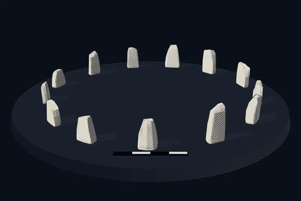
The reconstruction is ours, not a survey: it shows what a monument of this type looks like, at the size the record gives for this one.
Photographs
8 photographs, each with its author and licence
More photographs


Lore
Evidence & Lore
What the sources actually support — and, kept apart, what has been claimed.
What the evidence supports
Dates
Est. 4000–1200 BCEHow this date was established: Type comparisonTypological estimate, not a date for this site: a stone circle in the British Isles is normally dated between 4000 BCE and 1200 BCE (Atlas typological table).Source for this date
Measured facts
- Location
- Ramsley Moor, Peak District, United KingdomSource: Location
- Grid reference
- SK27857558Source: Grid reference
- Heritage designation
- Part of a Scheduled MonumentSource: Heritage designation
Where it stands
United Kingdom
The pin marks the monument itself — its exact point.
- Coordinates
- 53°16′35″ N, 1°35′01″ WFor a GPS or map app: 53.27650, -1.58370
Access is as our sources describe it; we have not visited the site to check.
Nearby
The closest sites in the Atlas, by straight line.
- Megalithic mound (tumulus with integral stones)Cairnfield 180m north east of Ramsley Lodge4000–800 BCE
- Megalithic mound (tumulus with integral stones)Cairnfield 400m north east of Ramsley Lodge4000–800 BCE
- Megalithic mound (tumulus with integral stones)Ring cairn and cairn on Ramsley Moor, 850m north east of Ramsley Lodge4000–800 BCE
- Megalithic mound (tumulus with integral stones)Cairnfield and field system north of Eaglestone Flat, 450m south west of Swine Sty4000–800 BCE
 Cairnfield and embanked stone circle 550m east of Barbrook Reservoir3200–2500 BCE
- Megalithic mound (tumulus with integral stones)Round cairn on Curbar Edge4000–800 BCE
- Megalithic mound (tumulus with integral stones)Cairn 1500m north west of Newbridge Farm4000–800 BCE
- Megalithic mound (tumulus with integral stones)Cairnfield 1400m north west of Clod Hall Farm4000–800 BCE

Sources
Every record behind this page, with the link it came from.
2 sources behind this page
- 01Wikidata Q14949367wikidata.org
- 02Wikipedia (en)en.wikipedia.org
Image files
- Barbrook 1 stone circle.jpgJohn KnightCC BY 2.0
- Stone circle and cairn - geograph.org.uk - 1214808.jpgMartin SpeckCC BY-SA 2.0
- Barbrook 1 Stone Circle - geograph.org.uk - 6931440.jpgBill BoadenCC BY-SA 2.0
- Barbrook I - Stone Circle on Big Moor - geograph.org.uk - 2959573.jpgNeil TheasbyCC BY-SA 2.0
- Stone Circle - geograph.org.uk - 3600801.jpgStephen BurtonCC BY-SA 2.0
- Barbrook 1 stone circle, main stone - geograph.org.uk - 3345945.jpgPeter BarrCC BY-SA 2.0
- Barbrook stone circle - geograph.org.uk - 5865546.jpgDavid LallyCC BY-SA 2.0
- Offerings? - geograph.org.uk - 5865549.jpgDavid LallyCC BY-SA 2.0
Report a correctionWrong date, name, photograph or source? Tell us and it will be put right.
Lore, kept apart
Legends and claims
These are stories and claims reported by the sources. They are not evidence, and they never stand in for the dating above.
- Tradition
Stone circles of this kind in the British Isles usually date from the Late Neolithic and Early Bronze Age, with most built between 3300 and 2500 BCE.
Stone circles of this kind in the British Isles usually date from the Late Neolithic and Early Bronze Age, with most built between 3300 and 2500 BCE. They are rings of standing stones, and the British Isles hold their greatest concentration. According to local tradition, saint William Hale used these stone circles to convert local pagans to Christianity.
Source
Around this place
The ten nearest sites, by compass
- Cairnfield 180m north east of Ramsley Lodge0.7 km SE
- Cairnfield 400m north east of Ramsley Lodge0.8 km E
- Ring cairn and cairn on Ramsley Moor, 850m north east of Ramsley Lodge1.1 km E
- Cairnfield and field system north of Eaglestone Flat, 450m south west of Swine Sty1.4 km SW
- Cairnfield and embanked stone circle 550m east of Barbrook Reservoir1.8 km N
- Round cairn on Curbar Edge2.0 km W
- Cairn 1500m north west of Newbridge Farm2.0 km S
- Cairnfield 1400m north west of Clod Hall Farm2.1 km SE
- Cairnfield, field system and ring cairn 1300m NNW of Newbridge Farm2.2 km S
- Round cairn on Curbar Edge2.4 km W
Credit
Text, licence and sources
Text from the Wikipedia article "Barbrook One" (English), licensed CC BY-SA 4.0; authors are listed in the page history. Reused under CC BY-SA 4.0. Read on Wikipedia · Edit history and authors
- Wikipedia (English): Barbrook OneCC BY-SA 4.0
- Wikidata Q14949367CC0